Results 121 to 140 of 455
Thread: Corner Canyon Conditions
-
02-17-2016, 08:44 PM #121
I rode CC today, the only trail that is rideable is the upper CC road. Everything else is still covered with snow drifts or contains sections of deep mud. But the good news is CC is drying fast. I'll post in this thread as soon as something is rideable.
For those that don't know, there is also a Bogley Strava group you can sign up for. It allows you to see where others in the group ride each day (I ride CC almost every day).
Following Strava will also give you an idea which trails are rideable and how to connect them together. One of the first trails that will be rideable is Rattler, and you can make some fun loops by combining it with the little known Quail and Saddler trails among others.
The pictures were taken 1.5 miles up the CC road where the connector cuts over to Rattler. I tried to ride down Rattler but quickly turned around when I kept encountering deep soft/slushy snow drifts followed by deep mud.
Please don't ride muddy trails.


-
Post Thanks / Like - 2 Likes
-
02-17-2016 08:44 PM # ADS
-
02-18-2016, 11:53 AM #122
So this morning I rode from the EQ up to Aqua Duct and was getting ready to attempt Rattler when the front passed over and I was caught in a wicked hail storm. The good news it some of the trails were rideable, the bad news is those same trails are now back under an 1" of snow and it's still snowing.
The one-way trail from the EQ up to the lower road CC is open and now a 2-way trail. The old one-way down trail is gone as they dug it up to up in a pipeline. I understand the new trail (old one-way down) will be paved up to the 3-way (left to Canyon Hollow, Right to Coyote Hollow) and follow over the top of the new pipeline. The trail will become a 2-way. I'm not sure if the upper dirt trail will stay or go. I'm guessing it will stay but might become a horse trail.
The lower CC rode is currently a huge mess as they dug it up to put in the new pipe line and now it's just a mud bog. When I hit the lower CC rode I went east and rode to the water tanks and than up to Gas Line. That route is always dry before other options, but later in the year it gets to sandy to be fun riding.
It was 50 degrees and sunny when I left the house and 30 degrees and snowing when I got home. You gotta love Utah weather.

-
Post Thanks / Like - 1 Likes
 accadacca liked this post
-
02-18-2016, 01:16 PM #123
Great info Shane! Yeah that dirt road was tore all to hell and a mud bog. I was thinking last night that the trails below that dirt road might be close to dry, but hard to put a loop together with the stuff in between being muddy and the upper stuff slushy. So I went over and rode the Quarry trail at the base of Little Cottonwood.
Honestly I'm hoping we get some more snow to keep my fat bike going for a while longer. I think we will get in a funk with part of the trails being muddy and the other half slushy. Hopefully though there are enough lower trails dry at the same time to get a decent ride in.
I'm wondering if the trails will be rideable tomorrow morning from coyote > bst > potato > ann's > canyon > silica and back. Thoughts?
-
02-18-2016, 01:25 PM #124
FWIW- attached is a map that shows what lower CC trails are currently opened and closed because of construction.
Brock's from Peak View down to it's intersection with Canyon Hollow is also currently closed because of construction. That section is easy to bypass as you just ride the upper CC road from Peak View down to where Canyon Hollow intersects the road.

-
02-18-2016, 01:31 PM #125I'm guessing "NO" right now. One problem is the warm weather is making the snow too soft/slushy for even the fat bikes. Maybe if it freezes and you ride early before they thaw.
 Originally Posted by accadacca

Things are really melting out fast. What was 3' snow drifts on Monday are now completely gone. I guessing in a week I'll be able to put together some fun south facing loops. I would have been able to do it today if it didn't start snowing again.
-
02-19-2016, 07:03 AM #126
Lower trails from Ann's, which is frozen right now.

-
02-19-2016, 01:55 PM #127
Corner Canyon is rideable if you hook things up correctly. I made it to Ghost Falls without getting into snow or mud. My suggestion is to start at the Orson Smith Trailhead and ride up the road to the BST trailhead and than up Rattler. There are a couple very minor sections of snow and mud but nothing that is going to rip the trails up.
The Upper Corner Canyon Road is rideable.
Rattler is rideable (provided you approach from the BST Trailhead)
Quail Trail is rideable
Saddler Trail is rideable
Aqua Duct Trail is rideable
You can also put together a short fun loop using Quail, Saddler, Aqua Duct and the CC Road. The loop can be easily ridden in both directions. It sure beats not being able to ride. I use this loop a lot in winter to train as it is usually the first rideable loop in CC.
Another loop I use to train that drys out early is >> up CC Road >> Up Aqua Duct >> and than down the bottom section of the Orson Smith downhill. This loop is also currently dry.
FWIW- I now own about two dozen Strava fast times of the year in CC. Mostly because I'm probably the first guy to ride many of the sections this year that was not riding one of those fat pigs.
Please do not ride muddy trails!
-
Post Thanks / Like - 1 Likes
accadacca liked this post
-
02-19-2016, 03:27 PM #128
Coolness! I've never ridden out of Orson Smith or most of the trails you mentioned. Looks like I will be hitting those trails next week!
-
02-21-2016, 04:28 PM #129
@Iceaxe I'm looking to ride tomorrow night and try that loop you rode on Saturday. It should feel good to be back on my skinny tire.
-
02-21-2016, 04:33 PM #130Just a heads up, it's supposed to snow tomorrow morning. Originally Posted by accadacca

I've ridden every day this week in Corner Canyon. Life is good.
-
02-21-2016, 08:15 PM #131Yeah I saw a chance of rain and possibly snow. I'm just hoping they are wrong or it doesn't do much. I'm going to try morning or evening...hopefully. Originally Posted by Iceaxe

-
02-22-2016, 06:19 AM #132
Dang! Pretty good rain. Might be hosed for a day, maybe two.
-
02-22-2016, 01:22 PM #133
Any idea on conditions? Rideable sometime tomorrow? How much moisture fell?
I had the following routes planned based on @Iceaxe's rides, both starting at equestrian.
Option 1
Lower Corner Canyon
Carolina Hills
BST to Orson Smith
Aqueduct
Sadler
Bunny
Option 2
Lower Corner Canyon
Carolina Hills
BST
Rattler
North Ghost Falls
Gas Line
Carolina Hills
Lower Corner Canyon
-
02-22-2016, 03:37 PM #134You need to look at my route suggestions again because you have some problems, also not all my Strava tracks are trails I'd currently ride again in the near future as some hike-a-bike was involved Originally Posted by accadacca
Lower Corner Canyon - OPEN
Carolina Hills - OPEN
BST to Orson Smith -??? BST doesn't go to Orson Smith. If you mean BST TH there are snow drifts you will have to walk over.
Aqueduct - OPEN
Sadler - OPEN
Bunny - OPEN
Option 2
Lower Corner Canyon - OPEN
Carolina Hills - OPEN
BST - Snow drifts, section of walking the bike
Rattler - OPEN
North Ghost Falls - Closed with snow drifts
Gas Line - Closed with snow drifts
Carolina Hills - OPEN
Lower Corner Canyon - OPEN
Orson Smith is the small park at the bottom of the Upper Corner Canyon Road. BST trailhead is located 1 mile up the Upper CC road.
Start at Equestrian Center (aka EQ, Andy Ballard). When you hit the Lower CC road turn east and follow the water tank access road up to Aqueduct (don't follow the CC road), turn north and follow Aqueduct north to Quail Trail. Turn east and follow Quail Trail up to the the Upper CC road. Ride up the CC road to the BST trailhead. Take BST to where it connects to Rattler, follow Rattler up to Ghost Falls.
If you want more bang >>> a great loop is BST TH up the CC road to the Rattler connecter trail, Take The connect over to Rattler and down Rattler. This route involves 5 minutes of climbing up the road and gets you a bunch of downhill. I do this lap all the time, in Strava it's listed under Rattler Hot Lap.
Still want more? From Aqueduct, Up Quail Trail, Down CC Road, Down Saddler, South on Aqueduct back to the base of Quail Trail, which is another lap I do a lot.
BST out to the new bridge looks really inviting, but it's not as about 1/2 way out the trail turns to mud and snow drifts. Give that trail another week to dry out.
It will probably be wet and muddy in the morning, but should dry out by afternoon if we don't get anymore rain.
If you want to ride tomorrow afternoon I could probably do it with you. I have some appointments in the morning but will probably be free after about 1:00.
-
02-22-2016, 07:29 PM #135
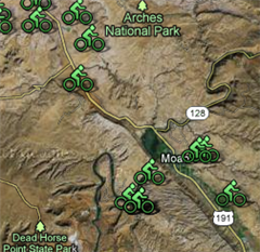
Thanks for the tips. Here is the map and trail info that I was using along with your latest tracks. I figured north ghost and gas line might have issues, but thought BST from CC Road to Orson Smith would be ok. Now to look at your suggestions and make a route.
I would love to get together and learn some new loops. Could you ride tomorrow 4:30-6ish PM?
http://www.trailforks.com/region/cor...z=15&m=roadmap
-
02-22-2016, 09:04 PM #136Let's see where things are at noon tomorrow and I'll know if conditions are going to be be dry. The earlier the easier for me. And if anyone else from Bogley wants to show they can join up. Originally Posted by accadacca
-
02-23-2016, 05:35 AM #137
Ok gotcha. I'm going to take my bike to work and go straight over. Let me know how it looks.
-
02-23-2016, 06:46 AM #138
I'd love to join in if you ride this afternoon. I need to learn the lower trail routes. I could be at the trailhead by 4 unless I find something majorly wrong with my bike, which hasn't seen the light of day since November.
Are we there yet?
-
02-23-2016, 07:38 AM #139
Let's do this! Does 4:00 work? Meet at the Andy Ballard (equestrian center) trailhead?
I don't have lights so I'm done when it starts getting dark.
-
02-23-2016, 07:42 AM #140
4 works for me. If I'm not there by 4, don't wait. It means I had bike issues (which I don't foresee).
Are we there yet?


 Reply With Quote

Similar Threads
-
[Conditions] Corner Canyon conditions
By bigred72 in forum Mountain Biking & CyclingReplies: 3Last Post: 03-08-2014, 03:12 PM -
Corner Canyon Trail Map
By Iceaxe in forum Mountain Biking & CyclingReplies: 1Last Post: 07-21-2013, 09:42 PM -
Corner Canyon open
By Iceaxe in forum Mountain Biking & CyclingReplies: 8Last Post: 06-17-2012, 11:56 AM -
[Invite] tuesday 17 corner canyon
By Ride On in forum Mountain Biking & CyclingReplies: 43Last Post: 05-23-2010, 04:57 PM -
[Trip Report] Corner Canyon TR
By TreeHugger in forum Mountain Biking & CyclingReplies: 6Last Post: 07-10-2008, 11:24 AM