

Results 1 to 10 of 10
Thread: Bowknot Bend
-
09-06-2011, 09:25 PM #1
Bowknot Bend
This trip had a little of everything: ATVing, river rafting, hiking/scrambling/climbing, rappelling, geocaching, fencing, fighting--well, you get the picture. I've had my eye on a geocache that was placed atop Bowknot Bend more than a year ago, and nobody had tried to find it in that time. I did an exploratory trip to the area in December 2010, but didn't make it far in my truck. I spent a fair amount of time over the months looking at satellite imagery and topo maps, and had a general plan put together. My friend Chris and I finally worked things out so we could try for it on Labor Day weekend.
Viewing on a mobile device? Click this link to open the map: http://maps.google.com/maps?q=http:%2F%2Fudink.org%2Fgeo%2FBowknotBend.kmz&hl=en&sll=37.0625,-95.677068&sspn=40.27343,86.572266&vpsrc=0&t=h&z=12
http://udink.org/geo/BowknotBend.kmz
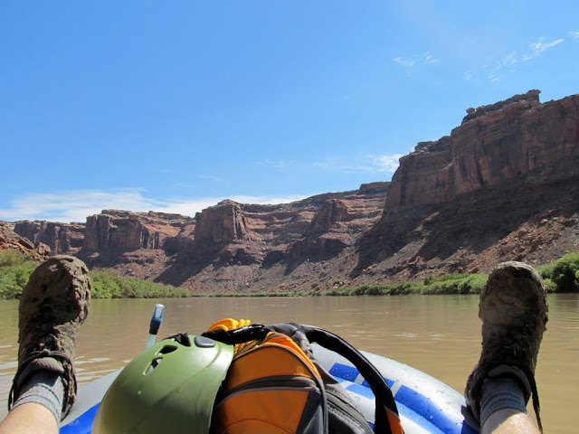
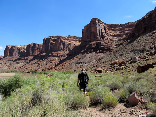
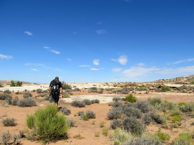
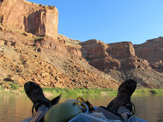
We spent Friday at my place making plans and getting things ready, then set out Saturday morning to get this done. I parked the truck at Bartlett Flat and we unloaded the ATVs and packed on our rafting and rappelling gear. It was a pretty quick jaunt from there down into Spring Canyon along the awesome shelf road and switchbacks. We reached the Green River and started checking out the chutes and gullies leading to the top of Bowknot Bend. None of them looked promising. The route that I thought looked good in Google Earth looked impossible in person. We continued up the road along the river and found the spot from which we'd planned on launching the boats. We thought the mosquitoes were bad there, but would later learn just how bad they could get. We shoved off in our rafts and had about a third of a mile of floating downstream before we needed to land on the opposite bank. Upon putting ashore, we stashed the rafts and life jackets and started hiking downstream. Instead of continuing to the route we'd planned, we started up the first big gully that we encountered, since they all looked difficult or impossible.
ATV loaded with raft and rappelling gear

Spring Canyon shelf road

Spring Canyon
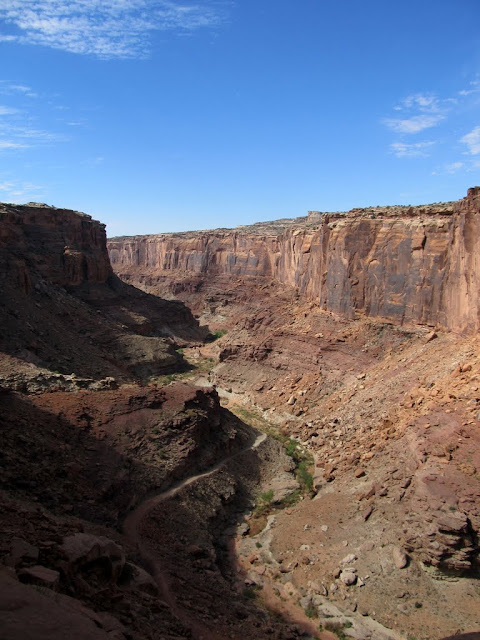
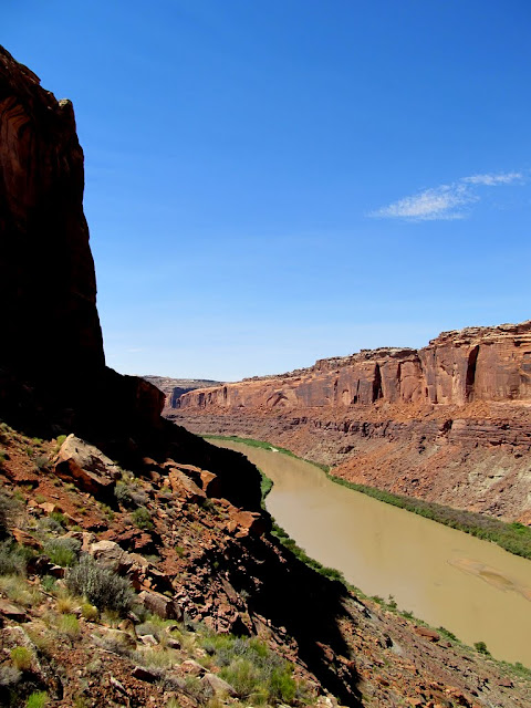
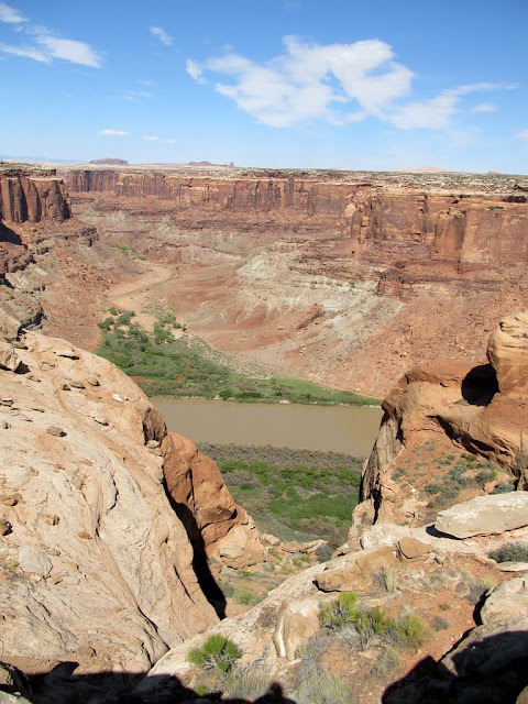
Stopped to check out Bowknot Bend along the Green River

Inflating the rafts

Ahh hell yeah
Landing spot on the opposite bank

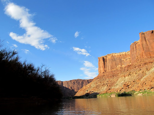
Hiking along the Green River
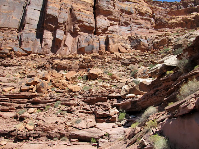
The first gully we scrambled up

Bushwhacky and bouldery

Navigating the cliff bands
I was lucky to have Chris along. He's a stronger hiker than me, and he did most of the routefinding work while I played catch-up. He would scout ahead for the next break in the cliffs. I would often come to a spot where I couldn't figure out how he got up, and after a while he would appear on the cliff above me and tell me the route he took to get up. We spent about three hours doing this. Most of the route up involved steep hiking and scrambling, and only in a few spots did it truly require climbing. One spot was too difficult for me to climb, so Chris dropped a rope and I handlined up it. We finally broke through to the top of Bowknot Bend, but it was much later in the day than we'd planned on, and we were both nearly out of water.
Bouldery ledges that we scrambled up
Green River below

More bouldery ledges

More of that not-so-Green River
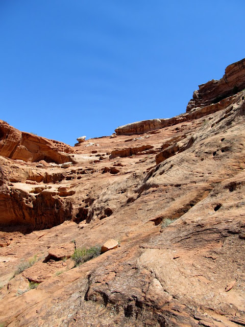
Last bit of scrambling ahead
Panorama of the Green River below our route

Packing rope away after I handlined up a cliffy section

The Man

One last shelf to traverse before topping out

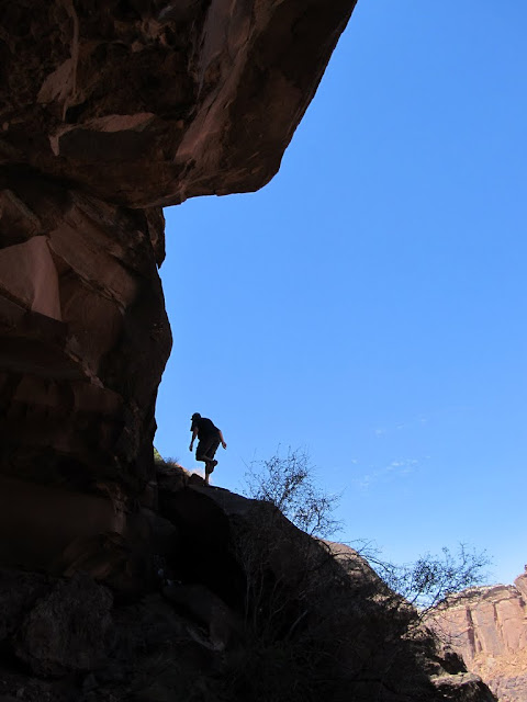
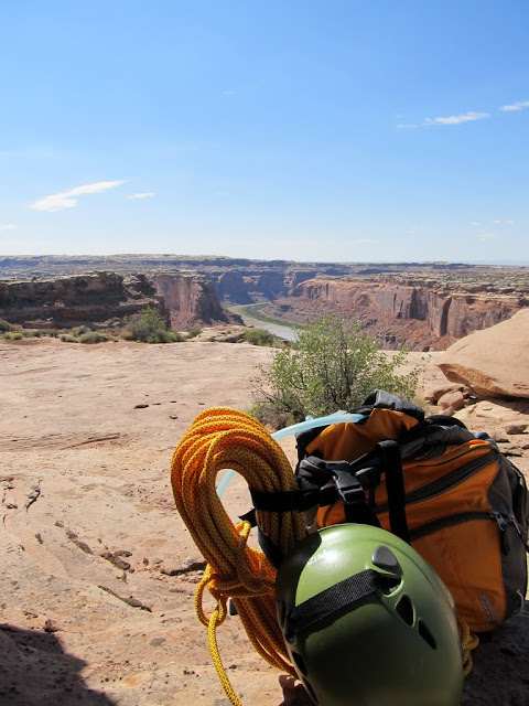
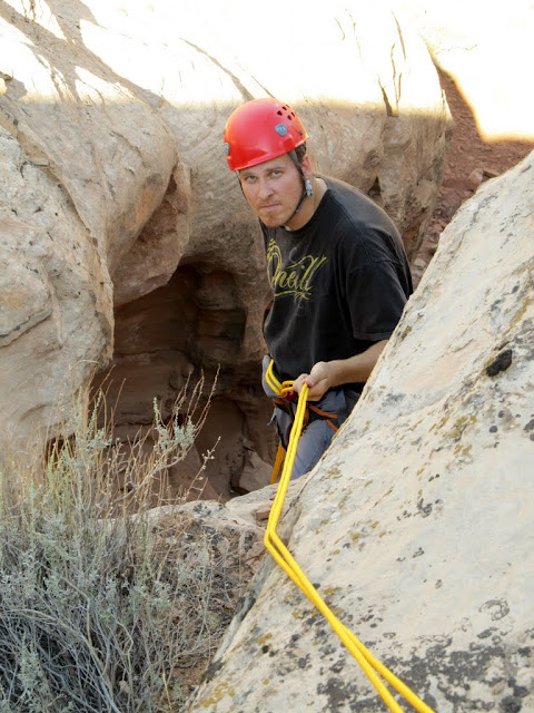
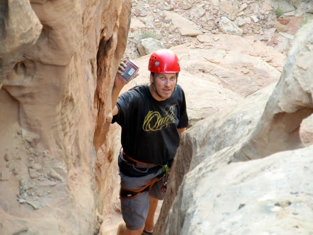
We shaded up below an overhanging cliff once we reached the plateau. From there, it was a quick 0.8-mile walk to the northeast side of Bowknot Bend where the geocache was hidden. I felt like the worst was behind us, even though there was an unknown rappel before us. I brought my brand-new Imlay Canyon Fire 120' rope, and Chris had a shorter climbing rope with him, plus between us we had other gear that we could use to piece together a longer rappel if necessary (all the while hoping that it would not be necessary). We reached the coordinates to the geocache, which put us at the top of a cliff. We walked the cliff's edge, looking for any possible hiding spots for the geocache. There was a big vertical crack in the cliff that was mostly hidden from our high vantage point, and that seemed the likely place to rappel. Chris, being the more experienced canyoneer, donned his harness and popped the cherry on my new rope. As he descended he looked for the geocache, and after reaching the bottom of the tall ledge inside the crack, he found it! There were a lot of "woo-hoos" and "f----yeahs" from above and below the cliff. While he ascended, I geared up and took my turn rappelling down so I could leave my mark in the geocache logbook.
Rest break after breaching the top of Bowknot Bend
Easy walking across the plateau
View into Spring Canyon once we reached the northeast side of Bowknot Bend
Chris dropping down to look for the geocache
Uhh, yeah. Solid anchor right there. Please, nobody show this to

"F-yeah" moment!
My view from the cache location

Out of water but feeling good, we hoofed it back across the plateau and mostly followed our route back down to the Green River. We took a shortcut that wasn't apparent from below and ended up descending directly above our rafts, where we found a group of guys from San Diego who were camped there while on their first river trip. They had plenty of water and generously shared some with Chris and me. We chatted with the Californicators for a bit, then jumped in our rafts and set off downstream. I had a spot picked out for landing about two-thirds of a mile downstream where the tamarisk looked the thinnest, but we were anxious to land anywhere that would save us some hiking back upstream toward the waiting ATVs. We landed on a sandy beach only a third of a mile downstream where the tamarisk looked thin. However, the mosquitoes were absolutely horrid there! Chris got out of his raft and climbed the river bank to check out the brush between us and the road, but as I got out of my raft, dehydration caught up to me and my legs cramped up horribly. Chris found that the tamarisk was impenetrable, and I could no longer even walk, let alone get back into the raft. The mozzies got to Chris and he said, "Sorry man, I gotta go," and I stayed behind for a brief while trying to pace up and down the beach and loosen up my muscles. I was finally able to get into the raft and start paddling downstream again, and we both set ashore at our planned landing spot. Chris sprinted for the road while dragging his raft behind him, but again my legs cramped up and I was forced to walk it off before I could climb the river bank. I heard Chris shouting obscenities at the bugs far off in the distance while running up the road. I finally regained the use of my legs and climbed the river bank, then ditched my raft and feebly jogged up the road while trying to stay ahead of the voracious mosquitoes. I made it a quarter of a mile when Chris returned with his ATV, and I hopped on and hitched a ride to my waiting machine, ending the maddening attack by the bugs.
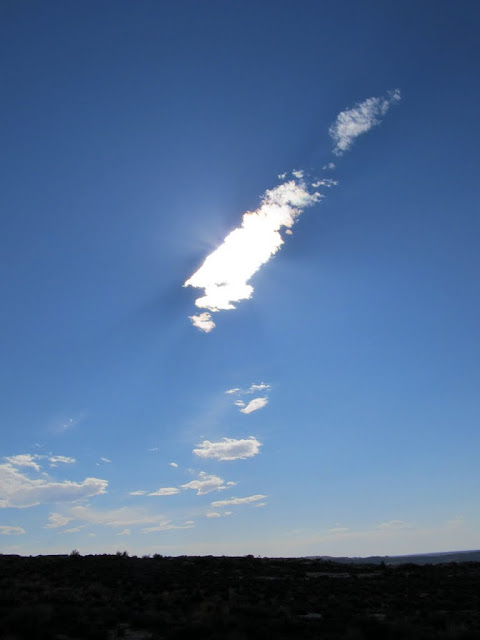
This cloud provided some much needed shade for two wayward hikers
Hiking back across Bowknot Bend

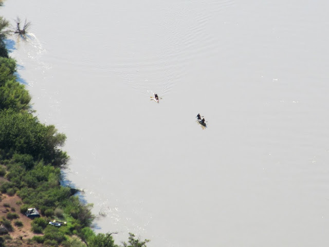
River runners far below
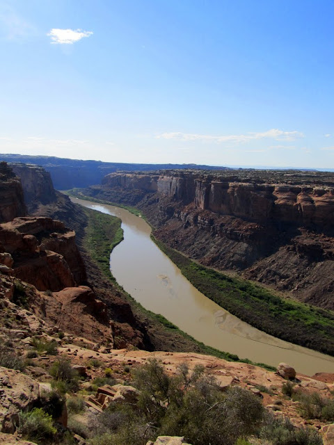
The Green River through Labyrinth Canyon
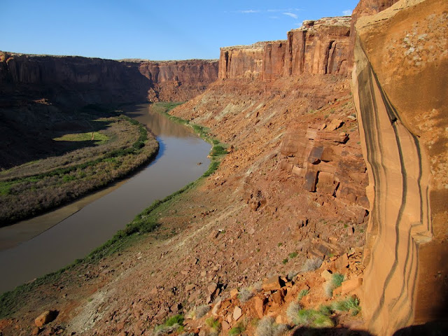
Nice view of the river on our descent
Finally, back on the river
Chris downstream below me
Chris

Once we were both on our ATVs, we returned to the rafts and hastily threw them on the machines and got the hell out of there. We didn't stop to properly deflate and stow the boats until we were half a mile up Spring Canyon and away from the river. The ride back to the truck was in nearly full-dark, though on the horizon behind us was a deep red glow that seemed to last longer than normal twilight. We drank some ice-cold Powerade and ate some salty snacks at the truck, then in complete darkness loaded the ATVs and packed our gear away while reveling in our accomplishment.
Sun setting on Bowknot Bend

Labyrinth Canyon sunset

Sunset behind us as we rode toward the truck

Full photo gallery here:
https://picasaweb.google.com/Dennis.Udink/BowknotBend
Blog entry:
http://udink.org/2011/09/06/bowknot-bend/
-
09-06-2011 09:25 PM # ADS
-
09-06-2011, 09:37 PM #2
Quit playin' with yer dingy!
-
09-06-2011, 10:03 PM #3
Now thats a heck of a geo cache.
-
09-07-2011, 09:11 AM #4
This report is full of win.

-
09-07-2011, 10:39 AM #5
Damn dude. Very, very nice.
-
09-08-2011, 10:02 AM #6
Wow, anything for a geocache! Sounds like fun..
-
09-08-2011, 05:31 PM #7
nice trip !!!!
-
09-19-2011, 08:47 AM #8
 How can you have your non-dairy pudding substitute if you don't eat your wok-braised tofu?
-
09-19-2011, 09:20 AM #9
Awesome trip!

-
09-20-2011, 06:29 AM #10
Quite an adventure. Nice shots.
Greg


 Reply With Quote


Similar Threads
-
TR:- Roost -: Colonnade Arch, Bow Knot Bend, Moonshine Wash
By asdf in forum Hiking, Scrambling & Peak BaggingReplies: 18Last Post: 10-05-2010, 02:13 PM -
Horseshoe Bend
By mjn_slc in forum General DiscussionReplies: 2Last Post: 09-11-2010, 12:45 PM -
[Trip Report] Big Bend
By Don in forum Backpacking & CampingReplies: 8Last Post: 12-23-2008, 09:40 AM
Visitors found this page by searching for:
Outdoor Forum
