

Results 1 to 7 of 7
Thread: Canyoneering Canyonlands
-
03-14-2014, 11:33 AM #1
Canyoneering Canyonlands
Introduction
Matt Lemke contacted me and asked me if I wanted to go canyoneering for the weekend. At first we were thinking of the Roost, but the un-betaed canyon I had in mind might be too long for the short days. Doing it in two days would be hard since it would be too tight to take packs through. I made the suggestion that we put the Roost canyon on hold.
I had remembered that years ago (1991) I had scouted out Elephant Canyon in Canyonlands National Park. I knew it wouldn’t be a tight slot, but what intrigued me about the canyon is that I could see huge pools and waterfalls and a narrows section. While canyons with pools and running water are common in places such as Zion National Park or Escalante, they are very rare in Canyonlands National Park. The canyon was also ruggedly spectacular and 1300 feet deep in its lower end. I suggested the possibility of descending the canyon to Matt and he was interested.
I wondered how many people had seen those pools and waterfalls up close. Probably not many people at all. Had anyone completed the entire route to the Colorado River? Almost no one goes canyoneering in Canyonlands. It's definitely a forgotten area when it comes to canyoneering.
I had known of a steep, rugged, and strenuous exit route by following the Colorado River down river and climbing a steep route to the rim. At first this was to be our planned route, but on the drive down I thought of a perhaps even grander possibility.
Matt Lemke is a good climber, so I wondered if we could actually climb up Salt Creek. Salt Creek does have a technical section that a few people have downclimbed and rappelled and then re-ascended. The only glitch to the plan was that those who re-ascended left ropes behind at a critical waterfall.
We were not sure if the waterfall was climbable without a fixed rope in place, but it seemed worth a shot. If at least Matt could get up, the rest of us would be able to ascend the rope if necessary.
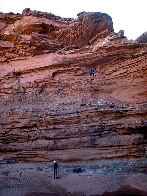
Me on the big rappel with Kessler below.
February 22
Kessler and I met Matt at the Lazy Lizard Hostel in Moab. I have a park pass, but the visitor center was closed and you just signed in for your own permit. I was relieved about this since we wouldn’t have to listen to the rangers telling us that our route was impossible (which seems to happen most times I’ve gone to Canyonlands in the past several years!) and trying to talk us out of attempting the route.
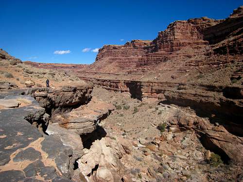
We started along the Confluence Overlook Trail with full backpacks, descended into Big Spring Canyon, and then climbed out and over the ridge to Elephant Canyon, which we descended. It was a beautiful February day and the views were really nice on the approach.
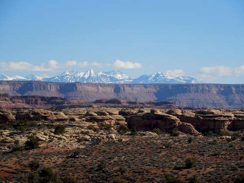
Views we had enroute to Elephant Canyon. These are the Wingate sandstone cliffs above Indian Creek and the La Salt Mountains.
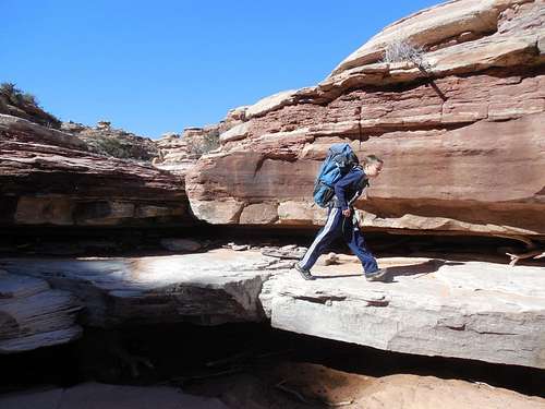
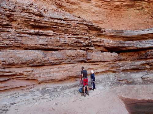
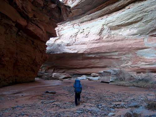
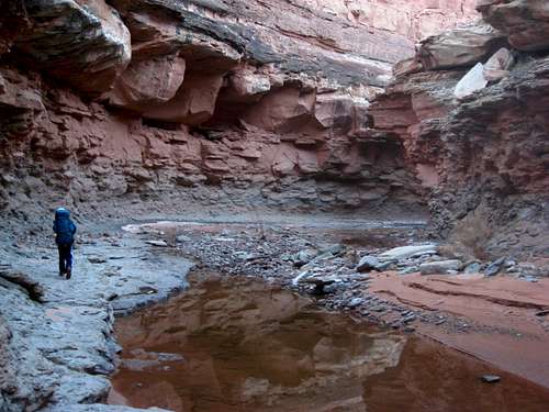
Kessler in the upper part of Lower Elephant Canyon.
The upper part of Lower Elephant Canyon.
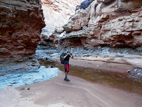
The first big drop in Elephant Canyon
After not too long we reached our first real obstacle, an approximately 100 foot/30 meter drop off. We could see running water below the drop, and I wanted to drop into the canyon directly, but Matt wanted to contour around since that’s what I did years ago. Somewhere I had found a rough scramble route to the canyon floor. I had left a sling behind for a handline in one location, but it was just down-climbable.
We contoured around for quite a ways on the west side of the canyon and found a location where the drop was short and we rappelled off a tree through the cliff band and scrambled. Somewhere in this vicinity I had found a handline route down, but we decided to rappel down the drop in order to enter the canyon.
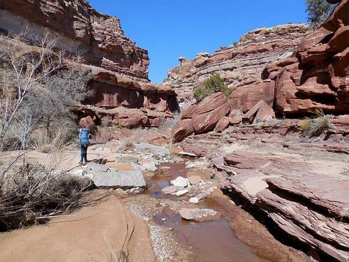
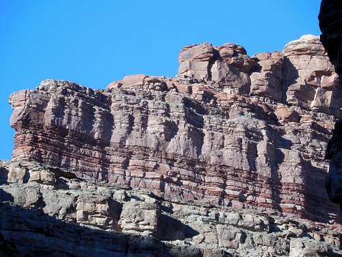
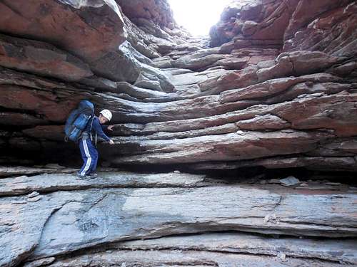
Once in the pristine canyon, we continued to follow it as it snaked around bends en-route to the Colorado River. One thing different about this part of Canyonlands is that the rocks are a mixture of limestone and sandstone, rather than just sandstone as it is in much of the park and region. The limestone layers formed several drops that were obstacles.
One of the little waterfalls in Elephant Canyon.
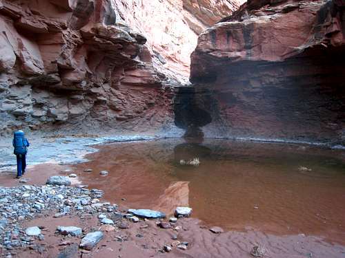
Eventually we found ourselves staring down a huge drop, one of two big ones we expected to find in the canyon. Years ago, I had made it down to this point using a really rugged route, but I was unable to continue down canyon. Instead I walked the benches on the west side hoping to find a route in, but I was stopped.
The drop was actually quite impressive and had a spring coming out of the cliff about 15 feet below the lip of the falls. The amount of water wasn’t huge, but it was a high waterfall, much of it covered in ice. We decided to eat our lunch in this spectacular place. This is also where we began to find some really nice fossils.
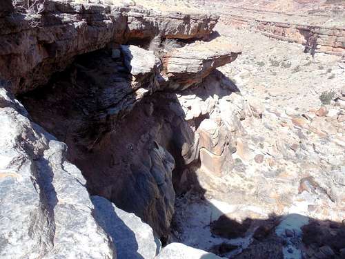
This is the first of the really big falls in Elephant Canyon. It is hard to see because of the lighting. The falls is maybe 200 feet/60 meters high. Water comes out of a spring just below the lip of the falls and falls the rest of the way to the ground. Some of it was frozen as well.
After lunch we worked our way along a rugged bench (with signs that the bench is used rather frequently by bighorn sheep) to where the drop was shorter. I had been here years ago as well, but remembered the drop as being bigger. I was able to lower belay Matt down the cliff and then Kessler as well. After that Matt spotted me down for the climb. It was challenging, but just doable (though more risky) without rappelling.
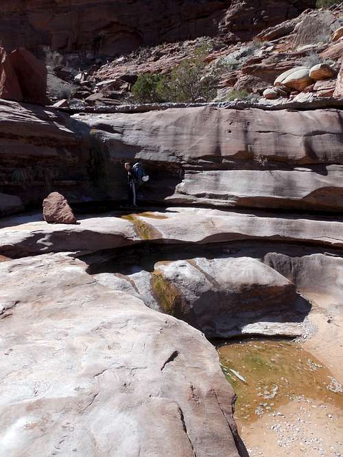
Since the rest of the canyon was new to me (and possibly to anyone else), it was a joy to explore new ground. There were some nice pools and waterfalls in the canyon, but no major obstacles until we reached a big and ominous looking drop into a narrows (not a slot, just a more narrow section of the canyon). There was a huge pool of water at the bottom of the falls as well. I had viewed this drop from a distance years ago and expected it to be much higher, thus we carried more than 400 feet of rope.
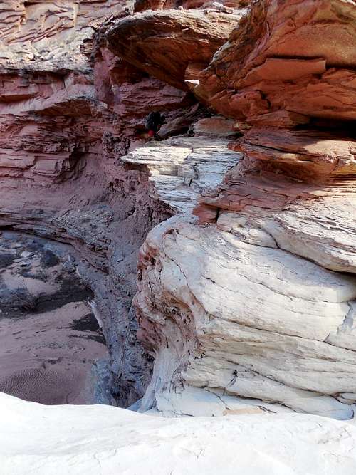
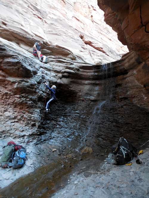
Matt starting on the big rappel in Lower Elephant Canyon (look closely). We had to crawl and traverse across that ledge and then rappel off a boulder which made a sturdy anchor.
We crawled over a narrow ledge (with a low ceiling) to a boulder which would serve as a solid rappel anchor. The drop though was sharply overhung and would make a challenging rappel. Because of the sharp overhang and huge packs, it was very challenging, but only 80 feet, when I had expected it to be much higher.
Matt rappelled down first and suggested that we lower our packs (dangling them off the harness is another possibility, but there were a lot of loose ledges on the way down).
Matt and Kessler at the bottom of the big rappel.
Kessler rappelled next and I followed. The canyon was mostly dry below the falls and I regretted not tanking up with the clear water.
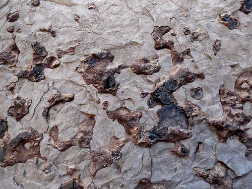
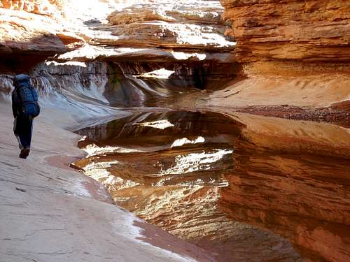
Some of the interesting rock texture in Lower Elephant Canyon.
As we walked down canyon, the fossils were really good. There were two more falls to bypass which would be the last obstacles. Near the Colorado River we found one Anasazi ruin that we checked out. I wanted to try and traverse high on the benches in order to reach Salt Creek, but the others wanted to try a route close to river level, so we descended Elephant Canyon to the Colorado River.
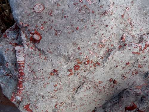
There were many interesting fossils scattered throughout the lower half of Lower Elephant Canyon.
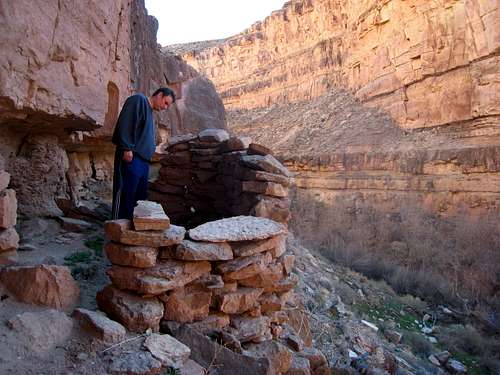
An Anasazi ruin at the mouth of Elephant Canyon.
We had finally traversed the entire Elephant Canyon to the Colorado River and we were elated. Were we first to do so? I don’t know with certainty, but it is possible.
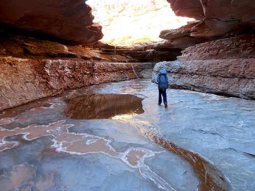
Rock in Lower Elephant Canyon.
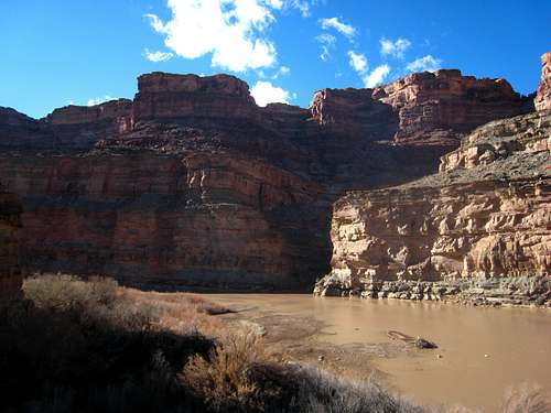
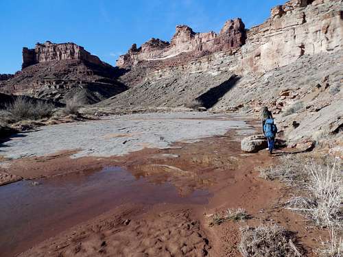
At the mouth of Elephant Canyon.
Even though we had made it all the way down to the Colorado River we were far from being done with the route. We still had to hike up the Colorado River to Salt Creek and attempt to climb out of it. If we couldn’t climb back we would have to return all the way back to Elephant Canyon and then make an arduous hike down river to another rugged exit point. Elephant Canyon, Salt Creek, and the Colorado River Gorge are all about 1300 feet (400+ meters) deep so we would have come climbing to do.
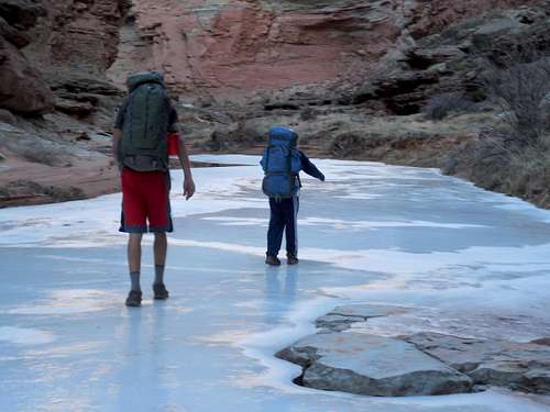
We made our way upriver towards Salt Creek. The route was very rugged going with lots of boulderhopping, some bushwhacking, loose rock, and many climbs up and down ledges. This part of the route was only a half a mile long, but it took us an hour in a half to negotiate, even moving at a good pace. This was the least pleasant part of the route. Some of the time, the going was aided by the fact that we could walk on the frozen Colorado River in the sections that remained permanently shaded throughout the winter. The rest of the time we were forced above river level.
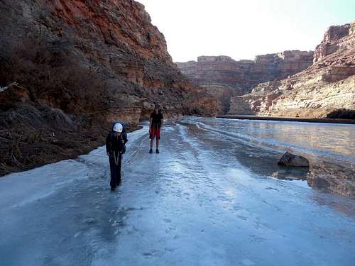
Part of the Colorado River was frozen so that we could walk on it. Walking on the ice was much easier than traversing the benches above the river.
We were relieved when we finally reached the mouth of Salt Creek. We had to fill all of our water bottles in the very muddy Colorado River since we weren’t sure if we’d reach more water by the time daylight ran out.
We made our way up canyon and eventually found a small clear pool. We immediately dumped out the river water and filled our bottles with the clear water.
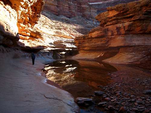
Kessler hiking through a narrower section in lower Salt Creek.
We made our way up canyon and found the first major obstacle. It was a fairly slippery climb up a “trickle fall”. We made the climb with no problems and continued up canyon. The stream got bigger as we continued up canyon, sometimes on the frozen stream. In addition to the high canyon walls, there was a really impressive pinnacle that kept catching our eyes. Kessler and I decided to call it Mom Rock because it looked like a mom sitting there with her arms folded after you have done something naughty.
Kessler climbing the first waterfall in Salt Creek.
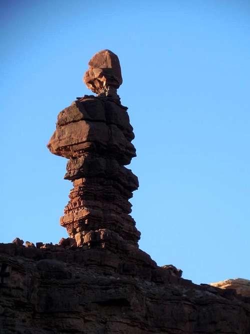
A huge tower in Lower Salt Creek. We called it mom rock since it looks like a mom folding her arms after you've done something naughty.
Walking on the ice in Lower Salt Creek.
Matt in Lower Salt Creek.
A narrows section of Salt Creek.
We eventually reached the technical obstacle in the canyon. It was a flowing waterfall 20 feet high. We hoped that we could climb it. The daylight was fading and if we couldn’t climb it we would have to backtrack all the way back to Elephant Canyon (in the morning).
The waterfall obstacle is just ahead.
The climb was slippery, wet lower down, and loose where dry. I belayed Matt the best I could and after several tries and fumbles, he was able to climb the drop. We were relieved! Kessler climbed the drop next while being roped in. I climbed last and was frustrated that a few of the footholds wouldn’t hold my weight and broke on me.
Kessler climbing the waterfall in Lower Salt Creek.
Once at the top of the waterfall, we breathed a sigh of relief and continued up canyon. The canyon was beautiful with water flowing over slickrock. We reached a nice area for a camp and stopped there not long before it got dark.
February 23
After waking up, we packed up and headed up canyon. It was another beautiful day. There was still a major obstacle ahead. We had to climb a very steep and slippery waterfall. When flowing, the climb is challenging. It still wasn’t as hard as the waterfall climb the previous evening though.
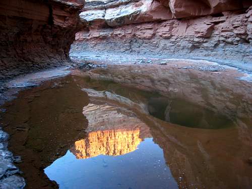
Reflection in a pool near camp.
A section in Lower Salt Creek just before the slippery waterfall climb.
We were glad that we could make the climb because above here there was an almost sure chance that we could climb all the way out. We continued up the beautiful canyon and climbed yet another waterfall, but this one was easier.
Another little waterfall in Salt Creek.
After this waterfall, the canyon began to open up and become wide. The walking became easier, though not quite as spectacular, though still pretty. It was a routine walk up Salt Creek to the confluence with Big Spring Canyon which we followed up canyon. We found some fossil footprints of some creature that expires eons ago.
Lower Salt Creek widens out in its upper reaches. It isn't as spectacular in this part, but still pretty.
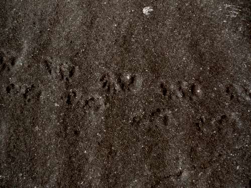
Fossil footprints along Lower Salt Creek.
There were several obstacles in Big Spring Canyon, but nothing really major until the very end. As we continued up canyon we began to see vague signs of travel by other humans, including a few cairns. The last fall was challenging to bypass, but only because we bypassed it on the wrong side. We climbed a cliff band and did a tricky traverse until we could descend back down to the canyon floor. It was later learned that we could have bypass the obstacle on the other side of the canyon and it would have been easier that way.
Shortly after the bypass, we intersected the Confluence Overlook Trail again and it was a route and short walk back to the trailhead.
The Lower Elephant Canyon/Lower Salt Creek Loop was a done deal and we had the privilege of seeing parts of the national park that few have ever laid eyes on. It was a beautiful trip.
Utah is a very special and unique place. There is no where else like it on earth. Please take care of it and keep the remaining wild areas in pristine condition. The world will be a better place if you do.
-
Post Thanks / Like - 9 Likes
 EmmaDean, Udink, Mountaineer, SRG, Taylor, Mojave Silence, Iceaxe, Slot Machine, Sandstone Addiction liked this post
-
03-14-2014 11:33 AM # ADS
-
03-14-2014, 12:30 PM #2
Thank you for sharing. What a great trip report!!
-
Post Thanks / Like - 1 Likes
Scott P liked this post
-
03-14-2014, 12:51 PM #3X2
 Originally Posted by zkeys

Love the shot of your son climbing the falls. Awesome!
-
Post Thanks / Like - 1 Likes
Scott P liked this post
-
03-14-2014, 01:09 PM #4
Great TR

-
Post Thanks / Like - 1 Likes
Scott P liked this post
-
03-16-2014, 06:00 PM #5
Sweet...Love the route idea and description. New places...New adventure...good for you!
-
Post Thanks / Like - 1 Likes
Scott P liked this post
-
03-16-2014, 10:11 PM #6
Nice job Scott!
-
Post Thanks / Like - 1 Likes
Scott P liked this post
-
03-31-2014, 06:11 PM #7
I'm so glad you wrote this trip report!!! I have been wanting to find some information on river access either via Elephant or Salt Creek since last year. I gave up last Spring when I found out people are not allowed to go in these canyons during a certain season, while the sheep are lambing. From May- September I think. Thank you for sharing.


 Reply With Quote


Similar Threads
-
[Trip Report] Big Hike Canyonlands
By Jammer in forum Backpacking & CampingReplies: 12Last Post: 05-02-2008, 08:08 AM -
TR: Rained out in Canyonlands
By James_B_Wads2000 in forum Backpacking & CampingReplies: 9Last Post: 10-20-2006, 11:31 AM -
A Little Canyonlands Explorin'
By rockgremlin in forum CanyoneeringReplies: 2Last Post: 05-30-2006, 10:41 PM -
Canyonlands Beta
By FOX in forum CanyoneeringReplies: 3Last Post: 05-25-2006, 07:37 AM -
The Canyonlands Anomaly
By rockgremlin in forum CanyoneeringReplies: 4Last Post: 04-04-2006, 02:25 PM
Visitors found this page by searching for:
Outdoor Forum

