

Results 1 to 9 of 9
Thread: The Great Traverse
-
03-02-2016, 05:26 AM #1
The Great Traverse
There is a pretty long unpaved stretch of roads and trails from Green River to near mile post 17 on Utah Highway 95 south of Hanksville.
The length is about 130 miles. We call it The Great Traverse. The last time we run it was in May 2013 under pretty good conditions. This was not always so. Sometimes part of the trails might be damaged and not passable, some times Dirty Devil River has simply too much runoff. To prevent standing on the river bank and see an amount of water not passable look at the USGS Gage Page für the Dirty Devil River Gage nearby the ford. For me a runoff of more than 100 cfs is not feasible but others may do better.
With good conditions one have to calculate with 8 to 10 hours from pavement to pavement. Worse conditions? Nobody knows but be always disposed to spend a night on the trail - or even more.
In 2013 we traveled from south (UT 95) to north (Green River Airport Road). If you start in Green River go from Main Street into Long Street and there down to th railroad. A short distance to the left is the railroad crossing on Airport Road. At 12S 0570415 4312655 a road goes left and gravel begins.

My wife driving the Jeep Wrangler on UT 24 southbound

Some danger on UT 95 south of Hanksville
Poison Spring Canyon
From Hanksville it is more or less exactly 17 miles to a gap in the left guard rail wher Poison Spring Trail starts (at 12S 0534242 4221412)

Other dangers in Poison Spring Canyon
The road leaves Poison Spring Wash after a short distance. We were told that years ago a flood clogged the wash and a bypass was build. This new road goes to Butler Wash, a tributary of Poison Spring and returns eventually to the main wash.

The Road in Butler Wash

Back in Poison Spring Wash
The gray rocks on the wash bottom are strangers here coming down from the Henry Mountains.

There are two cattle gates on the road down to the River

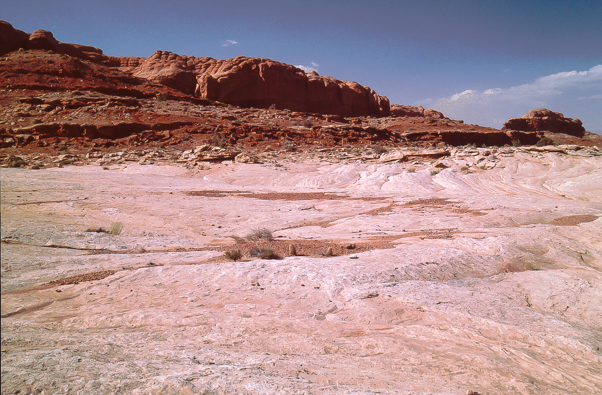
Windblown deposits

Within Navajo Sandstone

We call this stretch "The Channel"

Deeper down in Poison Spring Canyon - still gray gravel

Sand dune

Carmel(?) capped Navajo Sandstone

Not really hoodoos


Remains from the last runoff

Now we are in Kayenta Sandstone

Erosional details
Poison Spring has a number of springs but the "Poison Spring" is not here it is on the west side of UT 95 - towards the Henry Mountains.

A first spring horizon

Hanging gardens

The springs are forming a little creek
In times there is much more water making travel more difficult. We also have seen in the past ducks and frogs in the area.

Still in Kayenta Formation

Erosion

Mineral deposition

Going back in geological time. Dark Kayenta on top but now we are digging into Wingate Sandstone.
To be continued....
-
Post Thanks / Like - 4 Likes
-
03-02-2016 05:26 AM # ADS
-
03-04-2016, 04:08 AM #2
The Great Traverse - Part 2
Lower Poison Spring Canyon
The name Poison Spring Canyon has its own story. Locals say that the real historic name is "Pissing Spring Canyon" but this one was inappropriate for the USGS. So they modified the name on their maps.
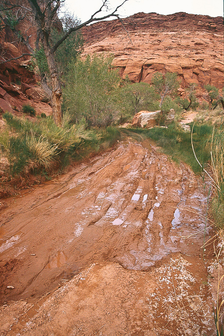
The road within the canyon seems to be graded from time to time, maybe for the gage down on Dirty Devil River. With a lot of water flowing from the springs it might be partially muddy.

Another year with much more water
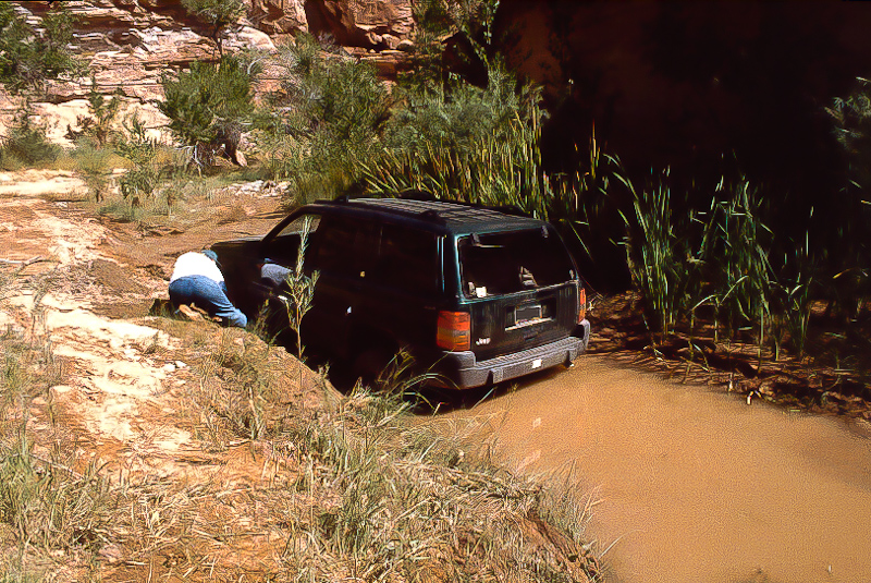
We had to rescue our rig....
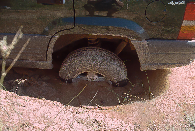
Digging is difficult, we prefer to lift the vehicle
More mud
Take these pictures only as an alert. The road can be easy or even not.
Now more pictures from the tour in 2013:


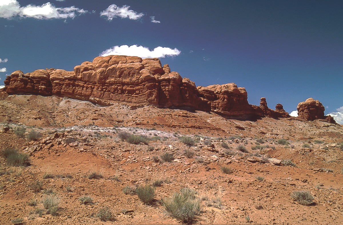
Erosional features

Now we are deeper than Wingate Sandstone but the gray gravel from the Henrys is still there


Chinle Hoodoos with Wingate caprocks

The canyons widens

A trench cuts deeper

It is called "The Black Jump"
The wash cuts into harder dark brown rock. For a while the road travels on to of the hard layer, the a dugway leads back into the wash down in the cut.

Black Jump

Back in the wash. The dark brown layer is above.

Presumably Moenkopi Formation

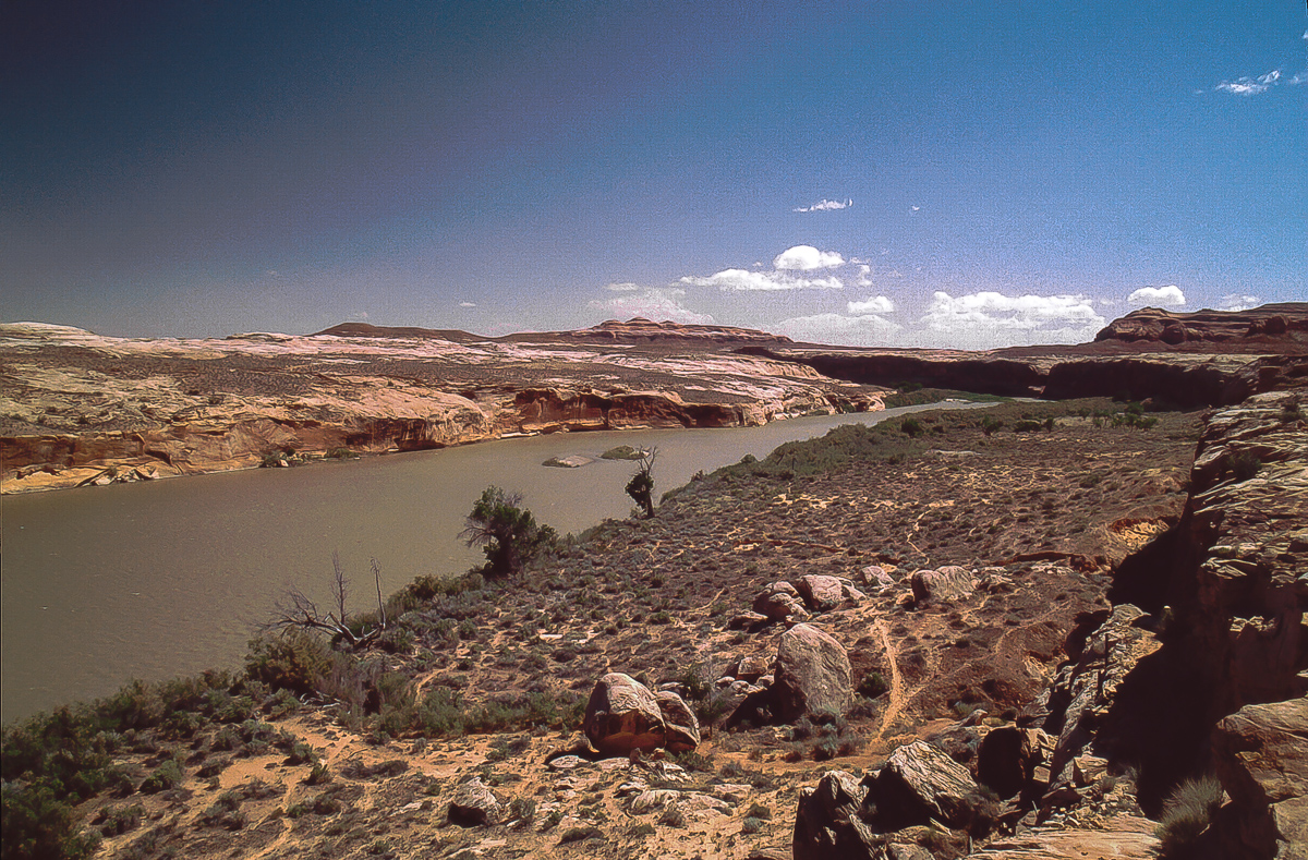
Down to Dirty Devil River

Easygoing

At 12S 0551624 4215867 the road leaves Poison Spring Wash
The road now climbs up a hill - call it a pass -on the north side but one can follow the wash down to Dirty Devil River Bank. It is half a mile away and we have seen a fire place there. People seems to camp occasionally at this point.

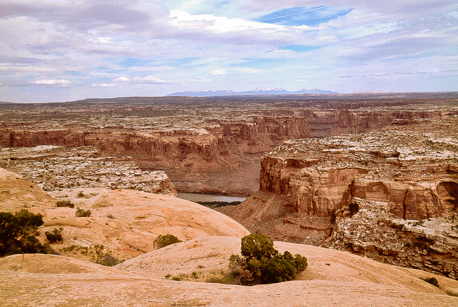
View from top of the pass
The high cliffs on the east side of the river are from Buckacre Point.

Buckacre Point is a wonderful view point - if one mekes it to the westernmost tip
Now we have to ford Dirty Devil River. This year it's very easy, so easy that we did not take any picture. (Shame on us!)
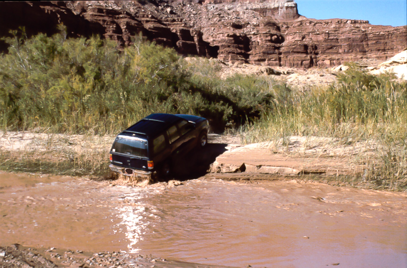
18-20 years ago the eastern bank was high and soft. Pretty difficult to climb up.
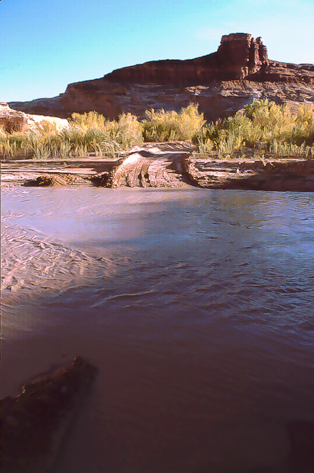
Sometimes there is more water in the river
To be continued....
-
Post Thanks / Like - 4 Likes
-
03-05-2016, 05:44 AM #3
The Great Traverse - Part 3
Dirty Devil River Canyon
Fording Dirty Devil River comes from easy to impossible. In May 2013 it was a snap. At least with our Wrangler.

Sandstone outcrop on the east side of the river
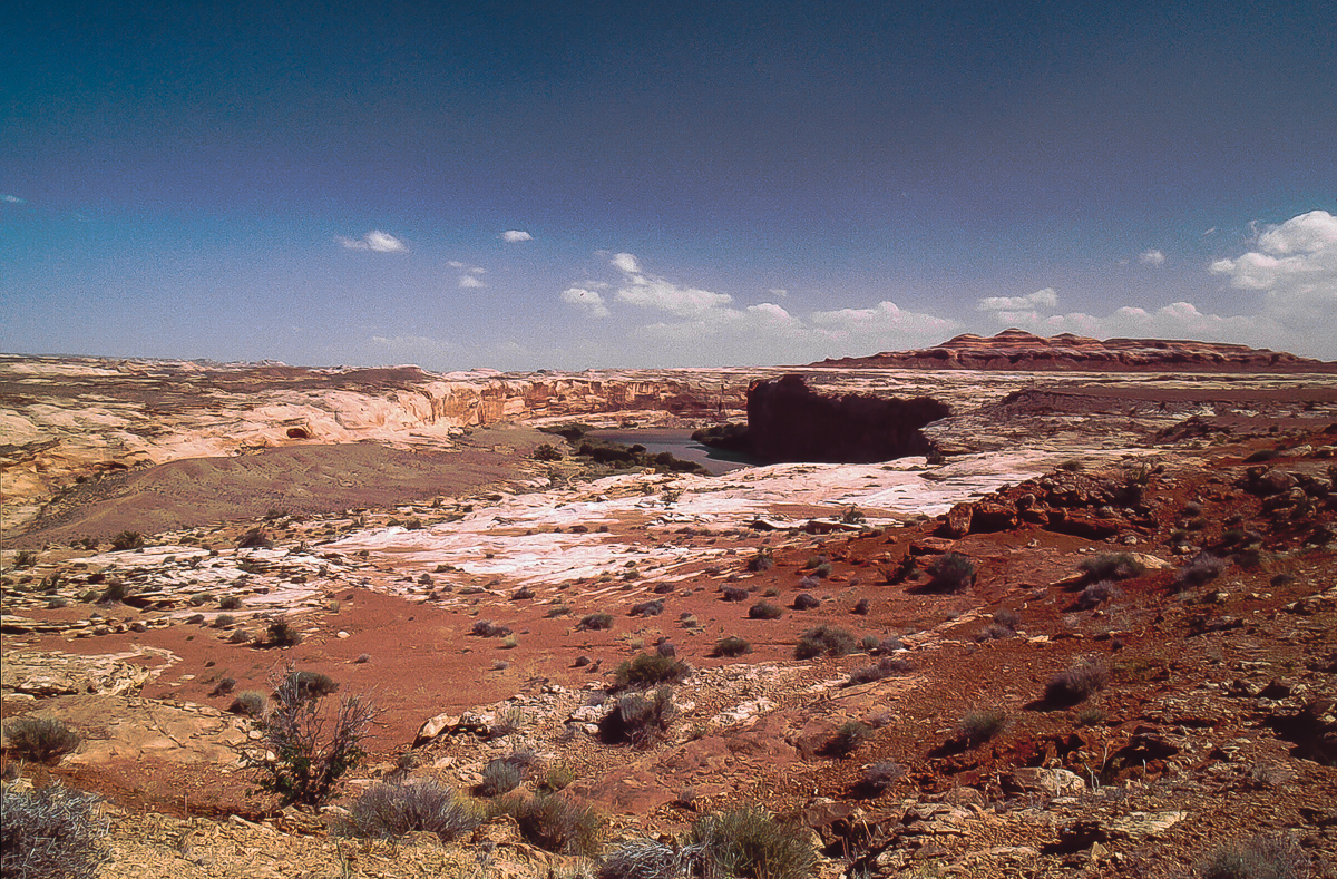
This is White Rim Sandstone. We are now in the Cutler Formation. But not for long, the road climbs into younger deposits.

Looking back to Poison Spring Canyon
It's an interesting place. The road on the west side of the river runs down from that little pass and it is in an old rincon of the Dirty Devil River. Near the river one can see the spur to the gage.

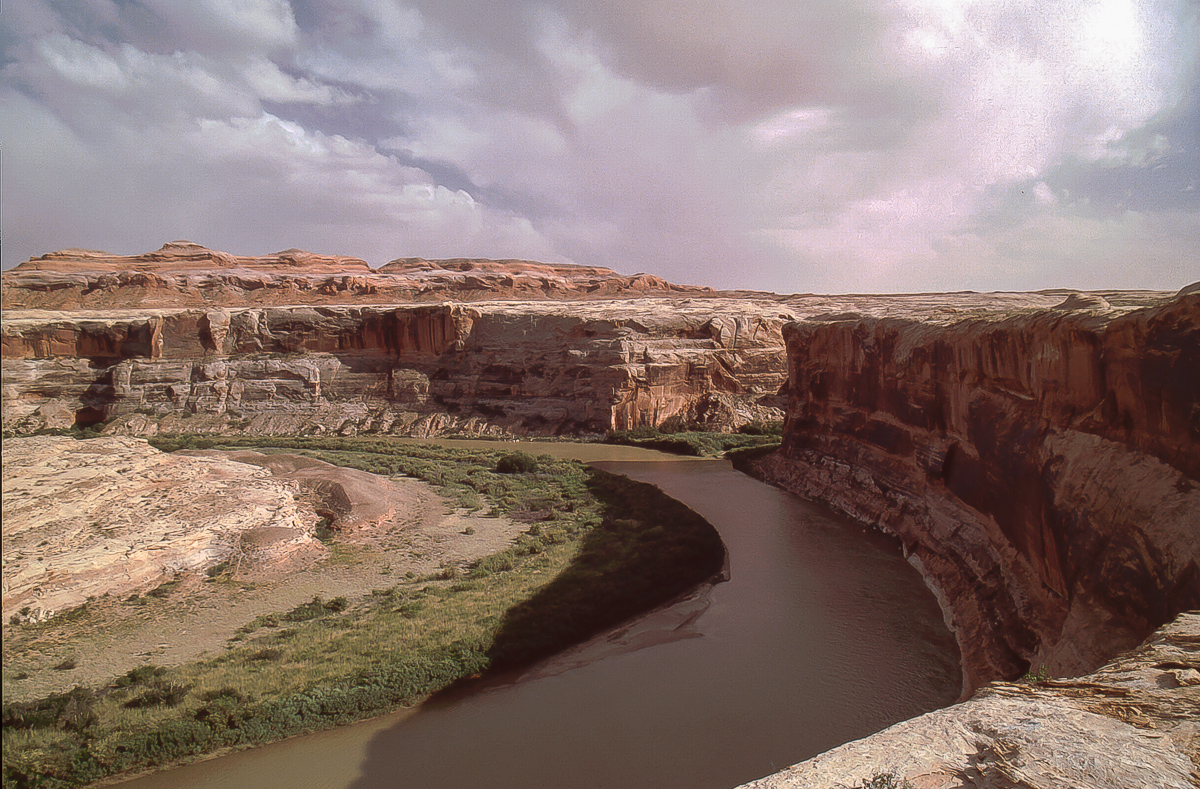
Dirty Devil River Canyon to the south

Dirty Devil River and the tip of Buckacre Point on the left

This notch gave us cover from some gusty winds. So we had a nice place for lunch.

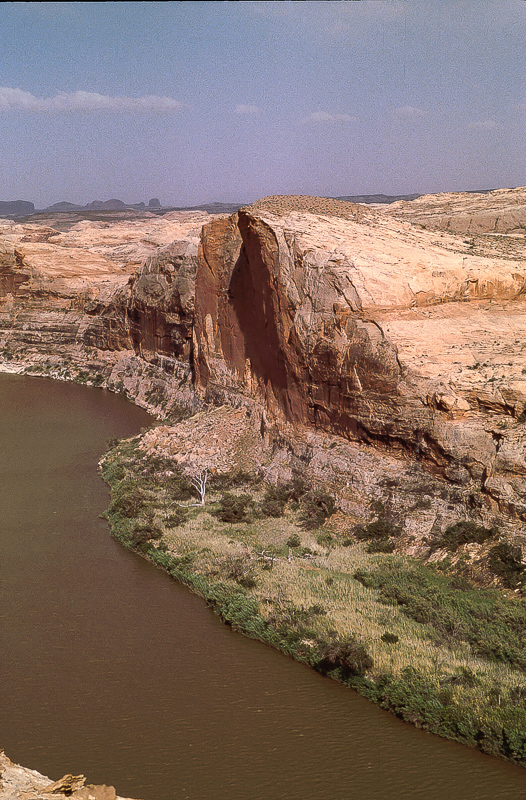
Cedar Point on the west side of the River
Cedar Point is in our opinion one of the greatest view points in southeastern Utah. The top is more than 2.200 feet above the river. Best time to visit it is in the late afternoon with the sun behind you in the west. Two unpleasant things: If it is dry Cedar Point is difficult zu reach due to deep sand. If it is wet you may have gnats. The last time we were there was mid of June 2015. May and June had been pretty wet and the sand was not a real problem but we got the gnats!

A view from Cedar Point - June 2015

Can you see the old mining road in the gray Chinle band?

Also on the west side of the river: Bert Mesa
The trail on Bert Mesa can be reached from Burr Point.

Once again Poison Spring Canyon

View to the south
The cliffline on the horizon are south of Colorado River / Cataract Canyon.

Moenkopi on top of White Rim Sandstone

At this point the road turns east into North Hatch Canyon

Heading into North Hatch Canyon - Buckacre Point above the road
To be continued....
-
Post Thanks / Like - 3 Likes
-
03-05-2016, 06:24 PM #4Bogley BigShot


- Join Date
- May 2007
- Location
- We're all here, because we ain't all there.
- Posts
- 19,424
Great photo's
I'm not Spartacus
It'll come back.
Professional Mangler of Grammar
Guns don't kill people--Static Ropes Do!!
Who Is John Galt?
-
03-06-2016, 03:49 AM #5
The Great Traverse
Part 4: North Hatch Canyon
Where is the name "Hatch Canyon" coming from? Seems that it has nothing to do with a trap door. In Navajo "atchee" means a red color or high cliffs and it is said that the Diné called the canyon "atchee atchee". Quite appropriate. (from Steve Allen: Utah's Canyon Country Place Names)
In 2013 the road was in excellent condition. We found it much worse in some years earlier. Simply some pictures:

Part of Buckacre Point

Chinle Hoodoos

More coloful Chinle


Ragged slopes

Good road....

....but take care of some hard to see ditches
This ditch is not very impressive. Years ago we found there some others 10 feet deep. Impossible to cross at least for us.

Small window on the brink of the inner canyon

Hatch Canyon System

The inner canyon is a steep walled trench
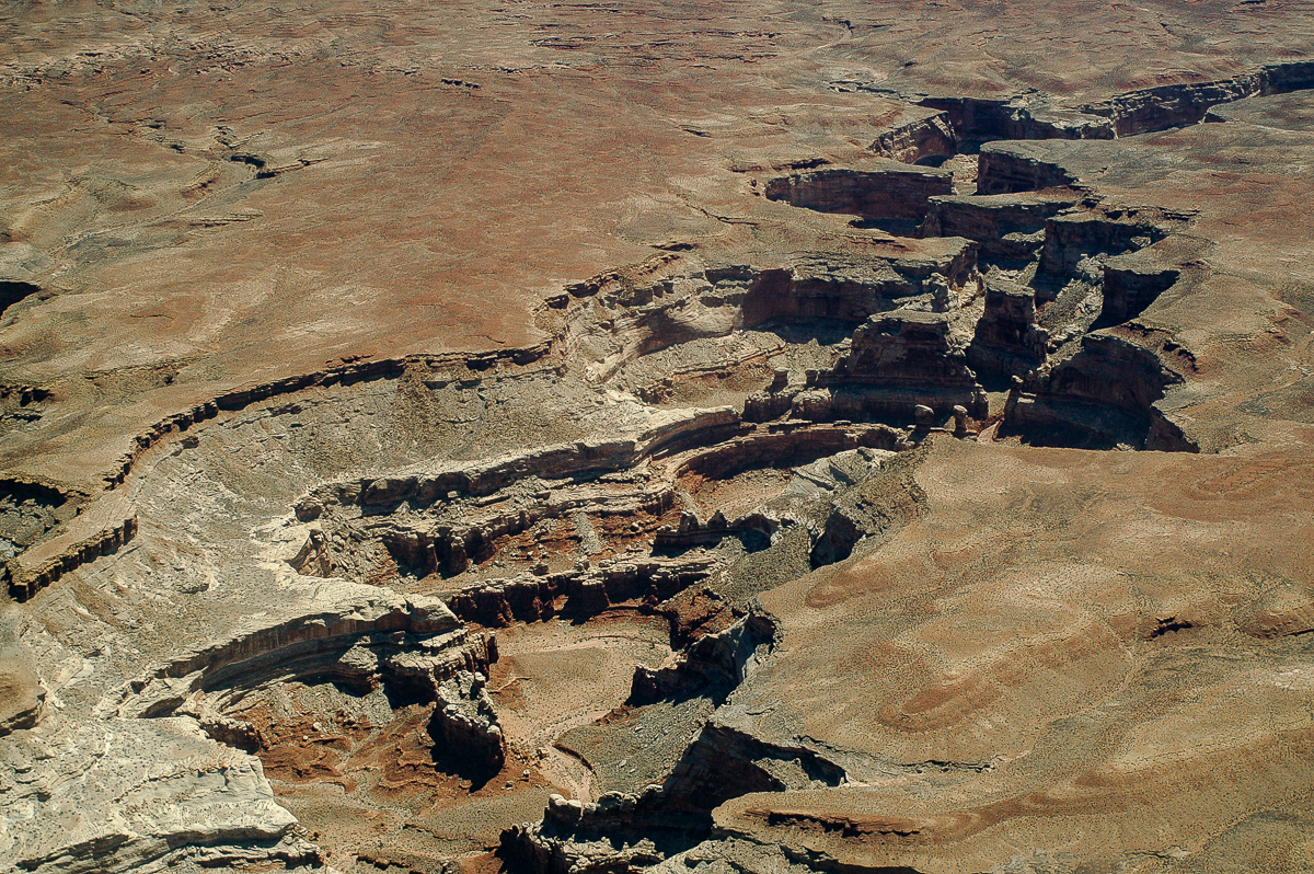
From the air: Hard White Rim Sandstone as a cover

From Kayenta on top down into Moenkopi

North Hatch Canyon Road

Chinle and Moenkopi: soft and colorful

Hoodoo

Mormon Tea (Ephedra nevadensis)

Cliffs of The Big Ridge

Middle of the picture: The dividing block between North and South Hatch Canyon

Looks like a smaller version of Monument Basin on White Rim Trail

"Atchee atchee" in Navajo

Two Pipe Spring Canyon is a tributary

Echinocereus triglochidiatus (Claret Cup Cactus)

Pituophis melanoleucus deserticola (Great Basin Gopher Snake)
To be continued....
-
Post Thanks / Like - 3 Likes
-
03-07-2016, 07:18 AM #6
The Great Traverse
Part 5:
On the eastern end of North Hatch Canyon the Big Ridge Cliffs are the main obstacle for any traffic. The road winds over a - as far as we know - nameless pass into South Hatch Canyon. The elevation difference is less that 400 feet but the road is in Chinle and that makes it sometimes difficult. Deep ruts occasionally with more than 3 feet depth run down the track. On other days ona might find a large boulder on the road - mainly Wingate from above. Every now and then one falls or tumbles down or slides over the surface when wet.

Looking back to the west on eastern end of North Hatch Canyon.
The picture was taken from the northern flank of the pass.

Yellow Sego Lilys are uncommon

Wingate boulders coming down

South Hatch Canyon and Sunset Pass with Gunsight Butte
Gunsight Butte is a well known landmark. The road over the pass goes through the northern - in the picture left - opening eventually reaching Waterhole Flat. Years ago Tim Martin flew us through the right gap - through, not over.

South Hatch Canyon
20 years ago another trail was running down South Hatch Canyon towards Fiddler Butte. The trail was more or less the wash. We made it down the trail for several miles. Nowadays it is closed. Might be that the western part is accessible via another trail branching off North Hatch Canyon Road at 12S 0560175 4217156. This must be the other end of the trail in South Hatch Wash.

Telephoto lense picture down South Hatch Canyon

Camping area on Sunset Pass

Looking down South Hatch to Fiddler Butte

Orange Cliffs
Two miles east of Sunset Pass is Waterhole Flat, the place where Hite Road, Hatch Road, the road from Flint Trail and the trail to Doll House cross.
Roads crossing on Waterhole Flat
Hite Road
At the crossroad we turn left and travel along the Orange Cliffs. To our right we see the large and wild Maze Area.

Orange Cliffs

Teapot Rock

Road towards Flint Trail

Chinle Formation below Wingate Sandstone

800 feet below: Trail to the Doll House

in 1994 on the trail to the Doll House

Chinle Deposits

Chinle comes in different hues
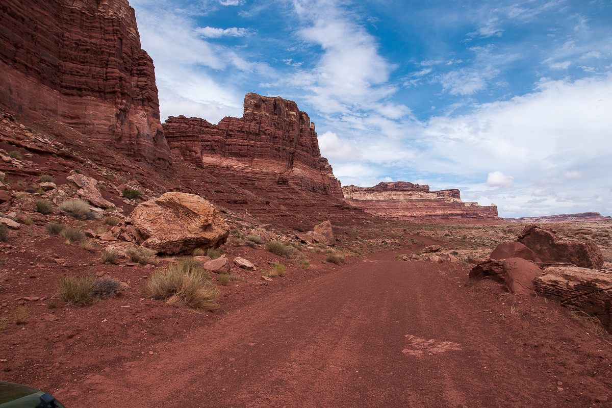
Flint Trail is well known for it's sometimes difficult trail on which two vehicles cannot pass each other. Elevation difference: some 600 feet.
12 miles from the upper end of Flint Trail to Hans Flat Ranger Station, the only "civilized" place on the 130 mile distance.

also in 1994: Hans Flat Ranger Station.
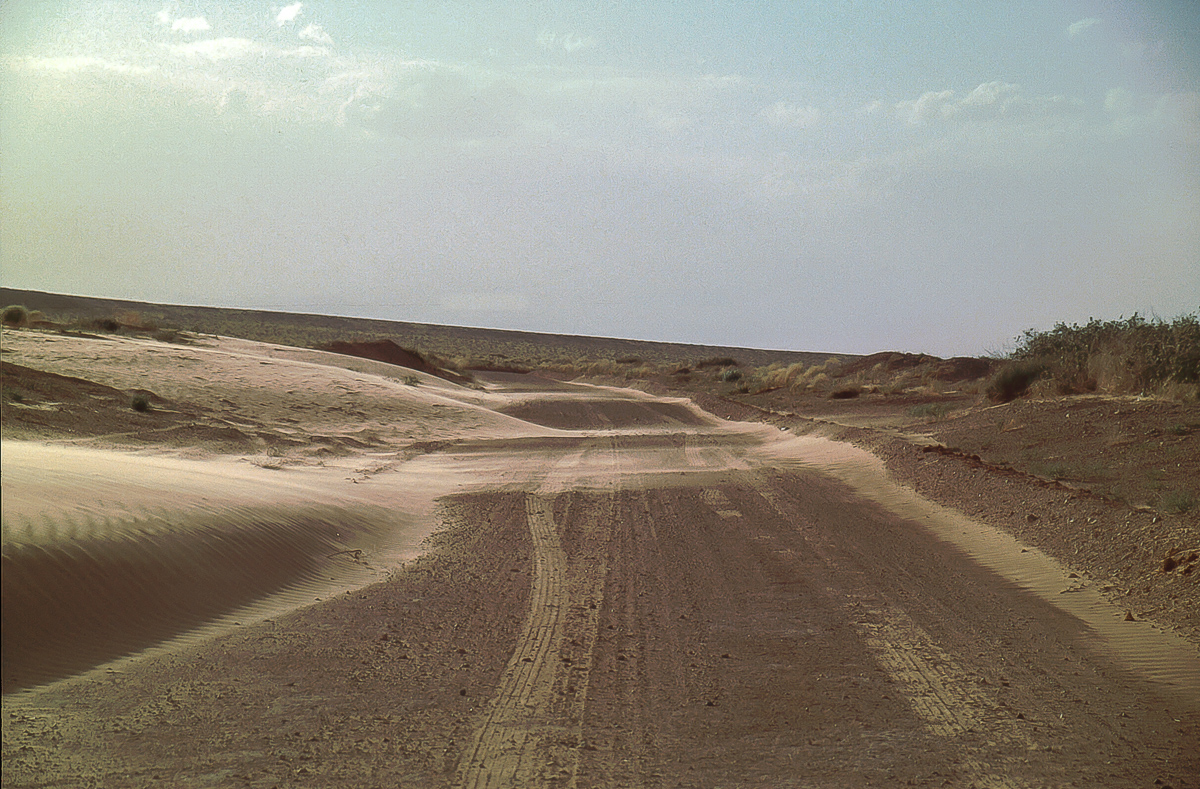
The road from Hans Flat to Green River does not have that much points of interest. Sometimes it is pretty sandy, sometimes you can drive nearly like on a paved highway.
To be continued....
-
Post Thanks / Like - 2 Likes
-
03-08-2016, 04:27 AM #7
The Great Traverse
Supplement
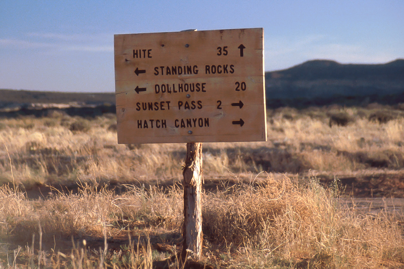
Found this picture from the beginning of Poison Spring Road not far away from the UT 95 pavement. Date: mid June 2015.

Sign on Poison Spring Road
The sign reads "Poison Springs" but the USGS Topo Quads have the name "Poison Spring". And wow - road no 15000! The number sign must be relatively new.
-
03-08-2016, 10:07 AM #8
The Great Traverse
Part 6
Sure, the road from Hans Flat Ranger Station to Green River is not a highlight by its own. The same is true if you prefer to take the other route to UT 24 where this road ends not far away from the beginning of the Road to Goblin Valley.
We take this one to the north and Green River. Be warned - in the dusk or dark sometimes Pronghors run across the road! Cattle is also there in open range.
11 and a half Mile from Hans Flat lies Granary Spring, a starting point for Blue John Canyon, the slot where Aron Ralston lost his arm (Movie: 127 hours). We didn't visit this Canyon. The same is true for Horseshoe Canyon with it's Great Gallery of Rock Paintings. For some people a must but we don't know much about these things.
At 12S 0573720 4268105 an interesting side trail goes east passes by Keg Knoll - some kind of a landmark - and ends on top of a slickrock field. A foot trail in northeastern direction bringy you to the brink of Two Canyon and a very special Arch. It is called Collonade Arch or 5 Opening Arch. Some older pictures:

End of the 4WD Trail - Keg Knoll behind
Two Canyon and Green River in Labyrinth Canyon

Potholes

You have to find your own way

A first glimpse

How to go to the arch? This way!

5 Opening Arch: Three in front, two on the backside
Another Point of interest is Entrada Gap, a 4 WD route mostly on slickrock. Not easy to find. The trail starts at the Bull Bottom Trail (12S 0575375, 4287525). This are also older pictures.
Entrada Cliffs
Bull Bottom ant the old cattle trail
Between the Entrada Cliffs and the Green River
There is a lot of chert in the area.
Slickrock and Entrada
To find the way stay always on slickrock but nearby the red rocks above it.
Trin Alcove Bend
"Half Dome" on the eastern side of the Bend
Back on Green River Road
To be continued....
-
Post Thanks / Like - 1 Likes
 oldno7 liked this post
-
03-09-2016, 09:53 AM #9
The Great Traverse
Part 7
Two and a half mile north of Bull Bottom Road crosses San Rafael River. North of the river bridge runs a trail east to the old Chaffin Ranch. Once there was a (drilled) cold water geyser but it is said that there are noc longer any acivities.
Here the road runs through an old nameless rincon of the Green River but it is a pretty flat one. After climbing up the western rim the road reaches the next old ringon within less than one and a half mile. This one has a name: Dry Lake.
six and a half mile further the road crosses the dam of Horse Bench Reservoir build by the CCC in the early 1940ies. It is not the reservoir - most times dry - that looks interesting it is the small badland around it. Color banded Morrison formation!


Horse Bench Reservoir and Horse Bench Cliffs

An evening picture
Even if the soil looks not very fertile there are some plants blooming.

Astragalus ????

Astragalus coltonii

Desert's Mule Ear


Simply a wonderland of colors.
The last leg to Green River is not that attractive, simply gray soil and soft hills. Bad in wet weather. Even there we found some flowers:

Astragalus newberryi variety newberryi (Halogeton glomerus left)

Halogeton glomerus is poisonous, at least for sheep.

Desert Trumpets

The yellow hue comes from the tiny flowers of the Desert Tumpet.
Now we are through after 130 miles!
-
Post Thanks / Like - 3 Likes


 Reply With Quote
Similar Threads
-
[News] Double Zion Traverse?
By Riseforms in forum RunningReplies: 2Last Post: 05-16-2012, 09:35 PM -
[Beta] Anyone do this traverse?
By jumar in forum Hiking, Scrambling & Peak BaggingReplies: 6Last Post: 05-25-2009, 12:38 AM -
The Utah Traverse
By montanablur in forum Offroad 4x4, Side by Side and ATVReplies: 6Last Post: 11-22-2008, 03:00 PM -
Nice traverse
By tmartenst in forum General DiscussionReplies: 6Last Post: 04-28-2008, 07:51 AM -
Devils Castle Traverse
By Iceaxe in forum CanyoneeringReplies: 7Last Post: 09-19-2005, 08:24 PM
Visitors found this page by searching for:
Outdoor Forum
