

Results 1 to 13 of 13
-
03-14-2012, 07:31 PM #1
San Rafael Reef between Iron Wash and Mormon Tanks
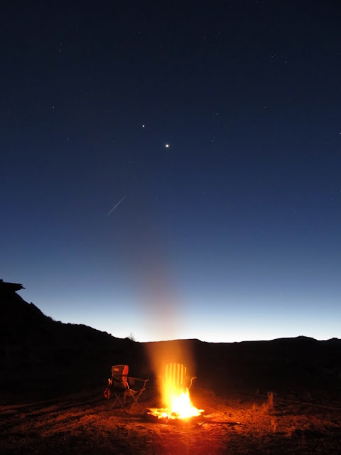
My last few trips to the San Rafael Reef were done with a particular destination in mind, but this time I just picked a canyon at random and hiked up it. I drove down after work on Friday and made a quick stop in Iron Wash. There's an old pioneer signature there that I wanted to see, and I found some other undated initials carved in the sandstone that looked pretty old. I also found a shallow cave with grinding marks and sharpening grooves, plus plenty of soot and old charcoal inside, but unfortunately no rock that I could see in the area. After leaving Iron Wash I drove a short distance and found a place to camp near the canyon that I wanted to hike up. I built a fire pit and got a fire going so I could cook some dinner, then set up my tent and relaxed around the fire and read a book. Watching the waning full moon rise over the La Sals was a treat.
Parked at the barricade in Iron Wash

J.A. Watt signature

Small cave in Iron Wash

Grinding marks at the mouth of the cave

Sharpening grooves

View out of another cave in Iron Wash

Getting a fire going

Camp fire
Tent and truck

Moon rising over the La Sal Mountains

My shadow in the moonlight

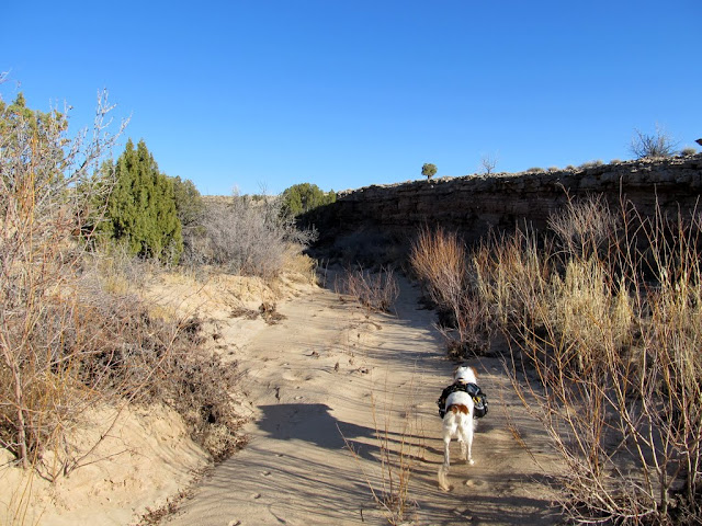
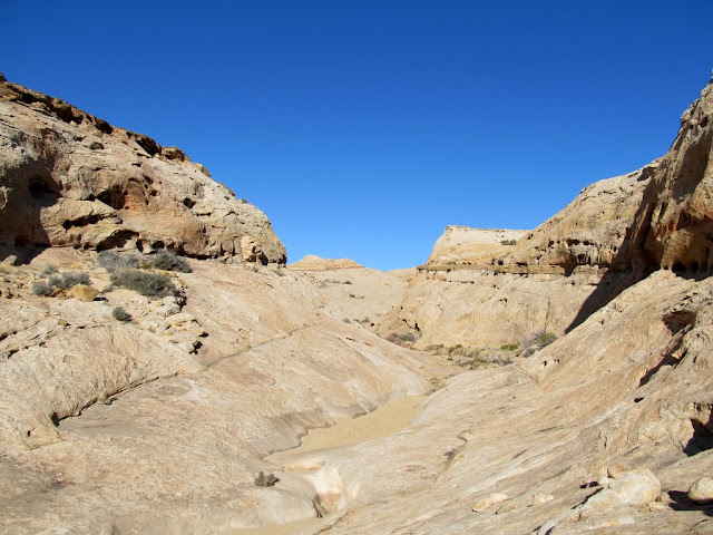
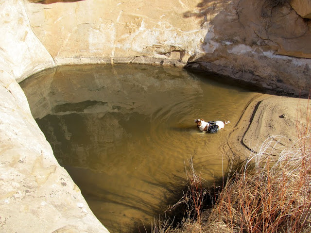
I was up early on Saturday morning and started hiking at about 8:00AM. The lower part of the canyon was not terribly interesting, but I took it slow and kept an eye out for rock art, which I can't help but do in this area. :) Farther up the canyon there were some large pools of water, which my dog couldn't help but take a dip in. I came to a large pool that gets no direct sunlight this time of year and had some sand-covered ice in the bottom, and a large dryfall above it that looked impassible. I had to do a steep scramble around one side to get past it, and it took some effort to shove my dog up ahead of me. Just above the dryfall was a narrow side canyon full of water. If it had been dry, I would have loved exploring it. In the main canyon above the first big dryfall were several smaller ones that were impossible for me to climb, but again I found a way around them by scrambling out of the drainage. Not far after getting back into the main drainage was yet another dryfall that I simply couldn't get around--well, my dog couldn't get around it, so that was where I turned around and headed back down the canyon looking for another way up to the canyon rim.
Early morning at camp

An old spur I found near camp

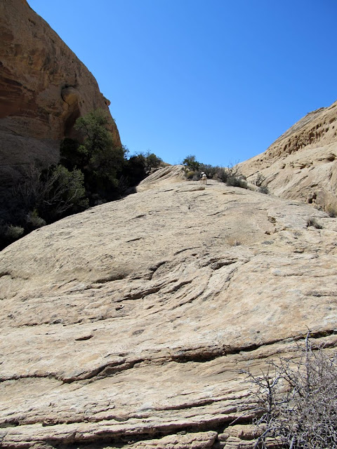
Starting up the canyon
A shallow cave with a few signs of ancient habitation

Small arch in the canyon wall

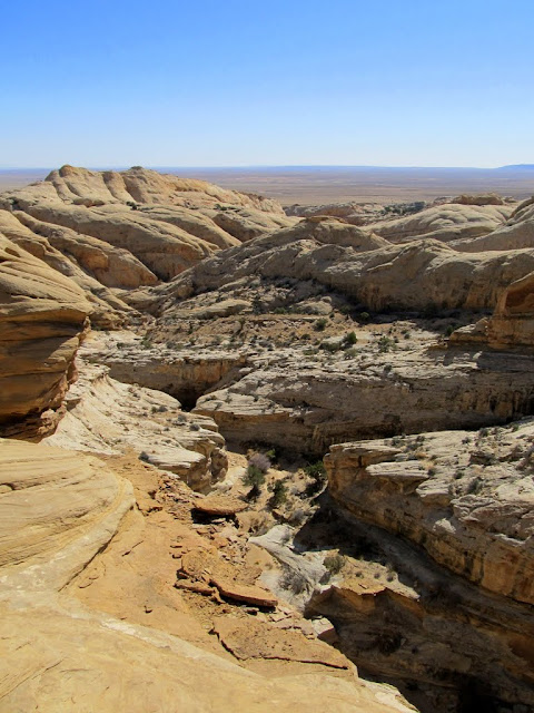
View up the canyon
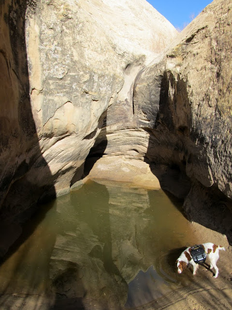
Torrey in a pool
A large row of Fremont's Mahonia

Just after scrambling around the first big dryfall

Water in a narrow side canyon

A series of small potholes that I went around

Crazy concretions on the canyon wall

Another dryfall that completely halted my progress
This was as far as Torrey would go when trying to bypass the dryfall

I backtracked more than half a mile before finding a spot to climb out of the canyon. On the way back down, though, I found an arrowhead that I'd walked right past without noticing earlier in the morning. After climbing out of the canyon, I dropped down into the next canyon to the north and started ascending it. Once I saw ahead that the canyon narrowed up and became choked with brush and trees, I started following the ramping sandstone wall on the north side that led to the canyon's rim. After scrambling up and down some sandstone fins and following some brush-choked cracks, I found myself overlooking the canyon I'd originally started hiking up, though I was about half a mile upstream from the dryfall that had stopped my progress earlier. I stopped there for lunch and scouted the canyon below me.
An arrowhead lying in the bottom of the canyon

An adjacent canyon that I dropped into
Lots of rockfall in this canyon

Looking back at the ramp I used to hike out of the canyon to the rim
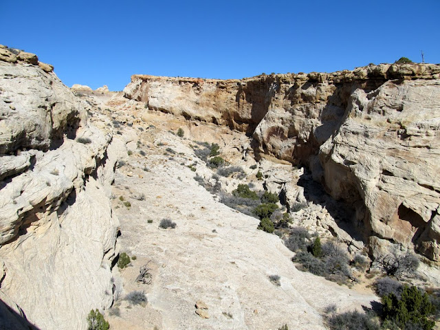
View into the canyon where it narrowed up

Descending a fin

A crack that I hiked through
Aiming for the gap in the center

Bushwhacking ahead

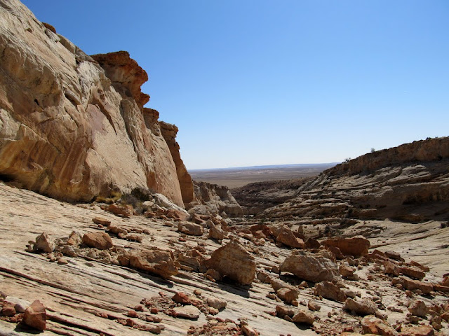
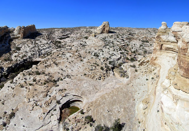
View from my lunch spot, looking down the first canyon I'd ascended
View up the canyon

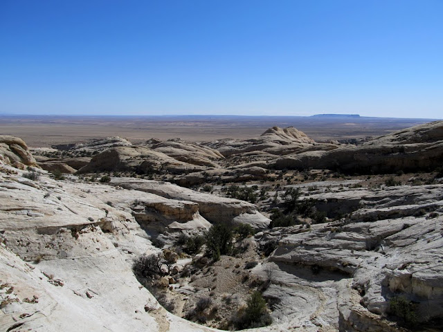
After seeing what kind of country was ahead of me if I wanted to continue up the San Rafael Reef, I decided to call it a day. The route up to that point had been pretty convoluted, and it was only going to get worse if I kept ascending. I didn't want to follow the same route back, so I continued a little farther up the Reef before rounding a corner and descending back into the section of fins. I exited the Reef through the second canyon I'd ascended, then walked along a dirt road just over half a mile back to camp, where I packed things up and headed home.
I followed this ledge between cliffs to the point on the left

Nice view into the upper canyon drainage
View down my exit route
Many more potholes on the descent


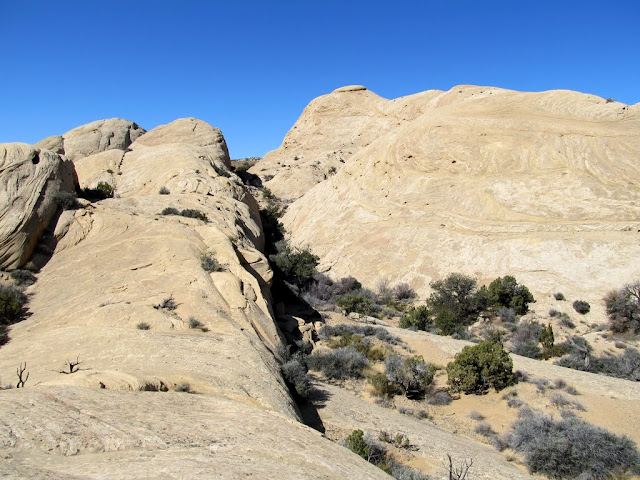
Cutting across some fins

Hiking up a fin
The dirt road back to camp

Full photo gallery:
https://picasaweb.google.com/Dennis....AndMormonTanks
Google Map:
Viewing on a mobile device? Click this link to open the map: http://maps.google.com/maps?q=http:%2F%2Fudink.org%2Fgeo%2FSanRafaelReefBetweenIronWashAndMormonTanks.kmz&hl=en&sll=37.0625,-95.677068&sspn=40.545434,86.572266&t=h&z=14
http://udink.org/geo/SanRafaelReefBe...ormonTanks.kmz
-
03-14-2012 07:31 PM # ADS
-
03-14-2012, 09:37 PM #2
Awesome TR!
 I liked the arrowhead and moon rising over the La Sals. Thanks Udink.
-
03-15-2012, 05:04 AM #3
the map with all of the points is much appreciated. Obviously, it makes it crystal clear where each area is. Thanks. I need to learn how to do that.
-
03-15-2012, 07:18 AM #4
Very cool TR man! Kinda off the subject but how do you like that doggie backpack? I bought a cheap one from Petco and it is wearing out after just a year, so I am looking to buy a nicer quality brand. Something similar to what yours has :) The handle on top looks ideal for helping them through tougher spots.
Your safety is not my responsibility.
-
03-15-2012, 08:36 AM #5
I like the pack just fine so far, but this is really our first back country trip with her wearing it. The handle was indeed very useful when I had to help her scramble up and down a couple of steep drops. The pack held up great after getting wet and doing a lot of bushwhacking. It's a Mountainsmith dog pack, size small, and it can hold a 1L Nalgene bottle in each side, plus still have room for food or whatever else. I got it at Sierra Trading Post for about $25.
-
03-15-2012, 02:05 PM #6
...another fine TR of the Reef.
Thx for sharing, Dennis.
Cool pics!
Map?
- 404 Not Found -
-
03-18-2012, 06:33 PM #7
Incredible! Nice work.
-
03-18-2012, 06:42 PM #8Bogley BigShot


- Join Date
- May 2007
- Location
- We're all here, because we ain't all there.
- Posts
- 19,424
Way nice again Dennis
-
03-18-2012, 08:06 PM #9
cool TR thanks
-
03-18-2012, 09:28 PM #10
Nice TR!
Looking forward to exploring that area even more after seeing your photos.
THE MOST TALKED ABOUT CANYONEERING TRIP OF 2017 - WEST CANYON VIA HELICOPTER.
TRIP REPORTS: TIGER | BOBCAT | OCELOT | LYNX | SABERTOOTH | CHEETAH | PORCUPINE | LEOPARD
DON'T BE A STRANGER, LEAVE A COMMENT AND/OR SUBSCRIBE.
WWW.AMAZINGSLOTS.BLOGSPOT.COM
-
03-19-2012, 11:12 AM #11
Concretions!!!! That's what we call all the concrete finishers on my crew!

Nice TR!
-
03-21-2012, 11:10 AM #12
Great TR...Awesome arrowhead find! Not many of those left I'm sure...
-
03-21-2012, 12:33 PM #13
The photos rock! Trip report was an interesting read and I thank you for including the map! Awesome!
[COLOR=#800080][FONT=franklin gothic medium]"Too often I would hear men boast of the miles covered that day, rarely of what they had seen." Louis L


 Reply With Quote


Similar Threads
-
[Trip Report] Old Woman Wash, San Rafael Reef
By Udink in forum Rock Art & RuinsReplies: 13Last Post: 02-25-2012, 12:22 PM -
[Trip Report] Marinus and N Fk Iron Wash in Bogley Format
By Scott P in forum CanyoneeringReplies: 4Last Post: 05-11-2010, 10:26 AM -
[Trip Report] Day of the San Rafael Reef
By coinslab in forum Rock Art & RuinsReplies: 2Last Post: 10-20-2009, 06:05 PM -
[Trip Report] iron wash
By goofball in forum CanyoneeringReplies: 4Last Post: 08-22-2007, 04:57 PM -
[Trip Report] North fork of Iron Wash
By rokh4x0r in forum CanyoneeringReplies: 4Last Post: 10-16-2006, 01:37 PM
Visitors found this page by searching for:
Outdoor Forum
