Results 1 to 9 of 9
Thread: Fifth Water Loop
-
07-23-2010, 09:55 PM #1
Fifth Water Loop
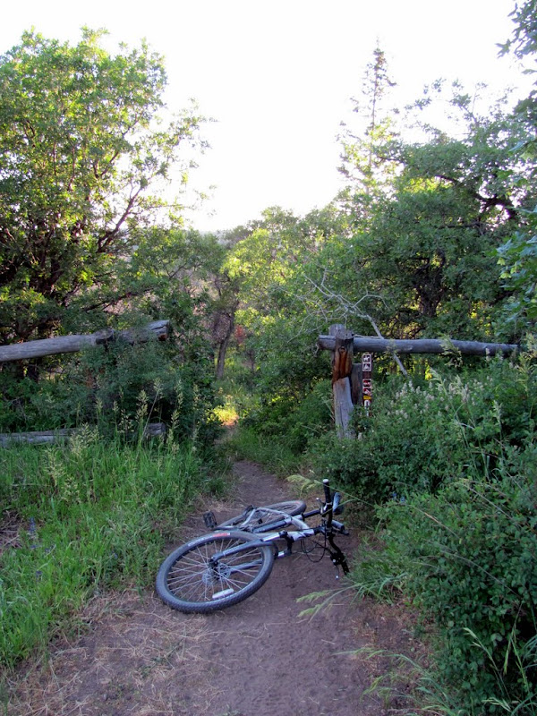
I worked all day in Orem yesterday, and on my way back to Price I took a detour to ride the Fifth Water loop. I started the ride around 6:00 PM, and apparently bit off more than I could chew. I rode the loop clockwise, and the uphill was relentless! I ended up riding well after the sun went down, and reached the car at 9:30 PM. Still, it was a beautiful area, and the singletrack was killer.
The trail started out fairly level, gently winding through brush and small trees. There were a lot of deer flies down low, but as I ascended there were more mosquitoes. The first two miles were mild as the trail followed the creek. After two miles the trail forked, and I took the left fork and began the steep climb up to Fifth Water Ridge.
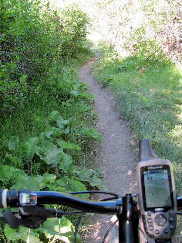
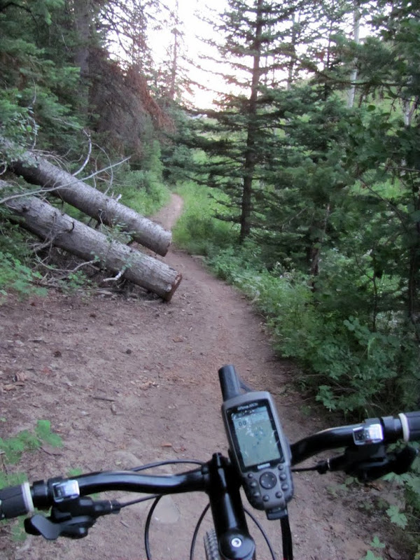
The beginning of the trail near Ray's Valley Road

Typical trail down low
A pond near the fork in the trail

At the fork

The creek and trail share the same space here
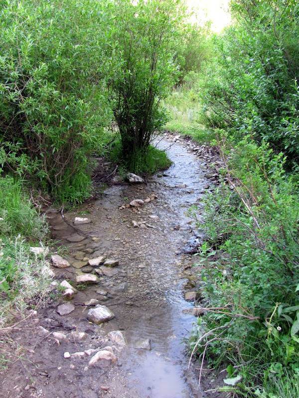
After riding through the creek
A brief level section

Nearing Fifth Water Ridge

Another fork in the trail (I went right)

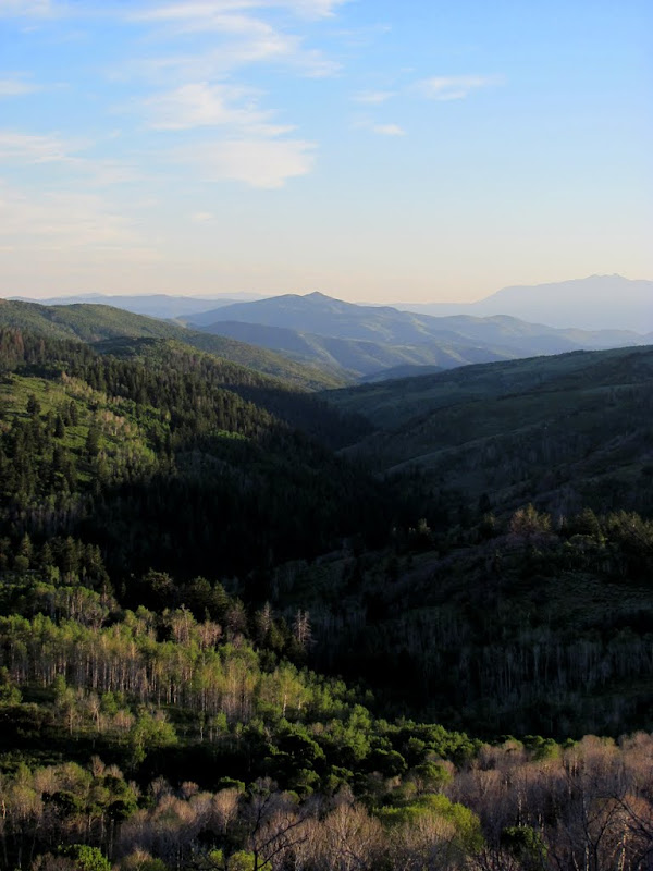
The hills to the west of Fifth Water Ridge
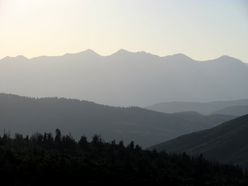
The top of Fifth Water Ridge
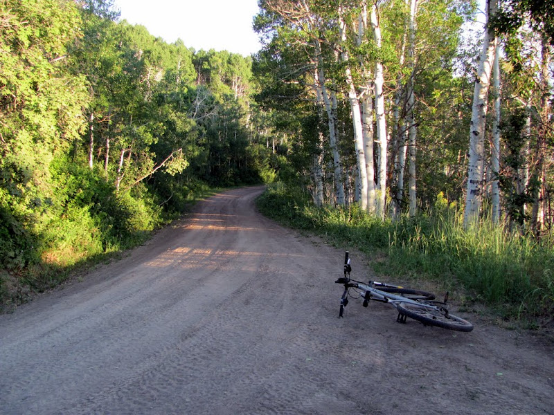
After reaching the top of the singletrack at the top of Fifth Water Ridge, I followed a graded dirt road to Strawberry Ridge. This was roughly the halfway point of the ride, and the sun was beginning to sink behind the horizon. The view toward Strawberry Reservoir was nice, but I didn't take nearly enough time to enjoy it. I knew that I didn't have much time to reach the car before full dark, so I didn't take many photos after reaching Strawberry Ridge.
Dirt road to Strawberry Ridge
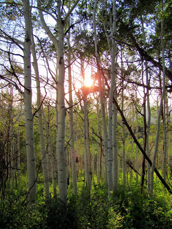
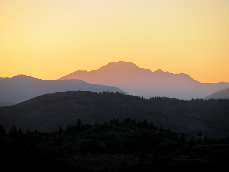
The sun setting behind the aspen
View down along the canyon between Fifth Water Ridge and Fifth Water Creek
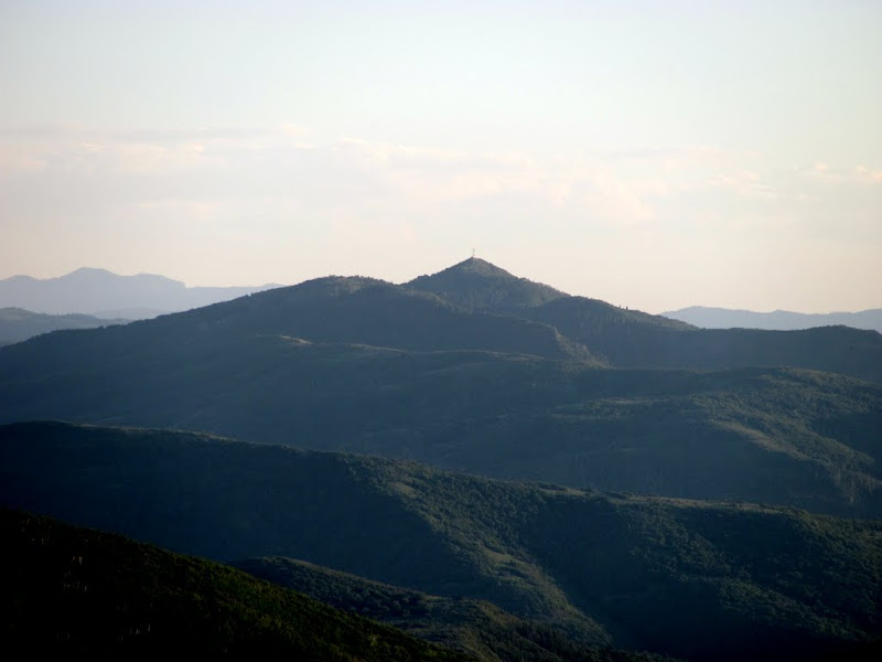
Teat Mountain (uh-huh-huh-huh)
A bird

Strawberry Reservoir
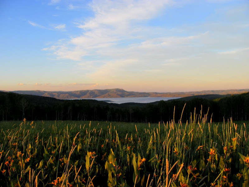
Close-up of the reservoir

Moun-uns
Finally, some downhill

Almost to Fifth Water Creek
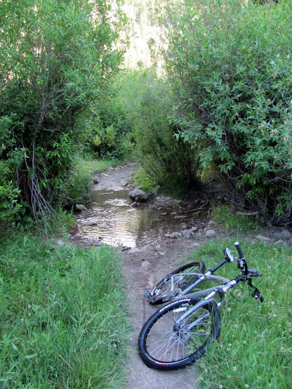
More riding in the creek

I walked my bike across this pool

Back at the car well after sunset

There are more photos here:
http://picasaweb.google.com/Dennis.U...ifthWaterLoop#
And you can download the GPS tracklog and photo waypoints here:
http://castlecountry.org/geo/FifthWaterLoop.kmz
-
07-23-2010 09:55 PM # ADS
-
07-24-2010, 07:06 AM #2
Nice!
Still trying to get in riding shape.
-
07-24-2010, 09:25 AM #3
Sweet. I'll have to try that someday. Excellent report.
-
07-24-2010, 09:30 AM #4
Well done trip report. Thanks.
Some folks may not know, but the newest Google Earth can show an elevation profile along with grade and distance. That plus these geotagged photos and descriptions round out the report nicely.Gene
-
07-24-2010, 11:45 PM #5
The bird pic is awesome!
-
07-30-2010, 05:38 PM #6Ditto. Cool trail and scenery.
 Originally Posted by tmartenst


-
08-07-2010, 09:10 PM #7
very nice! I've never been up that end of fifth water...although I know the Three Forks side well...at least up to the hotsprings

-
08-07-2010, 10:19 PM #8
I have been up in that area a lot. Lots of rattlesnakes in sections up there. Kind of a junkshow at the hotsprings these days. Nice one, looks like fun!
-
08-07-2010, 10:32 PM #9


 Reply With Quote


 I was worried enough about bears, which I'd seen several years ago about six miles to the south near Baldy Mountain.
Similar Threads
-
Water! [GIF]
By accadacca in forum General DiscussionReplies: 2Last Post: 02-22-2010, 12:45 PM -
[Beta] Water Canyon Squirrel Canyon loop help?
By Rented mule in forum Hiking, Scrambling & Peak BaggingReplies: 5Last Post: 05-27-2009, 03:04 PM -
Water - How much is too much?
By tanya in forum General DiscussionReplies: 11Last Post: 06-19-2007, 05:00 PM -
[Beta] Fifth Water
By caburt in forum Hiking, Scrambling & Peak BaggingReplies: 20Last Post: 04-05-2007, 10:29 AM -
how much water?
By Biner in forum CanyoneeringReplies: 4Last Post: 09-25-2006, 01:32 PM