

Results 1 to 7 of 7
-
06-23-2015, 05:15 PM #1
Misery Canyon, just outside East entrance of Zion
Hi,
I just wondered if anyone has done both the East and West (Fat Man's) forks of Misery Canyon before their confluence. Which one is best from a purely scenic and photographic point of view, forgetting which one is more fun for the canyoneering side. I've heard east is easier, but just wanted to pick the one with the prettiest slots.
-
06-23-2015 05:15 PM # ADS
-
06-23-2015, 05:37 PM #2
I've done both East and West Fork in just about every configuration you can think of. My preferred route if given a choice is to enter over Checkerboard Mesa, down the West Fork, Up Parunaweap, and exit out French Canyon. This is also the easiest and by far the most scenic route. The only downside to that route is the shuttle required sucks, it's not to bad if you set it up the night before. The best part of Misery is from the confluence of east and west forks down to the virgin. The upper sections of both east and west are comparable, west is more popular as it's a little easier to access and there is a lot more beta available on the west fork. Information to complete all options mentioned can be found here.
Misery Canyon
http://climb-utah.com/Zion/misery1.htm

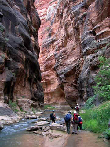
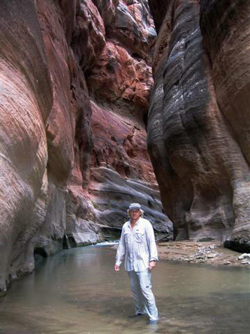
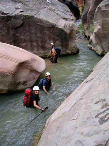
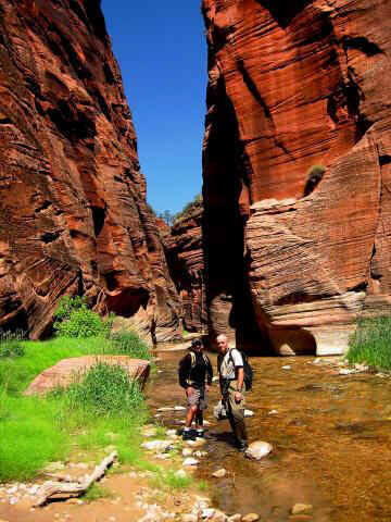
Below are a few pictures of what the exit up Parunaweap and out French Canyon looks like, which is why it's a favorite of mine. While everyone else is sweating and busting their butt to climb back over Checkerboard Mesa you can be strolling up P-weap wading in the cool, clear stream.
-
06-25-2015, 03:26 PM #3
with Zion temps running 108- 109 right now, this is probably the last canyon I would want to be dropping into. the water in the bottom is nice, coming out the other side helps get you out of the sun somewhat, but that deep sand over there in the heat ain't going to be much fun either. Find someplace to play in the water more.(Like Water). if you're locked into Misery get an EARLY start, to mitigate the heat somewhat.
-
06-25-2015, 06:25 PM #4Actually that's just bassackwards of how we do it in the heat. We get a mid-morning start. We lounge away the hot afternoon napping and playing in the east fork of the Virgin. We time our exit so we are hiking out in the cool evening. Last time we did this we reached our cars right at dark, perfect timing, another 5 minutes and we would have been breaking out the headlamps.
 Originally Posted by rick t

-
Post Thanks / Like - 2 Likes
-
06-26-2015, 02:07 AM #5
Thanks guys. But I'm thinking of going Oct so no heat worry I'll be cold! (i have come out French after Poverty before) I hope a wetsuit is enough and I don't need a drysuit!
Rick T, as you mentioned Water Canyon, you may be able to answer another question I was going to post. Was going to hike to the White Wave. Kelsey's book describes the route going up Squirrel Creek, but he drops in a line you can go up Water Canyon too, which seems firstly shorter and secondly more scenic, so I don't know why he describes Squirrel Creek unless Water is difficult for hikers..
Is it relatatively easy to hike/scramble up - or perhaps down - Water Canyon towards White Wave bearing in mind I'm not a climber, hence not too happy with exposure and I don't use ropes?
And is the route-finding up/down Water Canyon fairly easy? (I wlll have GPS, compassfor up on the top) Ideally I'd do a Water/Squirrel loop for different scenery, but if it's hard to pick the route sometimes it's better to go back the way you came, rather than searching out unfamiliar ways if it's a long day and light could become an issue.
And would either of these questions make a difference to difficulty and route-finding if I went up through Water Canyon or down through Water if I did a loop?
-
06-26-2015, 04:18 AM #6
There is a well defined hiker trail through Water Canyon from the trailhead to the top of the canyon at Top Rock, which offers great views. The canyon is very popular with both hikers and tech canyoneers. Once you reach the top of Water Canyon the trails are less traveled and not as well defined.
I've never done Squirrel so someone else will need to answer the rest of your question. I do knows it's not that popular.
-
06-26-2015, 10:23 AM #7Content Provider Emeritus


- Join Date
- Feb 2005
- Location
- Quiet and charming: Mount Carmel
- Posts
- 7,158
I personally have done about 150 trips to Water Canyon. It is a great canyon for guiding, and only a so-so canyon for recreationalists. Originally Posted by kaniukr
There is a well-defined trail going up Water Canyon with a couple spots of 3rd class. However, FINDING the trail from the top without a GPS and without familiarity would be quite difficult. If desiring to make it a loop, going UP Water and DOWN Sqwurel Canyon would probably work best. For a daytrip, Up and Down Water is probably the best route.
Did Up Sqrrrl a few years ago:
http://www.canyoneeringusa.com/rave/...rch-2728-2012/


 Reply With Quote


Similar Threads
-
[Trip Report] Parunuweap Canyon - The Barracks (east side of Zion Natl Park)
By redgoat in forum Backpacking & CampingReplies: 5Last Post: 08-13-2014, 10:22 PM -
[Invite] East Fork Misery 23-26 Jun
By Wasatch in forum CanyoneeringReplies: 0Last Post: 06-11-2011, 07:09 AM -
East Fork of Misery Questions
By french_de in forum CanyoneeringReplies: 5Last Post: 06-08-2010, 12:03 PM -
[Trip Report] Another Winter Day in Zion - East Rim Trail to Echo Canyon
By Bo_Beck in forum Hiking, Scrambling & Peak BaggingReplies: 27Last Post: 02-27-2008, 06:29 PM -
[Trip Report] Misery Canyon - Zion
By price1869 in forum CanyoneeringReplies: 3Last Post: 11-14-2005, 09:43 PM
Visitors found this page by searching for:
Outdoor Forum

