

Results 1 to 4 of 4
-
08-23-2013, 04:24 AM #1
Ben Lomond and Willard Peak - Aug. 6, 2013
On August 6, 2013, I drove up to Willard Basin and hiked to the summits of Ben Lomond and Willard Peak. The extra driving was not only scenic, it saved me a lot of miles hiking! However, I would recommend a 4WD for this road; though it was in relatively good shape the day I went, I'd say it's a bit too steep and rough for a sedan, etc.
This route to Ben Lomond is much shorter than hiking from North Ogden Divide. However, I'm not certain of the exact distance or elevation gain as I didn't utilize any tech to track my path. The Sierra Club "Ogden Area Outings Guide", my reference for this trip, is a bit vague on the numbers. It is at least a five-mile roundtrip, possibly as much as seven (going by the trail sign in the photo below); I'd estimate the elevation gain at 1300'. In contrast, per the same guidebook, from North Ogden Divide to Ben Lomond is a 16-mile roundtrip with 3500' elevation gain.
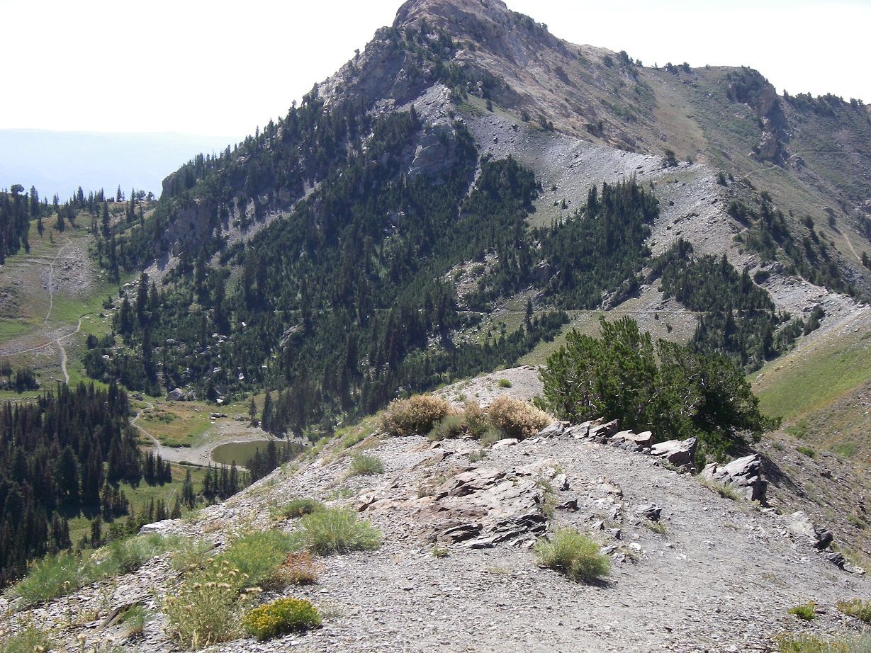
This route starts from a parking area/primitive campground that is about 11 miles up the road from Mantua (or about two miles before the road's end at Inspiration Point). In fact I first drove all the way up to the Point, where I'd never been before. Here I got a chance to enjoy the views of distant places and to preview the first mile or so of my upcoming hike, which can be seen in the photo below. You can see the pond that is the first goal of the hike, the trail from it, the long switchback up to the ridge, Willard Peak (the summit is cut off), and the trail that traverse's Willard's west slope on the way to Ben Lomond:
After leaving Inspiration Point, I drove the two miles back to the trailhead, and got started hiking about 11:20. I took what ended up being a slightly roundabout route up to the pond (there is a network of trails in the area), but it is such a short hike it doesn't really matter exactly which way you go.

As the guidebook notes, it is a steep climb up. Along the trail there was a lot of black netting, I suppose placed at one time to help prevent erosion or maybe to encourage revegetation. Sometimes it was on the trail as well, potentially presenting a tripping hazard.
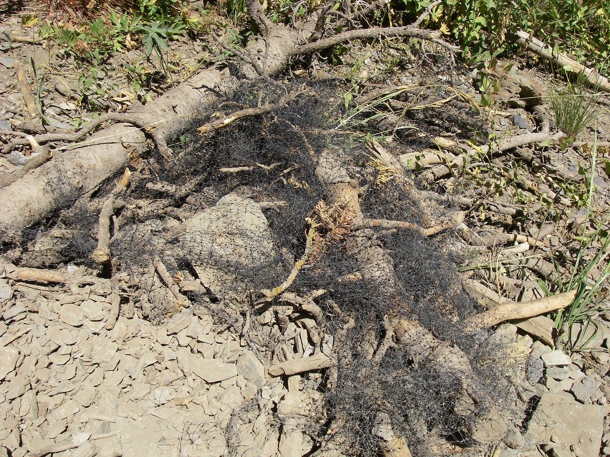
It also presents a hazard to wildlife, as demonstrated by a hapless sparrow or somesuch that I found hung up in some of it. Fortunately, I was able to shake, disentangle, and cut it free, and it flew quickly away, apparently uninjured.
I continued up and reached the pond from the west, followed the trail around it to the east side, then continued up to the long, obvious switchback. As I walked up this and approached the ridge, I could see there was a use trail that would have led more directly from the west side of the pond to the ridge, but it certainly wasn't apparent while I was down in the basin near the pond, so I don't know how you'd locate it on the ascent. By 12:00, I was on the ridge and ready to head toward Ben Lomond.
As the guidebook notes, you soon can choose to veer off the trail and head up Willard Peak's NW ridge on a use trail. However, I chose to focus on my main goal (Ben Lomond), reasoning that during the return leg I could make the sidetrip up Willard if the weather (and my energy level!) permitted.
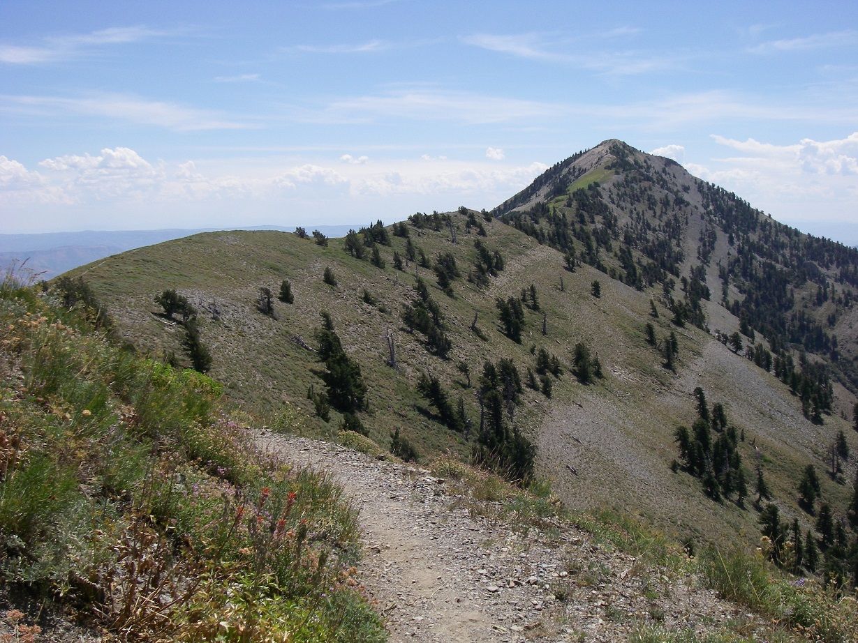
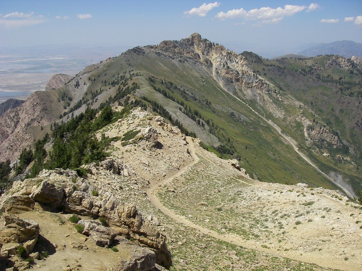
The trail toward Ben Lomond is well-maintained and has little elevation gain or loss until you pretty much get to the summit. Along the way you've got great views to the west, and down the steep and rough terrain of the ridge's west slopes. After awhile, the trail returns to ridge south of Willard Peak, and you then also have a nice view of Ben Lomond:
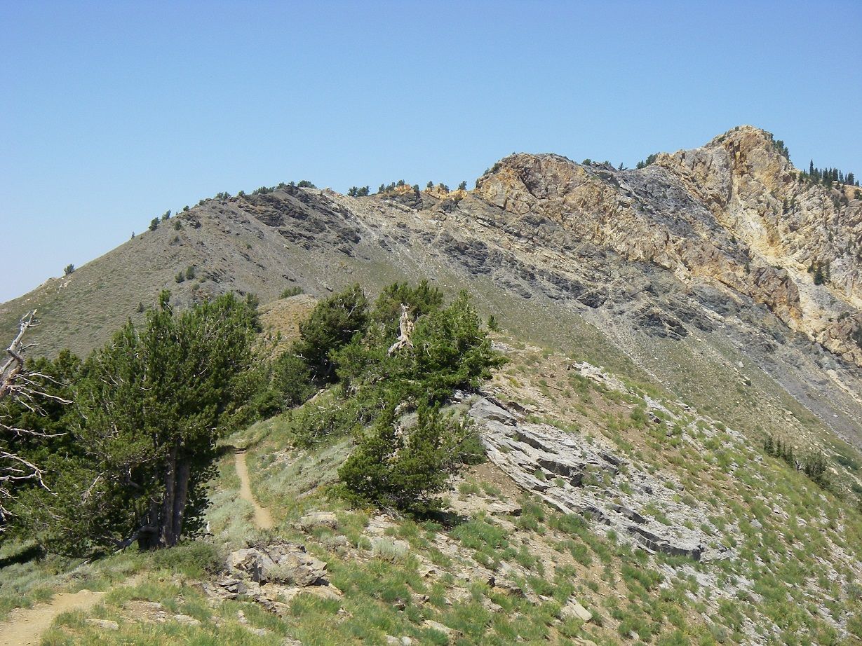
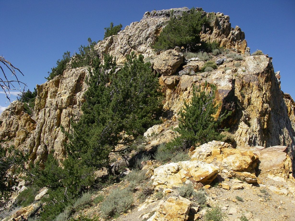
Continuing on the trail, I couldn't help but look back at Willard's south ridge and wonder if I could reach the summit that way. Such a route wasn't in the Sierra Club guidebook and I couldn't recall any other accounts of using it. There was a prominent rocky section on it that looked like it could be an obstacle, and it wasn't obvious if they could easily be bypassed either. Here's a photo looking back at Willard Peak, and showing the route I was evaluating:
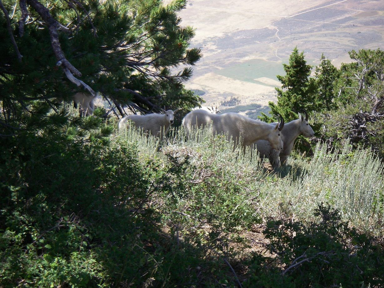
But Willard was on the back burner as I continued toward Ben Lomond. I came across two groups of mountain goats along the trail (a photo of one is below), and even a lone kid in the middle of the trail, who scurried off onto the slope and then began crying rather pitifully. As I continued up the trail, a minute or two later I noticed there was an adult goat on the same slope. But the adult seemed uninterested in the kid, simply ambling away from it (with occasional grazing stops).
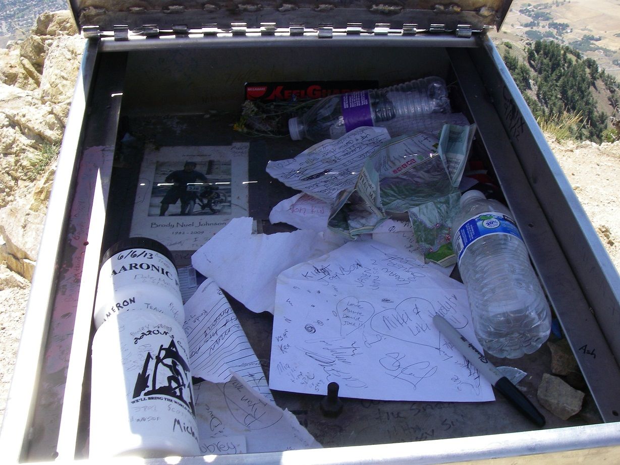
So far on the hike, I'd seen one person up on Willard Peak's summit, and some people on Ben Lomond's summit, but nobody on my route. As I approached the final steep climb up to the summit, I heard some voices drifting down. They were long gone, however, by the time I reached the top (at 1:38 PM). There is an elaborate and oversized summit register container up there, with an interpretive plaque on the lid. But the contents appeared to be mostly random items or junk, and a lot of people had simply signed the inside of the lid rather than any notebook within.
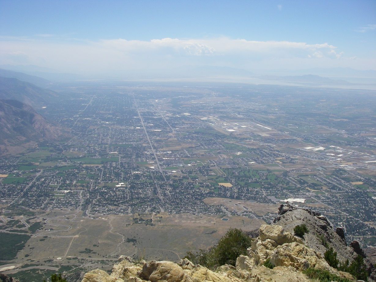
Conditions were cool and breezy, but no jacket required. It was clouding up a bit far to the east, but nothing going on nearby. As usual, there were lots of bugs around, including many ladybugs. I could hear occasional noise coming up from a gravel pit (?) down below west of the mountain. Eventually, a pair of hawks showed up to ride the thermals. The views were terrific! Below are photos taken looking out over North Ogden, and back toward Willard Peak and my route:
Edit: I almost forgot to include this little panorama video I took from Ben Lomond's summit:
Since I had the place to myself, I hung around for awhile to enjoy it. I didn't leave the summit until 2:45, by which time it was starting to cloud up in the distance to the south and to the northwest as well as to the east. On my return trip, the poor kid was gone (or at least not crying anymore), but I did come across some of the goats I'd seen along the trail earlier. As I walked, I again contemplated Willard's south ridge. By 3:30, I was at the point where the trail crossed a western spur off the south ridge, and I decided to head up and give it a shot.
This little ridge was pretty steep, with some vegetation to bypass but nothing too difficult and soon I was on the south ridge itself. There I found a fairly prominent use trail, but I'm pretty sure it was mostly mountain goat traffic that had created it. The going was not too difficult, with some vegetation and deadfall to bypass, but soon I was confronted with the rocky section I had looked at earlier:
Though it looked intimidating at first, by following he goat trail right up to it, I was able to scramble up on the left (west) side. Beyond that, there was basically just some hiking until another, smaller rock step that I got around on the right (east). I'd rate both these sections as class 3. Beyond that, I don't recall anything that I'd rate above class 2, even though the summit looks steep in the photos above. There are some big dropoffs to the east when you are way up on this ridge.
By 4:10 I was on Willard's summit. There's a benchmark up there, but it's south of what appears to be the highest point. So people who use the NW ridge route might miss it. I didn't make note of a summit register up there, and I can't recall one, but since I waited three weeks to write the report I may simply have forgotten about it, lol! I spent a few minutes on top and then headed down the NW ridge use trail. A few bits of this are also a scramble, but class 3 at the most (and probably slightly less difficult than what I'd come up). By 5:05 I was back at my vehicle.
-
08-23-2013 04:24 AM # ADS
-
08-23-2013, 06:26 AM #2
Nice report. Congrats on the summit!

-
08-24-2013, 05:59 AM #3
Loved your TR!
-
08-26-2013, 09:26 AM #4
Awesome!
Awesome!


 Reply With Quote


Similar Threads
-
[Trip Report] Inspiration P>Willard Peak>Ben Lomond>N Ogden Divid
By blueeyes in forum Mountain Biking & CyclingReplies: 6Last Post: 09-16-2009, 12:49 PM -
[Trip Report] Willard Peak
By peakbagger1971 in forum Hiking, Scrambling & Peak BaggingReplies: 1Last Post: 08-07-2009, 02:59 PM -
[Trip Report] Ben Lomond peak 7/12/08
By Sombeech in forum Hiking, Scrambling & Peak BaggingReplies: 11Last Post: 07-14-2008, 10:28 AM -
[Trip Report] TR Ben Lomond and Willard Peak
By rwpontius in forum Hiking, Scrambling & Peak BaggingReplies: 2Last Post: 06-04-2007, 04:37 PM -
Willard Peak
By Sombeech in forum Offroad 4x4, Side by Side and ATVReplies: 2Last Post: 03-06-2006, 07:48 PM
Visitors found this page by searching for:
Outdoor Forum
