

Results 1 to 4 of 4
-
08-13-2013, 04:00 AM #1
Red Baldy (11,171') - July 29, 2013
(Sorry it took me two weeks to write this up but 12-hour shifts will do that do you!)
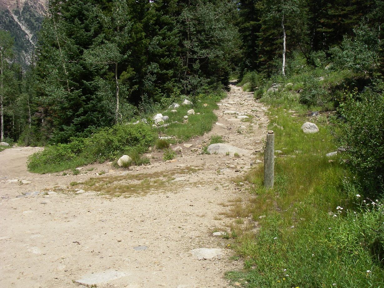
On July 29, I hiked Red Baldy from the White Pine Lake trailhead. I was using "Wasatch Eleveners" as a guide to the northwest slopes route (class 2, 8 miles RT, 3,570'). I hear this is a busy TH, but early on a Monday I arrived to find the lot empty. By 6:45 I was headed up the trail. The trail up to White Pine Lake is actually an old road, so for the most part is quite wide. The picture below, taken at the junction with the Red Pine Canyon trail, illustrates:
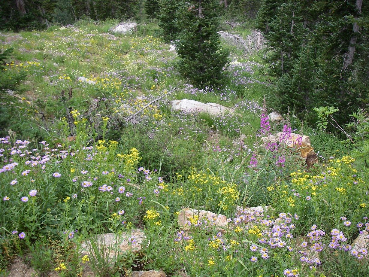
Soon after I left the trailhead I heard some other hikers, but never saw them; perhaps they went up Red Pine? At one point while walking along I looked to my left and saw a cow moose, who looked at me then turned and ambled off before I could get a decent photo. The meadows along the route are nice but were quite buggy. But in general this approach is a very nice hike through the forest., with lots of wildflowers in the open areas.
While following the route directions, I found for some reason my GPS was giving me elevations that were up to 200' less than what was in the guidebook. At any rate, it was easy to identify the NW slopes recommended starting point at the big switchback on the boulder field, though I was only reading 9,975' instead of 10,000'. I arrived there at 9:20 and took a little break before heading up the slope. Here I saw a pika, and the sun (hopefully auspiciosly) was peeking out; it had been overcast all day.
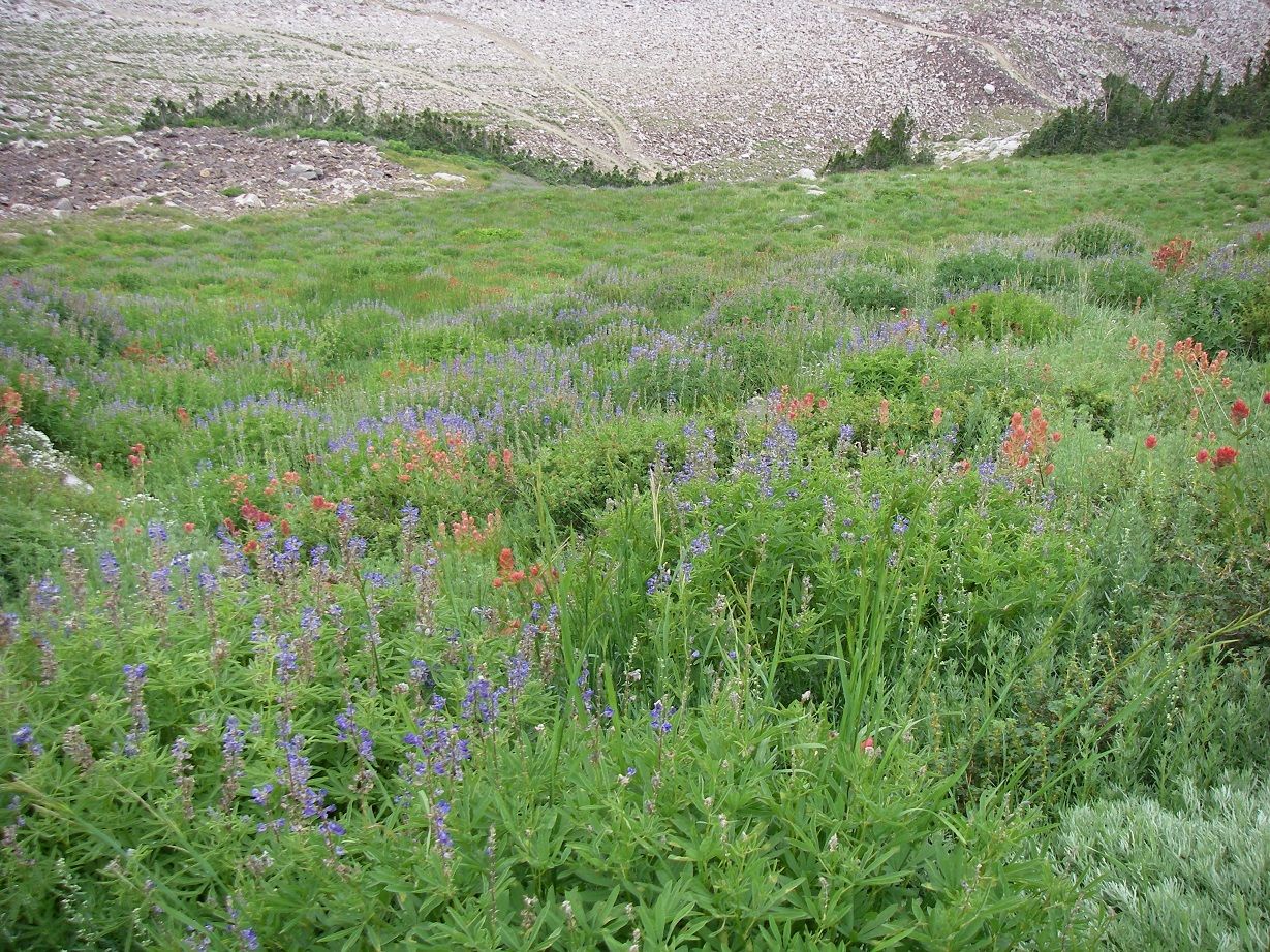
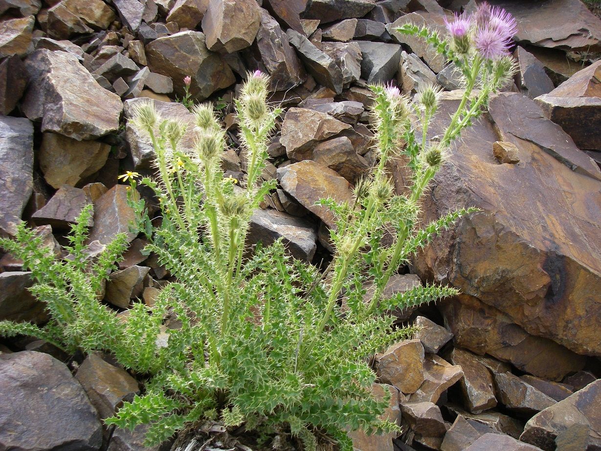
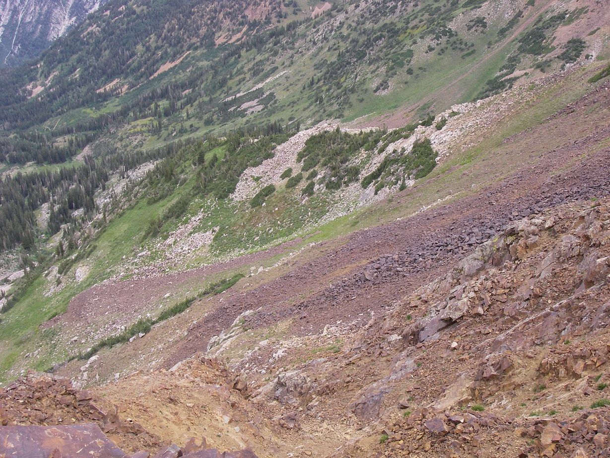
From the switchback, I was able to use a short section of an abandoned, overgrown roadbed to help bypass the initial super-steep base of the slope. However, the entire rest of this slope is still quite steep. The guidebook describes it as "tundra and rocks" but the reality didn't match the mental image I'd formed based on reading that. The vegetated parts of the slope aren't covered with short grass (what I think of when I hear "tundra"); the vegetation is so high and thick that it is often difficult or impossible to see the rocky, uneven surface. Add to this the fact it was quite wet, and it added up to some tricky footing. Plus, you need to watch out for a couple different plant varieties (I don't know the names) that are very "prickly"! Below is a shot looking down the lower part of the slope, and an example of some unfriendly vegetation:
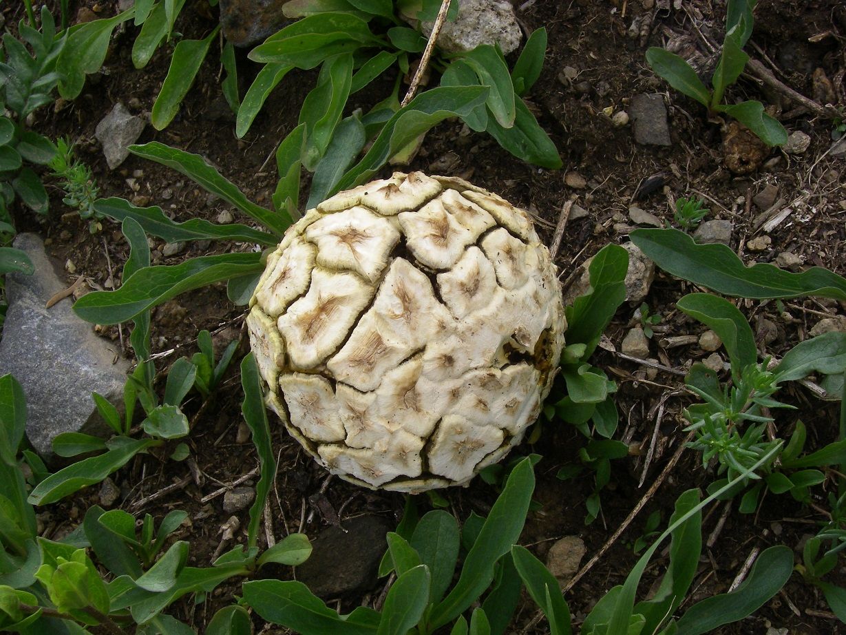
In the route description, it tells you to climb toward some trees. It should probably point out that you want to go around on one side or the other, not try to go through them (ask me how I know!). You should definitely heed his advice to head northeast and avoid the temptation to veer toward the summit. I didn't, and ended up reaching the ridge at 11,040' (per my GPS) vs. the 10,750' he recommends! On the way, I pricked my hand and legs a few times on the aforementioned nasty vegetation, slipped around on unseen wet rocks so that I'm surprised I didn't turn an ankle, and also grunted my way up some steep, loose dirt and rocks. In hindsight, gaining the ridge as soon as possible would have saved me some hard work. At least I did come across this unique fungus:
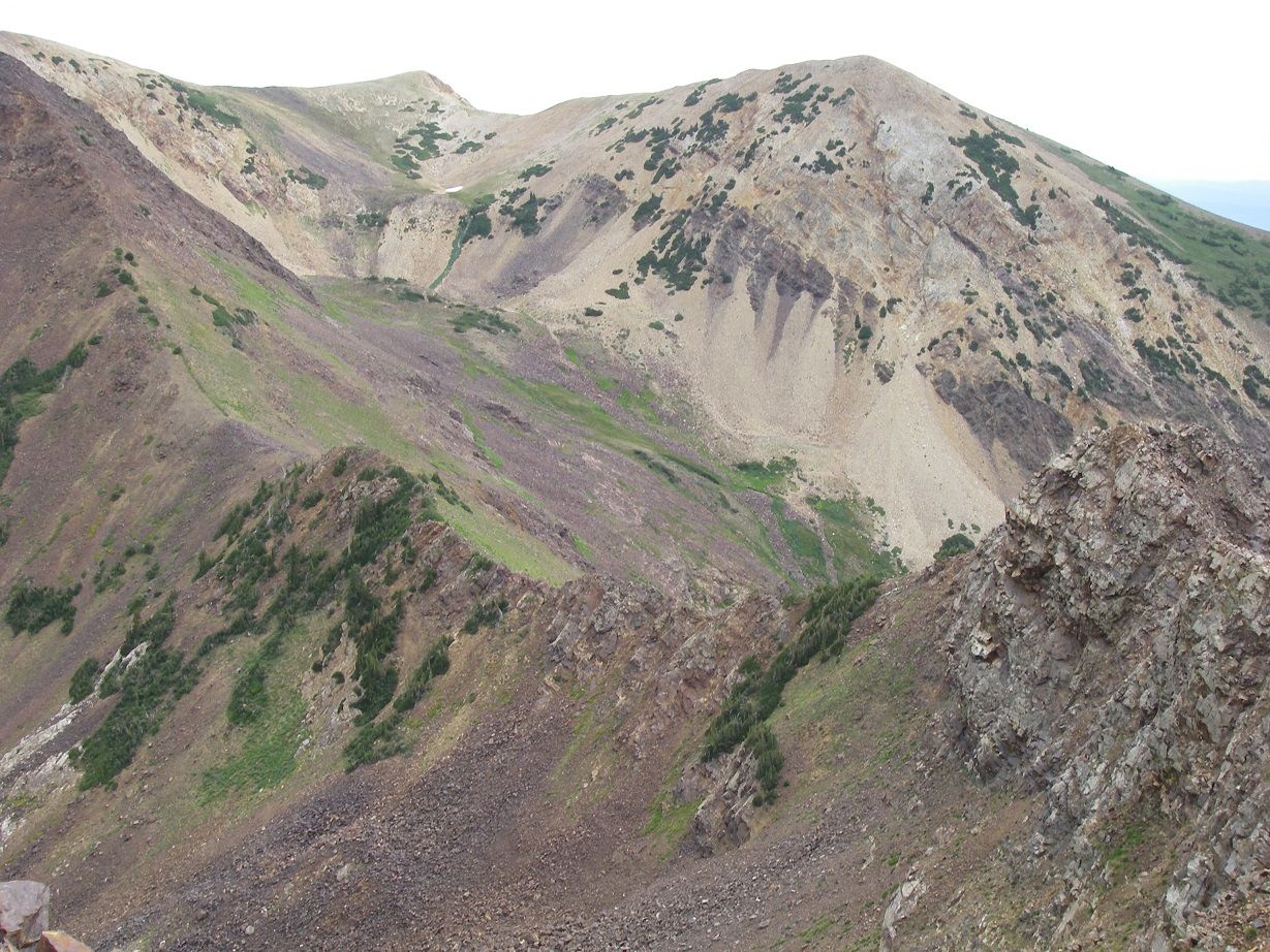
Despite getting a bit off track, as mentioned I did finally reach the ridge (at about 10:45 AM). According to my GPS, at this point I was only about 130' below the east summit! I also now had an expanded view, including nearby Red Top Mountain and Red Baldy's northeast ridge route (as described in "Wasatch Eleveners"). Here's a photo of that ridge, as well as American forks Twin Peaks in the background:
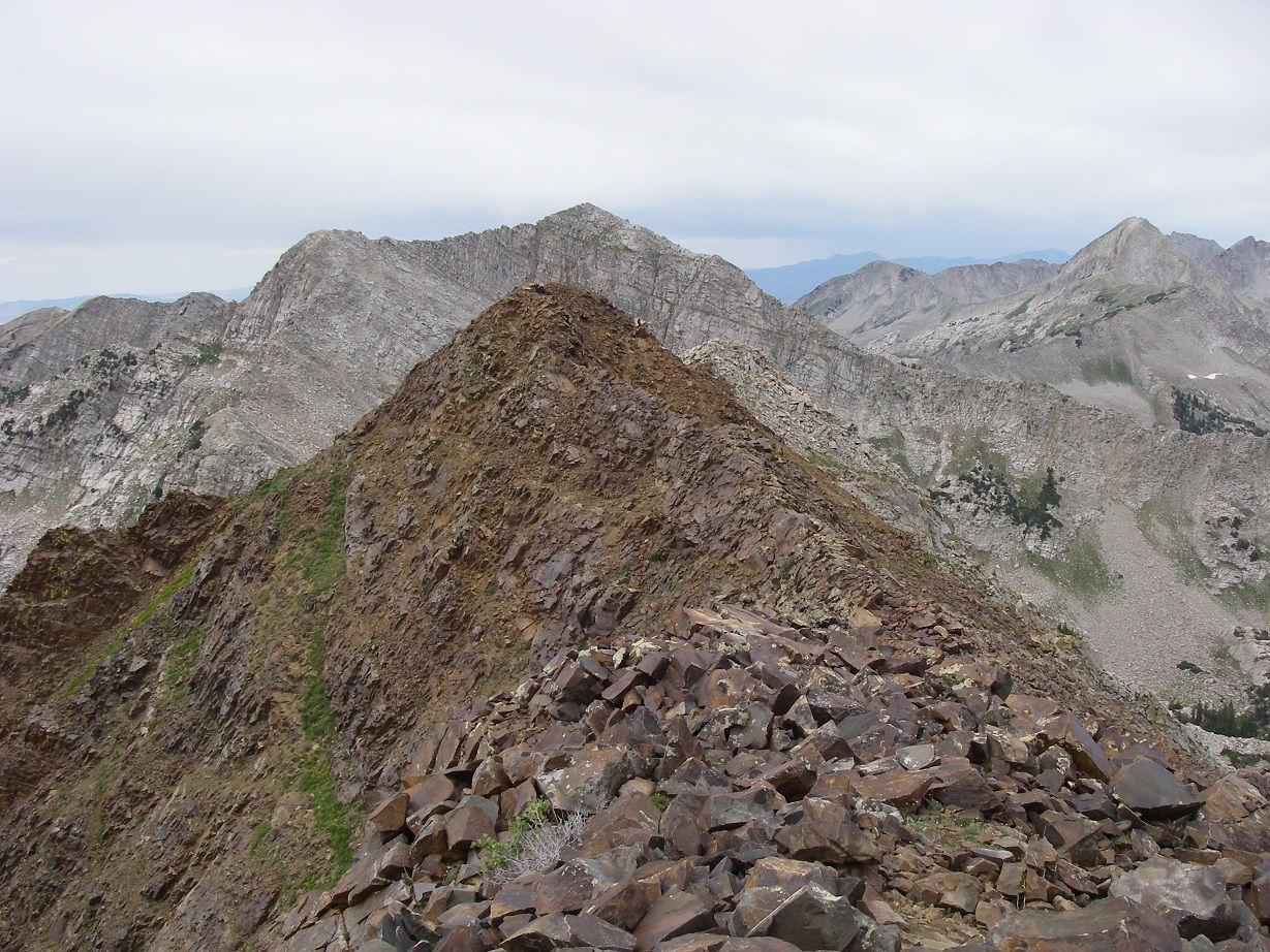
I headed up the ridge to the east (higher) summit, arriving there at 11:02. Here is the view of the west summit from there (with White Baldy right behind it), as well as a view of the slope I had come up:
After a few minutes on this summit, I left and made the fun scramble over to the lower west summit. Note I saw no benchmarks, reference marks, or registers on either summit. In fact, there was really no sign of human visitation, not even a cairn. Conditions were cloudy, breezy, and cool. I considered carrying over west and south to drop down to a saddle, and descending to the trail that way (this is the west ridge route described in the book). However, the weather looked shaky enough that I didn't want to be stuck out on that ridge if it decided to start raining.
So I scrambled back over to the east summit, then headed down the north ridge. This time I stayed on the ridge for quite awhile before dropping onto the northwest slope. By 1:00 PM I had safely negotiated the slope and reached the big switchback where I left the trail. By this time, I'd noted some more people hiking up the trail toward White Pine Lake. I would encounter a few more hikers and a mountain biker by the time I reached the trailhead at about 3:00. Though the sky never really cleared up, it was notably warmer than when I was last there. Not surprisingly, it was also much busier!
-
Post Thanks / Like - 1 Likes
 Sandstone Addiction liked this post
-
08-13-2013 04:00 AM # ADS
-
08-13-2013, 11:08 PM #2
-
08-14-2013, 09:05 AM #3
Nice report, thanks for sharing!

-
08-14-2013, 10:07 AM #4
That's cool! I hike Red Baldy a few years back and it was a blast. You were right - it's lonely up there. Once you branch off from either Red or White - the crowds drop to 0. Pretty area for sure. Thanks for sharing!
●Canyoneering 'Canyon Conditions' @ www.candition.com
●Hiking Treks (my younger brother's website): hiking guides @ www.thetrekplanner.com
"He who walks on the edge...will eventually fall."
"There are two ways to die in the desert - dehydration and drowning." -overhearing a Park Ranger at Capitol Reef N.P.
"...the first law of gear-dynamics: gear is like a gas - it will expand to fit the available space." -Wortman, Outside magazine.
"SEND IT, BRO!!"


 Reply With Quote


Similar Threads
-
[Trip Report] Bear Lake - Highline Etc. - July 2013
By accadacca in forum MotorcyclingReplies: 7Last Post: 09-10-2013, 07:23 PM -
[Trip Report] AF Canyon - July 2013
By accadacca in forum MotorcyclingReplies: 4Last Post: 07-24-2013, 10:44 AM -
[Trip Report] Rocky Mouth Falls--July 19, 2013
By Sandstone Addiction in forum CanyoneeringReplies: 6Last Post: 07-22-2013, 11:39 AM -
[Trip Report] Main Salmon - July 2013
By Alex in forum Boating, Rafting, Kayak and CanoeReplies: 4Last Post: 07-11-2013, 03:25 PM -
[Trip Report] The Great White Icicle - 8 July 2013
By Kuya in forum CanyoneeringReplies: 3Last Post: 07-10-2013, 05:33 AM
