Results 1 to 9 of 9
-
03-15-2013, 06:42 PM #1
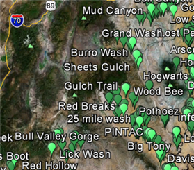
Google sat image of roads near North wash
What are these weird road grading formations found near North Wash? Why were they formed? Purpose? Anyone know?
-
03-15-2013 06:42 PM # ADS
-
03-15-2013, 08:01 PM #2
my first guess would be oil or mineral exploration related.
But if I agreed with you, we would both be wrong.
-
03-15-2013, 09:22 PM #3
-
03-15-2013, 10:25 PM #4
If you know where to look, there are a lot more of them than you would think. Different shapes too. I read something about them a few years ago. They weren't discovered until after google earth came around. They are thought to be similar to the aztec lines. Made by the natives for some reason. One possibility was an irrigation system for crops. Some of them are spiral shapes or squares that are all linked by straight lines. Weird stuff. I will try to find the link and locations of the other lines.
Sent from my DROID BIONIC using Tapatalk 2
-
03-15-2013, 10:33 PM #5
http://www.dailygrail.com/blogs/Ed/2...ah-Nazca-Lines
Sent from my DROID BIONIC using Tapatalk 2
-
03-15-2013, 10:43 PM #6
This is the one I found a while back when I was trying to figure it out.
http://www.googleearthanomalies.com/...yphs-Utah.aspx
Sent from my DROID BIONIC using Tapatalk 2
-
03-16-2013, 07:40 AM #7
A while back I also noticed some of the those 6 line markings when I was checking out the Hogs with google earth. I just chalked it up to maybe some kind of oil or gas exploration road building. But it appears to be more interesting than that after checking this site out
http://www.googleearthanomalies.com/...yphs-Utah.aspx
Here is the area that is just west of the Hogs
Don't believe everything you think.
-Borrowed from a bumper sticker I believe
-
03-16-2013, 12:06 PM #8
Cool
-
03-16-2013, 12:17 PM #9So is Peru not in the Americas? Perhaps it's in Africa, or Europe.
 Originally Posted by the News section of the website referred to by French_de

Similar Threads
-
[Beta] North Wash
By blueshade in forum CanyoneeringReplies: 9Last Post: 10-30-2011, 04:51 PM -
North Wash?
By moab mark in forum CanyoneeringReplies: 33Last Post: 09-13-2010, 08:01 PM -
North Wash
By Pubalz in forum CanyoneeringReplies: 4Last Post: 03-28-2009, 05:09 PM -
Indian image from google earth
By RugerShooter in forum General DiscussionReplies: 8Last Post: 10-29-2006, 05:57 PM -
Image Overlay's for Google Earth
By shaggy125 in forum General DiscussionReplies: 20Last Post: 01-19-2006, 03:55 PM
Visitors found this page by searching for:
Outdoor Forum


 Reply With Quote


