

Results 1 to 20 of 20
Thread: High Spur
-
11-03-2012, 04:02 PM #1
High Spur
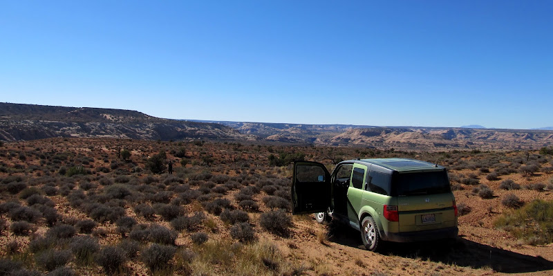
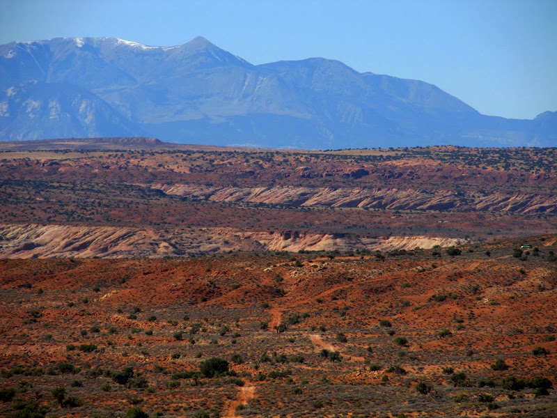
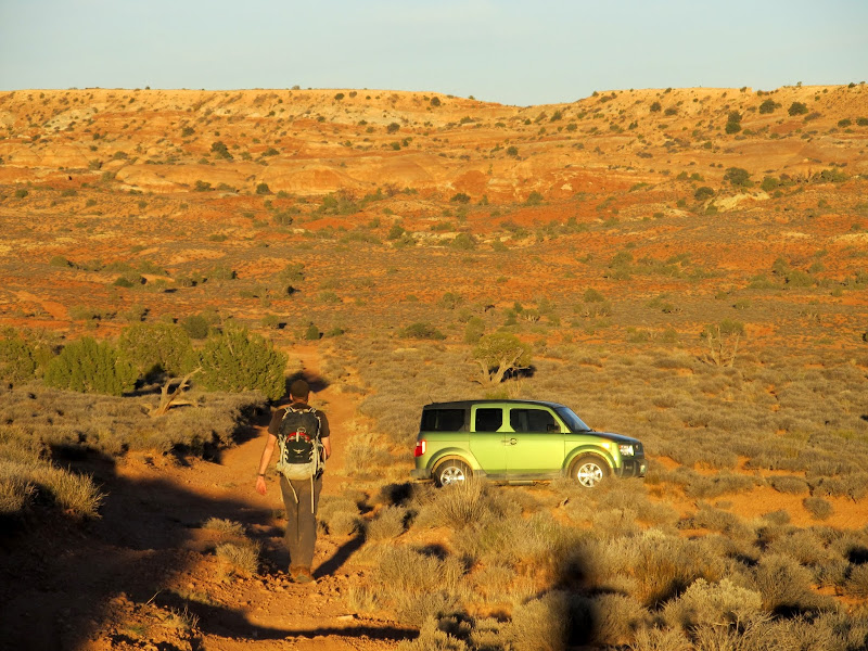
In a departure from my usual fare, my friend Chris and I descended High Spur, a technical canyoneering route in the Robber's Roost area. We woke up early on the morning of Friday, October 19, and started putting our gear together. We could have driven both our vehicles and saved ourselves from a 2.6-mile road walk, but I couldn't justify driving my Jeep over 120 miles of dirt roads for that, and Chris was willing to just take his Honda Element (which performed admirably on the rough parts of the road). Despite rising early we didn't reach the trailhead until around 11:00AM. We hid our packs under a juniper tree near the trailhead then drove toward the canyon's exit and left the vehicle there. It took less than an hour to walk the 2.6 miles back to the trailhead where we shouldered our packs and started off toward High Spur.
We parked the Element here near the end of the canyoneering route, then walked 2.6 miles down the road to retrieve our packs and get started
Road-walking to the start of the canyon

Drill hole along the road

Looking back down the road (the Element is on the far right)
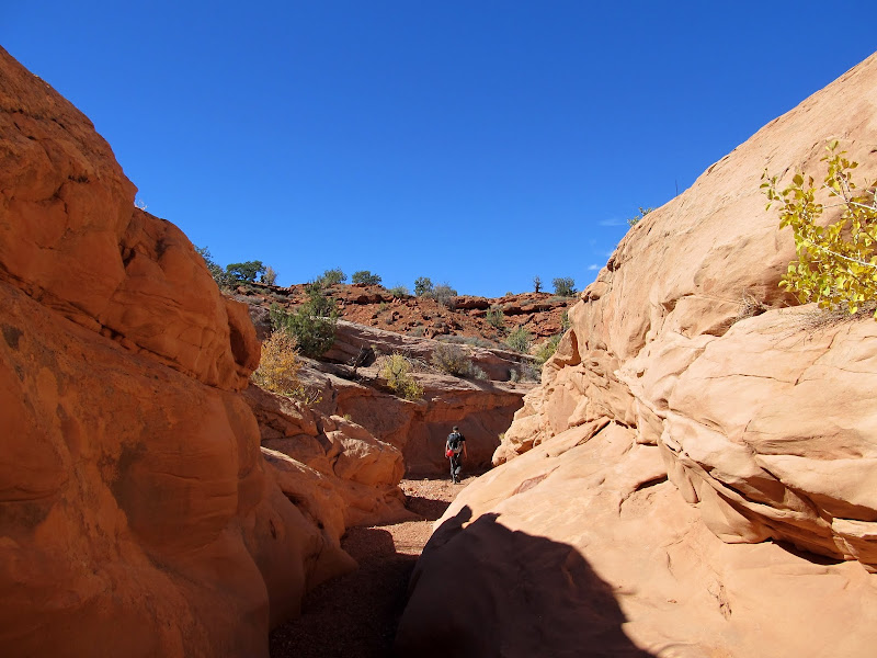
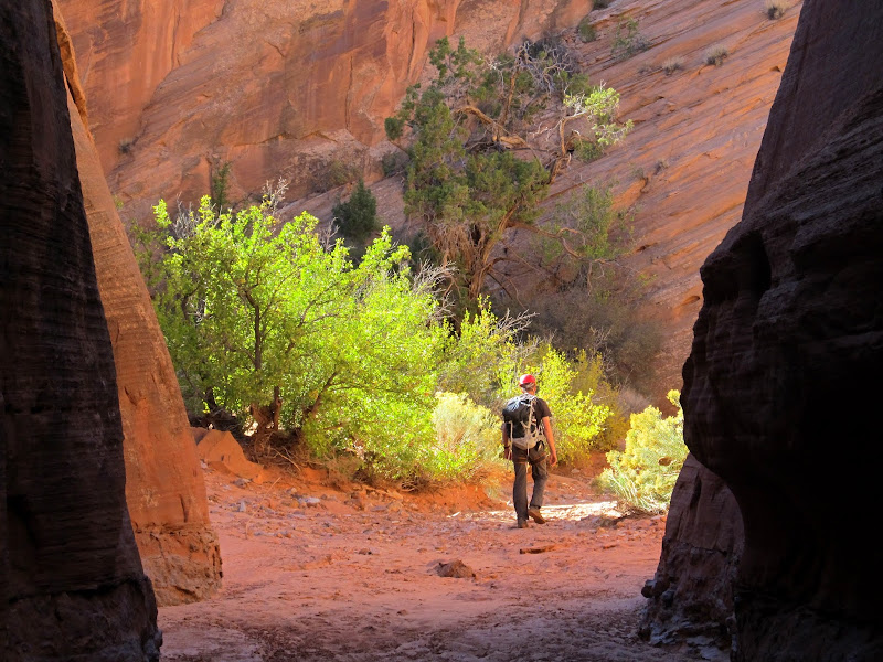
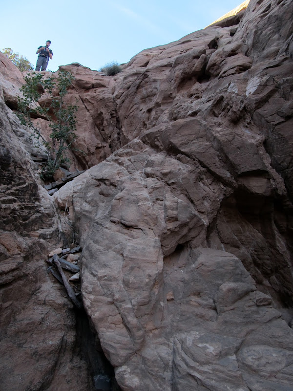
Approaching High Spur
The drop into the canyon

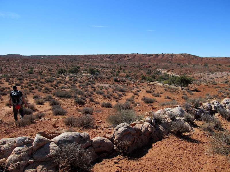
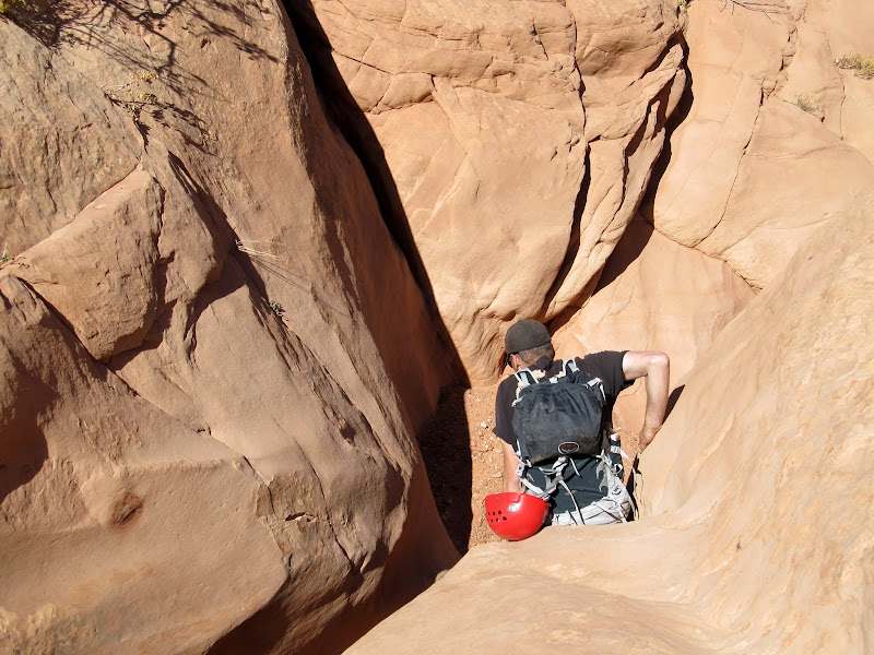
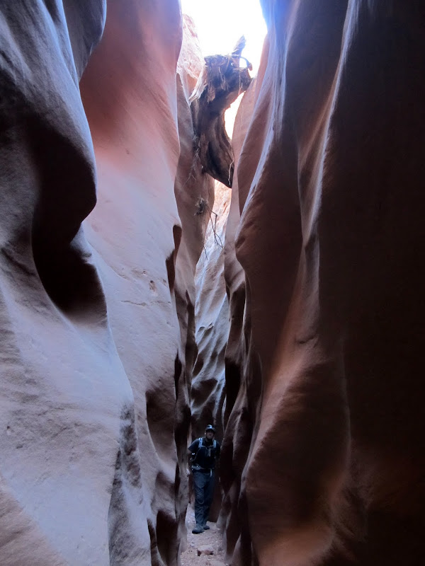
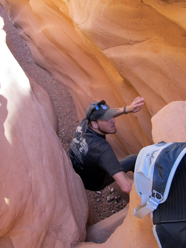
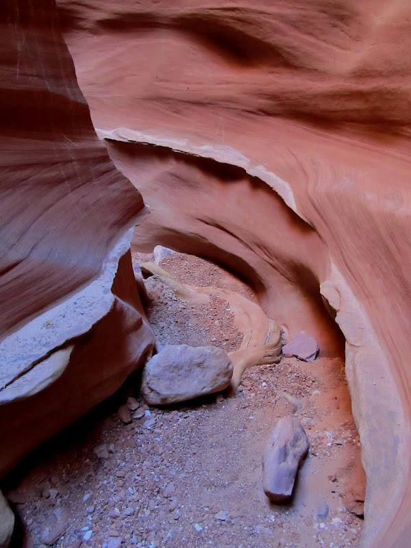
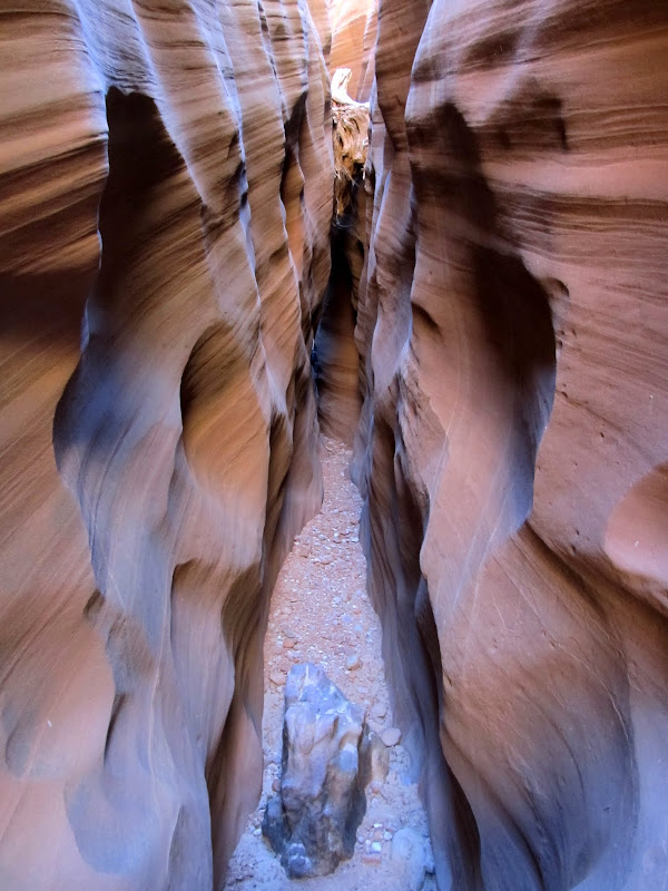
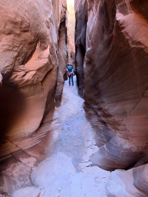
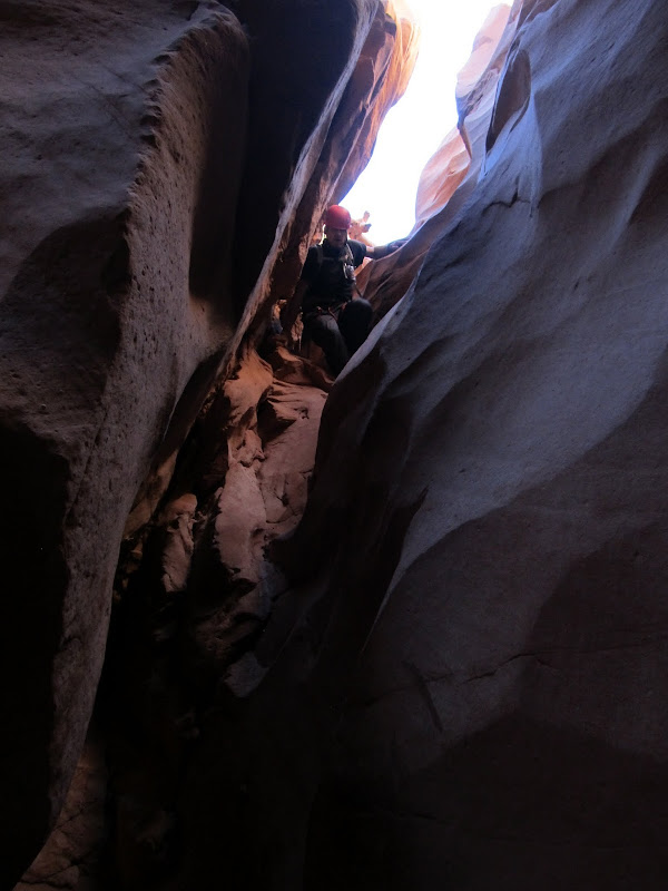
After a brief 2/3-mile overland hike we reached the canyon and dropped in. It started off shallow and narrow but soon grew deeper and darker while remaining skinny. We encountered a few obstacles: sketchy downclimbs where we had to remove our packs and lower them to each other, and boulders and trees wedged in the canyon that required climbing over and/or under. The canyon would occasionally widen and give respite from the dark confines of the narrows, but we never really stopped to rest. It was challenging and interesting enough to keep our pace slow, but easy enough that fatigue didn't present a problem.
Chris doing the butt-slide into the canyon
High Spur
It didn't take long for the canyon to get deep and dark
Climbing over a boulder

First big downclimb
High Spur


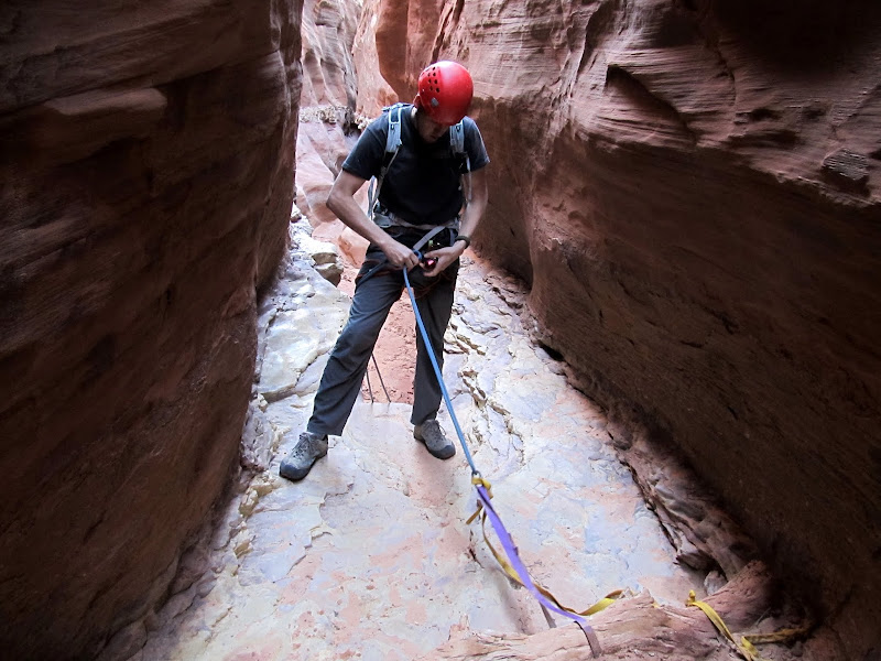
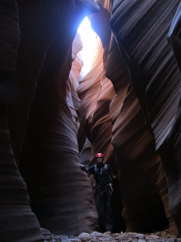
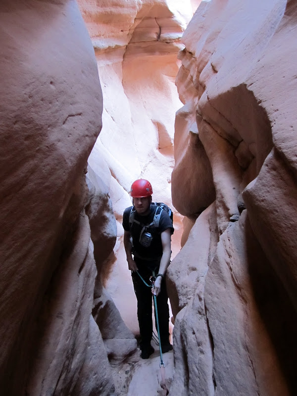
Things went on like that for one and a quarter hours before we reached the first rappel. Out came the helmets, harnesses, carabiners, and rappel devices. The drop was only about 15' so we used Chris' short rope. Some people downclimb this drop, but there was a pool at the bottom and I was certain that if I attempted it I'd end up face-first in the water. Chris rappelled first and tried avoiding the water at the bottom of the drop. The mud on the sandstone above the pool was too slick, though, so into the ankle-deep water he went. I rapped next and just walked backward into the water--if Chris couldn't avoid it, there was no point in me trying. To save time packing and unpacking gear, we left our harnesses and helmets on from that point until after the final rappel. After the first rappel was a stretch of water that was avoidable by clinging to the canyon wall and walking across some slippery mud.
Chris getting on-rope
First rappel

Looking back at our first rappel

It was tricky avoiding a slip-and-fall into the water

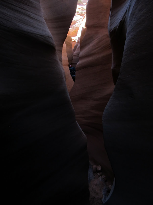
The canyon continued as it had before, with alternating lengths of narrow and wide sections. In the narrows there was little direct sunlight, but the reflected light made for some gorgeous scenes. 45 minutes after completing the first rappel we reached a pothole where the canyon began to really get spicy. The drop into the pothole was about 15' and the exit perhaps 6'. Chris did a butt-slide into the pothole unassisted, then I followed while he slowed my descent by grabbing my feet and lowering me. He stood on my bent knee to exit the pothole and I managed to climb out unassisted.
High Spur


Sliding into the pothole

After the pothole, High Spur grew very dark. There were beautiful reds, oranges, and purples formed by the reflected light, and I was disappointed that I couldn't capture that well with my camera. It was so dark in places that I had to remove my prescription sunglasses a few times to see where I was placing my feet. We encountered wall-to-wall water that disappeared around the corner ahead of us and we couldn't see the end of it. I knew from seeing @ststephen 's photos from a week earlier that we'd likely have to wade through some water, but up until that point I'd been hoping that the water was gone. Turning back would have been extremely difficult because of the pothole, though above the pothole there were many possible exits from the canyon--not that we seriously considered backtracking. Chris led the way into the abyss. The water was very cold, and as we stirred it up an odor that I can only describe as "sewery" entered our nostrils. I kept my camera out for this first length of water, which only just reached our crotches. Very shortly after the first pool was another that also disappeared around the bend, and this time I dry-bagged my camera. The second stretch was chest-deep, and just as cold and smelly. It was slightly horrifying, yet exhilarating and energizing at the same time.
High Spur
Our first real encounter with water. It was cold and stinky and crotch-deep in this first section.

Entering another stretch of water, this one chest-deep

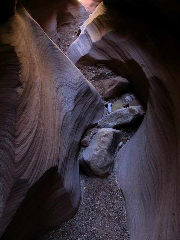
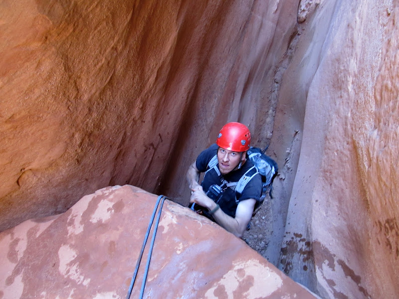
After a couple hundred feet of wading through water we came to what we hoped was the end of the sewer. There was a cavern-like section where one canyon wall had collapsed and was leaning on the other. We climbed over some boulders from the rockfall, scooted through another short narrow section, then came to another downclimb. It seemed that we were done wading through water. Chris and I both attempted to downclimb the short drop but with our muddy shoes neither of us felt comfortable with it. We used the short rope again and rappelled the drop, though the rappel felt as awkward as our attempted downclimb. My GPS indicated that we were very close to the final rappel--surprisingly I had good signal through most of the canyon. We downclimbed through an awkward section where the walls were very narrow but angled to one side, followed by another rappel. We couldn't see the bottom of this rappel because the canyon curved around a corner during the descent, so Chris deployed his 200' Canyonero rope. He reached the bottom of the rap and realized we could have used the short rope, but the final rappel was coming up so the long rope didn't even go back in his pack.
In the rockfall section after the water

We turned this downclimb into a rappel
Chris coming down the awkward downclimb
Setting up one short rappel before the final rappel
Second-to-last rappel

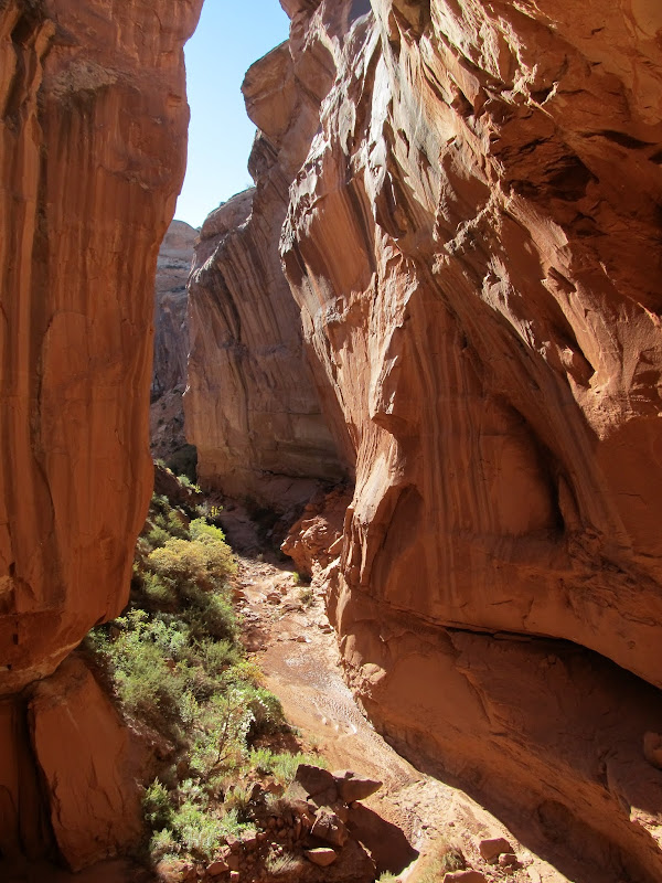
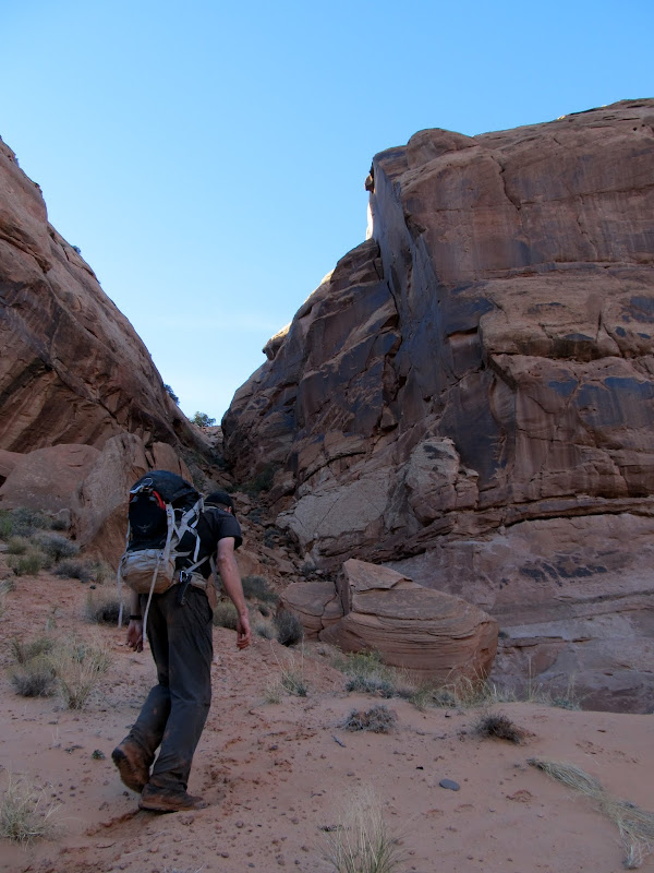
There was another cavern-like section at the top of the final rappel, and there lay a geocache. We signed the log and then inspected the rappel anchor. The anchor was crazy, consisting of four long lengths of webbing tied around a boulder, then three more lengths of webbing extending off those four using various knots and quicklinks. It was overkill, but neither of us felt compelled (or even qualified) to fix it. It was dark at the top of the rappel but the canyon below was bathed in direct sunlight, leaving a nice orange glow on the cliffs in between. Chris did the 80' rappel first and I followed in short order. It was my longest rappel to date, but it paled in comparison to what I'd already experienced in the canyon. While Chris pulled the rope, I changed out of my wet pants into some dry shorts. We continued down the canyon and had no difficulty finding the exit crack which follows a fault in the cliff. It was a short, steep, and bouldery scramble with a little climbing near the top, but it was no more difficult than descending the canyon. We topped out on a flat bench but we still had a couple more short climbs over the next mile before reaching the car. It was a relief to see Chris' Element waiting for us as the sun touched the horizon. It had taken almost seven hours to complete the route, including the road-walk and a lot of photo-taking. We enjoyed a colorful sunset on the drive back to camp that seemed to last for an unusually long time before fading away to darkness.
Signing the log in the geocache above the final rappel

Before the final rap

High Spur below the final rap
Checking out the webbing on the anchor

Final rappel


Looking up the final rap from the bottom

Hiking down the canyon after the final rap

Heading up the exit route
Some climbing was involved at this point in the exit route
Hiking to the top of the mesa to the waiting car

Somewhere in there is High Spur

What a relief to be back at the car!
Sunset during the drive out

Full photo gallery:
https://picasaweb.google.com/Dennis.Udink/HighSpur
GPS tracklog and photo waypoints:
Viewing on a mobile device? Click this link to open the map: https://maps.google.com/maps?q=http:%2F%2Fudink.org%2Fgeo%2FHighSpur.kmz&hl=en&sll=38.414661,-110.169182&sspn=0.038938,0.084543&t=h&z=14
http://udink.org/geo/HighSpur.kmz
-
Post Thanks / Like - 2 Likes
-
11-03-2012 04:02 PM # ADS
-
11-03-2012, 04:45 PM #2
-
11-03-2012, 06:32 PM #3
Awesome!
-
11-03-2012, 09:27 PM #4
Great TR!
-
11-04-2012, 04:14 AM #5
Holy crap! I sat there and watched that slide show for the better part of 15 mins. Awesome shots, and some that would definitely get my vote for the "monthly contest." One of the best TRs I've seen in a while.
 It's only "science" if it supports the narrative.
-
11-04-2012, 05:55 AM #6
High Spur
Excellent!
-
11-04-2012, 07:27 AM #7
Wow, what a great TR....thanks, I'm thinking of doing High Spur next summer and this is awesome beta.
-
11-04-2012, 05:33 PM #8
Nice TR!
It is good that warriors such as we meet in the struggle of life... or death. It shall be life. - Ten Bears, "The Outlaw Josie Wales"
-
11-04-2012, 07:44 PM #9
A great canyon...a great tr...thanks for sharing!
-
11-04-2012, 08:26 PM #10
Nice pics. Thanks for the TR
-
11-05-2012, 06:17 AM #11
Loved it, some wonderful pictures there!
Riverside Mountain Rescue Unit
http://www.rmru.org/
Personal Website
http://www.DrunkRedDragon.com/adventures.htm
-
11-05-2012, 09:07 AM #12
Nice! Can't wait to see this canyon!
CanyoneeringUtah.blogspot.com
My YouTube Channel
"As you journey through life, choose your destination well, but do not hurry there. You will arrive soon enough. Wander the back roads and forgotten path[s] ... Such things are riches for the soul. And if upon arrival, you find that your destination is not exactly as you had dreamed, ... know that the true worth of your travels lies not in where you come to be at journey
-
11-05-2012, 02:31 PM #13
-
11-06-2012, 10:33 AM #14I'm still upset that I didn't get to Red Spur in April. I'm hoping to make it down before year end.
 Originally Posted by Iceaxe

On another note, I love seeing pictures of High Spur. There are a couple of areas that change from year to year and month to month. The first spot you rappelled from we had maybe a 10ft down climb this past April. The year before, it was more like your picture and about 15ft. That place fills up and washes out constantly. It also looks like the pothole right that leads into the corkscrew is filled in a little more than April. There are a number of spots in your pictures that I can tell are completely different. High Spur is relatively easy, but fun to return to every year because of said changes. Great TR!Darin
-
11-06-2012, 10:39 AM #15
Here is my April 2012 High Spur video for reference to the changes. Next time, try down climbing that part right before the final rappel. It's fun.
Darin
-
11-06-2012, 11:26 AM #16
Re: High Spur
Out of the thousands of canyons I have visited I have never seen one that changes so drastically year to year as High Spur..... it's never the same.
I also think High Spur rivals Antelope in beauty, but without the crowds, regulations and rules.
Sent using Tapatalk
-
11-07-2012, 06:59 AM #171:58 Nice moves! That is typically how I down climb, more of a fall/run/make it look sweet move. Originally Posted by Audilard
Riverside Mountain Rescue Unit
http://www.rmru.org/
Personal Website
http://www.DrunkRedDragon.com/adventures.htm
-
11-07-2012, 07:58 AM #18
Wow, GREAT TR and fantastic photos!
I also like the map you've included. I understand how to add add a map to a thread, but how did you add the trail and photos to your map?
BobTHE MOST TALKED ABOUT CANYONEERING TRIP OF 2017 - WEST CANYON VIA HELICOPTER.
TRIP REPORTS: TIGER | BOBCAT | OCELOT | LYNX | SABERTOOTH | CHEETAH | PORCUPINE | LEOPARD
DON'T BE A STRANGER, LEAVE A COMMENT AND/OR SUBSCRIBE.
WWW.AMAZINGSLOTS.BLOGSPOT.COM
-
11-07-2012, 08:10 AM #19For the GPS track, I just download and save the track from my GPS using EasyGPS (in GPX format) then open it in Google Earth and copy the track to a new folder. I use Picasa to edit my photos, and when you upload geotagged photos to Web Albums, it automatically creates a KML file with the photos on the map. I open that KML file in Google Earth and copy it into the same folder as the GPS track, then save the folder as a new KMZ file. Upload the KMZ file to my website, paste the URL into the Google Maps search box and grab the new Google Maps URL link, then paste it into my post on Bogley between the SAVEDMAP tags. It's a little complicated but I like the results. :) Originally Posted by Slot Machine
-
11-07-2012, 08:15 AM #20Cool! Thanks for the detailed explanation! Originally Posted by Udink
I'll give it a shot when I get the chance.
THE MOST TALKED ABOUT CANYONEERING TRIP OF 2017 - WEST CANYON VIA HELICOPTER.
TRIP REPORTS: TIGER | BOBCAT | OCELOT | LYNX | SABERTOOTH | CHEETAH | PORCUPINE | LEOPARD
DON'T BE A STRANGER, LEAVE A COMMENT AND/OR SUBSCRIBE.
WWW.AMAZINGSLOTS.BLOGSPOT.COM


 Reply With Quote


Similar Threads
-
[Trip Report] High Spur
By ststephen in forum CanyoneeringReplies: 14Last Post: 10-15-2012, 03:52 PM -
Northeast Spur Fork Conditions (a.k.a. High Spur)
By Magic_Hour in forum CanyoneeringReplies: 4Last Post: 04-01-2012, 06:35 PM -
[Trip Report] High Spur
By akavalun in forum CanyoneeringReplies: 26Last Post: 05-09-2011, 09:57 AM -
High Spur 2/19/11
By P.J. in forum CanyoneeringReplies: 11Last Post: 02-28-2011, 01:07 PM -
[Trip Report] High Spur
By rockgremlin in forum CanyoneeringReplies: 14Last Post: 04-18-2007, 10:44 AM
Visitors found this page by searching for:
Outdoor Forum

