

Results 1 to 20 of 21
Thread: The Elusive Horse Canyon
-
07-23-2012, 05:01 PM #1
The Elusive Horse Canyon
Saturday & Sunday, July 14-15, 2012
The Original Trip Report on ADVENTR.CO
I first tried to explore Horse Canyon in the Needles District of Canyonlands National Park back in 2008 when I camped at Peekaboo with a few friends. Back then the entrance to the canyon had been washed out pretty good and there was a very deep hole blocking vehicle entry. For the past two years I have been checking the condition of the road so that I could finally get back there to start exploring the area, but both the Salt Creek and Horse Canyon roads have been washed out and closed for that long. I have hiked up Salt Creek Canyon twice during those two years, but Horse Canyon was a bit too long for a day hike. A few weeks ago I finally received word that the National Parks Service had finally reopened the roads in Salt Creek and Horse Canyon, so I quickly made plans to get back. I reserved a campsite at Peekaboo for the weekend and invited Jared and Marty to come along.
After work on Friday, I drove down to Cottonwood Canyon and setup camp so that I would be close to Canyonlands in the morning and wouldn't have to do much driving. There were a few rain showers in the evening, but the precipitation stopped before I went to bed, and I had a great night of sleep.
Good Morning by IntrepidXJ, on Flickr
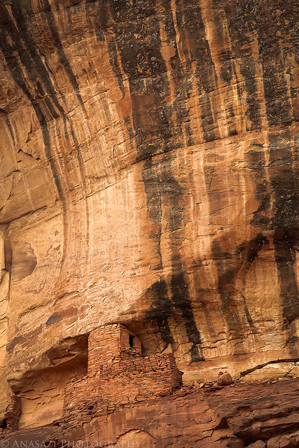
In the morning I had a little time to photograph this ruin high up on the canyon wall. I have driven by this site many times and had not been able to find it before. It would have been a long hike up to reach it, but unfortunately I didn't have the time this morning to try. I will have to return again to climb up to the ruin for some closer photos.
High Tower by IntrepidXJ, on Flickr
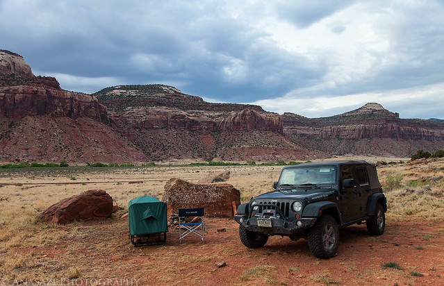
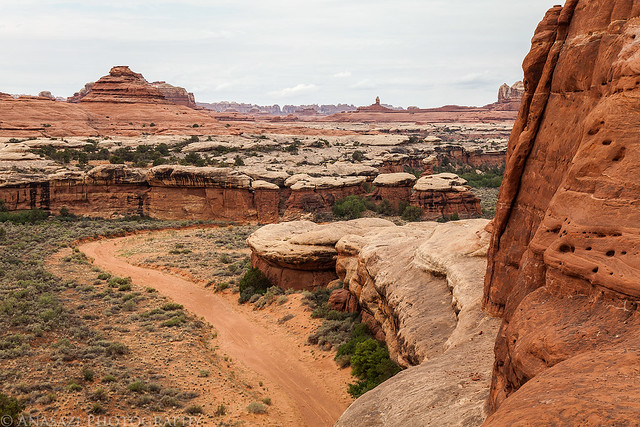
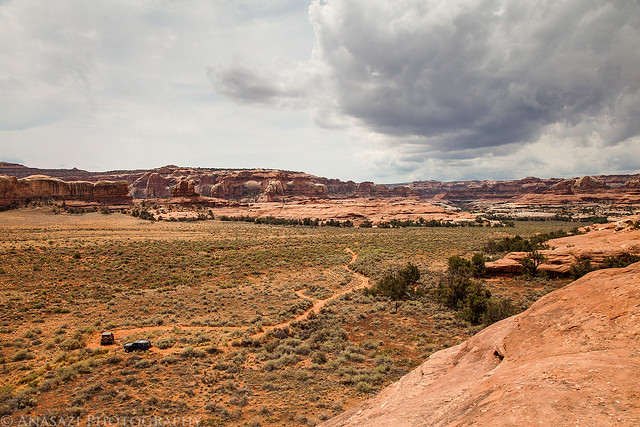
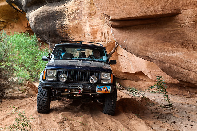
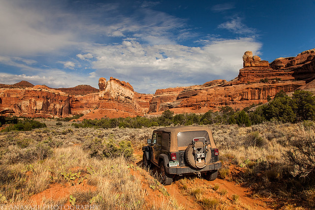
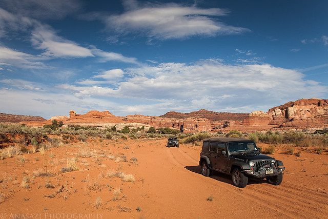
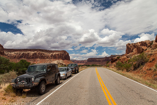
After photographing the tower, I continued my drive into the park where I met Jared and Marty at the Needle's Visitor Center so that we could get our permits and the combination for the lock on the gate. Jared transferred his camping gear into my Jeep and parked his car at the trailhead before we continued through the locked gate into Salt Creek. The drive through the wash was in soft sand as usual, but the debris that had blocked the road in May had been removed. It was nice to be able to avoid this mosquito-infested area by closing the windows of the Jeep ;) The deep holes that had blocked the entrance to Horse Canyon had also been filled in a bit. We drove through the holes and brush that was growing in the road and continued up Horse Canyon, where we would be spending much of the day searching for ruins and rock art.
We almost missed the remains of a tower near the mouth of the canyon. Good thing Marty spotted this one after we had passed it.
Watch Tower by IntrepidXJ, on Flickr
Jared checks out a very small granary that we spotted and climbed up to. The interesting part about this site is how the ledge in front of it was built out in order to make it larger. I can't recall seeing this done anywhere else?
Built Ledge Granary by IntrepidXJ, on Flickr
We almost missed this nice granary even though it was practically right next to the road.
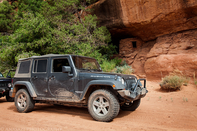
Jeep & Ruin by IntrepidXJ, on Flickr
A closer look at the ruin.
Horse Canyon Ruin by IntrepidXJ, on Flickr
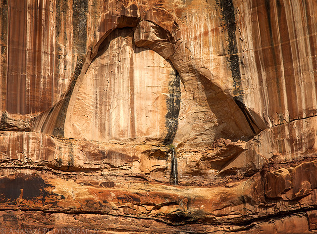
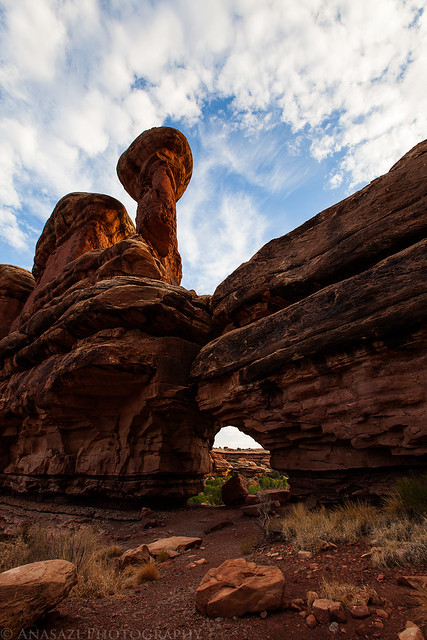
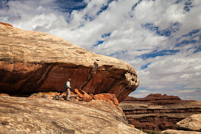
Soon we reached the large arch known as Paul Bunyan's Potty.
Paul Bunyan's Potty by IntrepidXJ, on Flickr
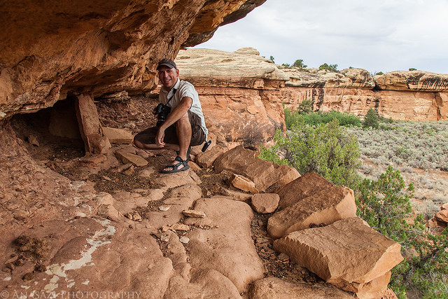
We found a route up the sandstone ledges that took us right under the arch so that we could try to visit the ruins and rock art hidden up there. Unfortunately, I was stopped stopped about 20 feet below the final ledge because the climb was just too steep for me. Jared, on the other hand, was able to make it to the final ledge to check it out. Here's Jared climbing the final pitch.
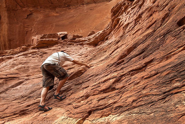
Jared Climbing by IntrepidXJ, on Flickr
Here's a view out from where I stopped climbing just under Paul Bunyan's Potty.
Overcast View by IntrepidXJ, on Flickr
Here's a photo from as high as I climbed of one of the ruins I was trying to reach.
Paul's Kiva by IntrepidXJ, on Flickr
There were also a few other smaller ruins up there that I could see, plus many red handprints and some white dots on the back of the large alcove. You can see them all in this photo if you look closely.
Upper Ruins by IntrepidXJ, on Flickr
Our next stop on our journey up Horse Canyon was the Tower Ruins. After we found a way to scramble up closer to the ruins, I took this photo back over the side road we had just driven up.
Tower Ruin Parking by IntrepidXJ, on Flickr
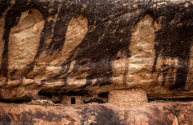
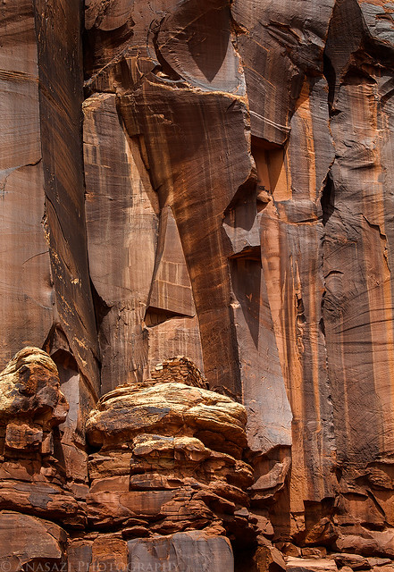
The Tower Ruins in the large alcove above were pretty much inaccessible without a tall ladder or some serious climbing skills.
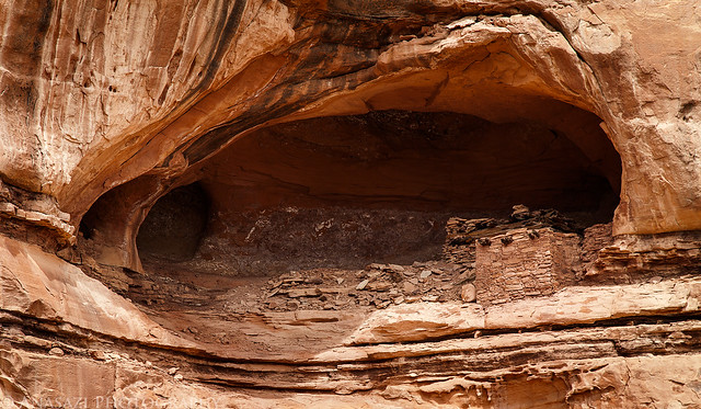
Tower Ruins Alcove by IntrepidXJ, on Flickr
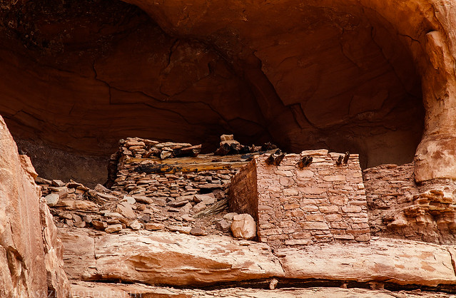
Here's a closer look at the ruins. I should have dragged my long lens up here with me...
Tower Ruins by IntrepidXJ, on Flickr
Jared found this small granary around the corner.
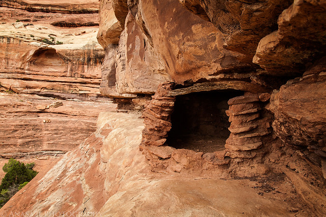
Ledge Granary by IntrepidXJ, on Flickr
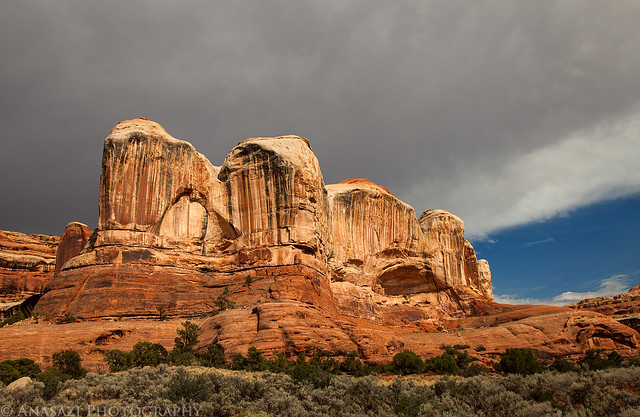
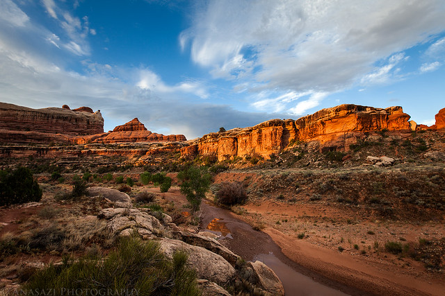
After climbing back down from the Tower Ruins, we drove further up the canyon as some darker storm clouds started to roll in.
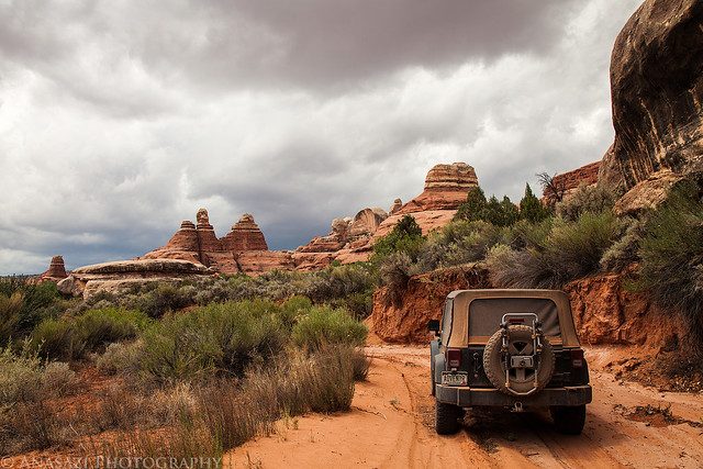
Storm Moving In by IntrepidXJ, on Flickr
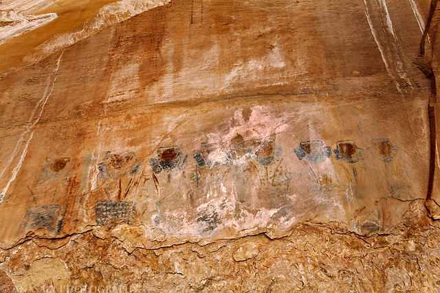
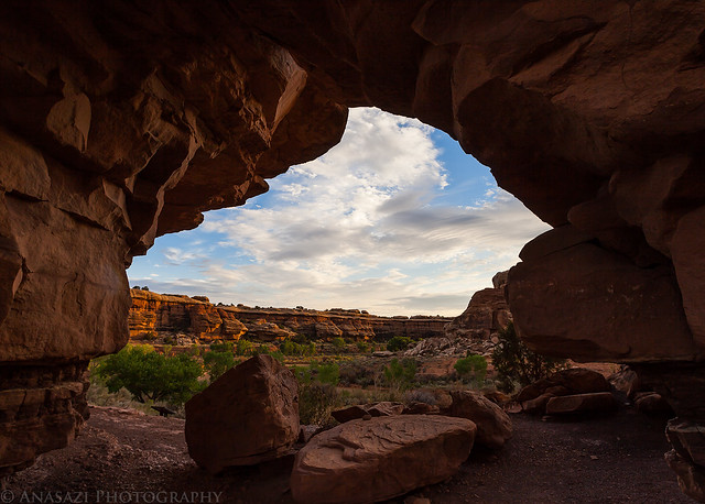
One of the main reason I've wanted to get into Horse Canyon for the past few years was so that I could visit the well-known Thirteen Faces pictograph panel. Once we drove a few more miles up the wash we stopped at a small side canyon that would lead us there. As we hiked up this canyon, the ominous clouds in the sky finally let loose and it started to rain on us. It was never a big downpour, but it was enough to get us wet. Luckily we reached the alcove containing the pictographs shortly after it started, so we were able to get out of the rain and take some photos at the same time. I'm just glad that we never got enough rain in the area to cause Horse Canyon or Salt Creek Canyon to flash flood since that could have caused trouble for us. We would later find out that the storm did indeed cause flash flooding in nearby Elephant Canyon, so we got lucky!
Even though this panel is called the Thirteen Faces, only about ten of them are actually still visible. I can't recall ever seeing a photo showing all thirteen faces, so I'm not sure how long they have been gone?
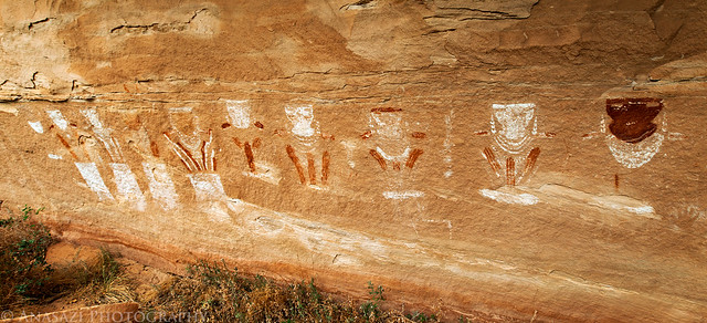
Thirteen Faces by IntrepidXJ, on Flickr
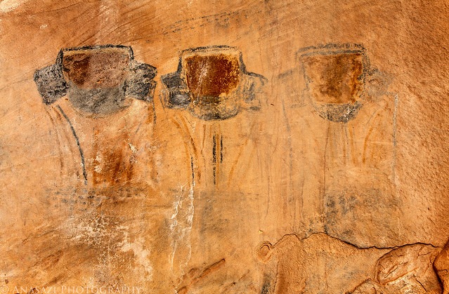
A closer look at six of the Thirteen Faces.
Six of Thirteen by IntrepidXJ, on Flickr
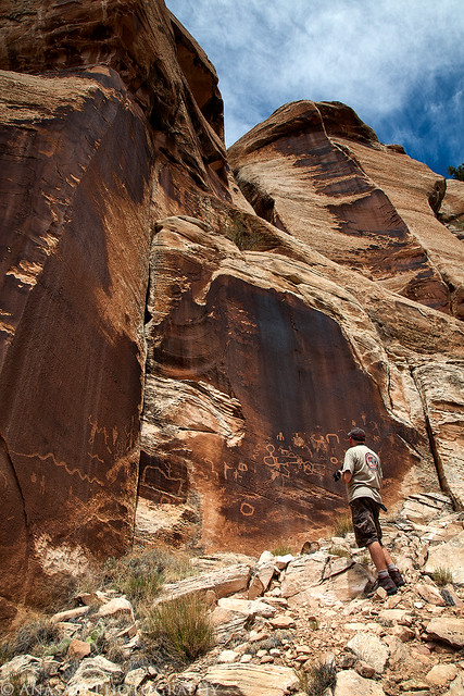
After we left the Thirteen Faces we spotted these ruins on a ledge high up on the canyon wall. We saw no way to access the ledge they were on, so we just took photos from the wash below.
Thirteen Canyon Ruin by IntrepidXJ, on Flickr
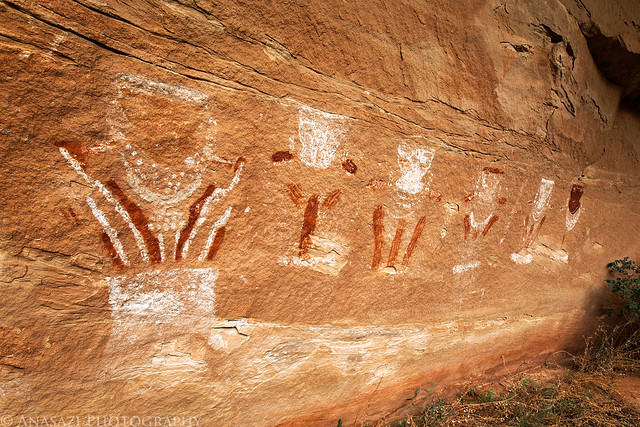
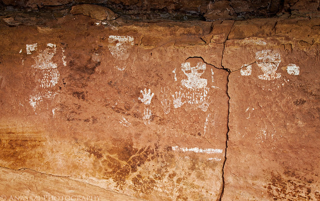
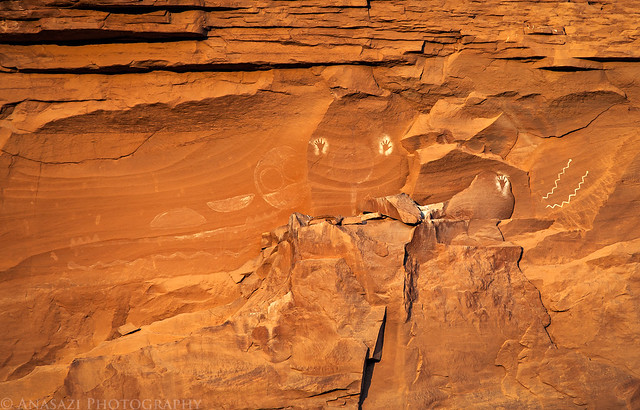
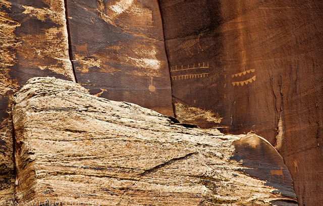
Next up, we searched for and found the ghostly Nine Faces pictograph panel. There are actually nine of them still visible, too!
Nine Faces by IntrepidXJ, on Flickr
Unlike the Thirteen Faces which have multiple colors, these are all white.
Four of Nine by IntrepidXJ, on Flickr
Jared taking a photo for some scale.
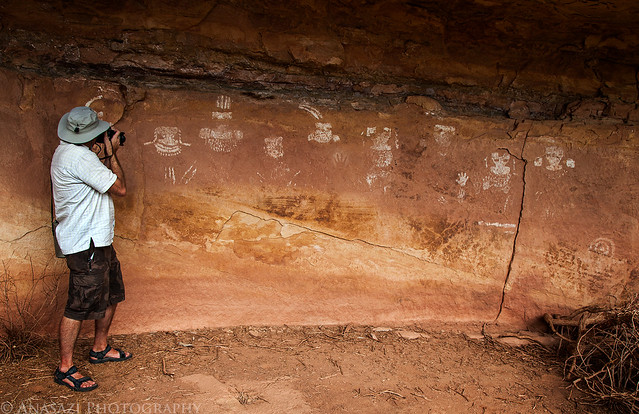
Jared and the Nine Faces by IntrepidXJ, on Flickr
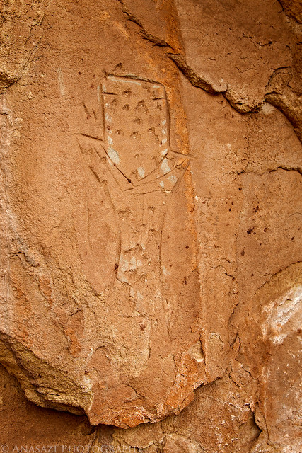
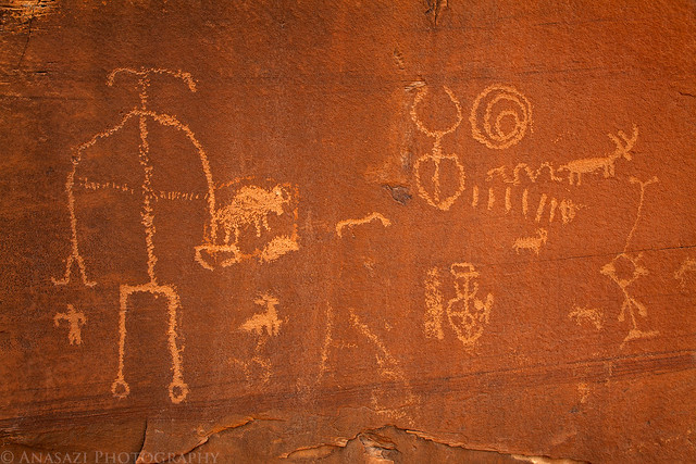
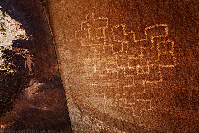
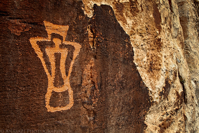
As we searched the area around the Nine Faces we spotted this faint but very large petroglyph. There appears to be an anthropomorph holding two very large shields.
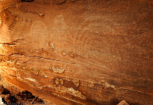
Big Shields by IntrepidXJ, on Flickr
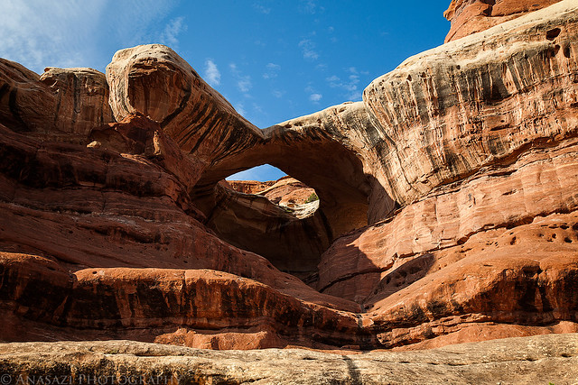
We continued our drive up the canyon to the end of the road and then took a short hike to a viewpoint of the impressive Castle Arch.
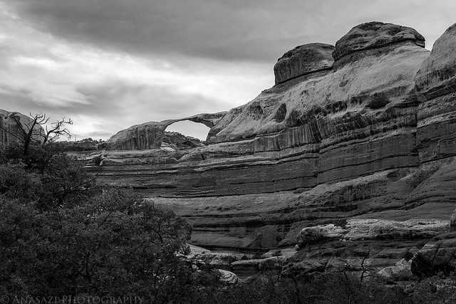
Castle Arch by IntrepidXJ, on Flickr
On our way back down the canyon I stopped for a photo under an overhang that apparently has cause some problems for other vehicles in the past.
Under the Ledge by IntrepidXJ, on Flickr
Marty shows that there's plenty of room for a Jeep...full-sized vehicles might need to be more cautious.
Plenty of Room by IntrepidXJ, on Flickr
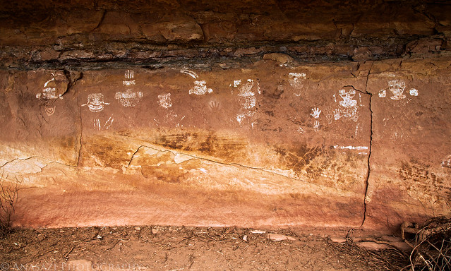
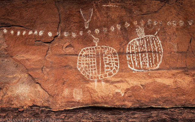
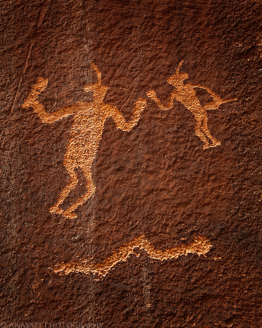
For our final hike of the day we set out to find the Eleven Faces. Again, this panel only really has eight faces that are still visible, although you can see some faint traces of the other three faces that are now missing. Unfortunately, calcite has been leaching from the sandstone that these pictographs were painted on, so much of it has been covered in the white substance, making it difficult to photograph. I did my best to bring out the details in this photo.
Eleven Faces by IntrepidXJ, on Flickr
Here's a closer look at the three figures on the right side of the panel that seem to be grouped together on purpose.
Three Warriors by IntrepidXJ, on Flickr
Before leaving the area, Jared spotted this lone petroglyph that is done in a similar style to the nearby Eleven Faces. While there are number of pictographs in the area done in this 'faces motif' this is the first and only petroglyph I have seen done like this. It's very cool, and I probably would have missed it if Jared hadn't spotted it.
One Face by IntrepidXJ, on Flickr
We also spotted an interesting ruin high above on our hike back to the vehicles. See if you can spot it in this photo...
Ladder Ruin View by IntrepidXJ, on Flickr
Here's a closer look at the ruin with the large ladder used to access the site. I'm curious to know if the ladder that is up there is original or not? It's hard to get a good look at it in this photo, and we didn't have the time or energy to climb up there to check it out. Maybe next time. If anyone has any information about the ladder or ruin, please feel free to leave a comment below.
Ladder Ruin by IntrepidXJ, on Flickr
Driving back out of the canyon as the clouds finally start to clear out of the sky.
Horse Canyon Road by IntrepidXJ, on Flickr
Horse Canyon Wash by IntrepidXJ, on Flickr
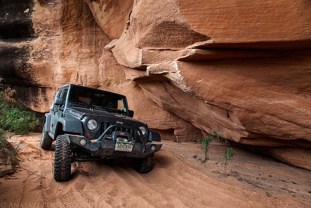
This is the deepest hole we had to drive through to get into and back out of Horse Canyon. No problem if you have high clearance and your air intake isn't too low.
Horse Canyon Hole by IntrepidXJ, on Flickr
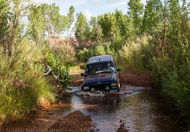
After reaching Salt Creek again we turned up the wash and drove through the deeper water and mild quicksand to reach our campsite at Peekaboo for the evening. We setup camp, had some dinner, talked and relaxed before finally getting to bed. It had been a long day and we were all pretty tired.
-
Post Thanks / Like - 1 Likes
 Tango liked this post
-
07-23-2012 05:01 PM # ADS
-
07-23-2012, 05:02 PM #2
The following morning I slept in just a little bit, but still managed to get up to Trail Arch as the sun started to shine into the canyon.
Salt Creek Sunrise by IntrepidXJ, on Flickr
A view through Trail Arch.
Trail Arch Sunrise by IntrepidXJ, on Flickr
Trail Arch with the large hoodoo standing above.
Trail Arch by IntrepidXJ, on Flickr
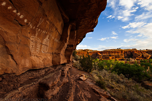
Since I didn't have my heavy long lens with me when I found this pictograph panel back in May, I was looking forward to getting a better photo of it this time. It just so happens that the panel looked great when struck by the early morning light.
High Five Panel by IntrepidXJ, on Flickr
Of course, I had to take some obligatory photos of the Peekaboo pictographs while we were there.
Peekaboo Morning by IntrepidXJ, on Flickr
Peekaboo Panel by IntrepidXJ, on Flickr
After having some breakfast and then packing up camp, we set out to hike up Secret Canyon and see what we could find.
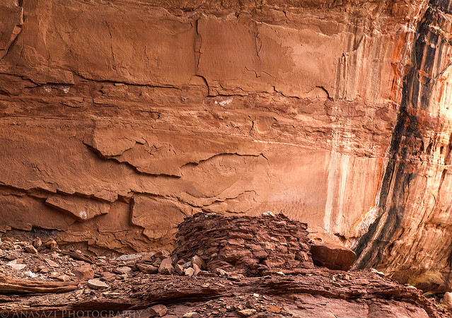
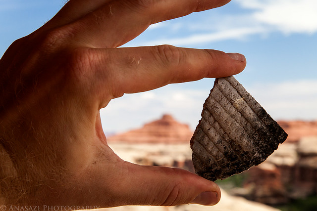
We soon found a site that had a few broken down ruins, handprints on the walls and many large potsherds on the ground.
Corrugated by IntrepidXJ, on Flickr
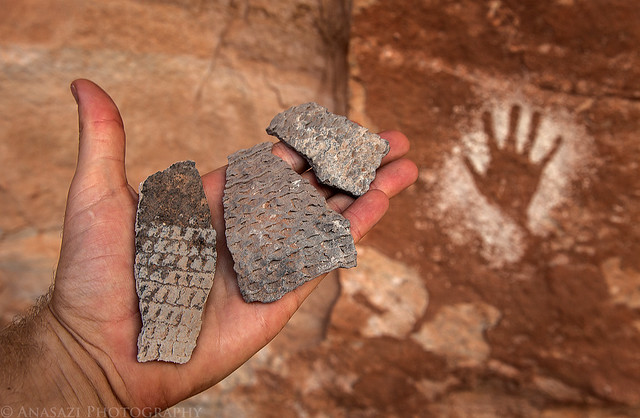
Jared takes a photo of the reverse handprint.
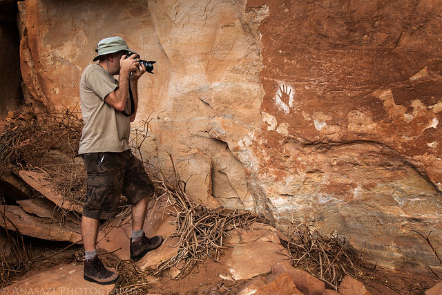
Handprint Photographer by IntrepidXJ, on Flickr
It almost seemed like there might be enough potsherds laying around to rebuild an entire pot.
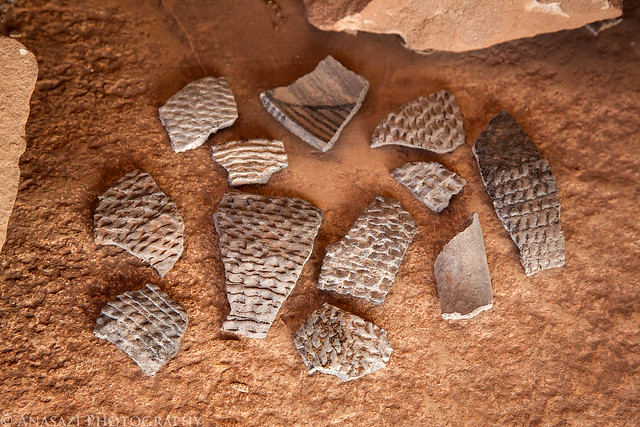
Potsherds by IntrepidXJ, on Flickr
A little further up the canyon I spotted a panel of white dots high above. Jared was able to climb up a steep crack to reach them, but I wasn't able to follow. It took a little time and work, but I managed to find an easier way up to them, too.
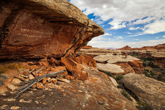
High Dots Panel by IntrepidXJ, on Flickr
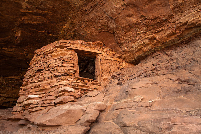
There was also the remains of a small storage cist or granary.
Storage with a View by IntrepidXJ, on Flickr
There was even another large potsherd up here, too.
High Potsherd by IntrepidXJ, on Flickr
Marty followed my route up and checks out the area.
Marty and the Dots by IntrepidXJ, on Flickr
There was a great view of Secret Canyon from up here.
Secret Canyon View by IntrepidXJ, on Flickr
After hiking back out of Secret Canyon, we finished the drive out of Salt Creek Canyon and exited the park. Since we were all pretty hungry, we stopped at the Needles Outpost for a burger.
I took a photo of this little guy posing on a rock before leaving the Needles Outpost.
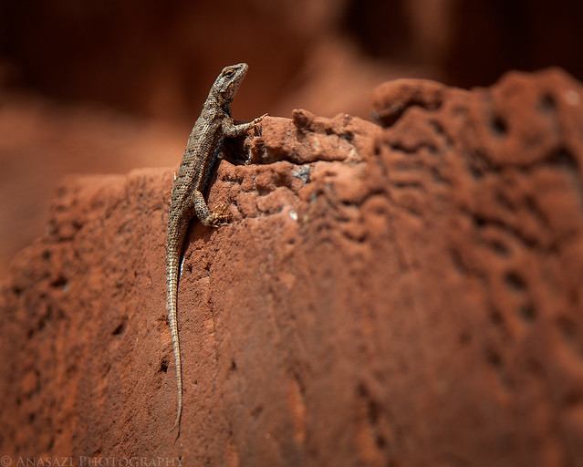
Poser by IntrepidXJ, on Flickr
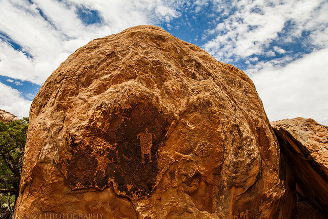
Before leaving the area and driving home, we stopped at a few more rock art sites along the Indian Creek corridor, starting with this large boulder that Jared had spotted before.
Ute Boulder by IntrepidXJ, on Flickr
A closer look.
Stickman Panel by IntrepidXJ, on Flickr
Then I took them to a small panel on a boulder right next to the road.
Roadside Boulder by IntrepidXJ, on Flickr
Our group of vehicles parked along the road in Indian Creek Canyon as we searched for new sites.
Rock Art Hunter Parking by IntrepidXJ, on Flickr
While scanning the canyon walls for more rock art we spotted the remains of a ruin high above. This is the first ruin I have come across in this area.
Indian Canyon Ruin by IntrepidXJ, on Flickr
This is another panel of petroglyphs that I had not seen before. I swear I find something new every time I spend some time searching this canyon.
Indian Canyon Designs by IntrepidXJ, on Flickr
Before calling it a day, we stopped at a large site of petroglyphs that Marty and I have been to before, but Jared had not. The following few photos are from the area.
Maze & Man by IntrepidXJ, on Flickr
This is still one of my favorite petroglyph figures.
Inside by IntrepidXJ, on Flickr

Snake Man by IntrepidXJ, on Flickr
Jared checks out the large panels of petroglyphs.
Admiring by IntrepidXJ, on Flickr
Fighting Men by IntrepidXJ, on Flickr
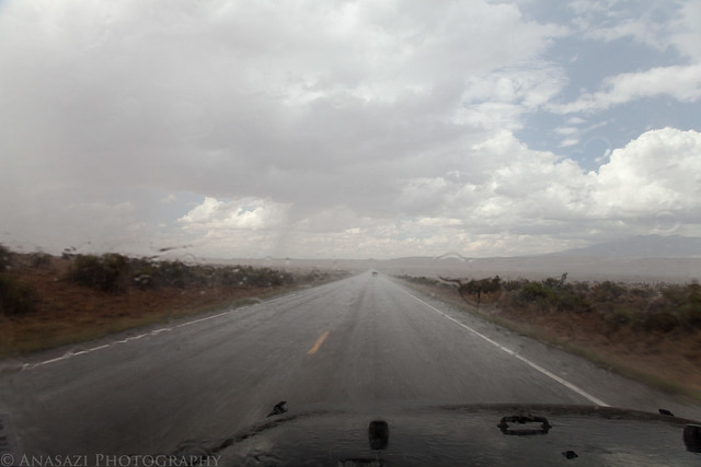
After hiking back down to the vehicles, we said our goodbyes and started the drive home. On the way back to Moab I drove though some pretty heavy downpours and wind. This is much needed rain for the area.
Downpour by IntrepidXJ, on Flickr
After passing through Moab and turning up the Colorado River Road I noticed that the river was colored red from heavy rain and flash flooding up by the Richardson Amphitheater area. Aside from driving through more storms, the rest of the drive home was uneventful. I actually got home just after a pretty big storm had passed over Grand Junction.
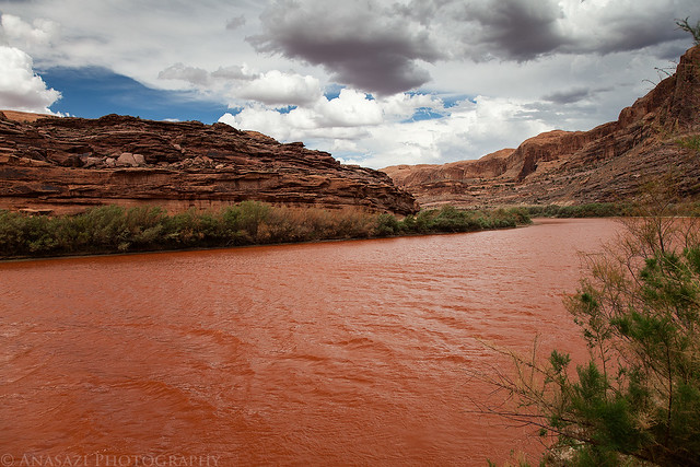
Red River by IntrepidXJ, on Flickr
I'm glad that I was finally able to visit and explore the elusive Horse Canyon and am looking forward to returning in the future since I'm sure that we still missed a lot of interesting things to see. Let's just hope that the road doesn't get closed for two years again after the next large storm comes through the area.
>> Horse Canyon Photo Gallery
-
Post Thanks / Like - 5 Likes
-
07-23-2012, 05:26 PM #3Bogley BigShot


- Join Date
- May 2007
- Location
- We're all here, because we ain't all there.
- Posts
- 19,424
Exceptional, Randy

-
Post Thanks / Like - 1 Likes
ladyrock liked this post
-
07-23-2012, 08:32 PM #4
-
07-24-2012, 05:41 AM #5 Great TR! Thanks
Quoting my best friend, Bob McNally, after a bad boating trip: "Nature scares me!"
Utah photos: www.winpics.fototime.com
-
07-24-2012, 06:34 AM #6
Cool. I missed some of those places in Horse Canyon. I'll have to get back.
Utah is a very special and unique place. There is no where else like it on earth. Please take care of it and keep the remaining wild areas in pristine condition. The world will be a better place if you do.
-
07-25-2012, 01:25 PM #7
...very, very nice TR and pics.
I plan to hike there next year.
Thanks for sharing.
-
07-28-2012, 09:54 PM #8
excellent TR. there's a lot of stuff to see in there.
But if I agreed with you, we would both be wrong.
-
07-29-2012, 08:02 AM #9
Nice trip report and pictures.
-
07-31-2012, 09:25 AM #10
Wow! Excellent. The Indian Canyon ruin shot is stunning.
Life is Good
-
08-08-2012, 09:54 PM #11
awesome TR Randy !!!
-
08-09-2012, 10:49 AM #12
Great trip and thanks for alerting me to Horse Canyon being open. Did you run into any quicksand on your trip? I talked to someone at the MIC here in Moab and they called Needles Visitor Center and as usual they mentioned quicksand and "deep" sand. I plan to go in two weeks. Also, did you see the Sky Faces while you were there?
-
08-09-2012, 11:52 AM #13
There may have been a little quicksand between Horse Canyon & Peekaboo below the deeper water, but we didn't slow down enough to find out.
I'm not familiar with the Sky Faces?
-
08-09-2012, 09:27 PM #14
Great TR and shots! Thanks for sharing
From wnorton using an iPad and Tapatalk HD.
-
10-22-2012, 06:19 PM #15
I remember that road and the quicksand. Fantastic trip report. Thanks for sharing. OZ...
Always remember that while traveling, A Tall Leggy Blonde is much better than a group of Gaseous chums! OZ....
-
10-24-2012, 12:41 PM #16
Great trip report. You always do excellent work. Love the photos.
We must go forward, even if we can't!
-
10-24-2012, 05:18 PM #17
-
10-25-2012, 07:27 AM #18
very nice pics, looks like you had some really busy days out there and saw a lot of cool stuff. Exceptional TR and really great pics!
Your safety is not my responsibility.
-
12-04-2012, 08:22 PM #19
As always your TR and photos did not disappoint! I did one little trip into Horse Canyon and since I have a wimpy 4WD, I hiked in from the TH and camped.
Thank you for sharing. I haven't heard of the 'Sky faces' either. Something to look forward to![COLOR=#800080][FONT=franklin gothic medium]"Too often I would hear men boast of the miles covered that day, rarely of what they had seen." Louis L
-
12-27-2012, 11:26 AM #20
Thank you for such excellent photos and narratives. Would this area be accessible in winter? I have tried the road in to Needles in the winter, and there was no plowing. With several inches of snow it was impassible. Does the park maintain it in winter? Thanks!


 Reply With Quote


Similar Threads
-
[Trip Report] Wolverine and Horse Canyon
By RedRoxx in forum Hiking, Scrambling & Peak BaggingReplies: 3Last Post: 05-22-2012, 01:59 PM -
[Trip Report] Wild Horse Canyon
By IntrepidXJ in forum Hiking, Scrambling & Peak BaggingReplies: 4Last Post: 11-29-2010, 06:54 AM -
[Trip Report] Little Wild Horse Canyon
By Uncle Rico in forum Hiking, Scrambling & Peak BaggingReplies: 5Last Post: 02-20-2008, 07:38 PM -
[Trip Report] Little Wild Horse Canyon
By TreeHugger in forum Hiking, Scrambling & Peak BaggingReplies: 9Last Post: 03-25-2007, 06:40 AM -
[Trip Report] Little Wild Horse Canyon
By accadacca in forum CanyoneeringReplies: 11Last Post: 06-16-2005, 12:42 PM
