

Results 1 to 5 of 5
Thread: Lost Horse Basin Road
-
04-19-2012, 06:16 AM #1
Lost Horse Basin Road
From Gateway, CO this might be the shortest way to travel to the top of Uncomphagre Uplift.
Over a distance of 5.5 miles this road climbs about 3,000 feet from the east side of the Dolores River to the forests on top of the cliffs. The top 1.8 miles are the steepest, giving a lift of about 2,000 feet.
Some pictures travelling down late in August after 7 p.m. The time we arrived on the road along Dolores River it was dark.
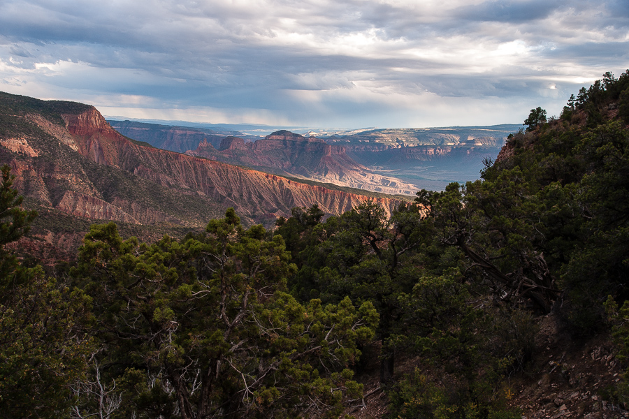
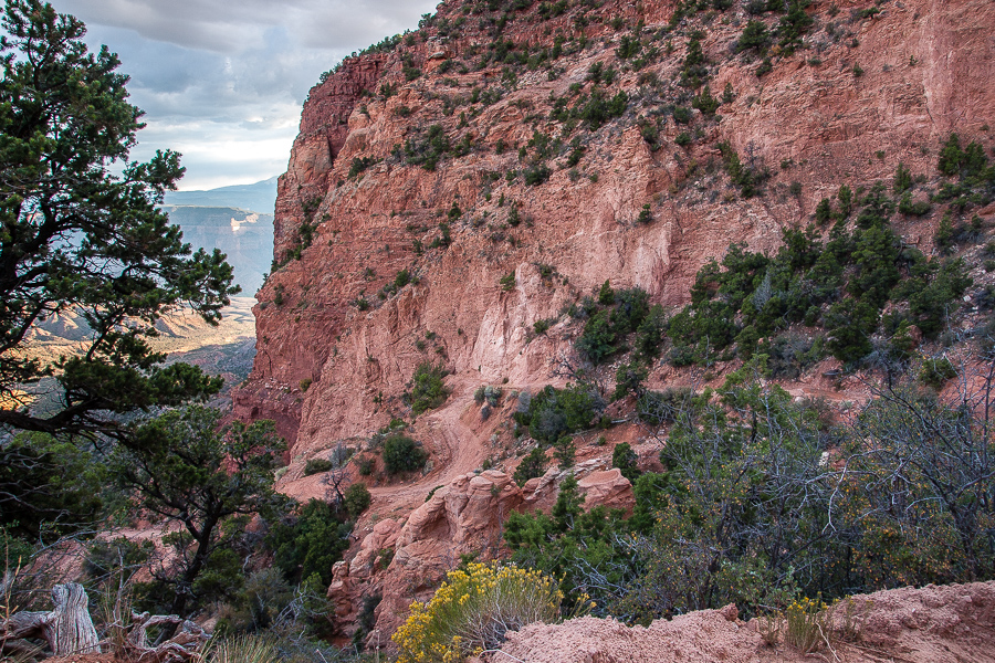
Looking down into Dolores River Canyon near Gateway, CO
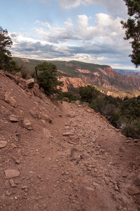
Road to Gateway - not that wide, but wide enough.
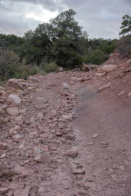
Some rocks
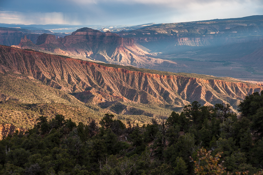
One of the last sunrays for the day.
Tight switchbacks. Backup!
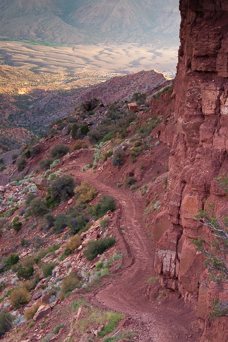
Another part of the road. One can see the very end of the road near the river.
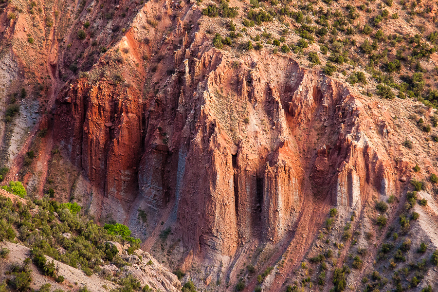
Rock? Dirt? Whatever it is, it is colorful!
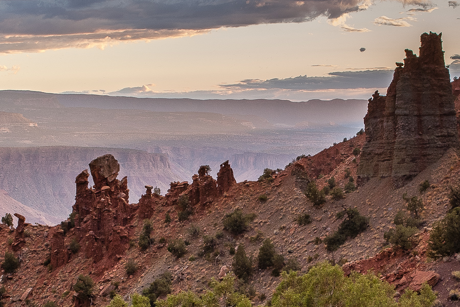
Twilight
(Some more pictures)
-
04-19-2012 06:16 AM # ADS
-
04-19-2012, 09:09 AM #2
Excellent trip report. Looks like a fun road and a beautiful drive. Thanks for sharing.

-
04-19-2012, 02:34 PM #3
It's a fun little road. It's actually called the Sheep Creek Road according to locals and the BLM.
A few years ago the tight switchbacks at the top were washed out for a while, but the BLM did end up repairing them.
-
04-20-2012, 03:07 AM #4Thank you for this information. We couldn
 Originally Posted by IntrepidXJ

-
04-21-2012, 12:03 PM #5
...
 TR and pictures!


 Reply With Quote


Similar Threads
-
[Trip Report] Uintas - Middle Basin - Naturalist Basin - July 23, 2011
By CarpeyBiggs in forum Backpacking & CampingReplies: 10Last Post: 07-27-2011, 10:02 PM -
Anyone know if Wild Horse Road (Co Road 103) is closed off past a certain point now?
By Ryebrye in forum Offroad 4x4, Side by Side and ATVReplies: 2Last Post: 07-28-2010, 09:23 AM -
lost spot in lost park canyon
By shaggy125 in forum CanyoneeringReplies: 1Last Post: 10-24-2008, 08:40 AM -
Anyone done the Squeeze from Wild Horse Road?
By intellectualdesperado in forum CanyoneeringReplies: 2Last Post: 08-27-2008, 11:24 AM
