

Results 1 to 15 of 15
-
12-28-2011, 01:07 PM #1
Ernie Benchmark - San Rafael Reef
I did a really fun hike in the San Rafael Reef on the day after Christmas. I'd long wanted to hike to the "Ernie" benchmark at the top of the Reef, but I couldn't find any information on whether it was hikeable, and the data sheet for the benchmark says that it was originally reached by helicopter. I spent a lot of time planning my route using Google Earth and USGS topo maps, but even so, there were numerous drainages I had to cross and any one of them could have been a barrier to reaching the benchmark.
Viewing on a mobile device? Click this link to open the map: http://maps.google.com/maps?q=http:%2F%2Fudink.org%2Fgeo%2FErnieBenchmark.kmz&hl=en&sll=37.0625,-95.677068&sspn=40.545434,86.572266&vpsrc=0&t=h&z=14
http://udink.org/geo/ErnieBenchmark.kmz
I left home before sunrise on Monday, and by 8:50 AM I was starting the hike up the Reef about half a mile northeast of the mouth of Ernie Canyon. I made a slight detour to once again see the old truck/drilling rig, then hiked up the slickrock some more before descending into a small, sandy valley. The trip pretty much went like that all day--hike up a hill or ridge, then descent into the next canyon or valley, then repeat. I followed the bottom of the wash in the valley for a while, then climbed out and over the ridge to the north and back down into the next canyon. The climb out of that canyon was through a large boulder field, but the hiking was easier than it had looked from the opposite side of the canyon as I was descending into it.
Shot from the side of Highway 6 near I-70 during the drive

Starting point of the hike

Truck/drilling rig

The first valley I descended into

Torrey leading the way down a steep chute

Small dropoff that I bypassed on the right

Following a wash that quickly turned into a deep canyon
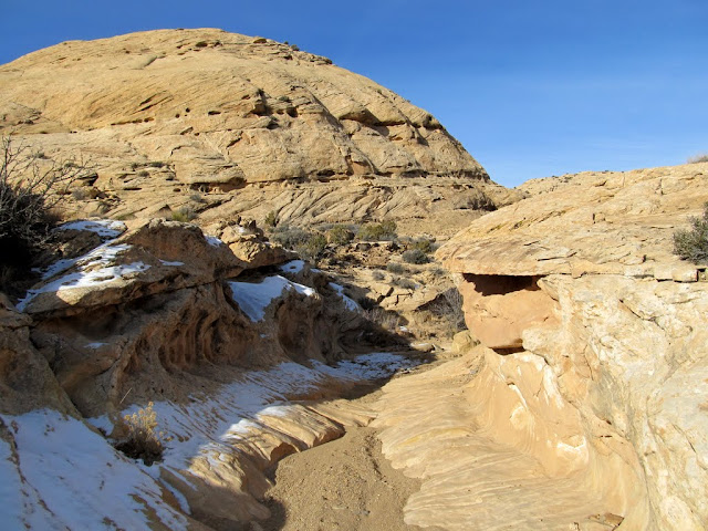
The climb up to the ridge (center) as the canyon deepened on the left
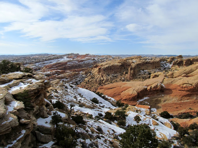
The canyon was much deeper upstream from where I climbed out
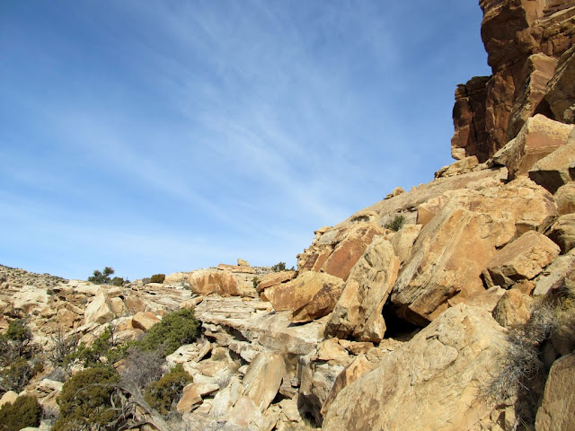
View of the boulder field across the next canyon
The start of the boulder field

Almost through the boulder field and back to some slickrock
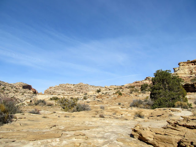
I reached the top of the next ridge and stayed high this time as I followed the rim of the next canyon I had to cross. The canyon floor rose up to meet the rim as I hiked, but there were still some cliffs on the other side of the canyon that I wasn't sure I'd be able to get past. I crossed the canyon at its shallowest point and found a nice break in the cliffs that I was able to climb up easily. That was the last major canyon I had to cross, though there were many more smaller drainages after that. This seemed like a good place to break for lunch, since the worst canyon was behind me and the steepest part of the hike was just ahead of me.
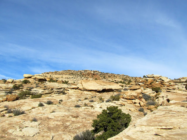
Easy hiking to the top of the ridge beyond the boulder field

Somewhat easier terrain for a while
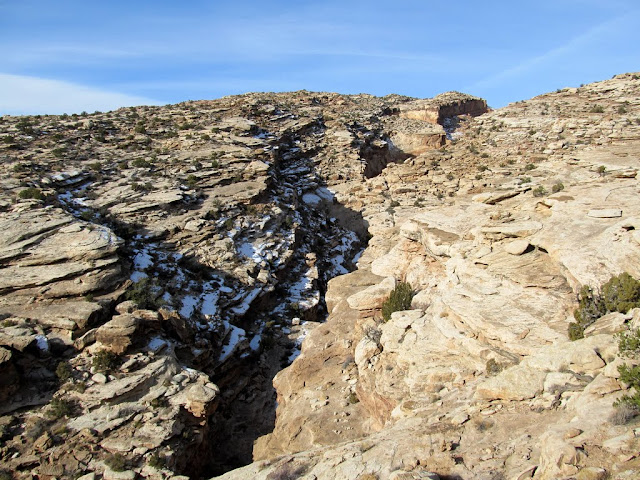
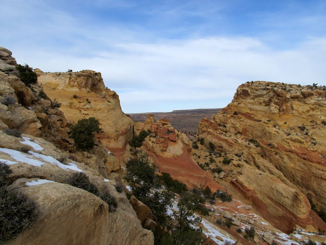
The last canyon I had to cross
A break in the cliffs that was easily climbable

View from where I stopped for lunch

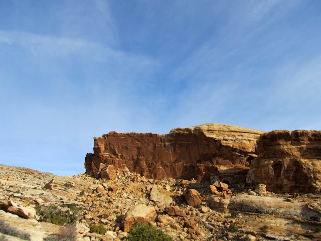
As I ascended the steep section after lunch, I began to see some nice views over the top of the San Rafael Reef. There was more snow higher up, but still not enough to make hiking difficult. I couldn't see the sandstone knoll where the benchmark resides until I was within about 500 feet of it. From that distance, it looked like I just might have been able to climb it. I got to within 100 feet of the benchmark and there was a short vertical section ahead of me that looked like it could be a sketchy climb, but both my dog and I made it up easily. I'd made it to the benchmark! There was a summit register there that had been placed by some Colorado hikers exactly one month before. The views were outstanding.
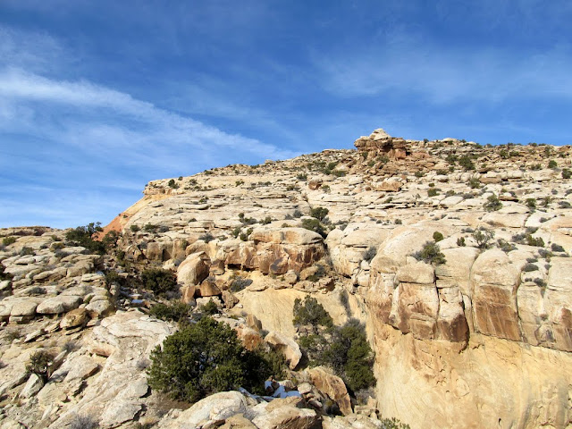
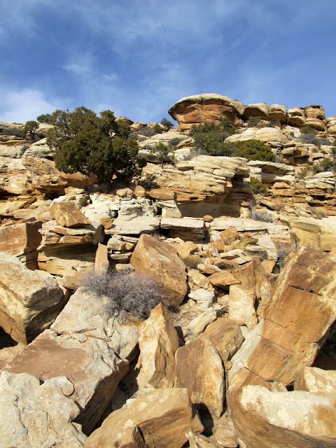
Rock formations along the steepest part of the hike


More scrambling over small boulders
View southwest as I neared the top of the Reef
A break in the top of the Reef with a glimpse into the central San Rafael Swell
Henry Mountains and Gilson Buttes

The first glimpse of the hill (center) where the Ernie benchmark is set
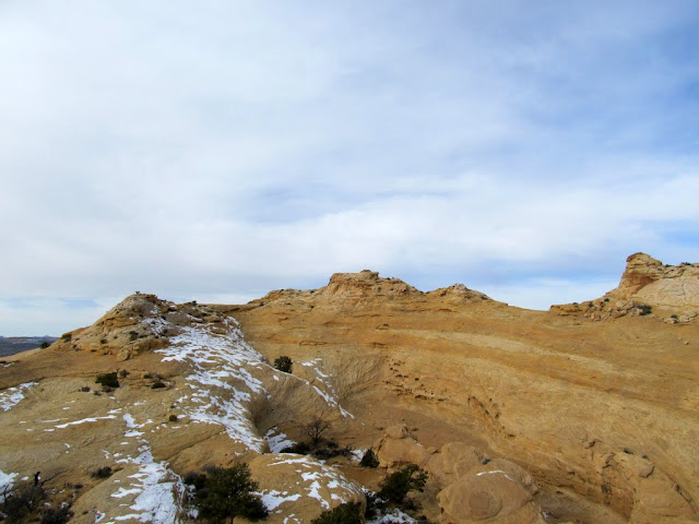
San Rafael Reef to the north

The last obstacle before reaching the benchmark

Torrey at the high point near the benchmark


The benchmark

Top of the Reef to the north

Before starting the return trip I donned my jacket since some clouds had obscured the sun and I knew I wouldn't be exerting myself as much on the hike down the Reef. I followed my GPS tracklog pretty closely since on the way up I'd encountered a lot of obstacles where there was only one really easy way past. The hike back was uneventful and the scenery was the same as I'd seen on the way up, until I found an arrowhead in the bottom of a sandy wash about two-thirds of the way back to the truck. I'd kept an eye out for rock art on the hike up the Reef and didn't see any, but the arrowhead inspired me to take a couple of side-canyons to actively look for more. I did manage to find one small but interesting pictograph panel, which was icing on the cake of an already great day. My round-trip hiking distance was 8.1 miles, and it took me about four hours to get to the benchmark and only 2.5 hours to get back down to the truck.
A tree seen on the way back down

Wonderful sky

Arrowhead

Pictographs


Sunset during the drive home

Here's a slideshow/link to the rest of the photos:
https://picasaweb.google.com/Dennis....ErnieBenchmark
-
12-28-2011 01:07 PM # ADS
-
12-28-2011, 01:42 PM #2
awesome thanks for sharing...headed down there tomorrow. how were the temps???
-
12-28-2011, 01:44 PM #3
-
12-28-2011, 01:49 PM #4
Thanks...good to hear...I am escaping the deep winter up North:) Looks to be nice for the next few days...
-
12-28-2011, 01:56 PM #5
thx for sharing TR and pictures.
A beautiful landscape again.
-
12-28-2011, 02:31 PM #6
Very Cool Adventure!
We must go forward, even if we can't!
-
12-28-2011, 02:32 PM #7
Can you pick up arrowheads??? Just wondering as I stumbled upon a ton of them at a very popular spot just barely off the beaten path and left them where they lay. Thought that picking them up was a no no?
But anyways, back to the TR!!! Looks fantastic, and perfect weather for a jaunt. Thanks for sharing.
-
12-28-2011, 03:04 PM #8Sure you can...they're not very heavy.
 Originally Posted by JONBOYLEMON

 Seriously, though, it depends on who you ask. Title 16 of the U.S. Code, Chapter 1B, Section 470ee makes it illegal, but Paragraph (g) removes all penalties for picking an arrowhead up off the ground.
http://www.law.cornell.edu/uscode/us...0--ee000-.html
(g) Removal of arrowheads located on ground surface Nothing in subsection (d) of this section shall be deemed applicable to any person with respect to the removal of arrowheads located on the surface of the ground.
-
12-28-2011, 03:20 PM #9
Good to know, not sure what I would do with an arrowhead though, other than to hold one would be cool, but I suspect I will continue to let them lay...
-
12-29-2011, 04:24 AM #10
Nice! Way to utilize this mild winter weather.
If this snowless trend continues, I may have to do a little road trip down that way. My powder "Jones" is not being satisfied.
-
12-29-2011, 05:52 AM #11
Sounds like an awesome trip. I used to live in Price (CEU class of 1999) and I loved exploring the swell when I lived there. Your TRs make me miss the area.
-
12-29-2011, 12:24 PM #12
Great report and pictures! Thanks for sharing your adventure.
-
12-29-2011, 12:48 PM #13
Looks like an awesome hike! I sure do enjoy following your adventures.:)
-
01-11-2012, 10:57 PM #14
-
01-12-2012, 07:34 AM #15
Thanks for sharing your adventures & photos. San Rafael Swell is very appealing because its so unexplored. Great reporting!


 Reply With Quote


Similar Threads
-
San Rafael Desert Road Closed at San Rafael River Bridge, July 2011
By Deserter in forum Offroad 4x4, Side by Side and ATVReplies: 1Last Post: 07-04-2011, 07:13 AM -
Mountain name vs benchmark name.
By Scott P in forum General DiscussionReplies: 1Last Post: 02-22-2010, 07:06 PM -
[Trip Report] Day of the San Rafael Reef
By coinslab in forum Rock Art & RuinsReplies: 2Last Post: 10-20-2009, 06:05 PM -
Cable Canyon & San Rafael Swell / Reef conditions?
By heliski2 in forum CanyoneeringReplies: 8Last Post: 09-18-2009, 07:15 AM -
[Trip Report] Behind the Reef Trail ATV Video - San Rafael Swell
By RedMan in forum Offroad 4x4, Side by Side and ATVReplies: 2Last Post: 01-12-2007, 10:30 PM
