

Results 1 to 20 of 27
Thread: The Wave Weekend
-
11-30-2011, 05:06 PM #1
The Wave Weekend
Friday-Sunday, November 4-6, 2011
The Original Trip Report on ADVENTR.CO
The Wave, located just south of the Utah-Arizona state line in the Vermilion Cliffs Wilderness Area, is one of those places that every photographer and hiker wants to visit. It's hard to blame them because it is such a unique and amazing area. Unfortunately, because of it's popularity, the BLM has a permit system in place that allows only twenty people per day the chance to experience this remarkable area. If you've read my blog for any length of time you might know that I am averse towards any kind of permit when I go out exploring, so in the past I have usually avoided those places. This year I have made an effort to finally visit some of those places that require a permit, including The Maze and the White Rim. A few months ago I decided that I would try to get a permit so that I could hopefully visit The Wave this year, too. Since there are only 20 permits per day, it can be difficult to obtain one. For anyone not familiar with the Coyote Buttes North permit system, ten of the permits for each day are awarded in a lottery three months in advance and the other ten are distributed in person the day before. I guess I was pretty lucky since I managed to snag two permits in advance on my first try. Once I had my permits, Amanda and I decided to make a long three day weekend out of the trip.
We left early on Friday morning and drove down through Monument Valley since Amanda hadn't been through there before. Shortly after passing through Kayenta we turned off the main highway so we could make a quick visit to Navajo National Monument. We took the short Sandal Trail to on overlook of the Betatakin Ruins. The viewpoint was still pretty far away from the large alcove containing the ruins so I'm glad I had my long lens with me. We were lucky that most of the ruins were all in the sunlight, so I didn't have to deal with a large shadow in part of the scene.
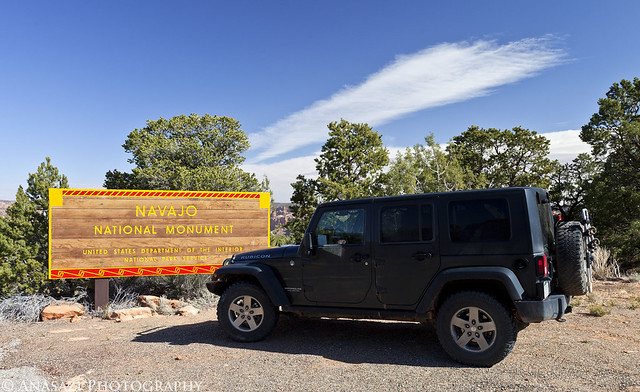
Navajo National Monument by IntrepidXJ, on Flickr
This huge alcove contains the Betatakin Ruins.
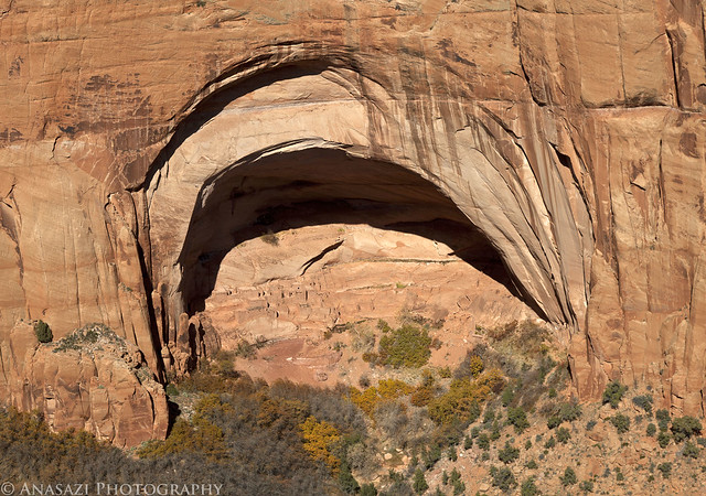
Betatakin Alcove by IntrepidXJ, on Flickr
A closer look at the ruins found here.
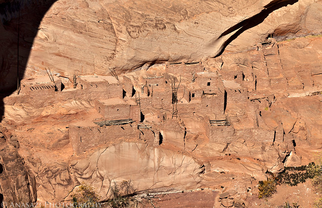
Betatakin Ruins by IntrepidXJ, on Flickr
Here's a view of the large alcove in it's canyon setting for a little better sense of scale.
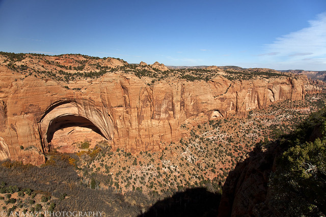
Betatakin Overlook by IntrepidXJ, on Flickr
In the future I am going to have to return to the park and take the ranger-guided tour down to the ruins, which is only offered on the weekends during this time of the year. I'd also like to make the trek to Keet Seel one day, too.
From Navajo National Monument we countinued across the Navajo Nation to Page, Arizona. Amanda hadn't been here before so I took her over to the Glen Canyon Dam Visitor's Center so that she could check it out. After checking into our hotel and grabbing some dinner we headed over to the Horseshoe Bend overlook for sunset. At first it looked like there might be an awesome sunset, but in the end there was only one small section of the sky that got any color. It was still a cool place to photograph at sunset.
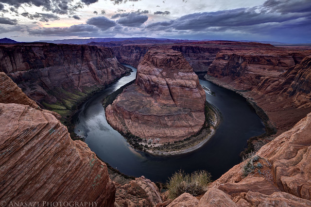
Horseshoe Bend by IntrepidXJ, on Flickr
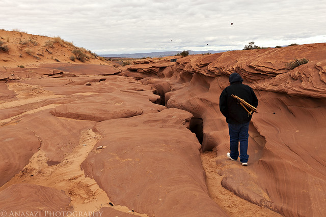
On Saturday morning we were up bright and early so we could visit The Wave. We drove to the Wire Pass Trailhead, where we found only one other vehicle, and then started the hike to The Wave. It was a cold and windy morning, and was supposed to stay that way all day. When we started the hike there was a thin layer of snow and ice on the ground, but as soon as the sun came out, it all melted off. The wind and the quick moving clouds made for some great skies and constantly changing lighting conditions for photography, but also kept us cold and sand-blasted us all day.
Here's a few photos I took on our hike to reach The Wave. There is spectacular scenery all over the place!
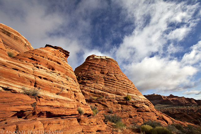
Hiking Scenery by IntrepidXJ, on Flickr
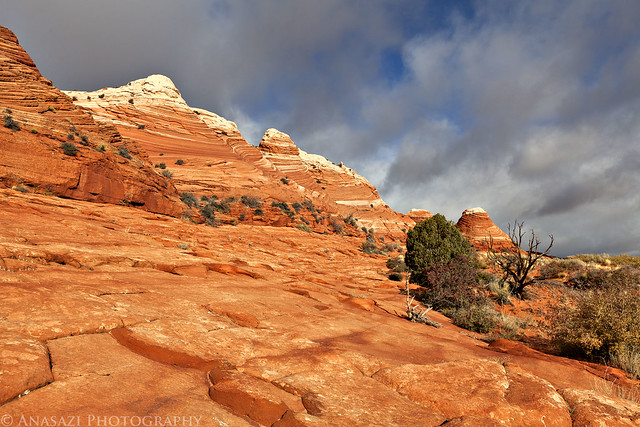
Sandstone by IntrepidXJ, on Flickr
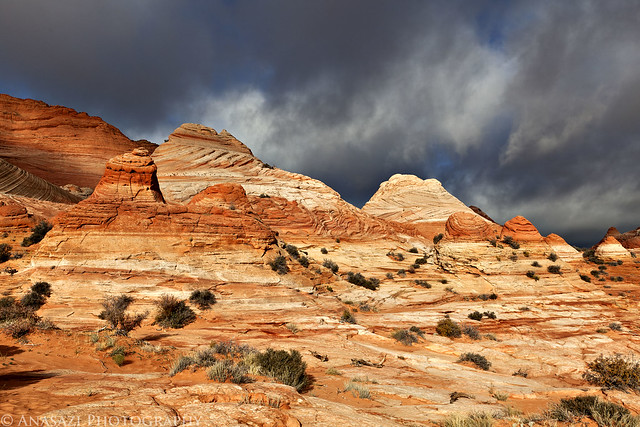
Scenery by IntrepidXJ, on Flickr
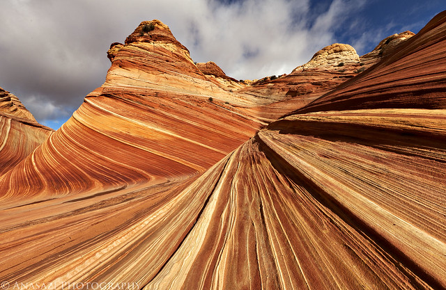
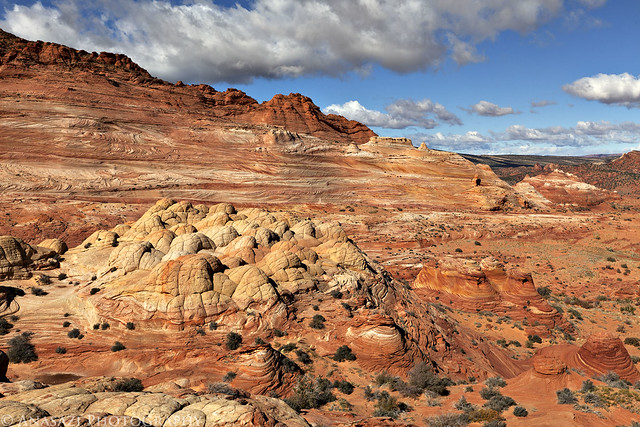
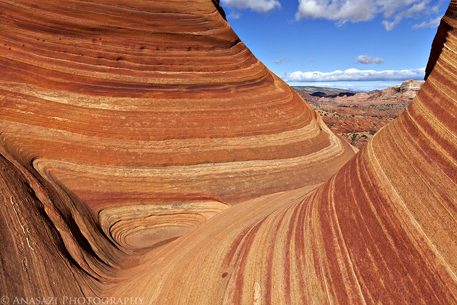
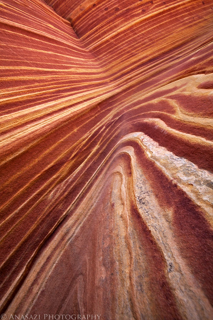
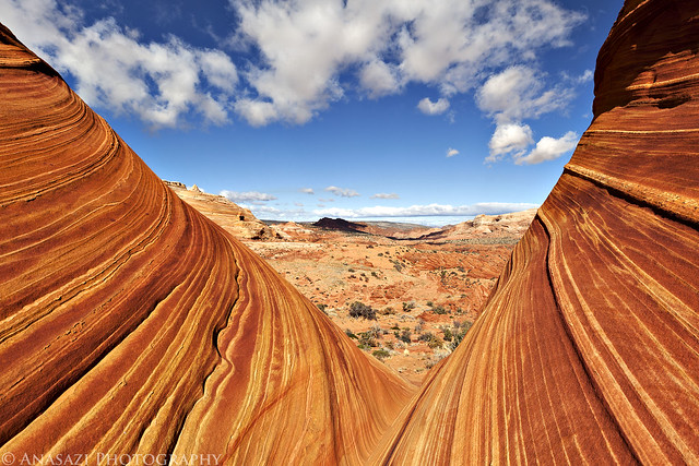
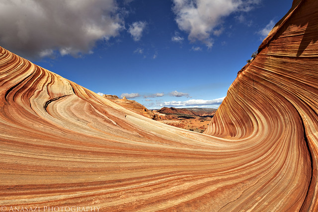
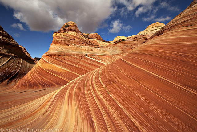
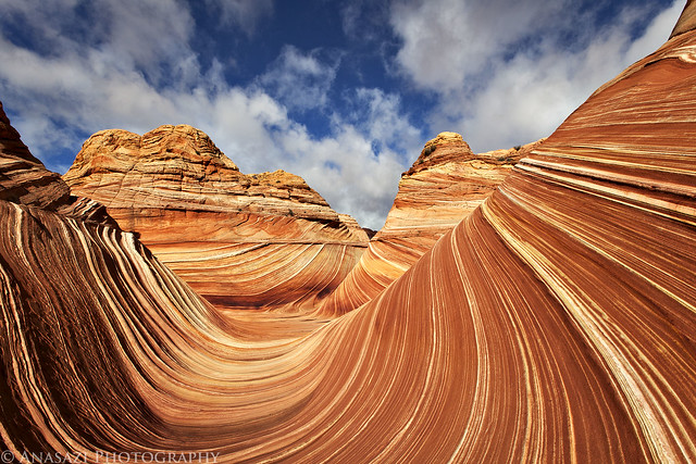
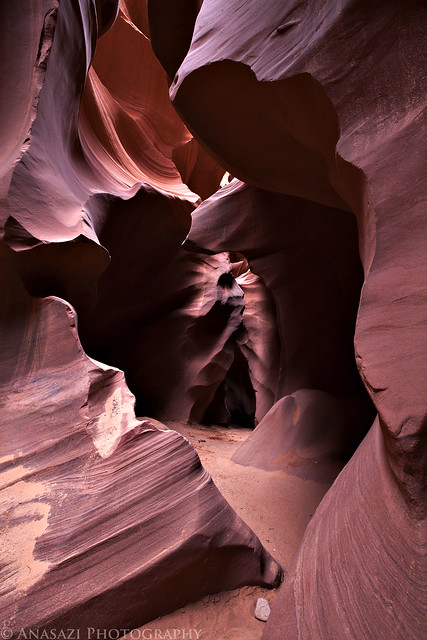
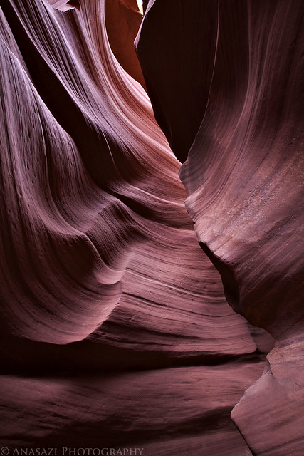
After a few miles of hiking we finally reached The Wave! Again we got lucky here, too. The one vehicle in the parking lot belong to a guy who had hiked in even earlier than us. By the time we reached The Wave he was heading off to do some more exploring elsewhere. We had the place to ourselves for a few hours to explore and photograph as we pleased. We didn't see another person until after lunchtime. It was great! This is an amazing place, so I'll let the photos speak for themselves...
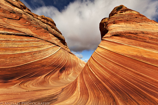
This is probably one of my favorite photos from the day taken in a narrow passage with nice reflected light.
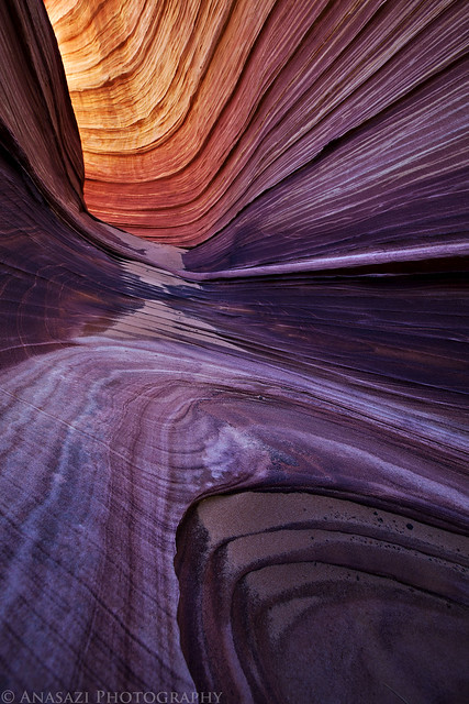
The Passage by IntrepidXJ, on Flickr
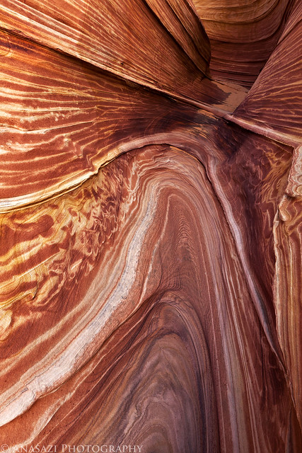
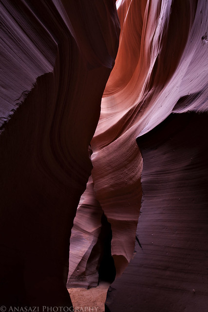
There are so many different lines found here to have fun with!
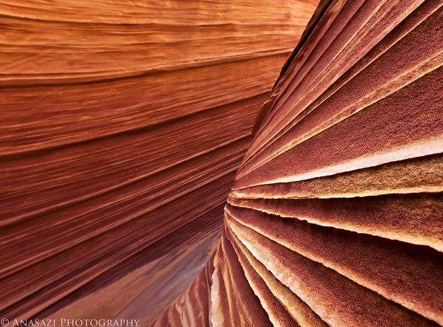
Colors & Lines by IntrepidXJ, on Flickr
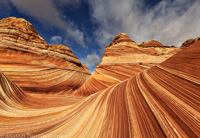
Wave I by IntrepidXJ, on Flickr
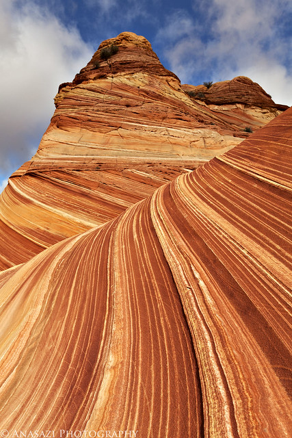
Wave II by IntrepidXJ, on Flickr
Wave III by IntrepidXJ, on Flickr
Wave IV by IntrepidXJ, on Flickr
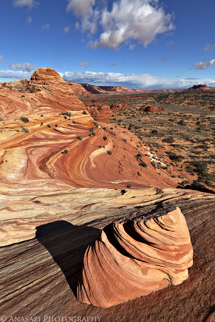
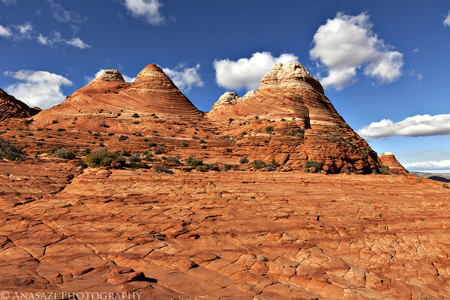
Since this was our first visit to Coyote Buttes North, we spent most of the time in the vicinity around The Wave and didn't explore too much of the surrounding area. I did end up doing a little exploring nearby and climbed up for a higher view of the area. I had wanted to visit Melody Arch but the wind and blowing sand was pretty bad the higher I climbed, so I changed my mind about that one. I will have to do some more exploring of the area when I return in February for my birthday weekend!
A view from above. Part of The Wave can be seen in the middle-left.
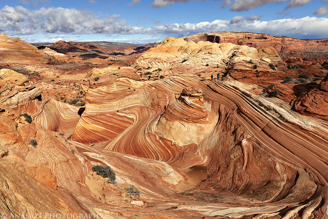
Wave Overview by IntrepidXJ, on Flickr
A moderate-sized hoodoo high above Coyote Buttes North.
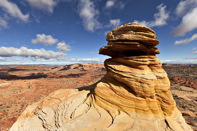
Above by IntrepidXJ, on Flickr
A little goblin and plenty more colorful sandstone to be found.
The Goblin by IntrepidXJ, on Flickr
Great View by IntrepidXJ, on Flickr
The Middle by IntrepidXJ, on Flickr
Stripes by IntrepidXJ, on Flickr
Framed View by IntrepidXJ, on Flickr
Wave Frame by IntrepidXJ, on Flickr
Wave V by IntrepidXJ, on Flickr
This is another photo of 'The Passage' but with a different composition and in different light. It's amazing how much different it looks in different lighting.
Passage II by IntrepidXJ, on Flickr
The Wave VI by IntrepidXJ, on Flickr
I would have liked to stay until sunset, but the cold, wind and sand had taken their toll on us so we headed back to the Jeep a little early.
One more photo I took as we hiked back to the Wire Pass Trailhead.
Hiking Back by IntrepidXJ, on Flickr
-
11-30-2011 05:06 PM # ADS
-
11-30-2011, 05:06 PM #2
Before leaving the area I made another quick stop at the Notch Panel so that I could get some better photos of it. The last time I was here I grabbed the wrong lens and forgot my polarizer in the Jeep when Jared and I hiked to this panel. Plus, since it was in the morning shade then, I thought it would photograph better in the late afternoon sunlight...I think I was right.
The main petroglyph panel in it's setting.
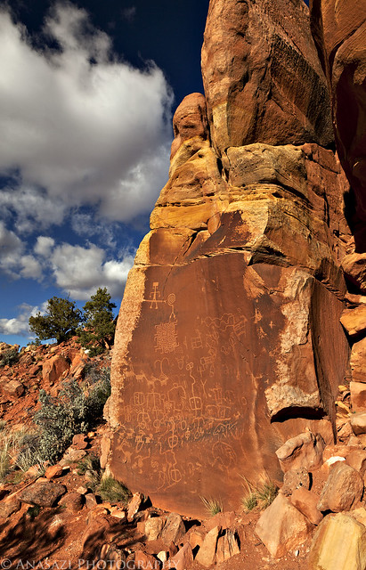
The Notch Panel by IntrepidXJ, on Flickr
A closer look at the most unique figures in this panel.
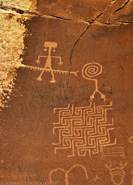
Two-Headed Snake & Maze by IntrepidXJ, on Flickr
Detail in the lower portion of the panel.
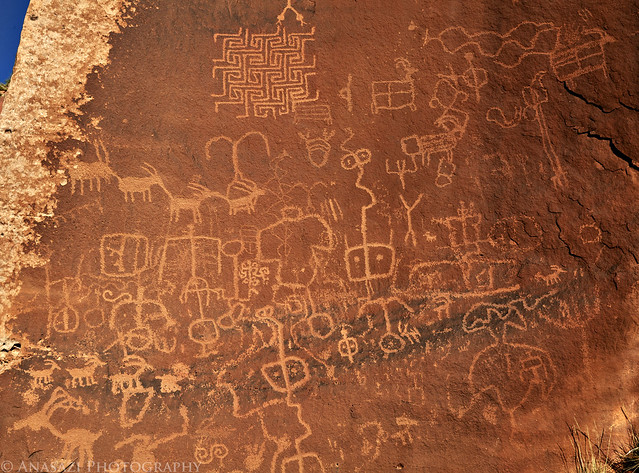
Notch Detail by IntrepidXJ, on Flickr
We decided to take the long and scenic drive back to Page by following the House Rock Valley Road south to the highway and completing a loop around the Vermilion Cliffs. We stopped when we reached the Navajo Bridges over the Marble Canyon of the Colorado River so that we could walk across the old one. Construction of the original Navajo Bridge began in 1927, and the bridge opened to traffic in 1929. During the design phase, a wider roadway was considered, but ultimately rejected, as it would have required a costly third arch to be added to the design, and the vehicles of the time did not necessitate the wider road. In 1990, however, it was decided that the traffic flow was too great for the original bridge, and that a new solution was needed. The sharp corners in the roadway on each side of the bridge's approach had become a safety hazard due to low visibility, and the deficiency in the original design's width and load capacity specifications were becoming problematic. The bridge had also become part of U.S. Route 89A. The new steel arch bridge was completed in September 1995 at a cost of approximately $15 million.
A view of the newer Navajo Bridge and the Echo Cliffs taken from the older bridge. Look closely under the bridge and you might spot a large black bird.
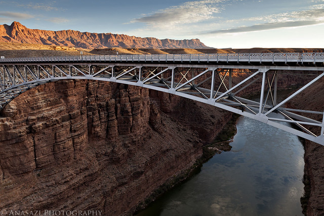
Navajo Bridge by IntrepidXJ, on Flickr
While walking across the bridge I noticed a large black bird sitting underneath the newer bridge. At first I didn't think much of it and just assumed it was another Raven which I see all the time, but quickly I realized just how large this bird actually was compared to the beam it was sitting on. There was no way it could be a Raven at that size! I took a quick photo and zoomed in on the bird on my LCD screen when I noticed the bird was tagged with a number. That's when I realized that this was one of the few endangered California Condors that were released in the Grand Canyon area. The California Condor is actually the largest bird in North America with a wingspan of over 9 feet and a weight up to 29lbs. It is also one of the world's longest-living birds, with a lifespan of up to 60 years. Surprisingly, in 1987 there were only 22 condors in existence and all of them were in captivity. The California Condor Recovery Plan has helped to try and restore their population. As of October 2010, the wild condor population in California reached 100 individuals, and there were 73 wild condors in Arizona. I went back to the Jeep and grabbed my long lens so I could get a closer look and photo.
A close look at the California Condor. Those claws look big and sharp!
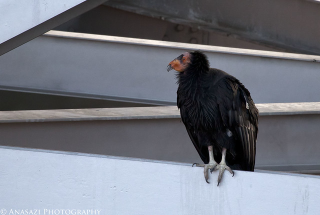
California Condor by IntrepidXJ, on Flickr
As we drove along the Echo Cliffs I stopped for a couple of road-side photos as the sun was setting.
The Echo Cliffs catching the last rays of sunshine for the day
Echo Cliffs Sunset by IntrepidXJ, on Flickr
Great scenery along this stretch of the road.
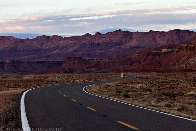
Curve by IntrepidXJ, on Flickr
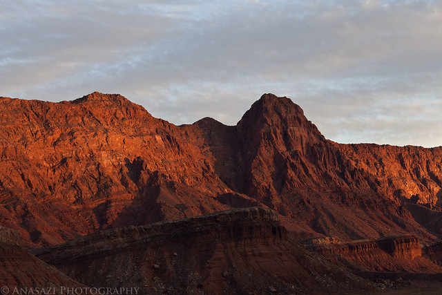
Looking back at the Vermilion Cliffs after the sun dipped below the horizon.
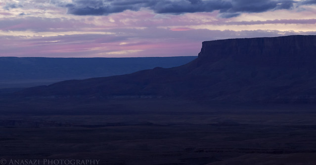
Vermilion Cliffs Sunset by IntrepidXJ, on Flickr
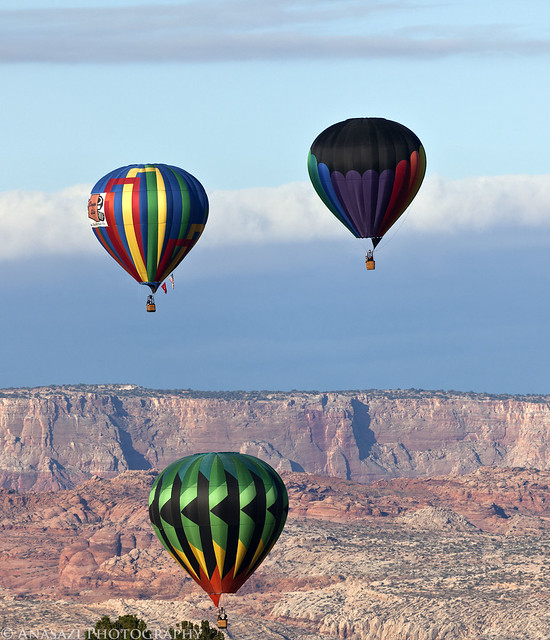
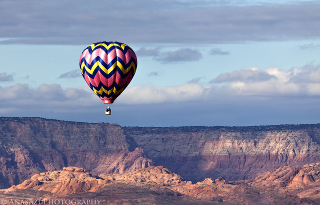
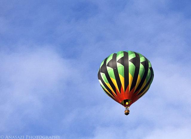
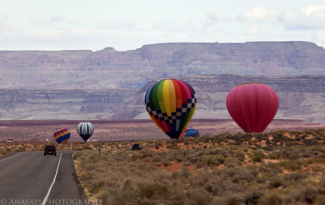
On Sunday morning we slept in a little and then left our room to go get some breakfast. As soon as we walked outside we saw that there were hot air ballons everywhere! It was an unexpected surprise. Apparently we were there on the same weekend as the Annual Page / Lake Powell Balloon Regatta and had no clue until we saw the balloons in the sky. I headed back into the room and grabbed my camera for a few photos. Then we had some breakfast and went back out to chase a few more balloons before leaving town.
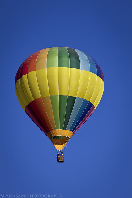
Rainbow by IntrepidXJ, on Flickr
Cliffs & Balloons by IntrepidXJ, on Flickr
Apparently we had not paid close enough attention to this sign the previous days we were in town...
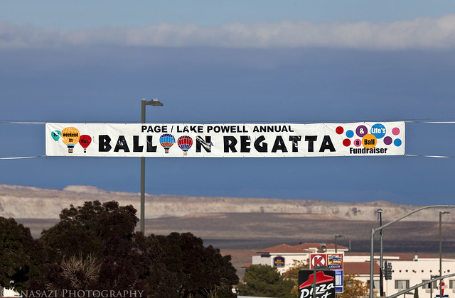
Page Balloon Regatta by IntrepidXJ, on Flickr
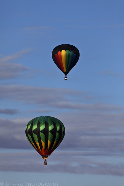
Two Balloons by IntrepidXJ, on Flickr
Flying Low by IntrepidXJ, on Flickr
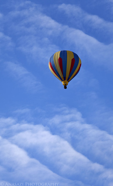
Balloon & Clouds by IntrepidXJ, on Flickr
Flame by IntrepidXJ, on Flickr
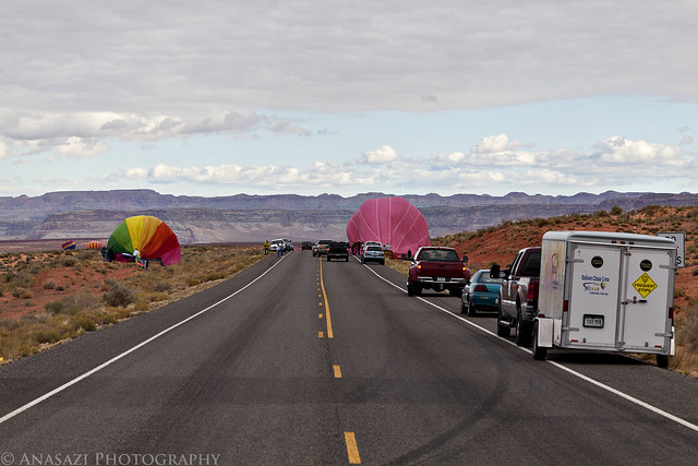
Just outside of town we found a bunch of them landing.
On the Ground by IntrepidXJ, on Flickr
Landing by IntrepidXJ, on Flickr
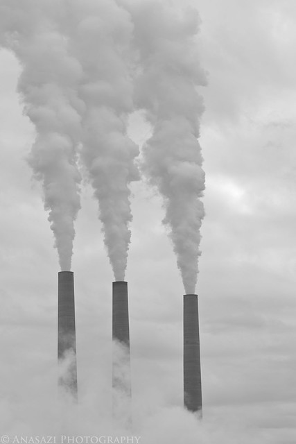
Anyone who has visited the area has most likely noticed the Navajo Generating Station smokestacks just outside of Page. While I'm sure most consider them a scar on the landscape, I still thought they were interesting enough to take a photo of.
Smokestacks by IntrepidXJ, on Flickr
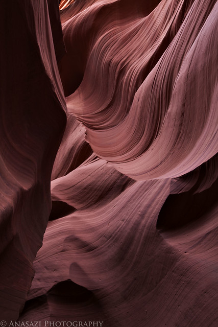
When we were done chasing balloons around we made one last stop at Lower Antelope Canyon so that I could check it out. This is another place that is popular with photographers and tourists. Upper Antelope Canyon is the more popular of the two slot canyons, but I decided to avoid that one since it requires staying with a guide the whole time. I was hoping I might find a little more solitude in Lower Antelope Canyon...and I was right. I got the photographer's pass and ended up having the slot canyon to myself for about two hours.
Lower Antelope Canyon became well-known on August 12, 1997 when eleven tourists were killed by a flash flood. You can find out more about that incident at this link if you are interested.
The Navajo guide leading me down into the entrance of the slot canyon. You can see a few hot air balloons in the sky in the distance.
Entrance by IntrepidXJ, on Flickr
Lower Antelope I by IntrepidXJ, on Flickr
Lower Antelope II by IntrepidXJ, on Flickr
Lower Antelope III by IntrepidXJ, on Flickr
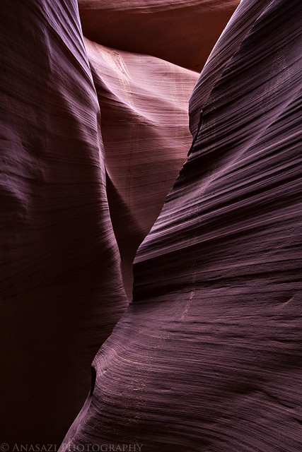
Lower Antelope IV by IntrepidXJ, on Flickr
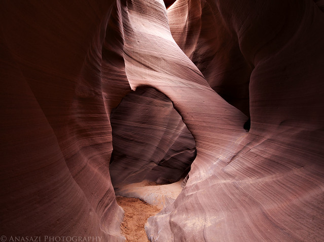
Antelope Arch by IntrepidXJ, on Flickr
Ripples by IntrepidXJ, on Flickr
After the flash flood that killed 11 tourists in 1997 the canyon was closed for a while. When it did finally reopen to the public stairs were installed to make it a bit easier to get in and out.
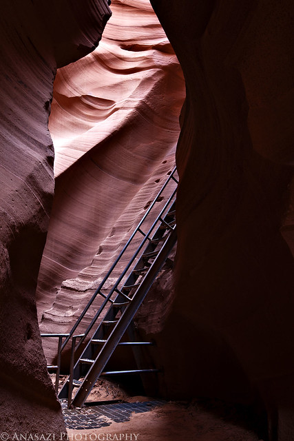
Canyon Stairs by IntrepidXJ, on Flickr
This is the last set of stairs that take you out of the slot canyon and back up top.
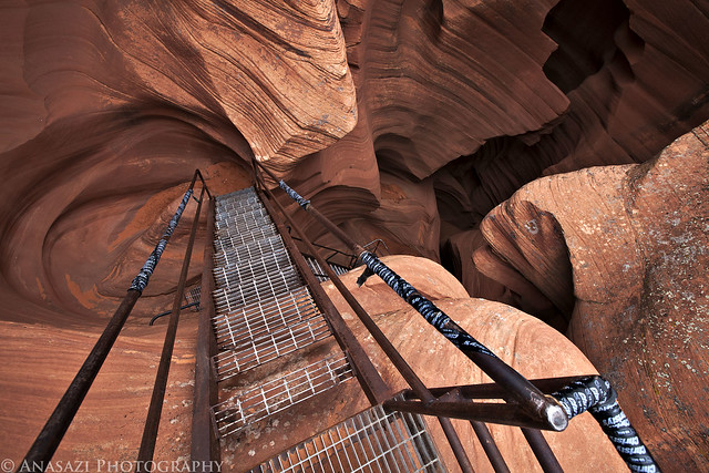
Exit by IntrepidXJ, on Flickr
The end of Lower Antelope Canyon.
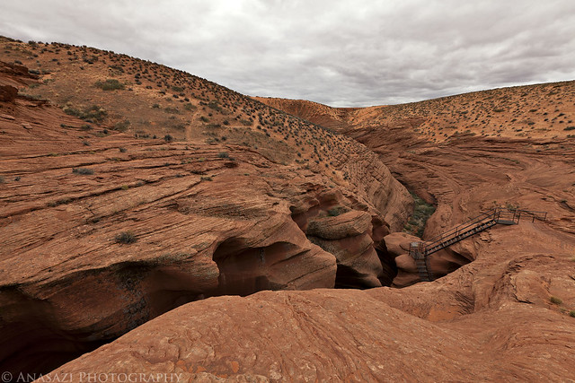
The End by IntrepidXJ, on Flickr
When I got back out of Lower Antelope Canyon we had an uneventful drive home which ended our fun-filled weekend. I can't wait to get back!
>> Navajo National Monument & Page Photo Gallery
>> The Wave Photo Gallery
>> Page / Lake Powell Balloon Regatta Photo Gallery
>> Lower Antelope Canyon Photo Gallery
-
11-30-2011, 06:31 PM #3
Wow! You killed it!

-
11-30-2011, 07:44 PM #4
epic report!
-
11-30-2011, 08:04 PM #5
Awesome photos! I can't wait to go back, and hopefully catch some clouds! Great stuff, again!
-
11-30-2011, 09:16 PM #6
Awesome as usual.Best wave pictures I have seen. Very impressive photography here. Thanks for the interesting
post.
-
11-30-2011, 09:41 PM #7
outstanding Randy !!!
-
12-01-2011, 07:52 AM #8Wilderness Photographer

- Join Date
- Jun 2011
- Location
- Land of Grits and Gravy
- Posts
- 354
Fantastic TR, thanks. I put in for the Wave lottery this morning for next April, fingers crossed. ;-)
Charlie...
Stalking Light
-
12-01-2011, 10:43 AM #9
Awesome trip-report man!

And the pictures rule as well.
And it bring back a lot of great memories: exactly 1 year ago during my holiday in the USA. I ended up in Page during a weekend a balloon-festival was organised. I didn
-
12-01-2011, 04:55 PM #10
Thanks everyone!
-
12-01-2011, 04:58 PM #11
[QUOTE=maarten.1975;480987]Did you happen to sleep in Best Western hotel? Driving a Jeep Grand Cherokee? hehehe that would be freaky...

During your next visit to the Coyote Buttes North area, you might wanna check out the area west of the Wave. During my visit I walked from the Wave up and to the west, and found some beautiful views. While on top of the rocks, many beautiful colors in the sandstone, carved by the wind. Further to the west you
-
12-02-2011, 05:02 AM #12
Very nice. You hit all the mandatory spots.
Hope to spend a week or 2 in the Sand Hills this spring.
-
12-02-2011, 06:29 AM #13
Great shots Randy. First time in a long time i have enjoyed photos of the wave. You have done some fresh interpretation of a much photographed icon, not easy to do.
BTW don't mean to be a downer but that stair in Antelope is a friggin crime, almost as bad as the Navajo smokestacks. Good shots of them though.
-
12-02-2011, 07:12 AM #14
Good stuff, Randy.
-
12-02-2011, 11:21 AM #15
Stunning photos!

-
12-02-2011, 11:43 AM #16
Great report and photos!
-
12-03-2011, 12:35 PM #17
Awesome report as usual! You got some really nice shots. I got to see a condor at Navajo Bridge a couple years ago, too, but didn't have much zoom on my camera at the time. Your condor shot came out great!
-
12-03-2011, 10:05 PM #18
Thanks for posting your amazing photos!!! This is the only way I've been able to enjoy the Wave as my friend and I have now been shot down 6 times. They need to do a point system where those who apply, but don't get in get moved up higher and have a better chance the next time around....
Love the shots of Antelope Canyon as well! Both it and the Wave are on my "bucket list"!
-
12-04-2011, 01:11 AM #19I forgot to mention, to get a first idea of the 'little valley' I visited in the Coyote Buttes North area east of the Wave, see my report:
 Originally Posted by IntrepidXJ

http://www.bogley.com/forum/showthre...e-Buttes-North
-
12-04-2011, 12:40 PM #20
A great report and beautiful pictures from a wonderful area.
I visited the Coyote Buttes a couple of times, most of in the summer.
If I see your pictures, I think the best light, the colors and the clear sky, are present in the month of winter and spring.
What's your opinion?


 Reply With Quote


Similar Threads
-
[Album] The Wave
By asdf in forum General DiscussionReplies: 18Last Post: 04-07-2011, 05:07 PM -
Going to the Wave this weekend - March 28th
By Corey in forum Hiking, Scrambling & Peak BaggingReplies: 2Last Post: 03-24-2008, 04:32 PM -
The Coolest Looking Wave Ever (PIC)
By accadacca in forum General DiscussionReplies: 19Last Post: 04-06-2007, 10:05 AM -
The Wave... Is it worth it?
By James_B_Wads2000 in forum Hiking, Scrambling & Peak BaggingReplies: 3Last Post: 01-23-2006, 07:13 PM
Visitors found this page by searching for:
Outdoor Forum
