

Results 1 to 7 of 7
Thread: Emery-Wasatch Plateau Loop
-
07-27-2011, 02:33 PM #1
Emery-Wasatch Plateau Loop
On Saturday I rode 80 miles in 11 hours on a nice loop starting near the town of Emery and climbing up into the Wasatch Plateau. I started up Link Canyon, then traveled north to the highest point on Skyline Drive between Twelvemile Flat and Ferron Reservoir. Then I headed south on a different road, passing Spinner's Reservoir and Ferron Mountain, coming down the Hole Trail back to the truck.
Viewing on a mobile device? Click this link to open the map: http://maps.google.com/maps?q=http:%2F%2Fudink.org%2Fgeo%2FEmeryWasatchPlateauLoop.kmz&hl=en&sll=37.0625,-95.677068&sspn=40.27343,86.572266&t=h&z=11
http://udink.org/geo/EmeryWasatchPlateauLoop.kmz
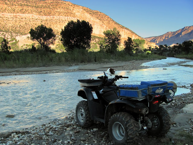
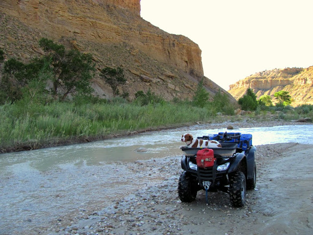
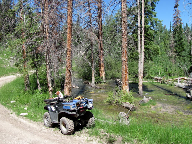
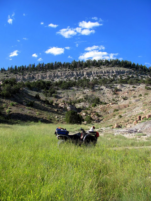
I staged at the trailhead for the Hole Trail along Muddy Creek. I thought there might be private property issues between there and Emery, but really the only issue I ran into was water. The normal place for crossing Muddy Creek was too deep to ride across, but just downstream there was a wider, shallower spot that I had to go off-trail to get to. After crossing the creek, the road was flooded and I had to bushwhack my way around that as well. From there, it was an easy ride through Emery and up Link Canyon. Once on top of the plateau, I did a little hiking around Box Canyon, but the canyon bottom was full of water and required a lot of bushwhacking, so I didn't hike as much as I'd wanted to.
Staging at the Hole trailhead along Muddy Creek

Muddy Creek was too deep to cross here
After crossing
Flooded area across the road

One last obstacle to go around

In the town of Emery

On the way to Link Canyon

Switchbacks going up Link Canyon

At the top of Link Canyon

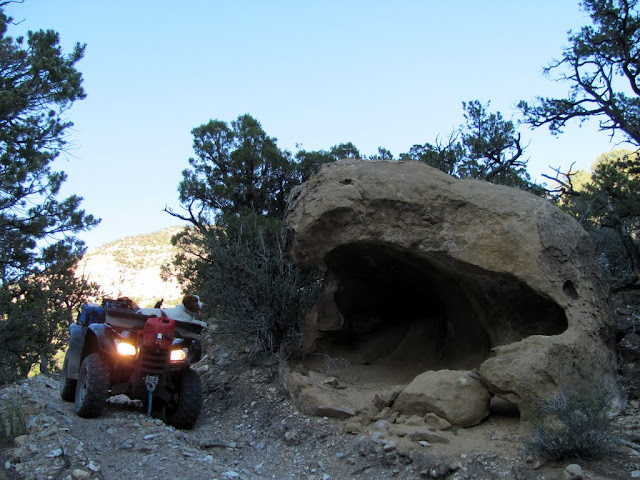
Parked at the top of Box Canyon

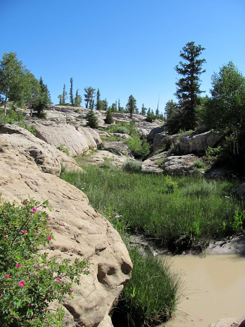
Box Canyon
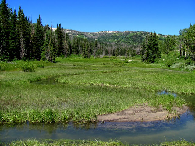
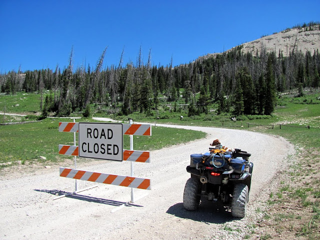
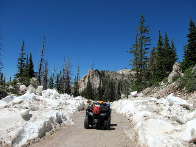
I continued north toward Skyline Drive. I'd heard that the pass between Twelvemile Flat and Ferron Reservoir was blocked by snow as of the previous weekend, and I was really hoping it was clear now. The Forest Service had placed a "Road Closed" sign east of Twelvemile Flat, but in fact the road was passable all the way to Ferron Reservoir (and appeared to have very recently been cleared of snow). There was still a big snow drift blocking one road up to Skyline Drive, but there was an alternate road that bypassed that section. I ate lunch on Skyline at a nice overlook of Duck Fork.
Remains of the Clay Springs ranger station

Plaque at the Clay Springs ranger station

On the way to Skyline Drive


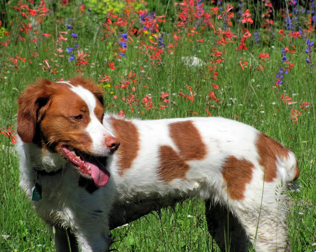
Torrey amid some wildflowers
Mill Fork Creek flooding
Columbine

Fish Creek
Almost to Skyline Drive

Block Mountain

Everybody ignored this sign--not sure why the FS left it there
Snow drift blocking Skyline Drive

Freshly cleared road leading to Ferron Reservoir

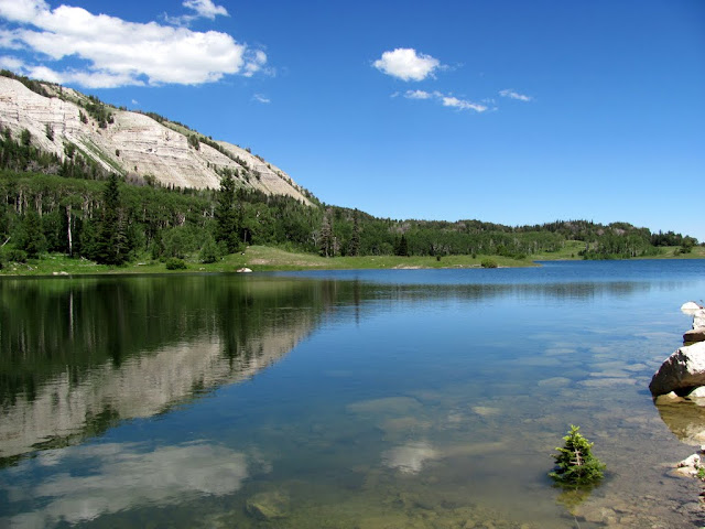
Ferron Reservoir
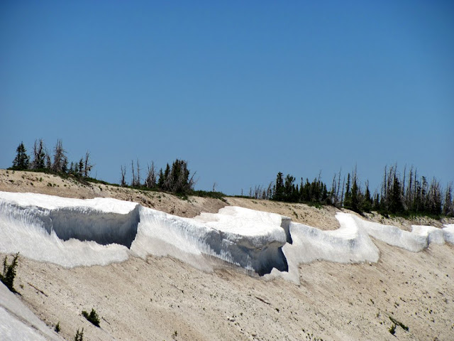
Snow drifts east of Skyline Drive
View along Duck Fork

Highest point on Skyline Drive

Snow in the pass between Twelvemile Flat and Ferron Reservoir
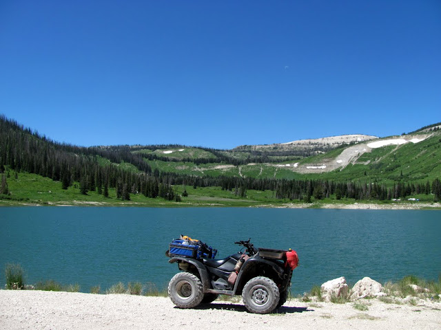
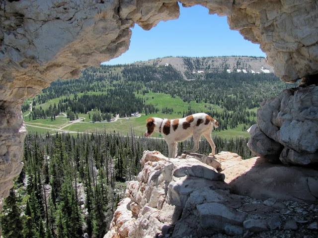
I turned around at that point and began heading back south. I had planned on hiking to the highest point on Heliotrope Mountain next, but it was late enough in the day that I felt I would be out after dark if I did the hike, so I skipped it. I did a short hike up to a natural arch that I'd noticed last year when I was in the area to hike Mary's Nipple. I rode past Spinner's Reservoir and found it to be tippy-top full--there were a lot of small pine trees that were completely submerged. The other hike I had planned was Flagstaff Peak, which is much shorter than Heliotrope Mountain. I almost skipped it after seeing the steep slope and thick trees on the north side where I was going to hike up, but I tried a different approach from the west and it was pretty easy.
Small natural arch east of Twelvemile Flat

Torrey in the arch
Star Gentian

Dragonflies at Spinner's Reservoir

Spinner's Reservoir
Almost to Flagstaff Peak
Hiking up the ridge to Flagstaff Peak

A loose, steep section up Flagstaff Peak

Almost to the top of Flagstaff Peak
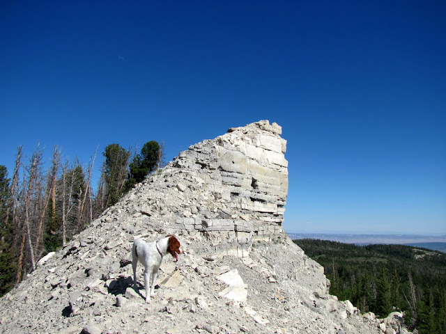
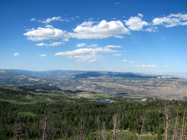
View north from Flagstaff Peak
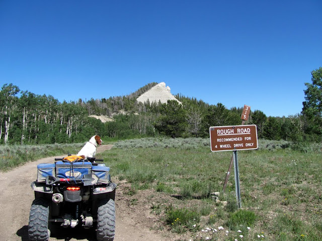
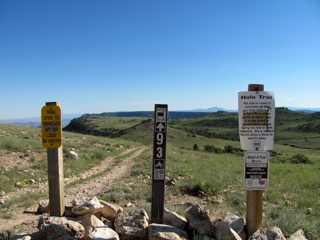
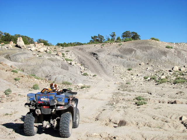
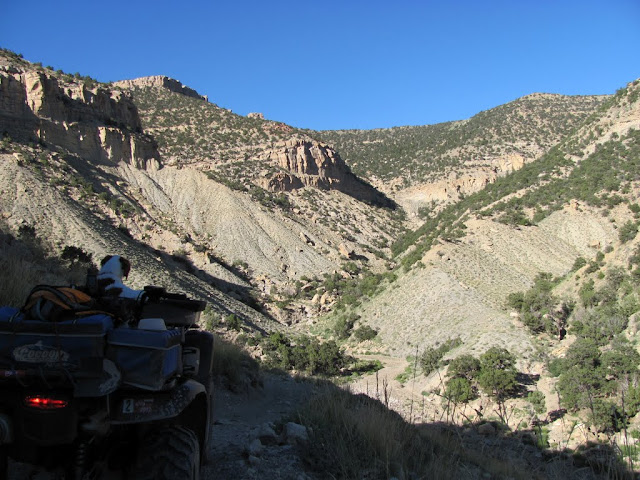
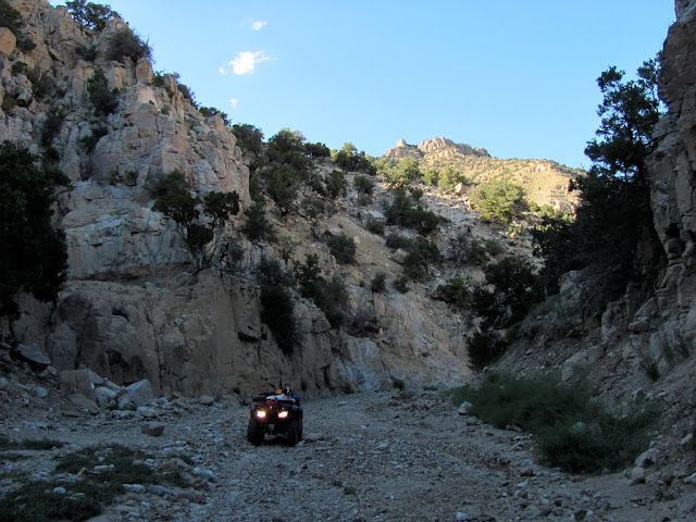
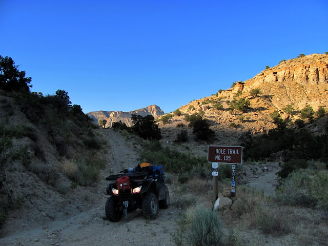
After summitting Flagstaff, I had no more plans except to head back to the truck via the Hole Trail. The road gradually got rougher and narrower, until reaching the top of the Hole Trail where it's limited to vehicles 50" or less. As I descended the mountain, the increase in temperature was very noticeable. The Hole Trail got rougher and rougher and, when it dropped into Bill's Hole, it was nasty. The bottom of the canyon was nothing but rocks and boulders, and for more than a mile I crawled along in 4WD, hoping that I could actually make it back to the truck. Recent flooding had left a few cut banks and obliterated the normal vehicle route through the canyon. I was seriously worried that I'd reach in impassible spot and have to abandon the ATV and hike back to the truck, but after what seemed like hours (though was only about 30 minutes), the trail climbed out of the canyon and paralleled it on more stable ground the rest of the way back to Muddy Creek. It was a fun ride, though it would have been better broken up across two days and camping along the way.
Riding toward the Hole Trail

South Horn Mountain (left), Little Nelson Mountain (center), Millsite Reservoir, and Hunter Power Plant

Above Sage Flat

Sage Flat

Top of the Hole Trail
Descending the Hole Trail

Hole Trail
Hole Trail through Bill's Fork


Bottom end of the Hole Trail
Back to where I started, 80 miles and 11 hours later

Here's the full photo gallery with many more photos:
https://picasaweb.google.com/Dennis....tchPlateauLoop
Blog entry:
http://udink.org/2011/07/25/emery-wasatch-plateau-loop/
-
07-27-2011 02:33 PM # ADS
-
08-02-2011, 09:08 PM #2
Nice TR and some awesome pic's !!!!
-
08-03-2011, 07:05 PM #3
Nice TR report. It looks like a fun ride even though it was a long day. Any geocaching?
-
08-03-2011, 07:13 PM #4Yep, I tried finding one at the highest point on Skyline Drive, but it was missing. I skipped a few others that didn't look as interesting. I'm hoping to help the owner of the geocache on Skyline by replacing her cache if I can get up there in two weeks while I'm camped at Potter's Ponds.
 Originally Posted by New Mexico

-
08-06-2011, 11:21 PM #5
Cool, I will have to get down there sometime.
-
08-10-2011, 12:04 PM #6
Epic report! You captured some great photos!
 I need to slow down and look for shots like that when I am out...
-
08-18-2011, 10:31 AM #7
As usual, Dennis.......
 Wish I lived closer to you and could tag along. You have some amazing areas to ride there in Castle Country.


 Reply With Quote


Similar Threads
-
Rock Art and Ruins in Emery County
By coinslab in forum Hiking, Scrambling & Peak BaggingReplies: 4Last Post: 08-19-2009, 08:11 AM -
Rock Art in Emery County HELP!
By coinslab in forum Hiking, Scrambling & Peak BaggingReplies: 4Last Post: 06-22-2009, 04:57 PM -
Emery County Drops the Ball
By coinslab in forum General DiscussionReplies: 6Last Post: 06-22-2009, 01:03 PM -
Emery County says OHV's are causing much damage
By Scott P in forum Environmental IssuesReplies: 15Last Post: 12-18-2006, 08:12 PM -
[Trip Report] East Mountain, Emery County
By Udink in forum Hiking, Scrambling & Peak BaggingReplies: 1Last Post: 05-12-2006, 11:31 AM
Visitors found this page by searching for:
Outdoor Forum
