

Results 1 to 5 of 5
Thread: San Rafael Swell - Spring 2011
-
04-24-2011, 06:06 PM #1
San Rafael Swell - Spring 2011
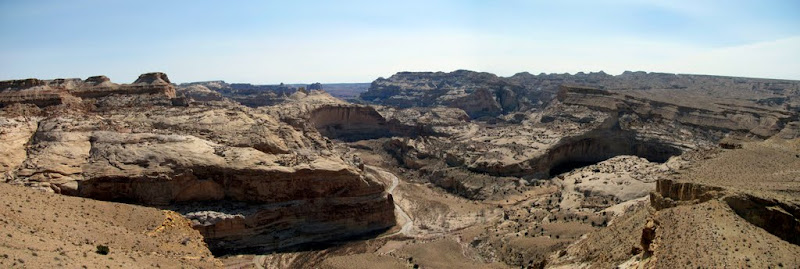
This was my 14th semi-annual geocaching event in the San Rafael Swell, and it was a great one, with almost 30 people in attendance. The group camped near South Salt Wash just off exit 108 on I-70, and we went to a lot of nearby places, including Lone Tree Wedge overlooking the upper Muddy Creek gorge, the Dike and Horizon Arch, Kimball Draw and Cat Canyon, and the Sid and Charlie rock formation.
http://castlecountry.org/geo/SanRafa...Spring2011.kmz
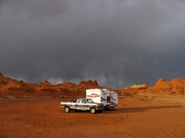
I arrived Wednesday evening to stake a claim on our campsite, but spent the evening in the trailer because of some nasty wind and a bit of rain. The next morning I went for a 4-wheeler ride south to Lone Tree Wedge and eventually found myself overlooking the upper Muddy Creek gorge. That afternoon people started showing up, and we had a nice night around the campfire.
Alone at camp on Wednesday evening
Bridge over Muddy Creek at Lone Tree Crossing

Muddy Creek north of Lone Tree Wedge

View along Muddy Creek from the eastern point of Lone Tree Wedge
Interesting clouds

Slab of pavement in Devil's Canyon left over from an old I-70 gravel quarry

Camp on Thursday evening

Campfire on Thursday night

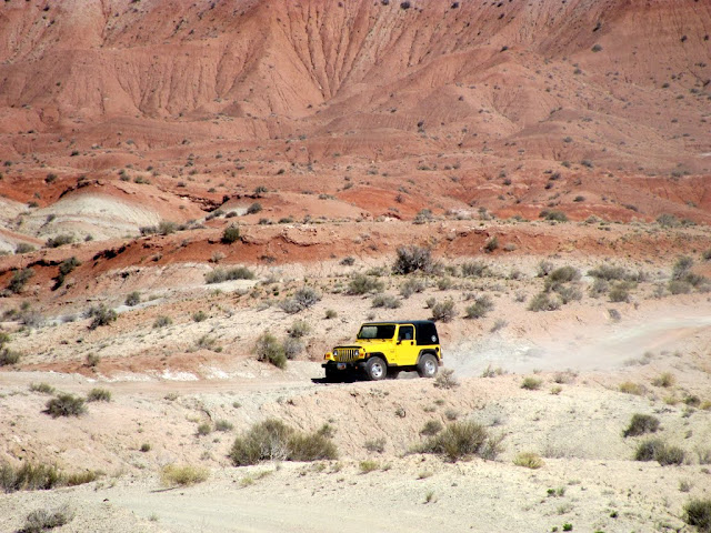
On Friday a few of us rode/drove out to the Dike, hiked around the Horizon Arch area, and found a few geocaches near the end of the road. It's a very interesting drive to the arch, and the views from there are amazing. That evening we got crazy around the campfire and blew some stuff up.
Driving to Horizon Arch
Near the end of the road at Horizon Arch

Horizon Arch

The canyon north of Horizon Arch

Cliffs southwest of Horizon Arch

Horizon Arch

Jeep on the way back to camp

Kimball Draw
Camp on Friday evening

Around the campfire

A 1-gallon can of green beans in the fire
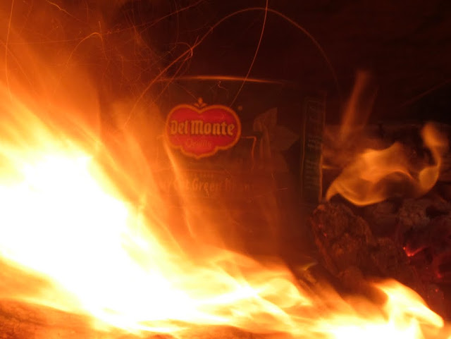
http://www.youtube.com/watch?v=Jn5VkjmF8n4
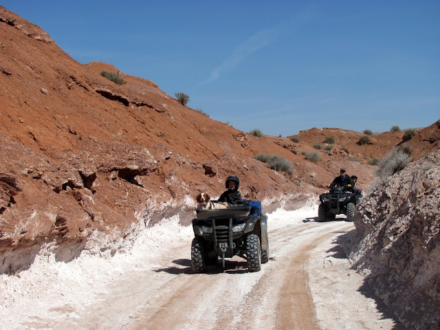
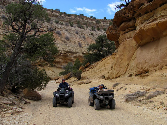
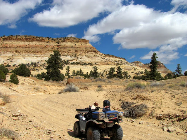
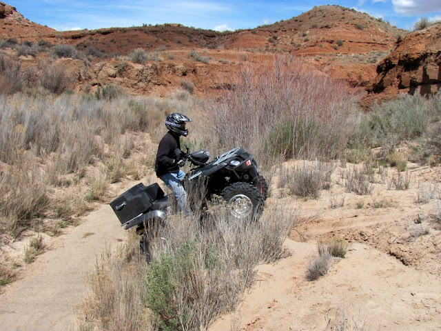
Everybody split up into little groups on Saturday, and since I only needed to find two geocaches within 20 miles of the area, my wife and I rode our ATVs from camp through Kimball Draw and Cat Canyon. We saw some pictographs right along the road in Kimball Draw, and stopped at an awesome area at the head of Cat Canyon. Somebody had build a steel dam at the end of a small slot canyon there, and there were tall ponderosa pine trees surrounding the area. It was a beautiful place, one that I'd like to return to and camp for a few days while hiking around and exploring.
Setting out for a ride on Saturday

Pictographs in Kimball Draw

Pictographs in Kimball Draw

Pictographs in Kimball Draw

The road where it enters Cat Canyon

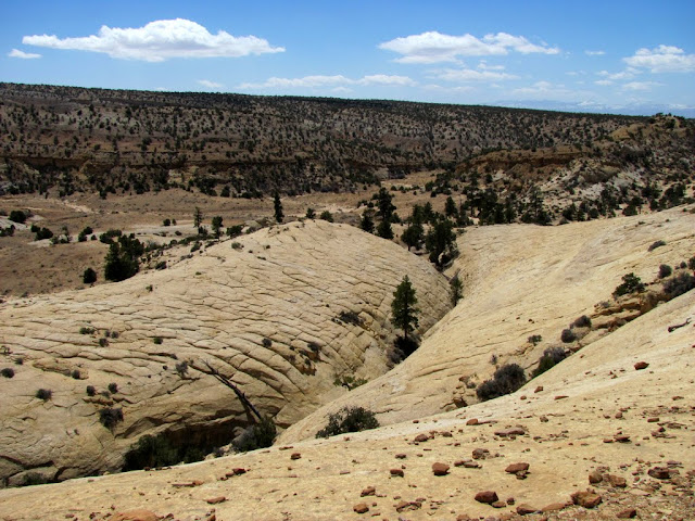
Cat Canyon
Near the head of Cat Canyon
Steel dam

My youngest climbing the steel dam

The kids heading up the canyon above the dam

The dam canyon
The dam canyon

My dog got really crazy at camp Saturday night

On Sunday I only went for a short 4-wheeler ride north of the Moore Cutoff Road, along Sand Bench toward Sid and Charlie. After returning from the ride, I pulled my camp trailer home, then fueled up and returned to pull a friend's trailer home because his truck was having engine problems. It was an awesome, fun filled weekend.
The Red Ledges and Lookout Point on the way north along South Salt Wash
Crossing a wash near Sid and Charlie
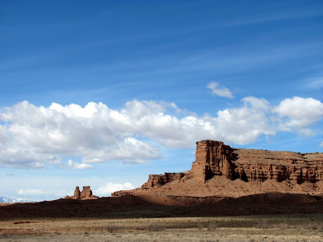
Sid and Charlie

Gopher snake in the rocks near a geocache

Sid and Charlie

Pulling my friend's trailer to Price

https://picasaweb.google.com/Dennis....ellSpring2011#
-
04-24-2011 06:06 PM # ADS
-
04-28-2011, 10:04 AM #2
I just moved to Price and I am already diving into the incredible landscape that surrounds us! Thanks for your trip report! I will be definitely referencing it the next time I head down into the swell. Also, thanks for the information on Gordon Creek Falls; i'm going up there today!

-
04-28-2011, 11:06 AM #3There's definitely some awesome scenery around here. Maybe not Carbon County so much, but Emery County is great.
 Originally Posted by mjmusil


Cool, let me know how the falls are running. I would expect that runoff should be pretty nice right about now. I might get out for a quick ATV ride out there some day next week after work. Originally Posted by mjmusil
-
04-28-2011, 08:23 PM #4Wow, my wife and I really loved the area! Unfortunately we only had time to see the lower and middle falls but it was well worth it! We hope to head back up there soon and finish our hike. ~ The falls are running nicely, plenty of water flow. Originally Posted by Udink
-
04-29-2011, 02:33 PM #5
Awesome report! Looks like a great time. I love the video...PYRO!


 Reply With Quote

Similar Threads
-
San Rafael Swell
By moab mark in forum MotorcyclingReplies: 9Last Post: 03-28-2012, 08:34 AM -
[Trip Report] San Rafael Swell
By coinslab in forum Rock Art & RuinsReplies: 2Last Post: 09-26-2010, 06:02 PM -
[Trip Report] TR: Ware Spring Trail (Cedar Mountain, San Rafael Swell)
By Udink in forum Offroad 4x4, Side by Side and ATVReplies: 3Last Post: 10-01-2008, 08:50 AM -
San Rafael Swell 3/16 - 3/19
By scoutabout in forum Offroad 4x4, Side by Side and ATVReplies: 14Last Post: 03-22-2007, 01:01 PM -
[Trip Report] San Rafael Swell
By Scott P in forum CanyoneeringReplies: 8Last Post: 02-13-2006, 01:18 PM
