

Results 1 to 8 of 8
Thread: Central Swell Camping/Hiking
-
03-24-2011, 11:40 AM #1
Central Swell Camping/Hiking
A friend and I spent Friday and Saturday hiking in the San Rafael Swell, and camping at the Head of Sinbad near the Lone Warrior pictograph. We hiked near the Wickiup Friday, then Saturday hiked part of the 5 Miles of Hell motorcycle trail, then hit up Uneva Canyon on the way home.
http://castlecountry.org/geo/Central...pingHiking.kmz
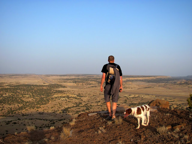
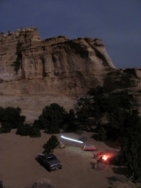
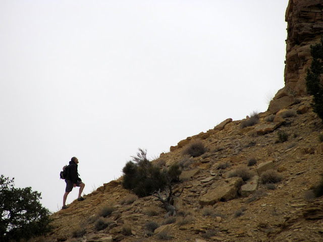
The goal Friday was hike to the top of the mesa south of the Wickiup. We scrambled up a steep hillside and climbed a couple of cliff bands before reaching the top, and from there it was an easy hike south to an overlook with a nice view of I-70 and a huge chunk of the Swell. We got back to the truck just after the sun had set, and didn't reach camp at the Head of Sinbad until after full dark. It was a full moon, however, and we set up camp without needing headlamps. It got a little chilly at night, and the wind rolled in early in the morning and made it only slightly miserable.
The scramble up the hill

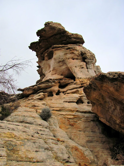
Petrified log embedded in the cliff

The Wickiup

After reaching the rim of the mesa

View from the mesa's southern end
Camp near the Head of Sinbad
The Lone Warrior

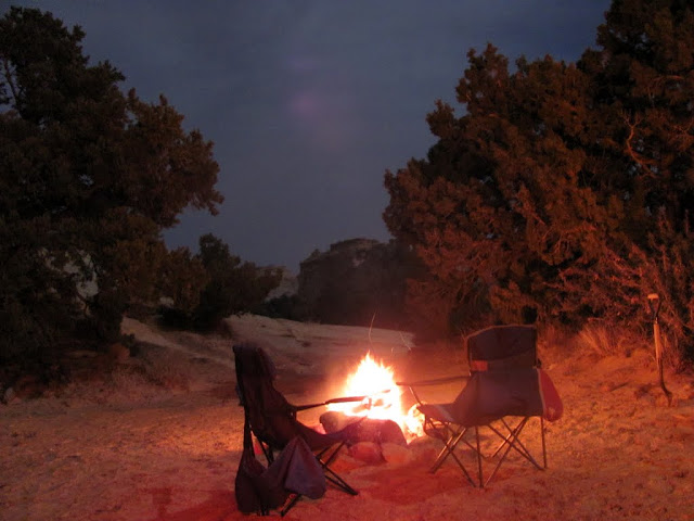
Ahh yeah, all is right in the universe
On Saturday morning we packed up camp and headed out toward the 5 Miles of Hell motorcycle trail. I drove past the motorcycle trailhead a bit, but a steep wash kept me from driving my long-wheelbase truck all the way to the start of the singletrack. We hiked from that point along the Red Trail, which could easily be driven by a 2WD high-clearance vehicle, though it's designated motorcycle-only. Just past Twin Knolls, the trail gets gnarly, and shortly after that we reached the junction with the 5MOH trail. This area is just amazing! There's a lot of heavily cross-bedded sandstone, most of it very colorful with reds and purples, and with a lot of small and large canyons cutting through it. The bike trail was insane! A few groups on motorcycles passed us (and we got some strange looks from them), one of which we were easily able to keep up with for a while, and it was fun watching them wrestle their bikes and wipe out all along the trail. We found a geocache at the rim of a big canyon, then hiked cross-country in a straight line back toward Twin Knolls. My friend scrambled to the top of both knolls, but I was too beat by then so I stayed down low. The entire hike was 7.5 miles and took four hours.
The Red Trail near Twin Knolls

View toward Lone Man Butte across some rugged country

5MOH trail sign--no snowmobiles?!

Sandstone formations along the trail


Some insane country for motorcycles (I gotta try this someday)!

Twin Knolls

Lone Man Butte

Panorama from the geocache location

A small canyon on the way back to the truck


Chris contemplating the climb up one of the Twin Knolls
Starting the climb

Almost there

Success

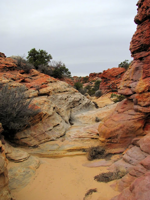
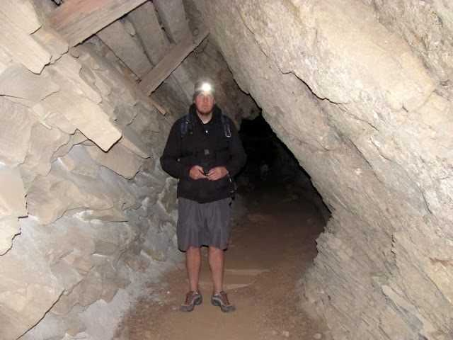
We hiked one more small hill in that area before moving on to the San Rafal Reef, where we hiked up Uneva Canyon to an old mine. I'd planned on hiking Uneva during several other trips in the past, but each time I ran out of daylight to make the hike. This time there was plenty of daylight left. There was still a little water in the canyon from melting snow, but for the most part everything was dry. Inside the mine was interesting, but the ceiling looked sketchy so we only went in a short distance. It was good to check this place off my list.
Parked at the Uneva trailhead

San Rafael Reef south of Uneva Canyon

San Rafael Reef north of Uneva Canyon

Entering the canyon

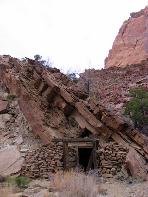
Upturned rock layers

Inside Uneva Mine
The outside of the mine
A nice perch in the canyon walls

More photos here:
https://picasaweb.google.com/Dennis....CampingHiking#
-
03-24-2011 11:40 AM # ADS
-
03-24-2011, 12:37 PM #2
nice trip !!!! I was at Lone Warrior panel Sat evening cool place

-
03-24-2011, 01:56 PM #3
Epic report dood. You post a bunch, but this one is awesome. The friggin' Loan Warrior!
How do you like the looks of that moto trail @Garbanzo ?
-
03-24-2011, 03:44 PM #4
Great report Dennis
-
03-24-2011, 06:14 PM #5
very cool. i had forgot how colorful the country around twin knolls/lone man butte is.
signature
-
03-24-2011, 09:32 PM #6
i like your perch in the canyon wall
 Chere'

-
03-26-2011, 07:05 AM #7That looks like Epic Fun!!! and sweat. I've never been riding in the swell.
 Originally Posted by accadacca

 Maybe it's time to plan a trip? Very cool photos and report!
I just dropped by to see what condition my condition is in.
Maybe it's time to plan a trip? Very cool photos and report!
I just dropped by to see what condition my condition is in.
-
03-26-2011, 09:35 AM #8
I like your Wickiup photo. Great TR.


 Reply With Quote


Similar Threads
-
San Rafael Swell: Camping & ATV'ing
By BruteForce in forum Backpacking & CampingReplies: 5Last Post: 10-14-2008, 08:52 AM -
Camping in the Swell
By R in forum Backpacking & CampingReplies: 6Last Post: 11-15-2007, 04:17 PM -
Hi Neebie needing camping spots in the Swell
By Mountaincin in forum Backpacking & CampingReplies: 4Last Post: 05-02-2006, 06:42 AM
Visitors found this page by searching for:
Outdoor Forum
