

Results 1 to 6 of 6
-
02-23-2011, 11:20 AM #1
San Rafael River, Sorrel Mule Mine
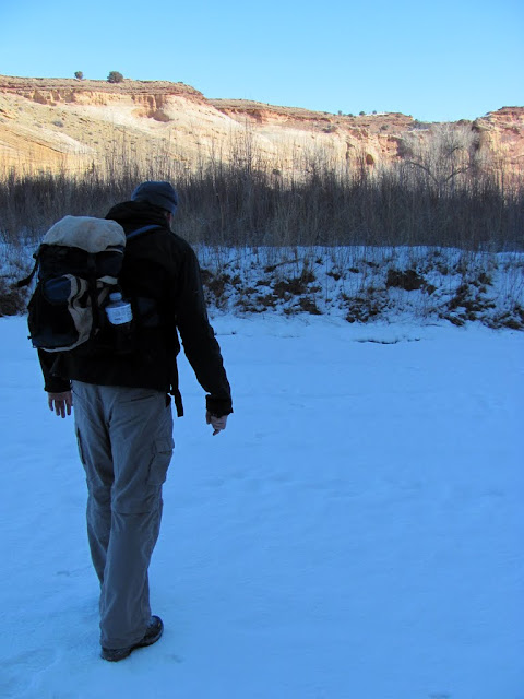
A friend and I hiked five miles round-trip along the San Rafael River to the Sorrel Mule Mine on Monday. There are normally a couple of water crossings required on the way to the mine, but we found places where there was a thick enough layer of ice on top of the flowing water that we could walk across. The Sorrel Mule Mine was started in the 1890s and runs for about 2,000 feet along a fault in the Navajo Sandstone.
http://castlecountry.org/geo/SanRafa...elMuleMine.kmz
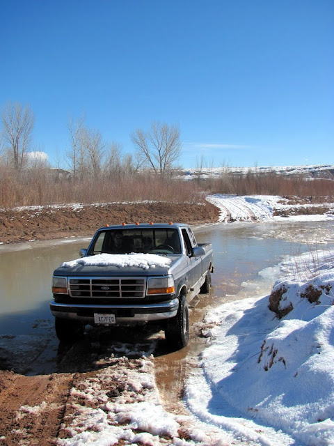
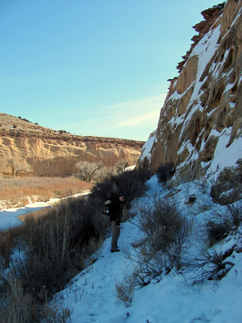
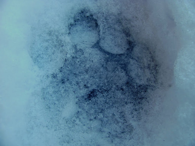
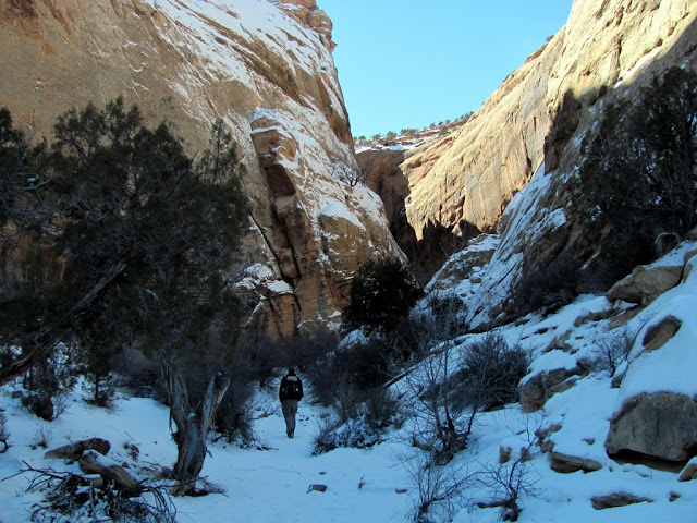
I was nervous about driving my truck across the river at Fuller Bottom--there was more water flowing than I was expecting--but it made it across easily and we were able to begin our hike at the usual trailhead by 11:00AM. The trail was easy to follow at first, but we lost it a couple of times under the snow on the descent to the river bottom. Once at the river bottom, the trail narrowed up and ran between the river bank and a cliff, and there were cougar tracks in the snow that had fallen the day before. When the trail came to the first river crossing, we left the trail and followed the river bank until we found a shady stretch of river that was covered in ice and snow. We walked across without falling in, then bushwhacked our way back to the trail.
Crossing the San Rafael River at Fuller Bottom
Starting the hike at the trailhead

Almost down to the river bottom

View upstream toward Fuller Bottom

The trail between the river bank and some cliffs
Cougar track in the snow
Bushwhacking to get to an iced-over river crossing

Chris testing out the ice
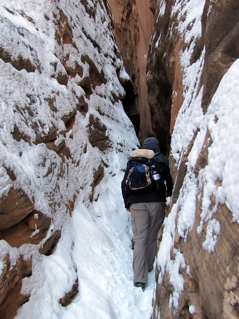
On the other side of the river we checked out some petroglyphs. There were several panels spread out over several hundred feet of the cliff line, and some of them were 30' up off the ground, only accessible via some sketchy ledges. Past the rock art the trail narrowed up again and we followed more cougar tracks until we got to the next river crossing. This time we also found some ice covering the entire width of the river, but the sun was shining on it and it didn't feel as stable (coming back across later in the day it creaked a lot), but we got across without breaking through.
Petroglyphs
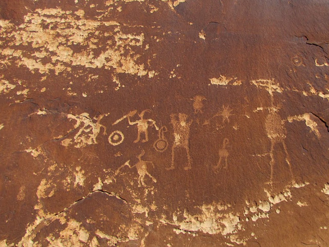
More petroglyhps high up on a cliff

A sketchy river crossing over the ice

Almost safely across

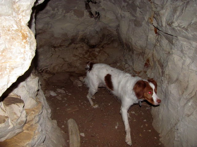
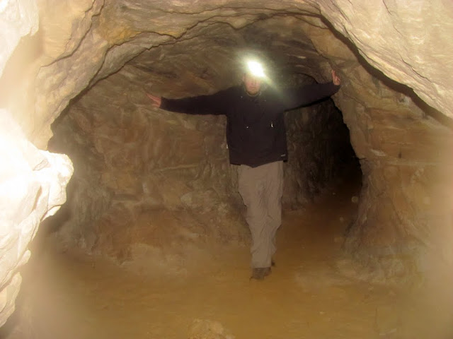
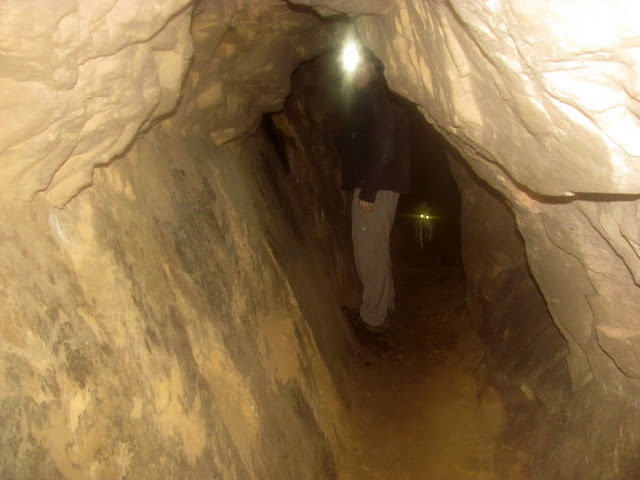
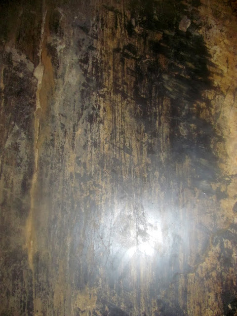
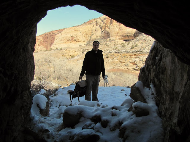
Just past that river crossing was a short box canyon where the mine entrance was. We hiked to the end of the box canyon first, then returned to the mouth of the canyon and found the mine entrance. We donned our headlamps and entered, not quite knowing what to expect. It was warm and humid inside the mine, and many of the walls were flat and smooth (some even highly polished) due to fault movement. There were timbers left in the floor from what we guessed was a rail system to haul out the rock and ore. There were a few very short side tunnels, but for the most part the main shaft just continued to follow the fault. We reached the end of the mine and turned back, and on the way out I was very surprised to see some plants growing somewhere near the middle of the mine where no sunlight ever reaches. Once out of the mine, we retraced our route back across the ice and to the truck. The hike had taken us a little less than 3.5 hours to complete and was 5 miles total (not including more than half a mile inside the mine).
Heading up the box canyon
Short narrows in the box canyon
Torrey at the end of the canyon

Old timbers near the mine entrance

Mine entrance

Smooth walls inside the mine

A tiny side tunnel
A junction, with the main tunnel leading to the right
More flat walls
Polished walls
The end of the main tunnel
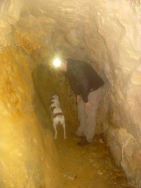
Plants sprouting up inside the mine

Back outside in the cold again
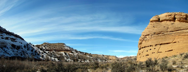
Panorama from the river bottom on the hike out
https://picasaweb.google.com/Dennis....orrelMuleMine#
-
02-23-2011 11:20 AM # ADS
-
02-23-2011, 11:32 AM #2
Nice report, thanks for sharing.

-
02-23-2011, 11:51 AM #3
I would be nervous driving a truck across that river too.
 Hey great report and pix. Cheers!
-
02-23-2011, 12:22 PM #4
great pics again.
Glad you made it easily across the river.
-
02-23-2011, 02:13 PM #5Bogley BigShot


- Join Date
- May 2007
- Location
- We're all here, because we ain't all there.
- Posts
- 19,424
Nice job Dennis
-
02-23-2011, 02:46 PM #6
the swell..one of my favorite places in the world..so much to find there
go get lost, it is good for the soul


 Reply With Quote


Similar Threads
-
The Burro Mine & Treasure Box Mine
By uintahiker in forum Climbing, Caving & MountaineeringReplies: 3Last Post: 12-13-2010, 09:27 AM -
[Trip Report] South Mule Canyon
By apcronnelly in forum Rock Art & RuinsReplies: 1Last Post: 05-08-2010, 04:45 PM -
San Rafael River is in season....
By ajroadtrips in forum Boating, Rafting, Kayak and CanoeReplies: 0Last Post: 06-01-2009, 09:44 PM -
Deathcrickets Mule Poll
By RedMan in forum The Political ArenaReplies: 4Last Post: 12-03-2008, 07:12 AM -
San Rafael River Area
By asdf in forum Hiking, Scrambling & Peak BaggingReplies: 7Last Post: 10-12-2006, 07:30 AM
