

Results 1 to 9 of 9
Thread: Keg Point
-
01-09-2011, 12:43 PM #1
Keg Point
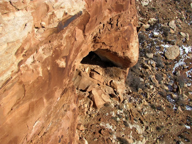
I did some exploring yesterday on Keg Point, which is basically directly west of Moab and directly south of Green River. I was looking for a cave listed on the USGS topo map, and although I found it, it was in the bottom of a canyon rather than at the canyon's rim like the topo map suggested, so I didn't get a chance to go inside.
http://castlecountry.org/geo/KegPoint.kmz
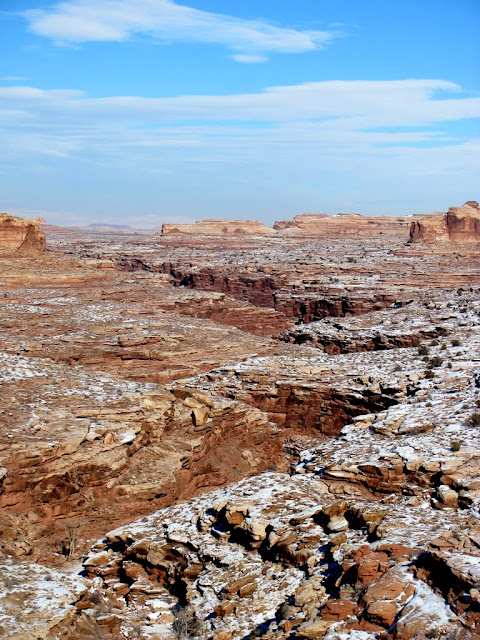
I was optimistic because the amount of snow on the ground gradually decreased as I drove south toward Green River, but after getting on the dirt road and heading south from Green River, snow levels gradually increased. There were deepish drifts while I hiked, but on the slickrock there were places where the snow had melted completely. I started my hike near the end of the road on Keg Point (the same place you'd begin the hike for Colonnade Arch) and hiked a couple of miles northwest to a point overlooking Keg Spring Canyon. Some places were a little dicey, with steep snow-covered sandstone slopes, but most of the hike was relatively flat. The sky was amazing for most of the hike, but some thick storm clouds moved in toward the end of the hike and it got cold very quickly. It was an amazing day, and when the days are longer I'm planning on going back to check out Colonnade Arch and Bowknot Bend.
Very little snow closer to Green River
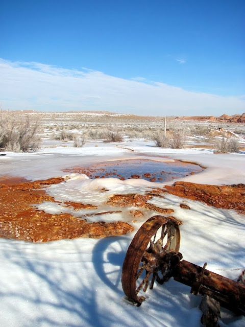
Coyote heads near Chaffin Geyser

Chaffin Geyser
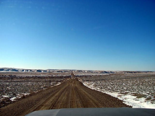
The road south of Saucer Basin

The road to Keg Point

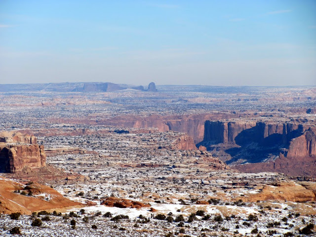
View over Labyrinth Canyon toward the Needles
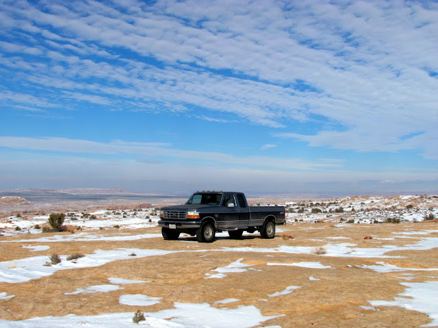
My parking spot on Keg Point
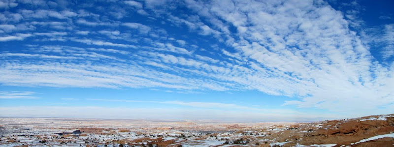
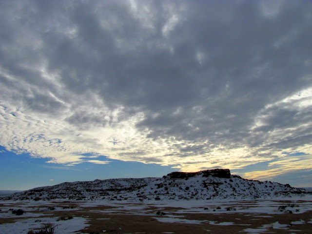
Incredible sky
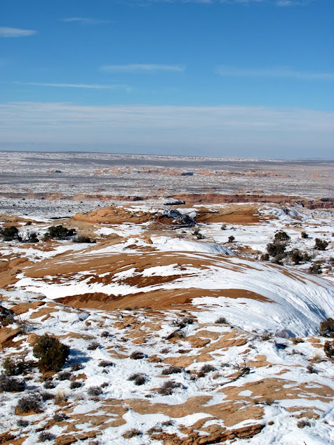
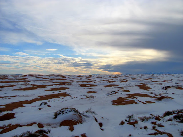
View toward my destination
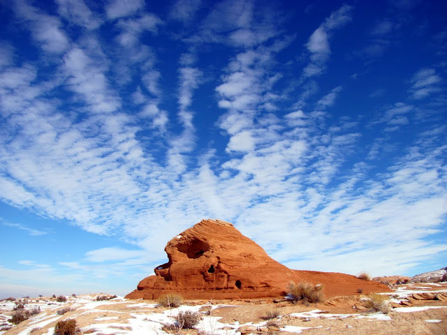
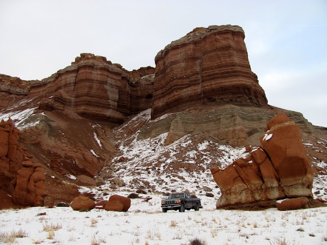
Rock formation along the way
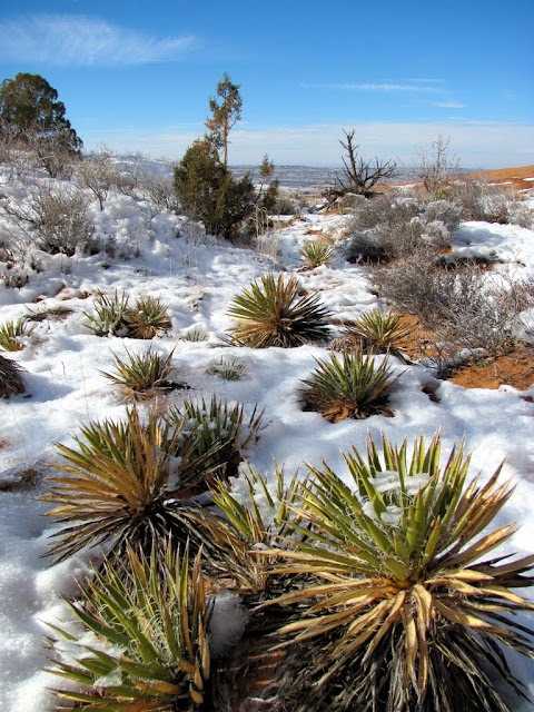
Yucca
A fork in upper Keg Spring Canyon

The cave I was looking for
A small arch
Keg Spring Canyon
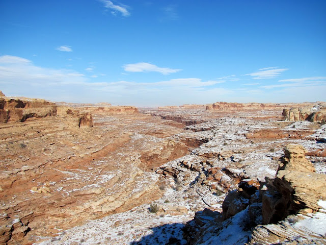
Closer view of the canyon
Clouds moving in at the end of the hike
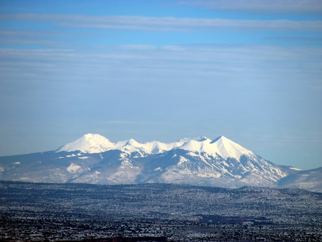
The La Sals
Sand dunes southwest of Middle Canyon
Little Flat Top
Factory Butte seen from Little Flat Top

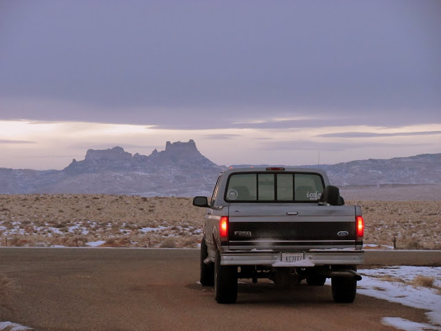
Back on the pavement at UT-24, with Temple Mountain in the distance
There are a ton more photos here:
http://picasaweb.google.com/Dennis.Udink/KegPoint#
-
01-09-2011 12:43 PM # ADS
-
01-09-2011, 01:06 PM #2
Sweet pics! This is inspiring that it's not that unreasonable to get out there right now. I've been wanting to take another trip out to Colonnade.
-
01-09-2011, 01:19 PM #3Bogley BigShot


- Join Date
- May 2007
- Location
- We're all here, because we ain't all there.
- Posts
- 19,424
nice Tr Dennis,
I need to get out to Colonnade also.
-
01-09-2011, 03:10 PM #4
In case you couldn't tell from the rim, "cave" is more a rock shelter/alcove than a cave. There are a few not-that-old signatures in it and there are three old trails leading down to the area to access the cave. I was last there Christmas 1996 looking for slot canyons. We were going to use ropes to access the west fork of the drainage containing the cave (next fork west of Keg Spring), but then we found this old sheep trail blasted into the side of the canyon to reach a waterhole.
Next month I am headed back down there for a loop hike visiting Bowknot Bend, Colonnade Arch, Twomile Canyon and lower Horseshoe Canyon. I was hoping to do it this (3 day) weekend, but I'd rather do it when the snow melts.Utah is a very special and unique place. There is no where else like it on earth. Please take care of it and keep the remaining wild areas in pristine condition. The world will be a better place if you do.
-
01-09-2011, 03:41 PM #5I even managed to get to the trailhead (with only a little difficulty) in 2WD, but I used 4WD to get back up the hill on my way out.
 Originally Posted by ibenick

That's pretty much what I thought, but I couldn't see the back of the alcove from the canyon rim above. You just saved me another trip back out there to check it out. Originally Posted by Scott P

That sheep trail sounds interesting. Do you remember roughly where it is? I would someday like to find my way down into the main Keg Spring Canyon and follow it down-canyon for a few miles just to check things out.
-
01-09-2011, 04:53 PM #6Here is a map:That sheep trail sounds interesting. Do you remember roughly where it is? I would someday like to find my way down into the main Keg Spring Canyon and follow it down-canyon for a few miles just to check things out.
If you want to see the part of the canyon below the Water Tank Trail, it's actually best to come in the big side canyon coming in from the west (well below the Water Tank Trail and off this map). Just below the Watertank Trail, the canyon turns into a bushwhack, so the section of the canyon between the Water Tank Trail and the big side canyon is best avoided. Keg Springs Canyon is nice in it's upper end all the way down to the Watertank Trail and it is is nice again below the big side canyon all the way to the Colorado River.
The upper end of the canyon is nice with lots of alcoves, springs, old sheep trails, and somewhat narrow canyons to explore.
The lower end is deep, pretty and open with one alcove with some broken down ruins. If you look under some of the cairns there are old mining claims dating back to the 1950's.
There is a short bushwhack right at the river, but the next canyon just up river makes a good route out. A very old mining trail (Wolverton's Trail from around 1903-1910) goes up the north side of this little canyon and makes a fairly easy route out, but years ago two of my two brothers and I found an interesting route going up the south side of the canyon. At one place we used our coats as a makeshift handline on one tough ledge. At the time my youngest brother was still small and we could boost him up on our shoulders where he could stand on my palms at which point he dropped the tied together coats to us to use as a handline. Someday I'll have to revisit the route we did when we were young, but I doubt I could do the route anymore (especially since my "little" brother has long since grown up and too heavy to stand on my palms!).Utah is a very special and unique place. There is no where else like it on earth. Please take care of it and keep the remaining wild areas in pristine condition. The world will be a better place if you do.
-
01-13-2011, 03:00 PM #7
-
12-05-2018, 03:27 PM #8
I'm very late to this party but after doing a quick search on 'Chuchuru Sheep Trail' came across this interesting account in "Tales of Canyonland Cowboys"... Ch. 9 mentions the Chuchuru Sheep outfit in the account of Chad Moore.
https://www.jstor.org/stable/j.ctt4c...5f4800fb17624c
-
12-07-2018, 09:38 AM #9
Last month I returned to Keg Spring Canyon and hiked four different trails in a single day. I'm still a little confused on all the names, but the names I use here came from Kelsey and/or Allen. I descended the Andy Moore Trail (marked as the Chuchuru Sheep Trail on Scott's Map), visited the "cave," went up and back down the Wolverton Mining Trail (old mining trail on Scott's map), then up the "sheep trail found by mistake" (which neither Allen nor Kelsey mention, I don't think). Then I drove over to the Chuchuru Sheep Trail (water tank trail on Scott's map), but only descended the first portion without dropping into the canyon bottom. The next day I hiked the Wolverton Canyon Trail all the way to the Green River.
I've got future plans (next year, maybe) to do a loop hike including the Chuchuru Sheep Trail and the Buck Canyon Trail (northwest tributary to Keg Spring Canyon).
Here are a few photos of last month's trip. Once I get the trip report written up I'll post it here (I'm way behind on TRs).
Andy Moore Trail
Wolverton Mining Trail
The "Cave"
Sheep trail found by mistake
Chuchuru Sheep Trail
Upper Wolverton Canyon Trail
Lower Wolverton Canyon Trail
-
Post Thanks / Like - 4 Likes


 Reply With Quote


Similar Threads
-
Alstrom Point
By oldno7 in forum General DiscussionReplies: 9Last Post: 08-22-2010, 07:27 AM -
The point. I think you might have missed it.
By accadacca in forum General DiscussionReplies: 2Last Post: 04-23-2009, 07:05 PM -
[Trip Report] point 1109
By goofball in forum Hiking, Scrambling & Peak BaggingReplies: 0Last Post: 02-08-2009, 09:13 PM -
[Trip Report] The Point
By R in forum Hiking, Scrambling & Peak BaggingReplies: 4Last Post: 07-01-2006, 09:24 AM -
A decent 3 point
By MY T PIMP in forum Hunting & ShootingReplies: 3Last Post: 12-15-2004, 12:46 PM
