

Results 1 to 20 of 29
Thread: Utah Winter Storm Warning
-
11-19-2010, 05:40 PM #1
Utah Winter Storm Warning
Urgent - winter weather message
national weather service salt lake city ut
312 pm mst fri nov 19 2010
...heavy snow across mountains and northern valleys of utah this
weekend through early next week...
The ingredients remain in place for a series of increasingly cold
winter storms to impact the higher terrain of utah beginning
saturday...and continuing into the first part of next week.
The first storm in this series is expected to cross utah saturday
through saturday night bringing heavy snow along with strong
winds. A second colder system is expected to quickly arrive
during the day sunday bringing another round of heavy snow. This
storm may also bring heavy snow to the valleys of northern
utah...including the wasatch front. Yet another system is expected
monday before the coldest system in this series arrives during the
day tuesday...bringing a very cold arctic airmass southward into
the area. Precipitation is expected to finally taper off across
the region by wednesday morning.
Utz007>010-201200-
/o.upg.kslc.ws.a.0010.101120t1400z-101124t1200z/
/o.new.kslc.ws.w.0014.101120t1400z-101124t1200z/
wasatch mountains i-80 north-wasatch mountains south of i-80-
western uinta mountains-wasatch plateau/book cliffs-
including the cities of...woodruff...randolph...alta...brighton...
Hanna...scofield
312 pm mst fri nov 19 2010
...winter storm warning in effect from 7 am saturday to 5 am mst
wednesday...
The national weather service in salt lake city has issued a
winter storm warning for heavy snow and strong winds...which is in
effect from 7 am saturday to 5 am mst wednesday. The winter storm
watch is no longer in effect.
* affected area: The wasatch mountains...western uinta
mountains...and the wasatch plateau and book cliffs.
* snow accumulations: Total accumulations of 2 to 3 feet are
expected across the northern mountains of utah beginning
saturday... And ending late tuesday night...with the
greatest accumulations expected across the wasatch range.
Locally higher amounts are possible.
* timing: Snow will develop during the day saturday across the higher
terrain of utah. Periods of snow...heavy at times...will persist
through late tuesday night as a series of cold storm systems
parade through the region.
* snow levels: Snow levels will start out around 6500 feet
across northern and central utah saturday then fall to the
adjacent valley floors saturday night...and remain there
through the duration of the event. Snow levels across the
south are expected to be near 8000 feet during the day
saturday before falling to most valley floors by sunday.
* winds: South winds will become very strong during the day
saturday...with gusts in excess of 75 mph expected along the
upper ridgelines. Winds will diminish across the north on sunday
but will remain strong across the south... Then diminish across
the south monday. Very strong winds could redevelop along and
behind the cold front for tuesday.
* impacts: Blizzard like conditions are possible at times
across portions of the higher terrain saturday through
tuesday. This will likely make travel difficult if not
impossible at times. Higher passes impacted will include
those along i-80 across northern utah and i-70 through
central utah. Snowfall tuesday through tuesday night will
also have an impact on those getting an early start for
holiday travel. Additionally...strong winds expected
saturday through saturday night could result in downed trees
and power lines.
Precautionary/preparedness actions...
A winter storm warning means a mixture of heavy snow and strong
winds is expected or occurring. Driving conditions may be
hazardous. Use caution. Be prepared for sudden restrictions in
visibility due to blowing snow. Keep a winter storm survival kit
in your vehicle in case of an emergency.
For winter road conditions from the utah department of
transportation visit...http://www.commuterlink.utah.gov or dial
511.
&&
$$
-
11-19-2010 05:40 PM # ADS
-
11-20-2010, 07:45 PM #2
...winter weather advisory remains in effect until 10 am mst sunday for the benches... ...winter storm watch remains in effect from sunday afternoon through monday morning... A winter weather advisory for the benches for snow remains in effect until 10 am mst sunday. A winter storm watch remains in effect from sunday afternoon through monday morning. * affected area: The benches of the salt lake and utah valleys. * snow accumulations: 3 to 6 inches overnight tonight through sunday mid morning. There is a potential for an additional 2 to 6 inches of snow tomorrow late afternoon through tomorrow night. * snow levels: Snow levels will fall to valley floors this evening. * impacts: Accumulating snowfall may make travel difficult along the benches tonight...and across all of the northern wasatch front late sunday afternoon and night. Use caution when driving. Precautionary/preparedness actions... A winter weather advisory means that snow accumulations will cause primarily travel difficulties. Be prepared for snow covered roads. Use caution while driving. A winter storm watch means there is a potential of significant snow. Continue to monitor the latest forecasts. For winter road conditions from the utah department of transportation visit...
-
11-23-2010, 05:46 AM #3
The weatherman just said that this is the largest blizzard warning ever issued by the national weather service in Salt Lake City.
--
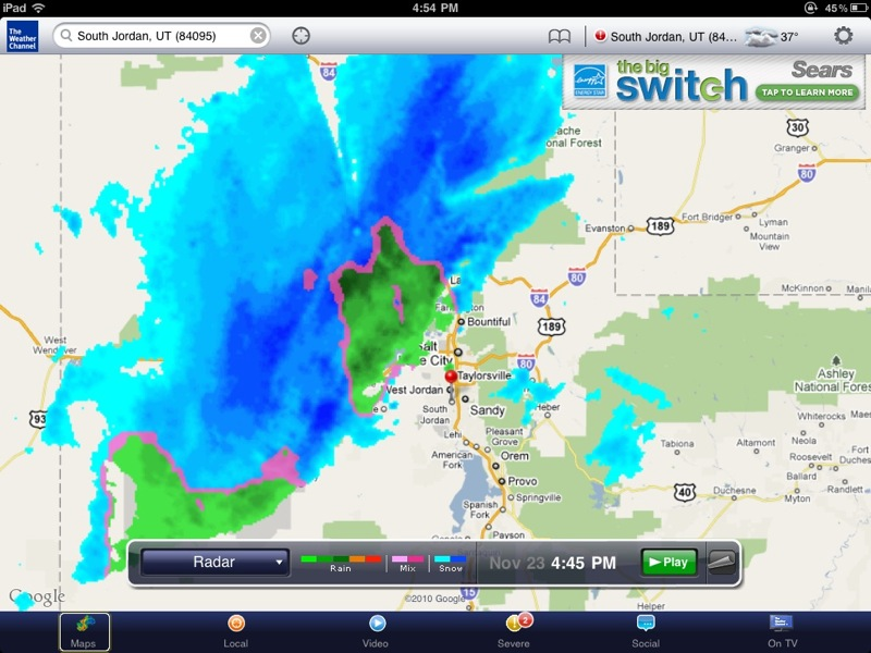
...BLIZZARD WARNING REMAINS IN EFFECT FROM 3 PM THIS AFTERNOON TO 8 AM MST WEDNESDAY... A BLIZZARD WARNING REMAINS IN EFFECT FROM 3 PM THIS AFTERNOON TO 8 AM MST WEDNESDAY. * AFFECTED AREA: CACHE VALLEY...WASATCH FRONT...THE GREAT SALT LAKE DESERT AND MOUNTAINS...AND SOUTHWEST WYOMING. * SNOW ACCUMULATIONS: AN ADDITIONAL 1 TO 3 INCHES IS POSSIBLE THROUGH THIS MORNING NORTH OF OGDEN. ANOTHER 4 TO 8 INCHES OF SNOW IS LIKELY LATE THIS AFTERNOON THROUGH TONIGHT. * TIMING: SNOW SHOWERS ARE LIKELY THROUGH THIS MORNING... MAINLY NORTH OF OGDEN. SNOW WILL BECOME HEAVIER LATE THIS AFTERNOON AND EVENING WITH THE PASSAGE OF THE ARCTIC FRONT. * WIND: SOUTHERLY WINDS OF 15 TO 30 MPH WITH GUSTS OF 55 MPH OR GREATER ARE LIKELY THIS AFTERNOON...SWITCHING TO NORTHWEST 25 TO 40 MPH WITH GUSTS TO 50 MPH LATE THIS AFTERNOON AND EVENING. * IMPACTS: TRAVEL WILL BECOME DIFFICULT OR IMPOSSIBLE DUE TO HEAVY SNOW...HIGH WINDS...AND WHITEOUT CONDITIONS LATE THIS AFTERNOON AND EVENING. TRAVELERS ARE URGED TO COMPLETE THEIR EVENING COMMUTE EARLY THIS AFTERNOON SO THEY ARE NOT CAUGHT IN THE STORM. PRECAUTIONARY/PREPAREDNESS ACTIONS... A BLIZZARD WARNING MEANS SEVERE WINTER WEATHER CONDITIONS ARE EXPECTED OR OCCURRING. FALLING AND BLOWING SNOW WITH STRONG WINDS AND POOR VISIBILITIES WILL LEAD TO WHITEOUT CONDITIONS...MAKING TRAVEL EXTREMELY DANGEROUS. DO NOT TRAVEL. IF YOU MUST...HAVE A WINTER SURVIVAL KIT WITH YOU. IF YOU GET STRANDED...STAY WITH YOUR VEHICLE.
-
11-23-2010, 05:59 AM #4
youre really getting into this

-
11-23-2010, 06:12 AM #5
 Originally Posted by Summit

 Your local weatherdood...
Glad I am not going into work tomorrow. I think I'll tell my peeps to work from home.
-
11-23-2010, 08:02 AM #6
-
11-23-2010, 08:03 AM #7
Looks like the warnings from UDOT for people to leave work early today are getting some attention. My work is shutting down at 3:00 and my wife's entire department at the U hospital is too. From the sound of it I wouldn't want to be commuting at 5 tonight.

-
11-23-2010, 09:34 AM #8
It looks clear all the way to Vegas. Just going through mesquite.
Sent from my Droid using TapatalkIF YOU WON'T STAND BEHIND OUR TROOPS, PLEASE, FEEL FREE TO STAND IN FRONT OF THEM!!!!
2008 V2K Classic LT
2004 Toyota Tacoma
Schwinn Homegrown
CouchSurfing
Patriot Guard Riders
-
11-23-2010, 10:09 AM #9
The School Districts are in a panic too, talking about setting up the schools as Red Cross stations. Is it really going to be that bad?
-
11-23-2010, 10:15 AM #10
My UPS driver just told me that they're pulling all of their drivers out of Summit County no later than 3pm today. No package pickups. They've never done it before. Craziness. It is already a pretty bad blizzard up here so I can imagine that if the real storm has yet to roll in, it could be nasty.
-
11-23-2010, 04:30 PM #11
Yikes!

-
11-23-2010, 04:38 PM #12
this just in...
we're all gonna die.
and generators are on sale at walmart
-
11-23-2010, 04:47 PM #13
Please use "hamburger time" instead of die.
If the interwebs go down me might just die...I mean hamburger time.
-
11-23-2010, 06:08 PM #14
Snowmageddon......
-
11-23-2010, 06:28 PM #15
Women and children are being encouraged to leave the state NOW!!!!
-
11-23-2010, 09:21 PM #16
OMG now I'm getting an email from KSL warning about the snowstorm:
SEVERE Storm Approaching Utah
Dear KSL.com visitor,
With the severe weather system approaching the Wasatch Front, KSL.com has set up a special page to keep you up-to-date with the latest information on this storm. This page includes links to closures, the Live 5 Weather map and the latest news. Please visit the KSL Storm Coverage Page for the most recent information.National Weather Service issuing a blizzard warning for much of the state. A strong cold front is expected to arrive in Northern Utah by 2-4pm, in the Wasatch Front between 3p-6p, and then through the rest of the state. Expect the wind gusts to blow between 30 and 50mph as the front arrives. Bitter cold air should move in quickly, with temperatures in the teens tonight. Single digits possible tomorrow morning. More snow is possible along the Wasatch Front tomorrow morning as well. Highs tomorrow could stay below 20. Lows Thanksgiving could drop below zero if skies clear. Download the Live 5 Weather app to keep you informed. Also keep viewing ksl.com for more updates. -Grant Weyman, Live 5 Weather HD 11.23.10 It is highly recommended that you do not attempt to drive in this storm. If it is necessary please give yourself extra time and take extra precautions while on the road.
Be safe out there!
Your KSL.com Team
-
11-23-2010, 09:30 PM #17
Headed home at 8:30 pm tonight from the Sandy area. Fourwheel drive 55mph all the way home. There wasn't very much trafic on the roads.
-
11-23-2010, 09:31 PM #18
After all the hoop-la about this storm I'm going to be very disappointed if I don't have to break into my emergency liquor supply somtime in the next 72 hours.

-
11-23-2010, 09:36 PM #19
Talk about a giant hype!
Maybe SLC, Ogden, and Park City got the real storm (the reports didn't look too bad), but it seems to have skipped Orem. Hardly even dusted us with snow.
Just a chilly breeze down here.
And talk about a panic! Businesses sending everyone home at 3 expecting the "worst storm in a decade".
I drove through a real blizzard two weeks ago from Fountain Green to Nephi. This storm is a joke.
Someone, please tell me you got pounded (by the storm, I mean).Lost On A Hill
Utah Water Log
-
11-23-2010, 09:47 PM #20
No pounding storm from Provo to Mapleton. I went to the BYU basketball game "IN THE BLIZZARD" parked, watched a blow out game and then returned to the car without hardly any snow to be found. Dud.
 At least so far. I am not looking forward to the annual "Turkey Bowl" in minus 2 degree weather. Of course, based on the predictions, it could be 40.
Life is Good
At least so far. I am not looking forward to the annual "Turkey Bowl" in minus 2 degree weather. Of course, based on the predictions, it could be 40.
Life is Good


 Reply With Quote


Similar Threads
-
Southern Utah winter Backpacking
By naofumi in forum Backpacking & CampingReplies: 2Last Post: 02-10-2009, 01:54 PM -
Winter in southern Utah
By Rob L in forum Hiking, Scrambling & Peak BaggingReplies: 11Last Post: 11-21-2008, 04:57 PM -
High Mercury Level Warning in 6 Utah fishing spots
By Mtnman1830 in forum FishingReplies: 2Last Post: 09-30-2008, 05:07 PM -
Utah Winter Snorkling
By savanna3313 in forum General DiscussionReplies: 20Last Post: 01-26-2007, 08:53 AM -
Winter hikes in Utah.
By KillEmAll in forum Hiking, Scrambling & Peak BaggingReplies: 7Last Post: 12-15-2005, 11:59 AM
Visitors found this page by searching for:
Outdoor Forum
