

Results 1 to 10 of 10
Thread: San Rafael Fall 2010
-
10-26-2010, 11:07 AM #1
San Rafael Fall 2010
This past weekend was the 13th semi-annual San Rafael geocaching event. Attendance was light--about 15 people showed up--but it was nice having a tight-knit group around the campfire each evening. There was a fair amount of rain--it came down all Thursday night and Friday morning, and again Saturday afternoon.
http://castlecountry.org/geo/SanRafaelFall2010.kmz
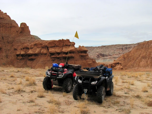
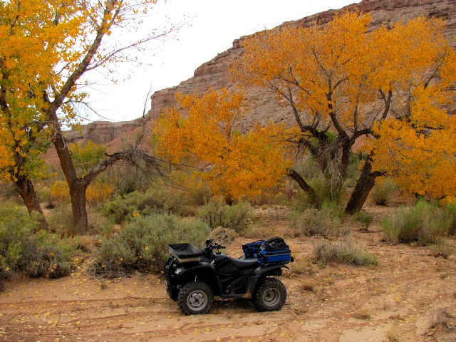
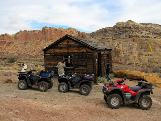
On Wednesday evening I went for an ATV ride with PlumNuts around Temple Mountain. I spent Thursday again riding ATVs with PlumNuts and doing some hiking in the southern Wild Horse Creek area.
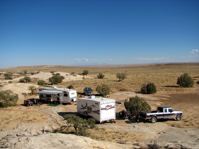
Camp on Wednesday afternoon
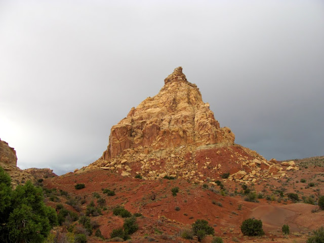
East side of Temple Mountain
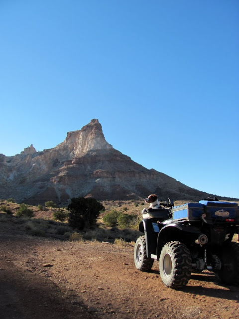
West side of Temple Mountain
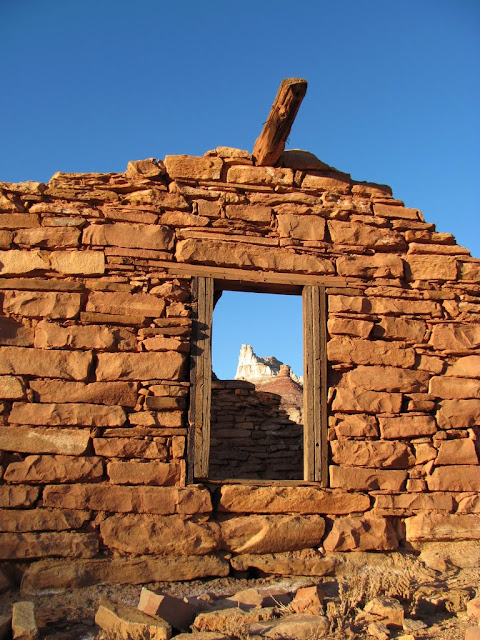
Temple Mountain framed by the window in an old stone cabin
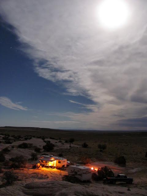
The moon over South Temple Wash

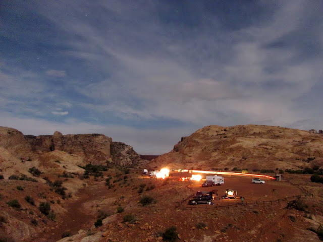
Camp on Wednesday night
ATVs parked at a geocache near Wild Horse Creek
Hiking up to another geocache
Two geocache locations are visible in this photo
Cottonwoods near Wild Horse Creek
Around the fire on a rainy Thursday night

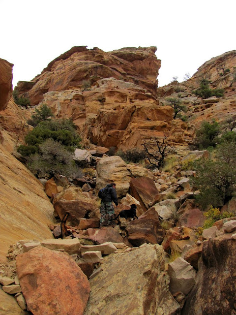
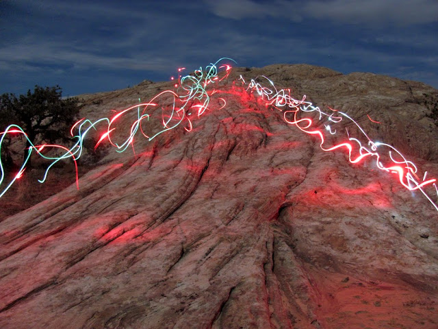
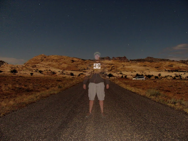
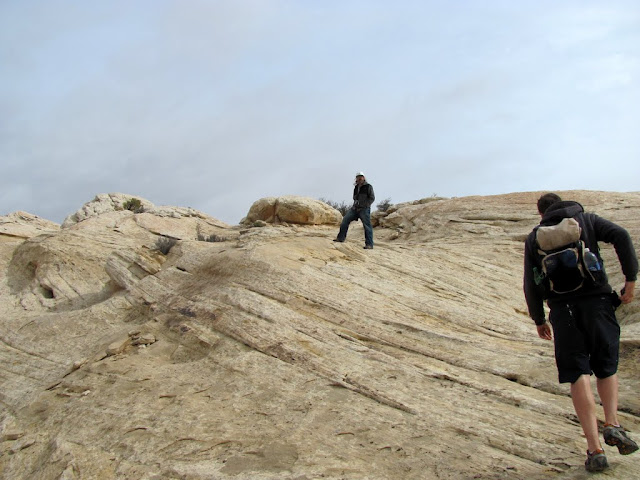
On Friday, I hiked to the top of the San Rafael Reef near Farnsworth Canyon with Dorkteam6 and GEOTlr to find a cache (http://coord.info/GC1TR78) that had been sitting for more than a year without any finds. That evening I spent a lot of time wandering around on foot and taking night shots.
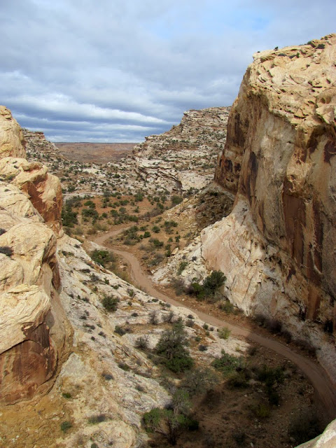
Low clouds over South Temple Wash

Finding a geocache in North Temple Wash

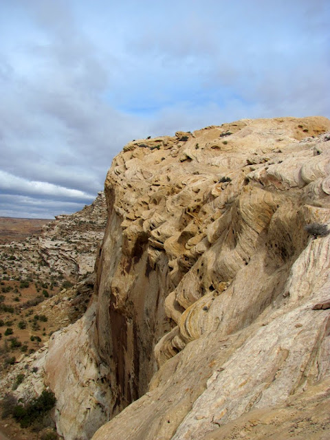
Hiking up the backside of the San Rafael Reef

Steep, bouldery hiking up the Reef
GEOTlr on top of the Reef

Dorkteam6 on the Reef

People camped in "the Corral" in South Temple Wash
Some strangers throwing a lighted frisbee
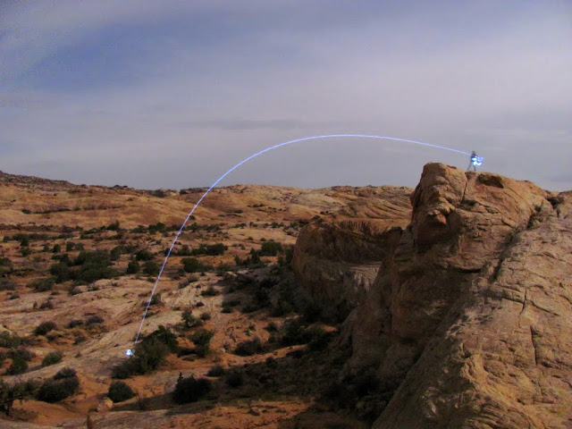
My kids light painting
Dorkteam6 on fire

Dorkteam6 on the Temple Mountain road
I went for another ride on Temple Mountain with PlumNuts and Dorkteam6 on Saturday, then later in the day went with my wife and Dorkteam6 for a ride on the Behind the Reef trail. We found a geocache in upper Little Wild Horse Canyon (http://coord.info/GC1NTBR) and another near Ding Dang Dome (http://coord.info/GC1NZTH). We got rained on pretty good riding back to camp, then enjoyed a potluck dinner and blew up a 1-gallon can of corn in the campfire.
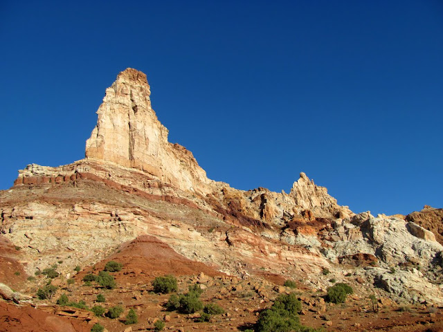
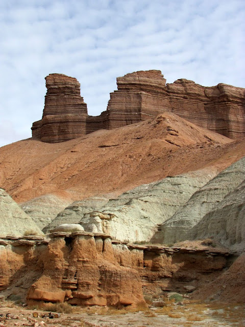
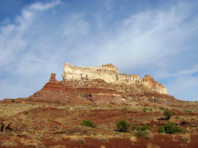
Temple Mountain
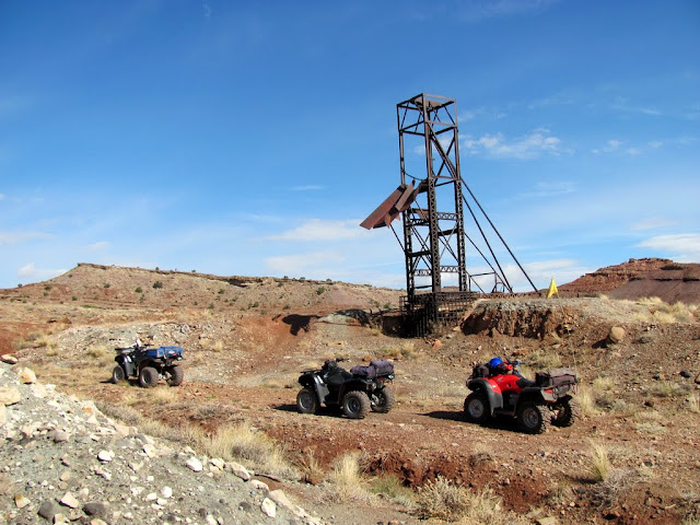
ATVs near a vertical mine shaft on Temple Mountain
Temple Mountain

Cabin near Bell Canyon on Behind the Reef trail
Ding Dang Dome
Getting soaked on a ride

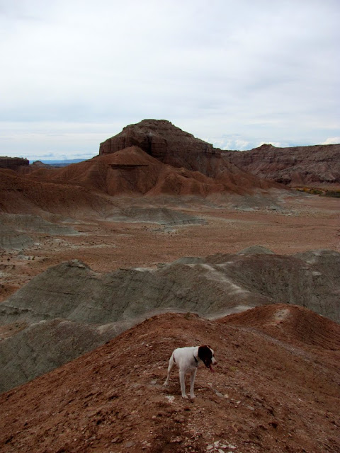
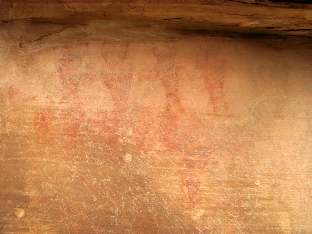
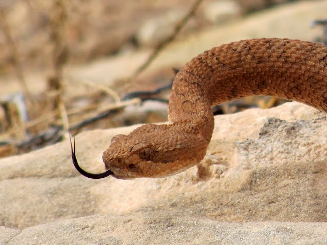
On Sunday I hiked with KimBest and Dorkteam6 to Thor's Cache (http://coord.info/GC1D360). Then my family and I took down camp, and went for one more short hike near our campsite before heading home. I found some pictographs and a rattlesnake on the hike.
North Temple Wash
View up the San Rafael Reef
KimBest and Dorkteam6 hiking up the Reef
Pictographs in South Temple Wash
Rattlesnake in South Temple Wash
http://picasaweb.google.com/Dennis.U...afaelFall2010#
-
10-26-2010 11:07 AM # ADS
-
10-26-2010, 01:25 PM #2
Great pics! So do cans of corn have an unusually high explosive factor or is that just what you had laying around?

-
10-26-2010, 03:12 PM #3
-
10-26-2010, 04:42 PM #4
I told you about the snakes.

-
10-26-2010, 08:29 PM #5
-
10-27-2010, 07:49 PM #6
Great post!

-
11-04-2010, 06:45 PM #7
I've never Geocached. But I have riden my horses extensively in the Swell. In the area that you were, We ride up Chute Canyon across the back of the reef and and down Wild Horse and back to our camp.
Chute Canyon

Wild Horse Canyon

-
11-04-2010, 07:18 PM #8Very cool! I just put two-and-two together and realized that I've heard of you before. I ran across this trip report of yours a while back, and since seeing it I've wanted to hike up McCarty Canyon. I hiked down into North Salt Wash and up a side-canyon just east of McCarty trying to see if I can make it a loop without going through Mesquite Wash (which looks much less interesting).
 Originally Posted by Painted Horse

Anyhow, it seems like it would be a great time taking horses through Chute and Wild Horse canyons.
-
11-08-2010, 10:30 AM #9
Yep, that's me. I published that article in Trail Rider Magazine and then uploaded it to that website.
Very few people will every hike/ride McCarty canyon. The starting point is hard to find, It's very non-descript and no specific landmarks to mark the start of the trail. You need to just drive to a gps point.
When you go up McCarty, you need to turn off up Still canyon. This is where the Wild Bunch hid their moonshine still. If you continue up McCarty, it becomes a box canyon. Part way up Still canyon, you need to crawl up the side of the canyon and get on the shelf that will carry you to the plateau summit. Otherwise the horses get trapped in the canyon.
When you come down Mesquite Wash, You can cut over to salt wash, so you don't have to traverse the entire length of Mesquite.
It's still 20+ miles round trip.
Most of the trails down Mesquite follow cattle trails.They migrate up to the plateau tops to graze and down to wash to water.
The ranchers ( Judds) ride through the area on a regular basis checking their cattle. So you can usually find their trails and follow them downhill.
There are some ATV trails in SaddleHorse canyon. I guess you could access McCarty from Saddlehorse if you knew where to cross over.

-
03-18-2011, 10:20 PM #10
awesome pictures and videos i really like your trips.


 Reply With Quote

Similar Threads
-
[Conditions] San Rafael Swell 9/28/2010
By ratagonia in forum CanyoneeringReplies: 11Last Post: 03-11-2011, 10:57 PM -
[Album] 2010 Fall Colors
By asdf in forum General DiscussionReplies: 18Last Post: 11-11-2010, 07:13 AM -
[Trip Report] Flat Tops Trail | Fall Colors 2010
By IntrepidXJ in forum Offroad 4x4, Side by Side and ATVReplies: 7Last Post: 10-10-2010, 06:21 AM -
[Trip Report] Fall Vacation, Sept 2010 - Part One: Escalante
By Cirrus2000 in forum CanyoneeringReplies: 5Last Post: 10-04-2010, 09:00 AM -
[Trip Report] Fall Vacation, Sept 2010 - Part Two: Zion
By Cirrus2000 in forum CanyoneeringReplies: 5Last Post: 09-27-2010, 02:56 PM
Visitors found this page by searching for:
Outdoor Forum
