

Results 1 to 7 of 7
Thread: Beckwith Plateau, Mt. Elliott
-
05-02-2010, 10:01 PM #1
Beckwith Plateau, Mt. Elliott
This was an incredible trip! I've been wanting to hit Mt. Elliott ever since a geocache was placed there in 2007. It's taunted me every time I've driven by on the highway below, and this weekend I finally made it up there.
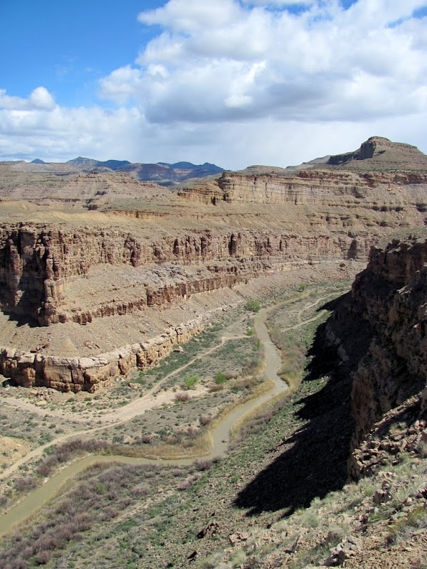
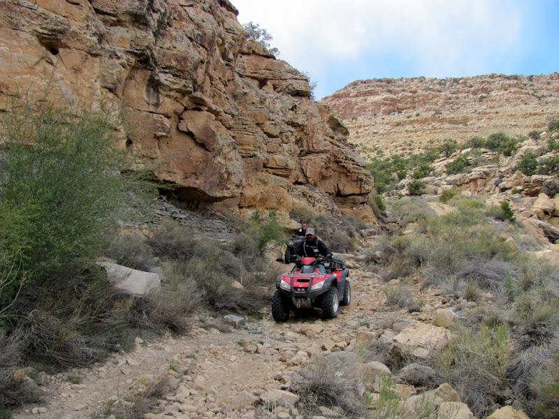
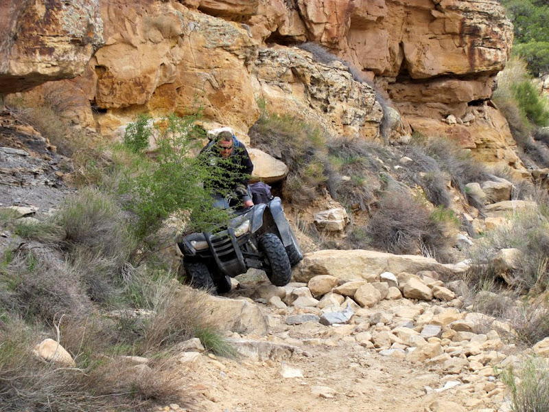
Two friends and I started out just off US-6 near Woodside at 10:00 in the morning. The first several miles of road were nice, but at the end of county maintenance, the trail is plagued with rockfalls and boulders. One section was steeply off-camber, and I had a bit of trouble there. My friend applied some weight to the uphill side of my ATV and kept me from rolling down into the river. From there it was pretty easy going until the crossing of the Price River. 50 CFS is supposed to be the upper limit for crossing the river, and it was running at over 60 CFS when we crossed. It was the highest water any of us had ever forded.
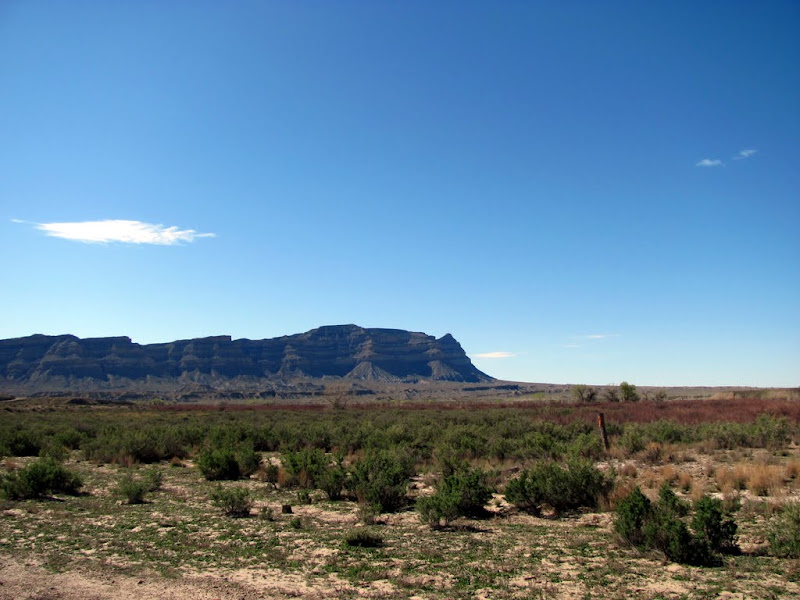
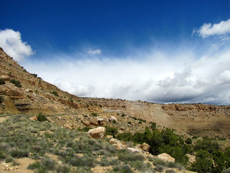
Mt. Elliott from near our starting point
The trail along the Price River

One of the tougher spots

The Price River crossing

Getting our courage up

Video of the crossing (both ways)
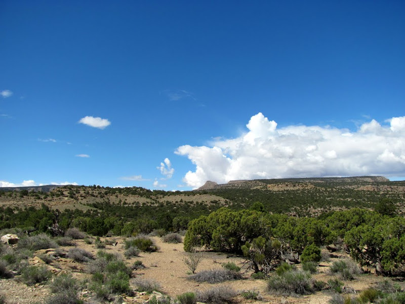
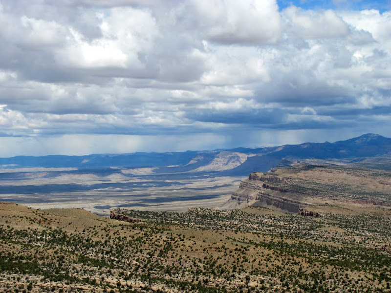
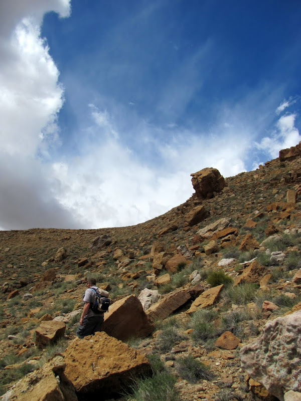
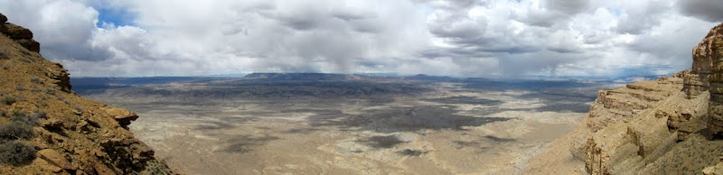
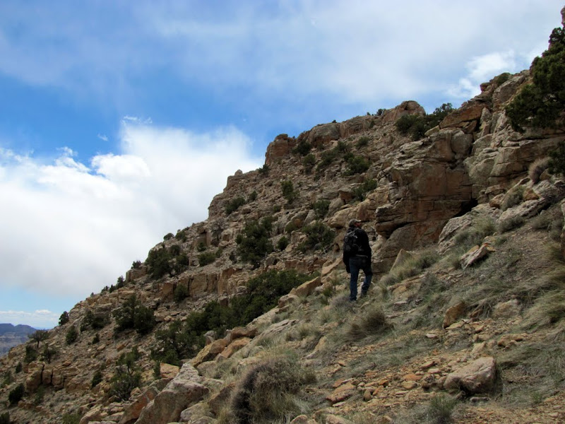
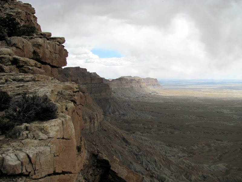
After a successful crossing of the river, we started up the switchbacks as the trail climbed up out of the canyon. After a flat stretch and another set of switchbacks, we were on top of Beckwith Plateau. From there it was a pretty straight shot to Mt. Elliott. Just before reaching the parking spot where the hike begins, we descended a huge road cut and dugway. The hike involved a lot of scrambling, and we gained just under 600' of elevation in about 0.4 miles. The view from the top was amazing. I could see well into the San Rafael Swell, and the views north and south along the Book Cliffs were impressive. After the hike we returned to the 4-wheelers and ate some snacks, then pressed on along the trail to its end at the drill hole.
Stopped to enjoy the view off the switchbacks

View of the river crossing from above
More switchbacks ahead

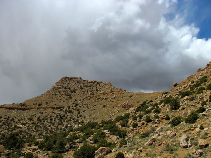
First view of Mt. Elliott from the backside
View along the Book Cliffs to the north
View up the dugway from the start of the hike
Parked at the start of the hike

Mt. Elliott
Nearing the saddle
Panorama from the saddle
Near the top
View north from the peak

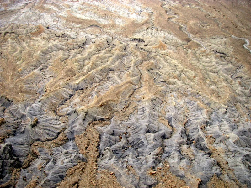
The valley floor below
View south from the peak

The trail to the drill hole was rough at first, as it skirted around the heads of two canyons. Once the trail reached Elliott Mesa, it straightened out and was much smoother--lots of fifth gear. We made it to the drill hole in good time, then took a quick jaunt over to an old corral with a nice view down Short Canyon. It was getting late by then, so we burned back toward the trucks and didn't make many more stops.
The trail as it skirts Long Canyon
More of the trail near Long Canyon
View from an overlook near Elliott Mesa
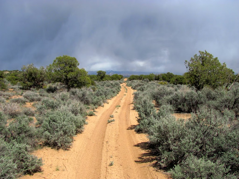
Snow flurries
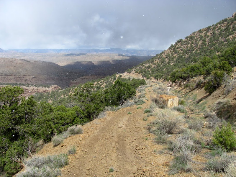
The trail on Elliott Mesa
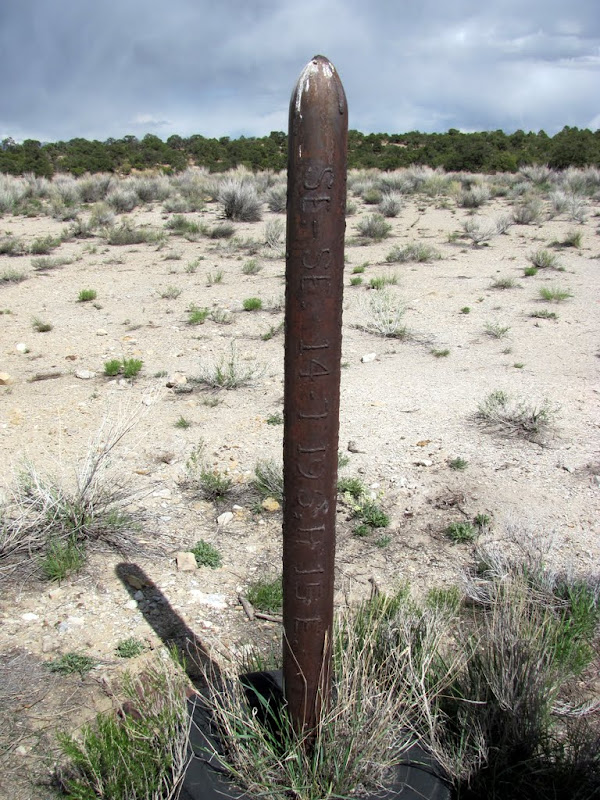
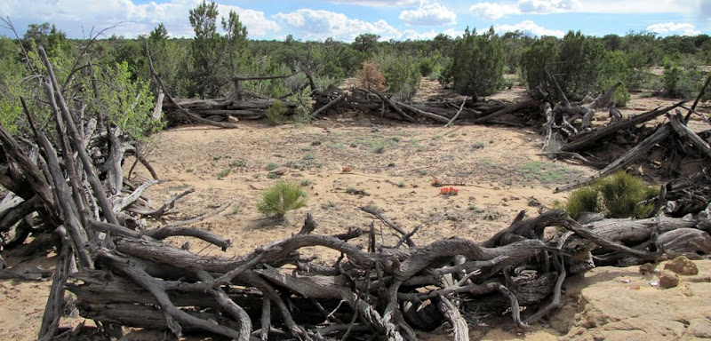
The drill hole
The corral
View down Short Canyon toward the Green River

Book Cliff views on the return trip

Lots more photos here:
.KMZ file for Google Earth:
http://castlecountry.org/geo/Beckwit...uMtElliott.kmz
My blog entry (if'n ya like readin' words):
http://udink.org/archives/2010/05/beckwith_platea.shtml
-
05-02-2010 10:01 PM # ADS
-
05-03-2010, 06:22 PM #2
 Originally Posted by Udink


Viewing on a mobile device? Click this link to open the map: http://maps.google.com/maps/ms?ie=UTF8&hl=en&msa=0&ll=39.219032,-110.287516&spn=0.100143,0.154324&t=h&z=13&msid=100749669156101003180.000485ba89013fd172321
-
05-03-2010, 06:49 PM #3Thanks--I was gonna do that, but I forgot. Too bad the waypoints and part of the tracklog aren't showing up. One of the limitations of Google Maps, unfortunately. They have either a file size limit or a limit to the number of points in a track before it just stops displaying stuff. At least the embedded map puts you in the ballpark. :) Originally Posted by Sombeech
-
05-03-2010, 08:21 PM #4
Freakin' awesome man! The river crossing...
-
05-05-2010, 02:45 PM #5
Fun ride isn't it. I've been going up there for nearly 20 years. You probably wont belive me but it's easier now than back in the day. We tossed a lot of rocks to make it passable again. And please, no driving beyond the well (Not saying you did). Everthing but the old road is a wilderness study area and we dont want the BLM shutting it down because people cant behave themselves.
-
05-05-2010, 03:34 PM #6
I assume you're the same Old Jeeper that found the geocache up there in 2008? I couldn't imagine taking a Jeep up that road!
 We were in awe as we passed some spots that looked like they'd stop a full-sized vehicle, knowing that you'd taken a Jeep there. It was indeed a fun ride. I'm looking to do the Little Park Road next, all the way to Range Creek, then hiking the rest of the way to the Green River. There's not a lot of wheelin' in the western Book Cliffs, but what there is sure is fun.
-
05-06-2010, 09:12 AM #7
Yes, one and the same. The biggest difference is a Jeep is slower. A day to get up and a day to get down.
I've done the Little Park road twice. The first time, years ago, I rode all the way to the river. Then in Turtle Canyon there was a road that went out on the Big Horn Benches. That's closed now too. I put a 100 miles on my motorcycle that time.
Next for me is the Wilcox Ranch end of Range Creek. I've never been up there. Just need to decide it I go it alone or join a tour group.


 Reply With Quote


Similar Threads
-
Canyoneering history of the Colorado Plateau
By moab mark in forum CanyoneeringReplies: 12Last Post: 06-17-2010, 01:15 AM -
[Trip Report] Dome Plateau & Yellow Cat Areas
By IntrepidXJ in forum Offroad 4x4, Side by Side and ATVReplies: 3Last Post: 11-03-2009, 05:40 PM -
[Trip Report] Dome Plateau
By IntrepidXJ in forum Offroad 4x4, Side by Side and ATVReplies: 2Last Post: 10-20-2008, 09:39 PM -
DOCUMENTARY: Canyoneering the Colorado Plateau
By stefan in forum CanyoneeringReplies: 9Last Post: 08-09-2006, 01:19 PM -
[Trip Report] Aquarius Plateau
By fourtycal in forum Offroad 4x4, Side by Side and ATVReplies: 10Last Post: 07-09-2006, 07:10 PM
