

Results 1 to 10 of 10
-
04-11-2010, 02:43 PM #1
Sand Bench - Cat Canyon Overlooks
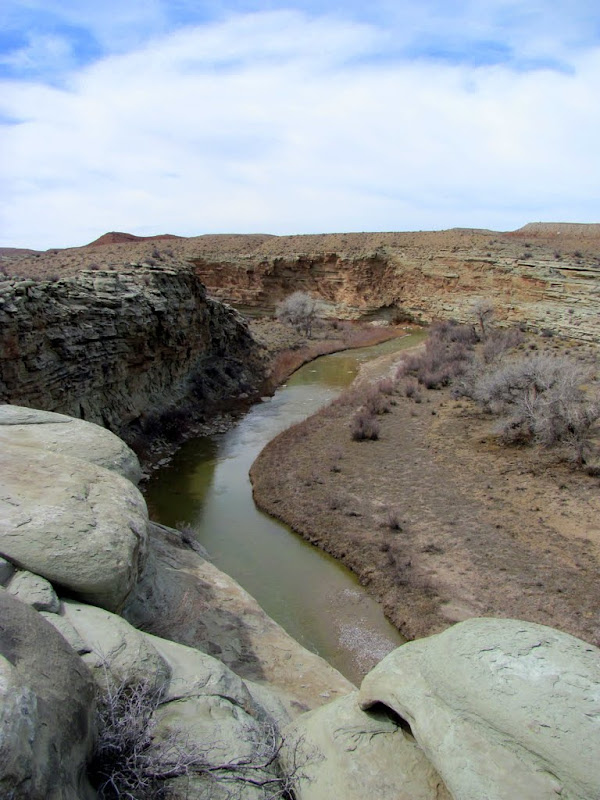
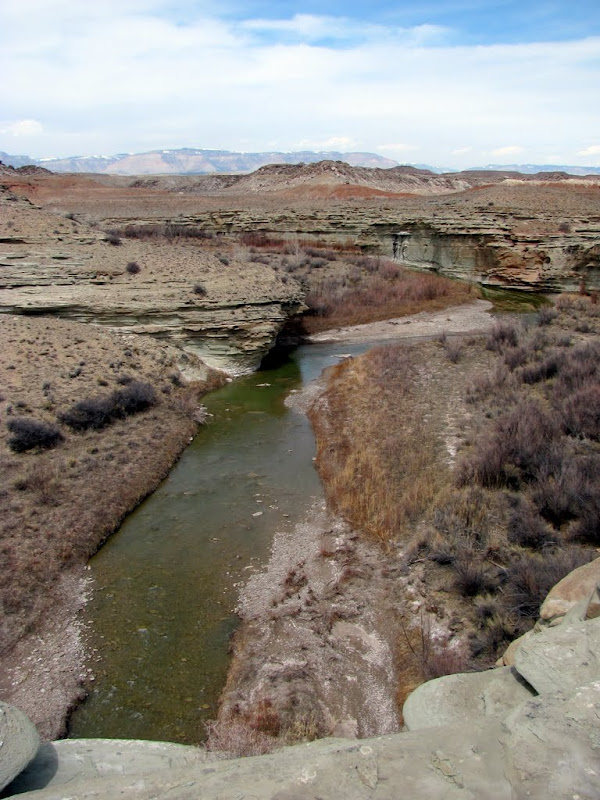
Last weekend my family and some friends went to the San Rafael Swell for Easter and spent some time on Sand Bench near Hambrick Bottom. While there, I spotted what looked like a great place to hike, so this weekend I returned alone and did just that. First I hiked to an overlook of the San Rafael River nearest to where I'd parked the truck.
View downstream
View upstream
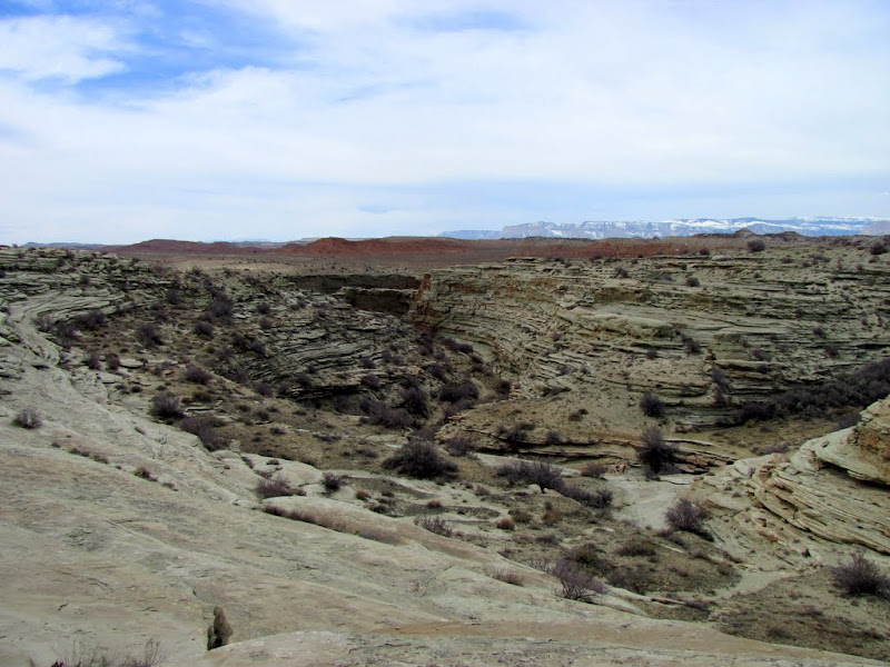
After that, I hiked away from the river to skirt around a steep canyon, but after crossing the canyon where it was less steep, I headed back to another point overlooking the river. On the way to the point, there was a lot of chert on the ground as I neared the river. At first the terrain was sandy, but after a while it returned to the typical ledgy Curtis Formation sandstone.
View of the truck about 1/4-mile away, Summerville Formation hills in the background

The canyon I hiked around
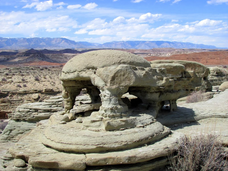
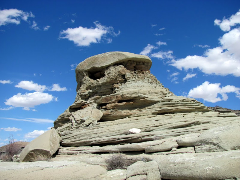
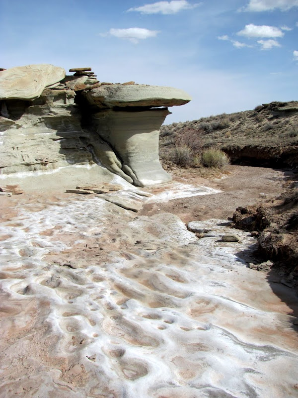
Curtis Formation domes
More Curtis Formation rocks
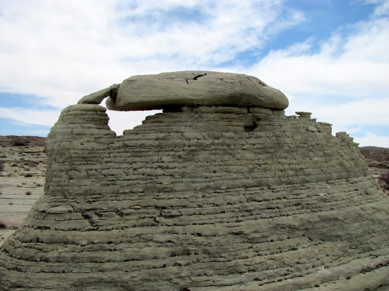
More Curtis Formation rocks
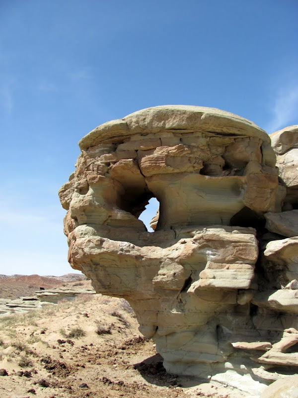
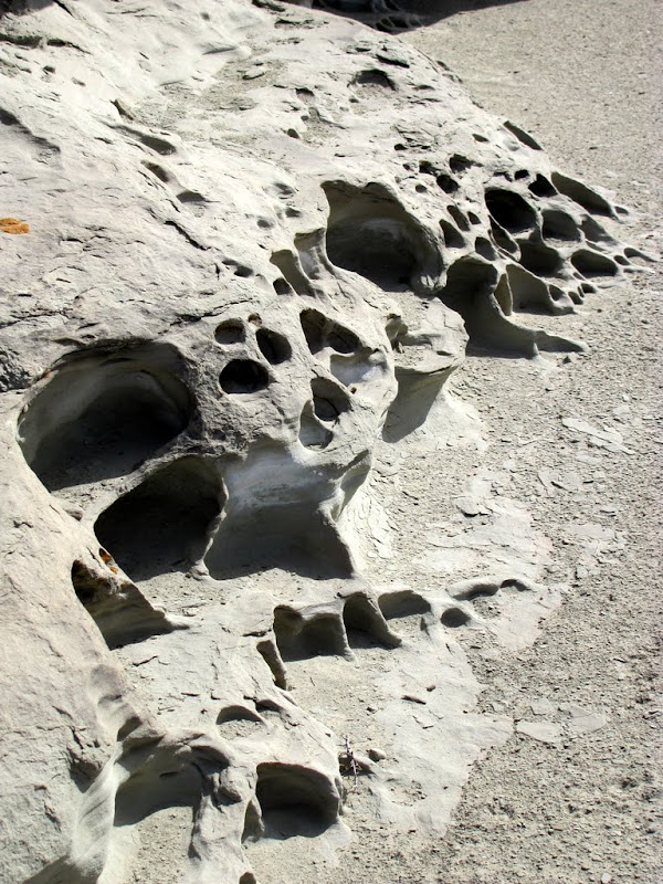
There were a lot of holes like this in the rocks

Yet another rock formation
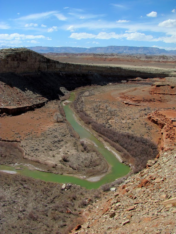
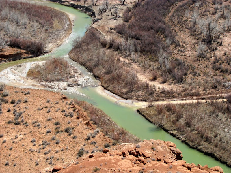
View of the San Rafael River after hiking around the canyon

Cactus

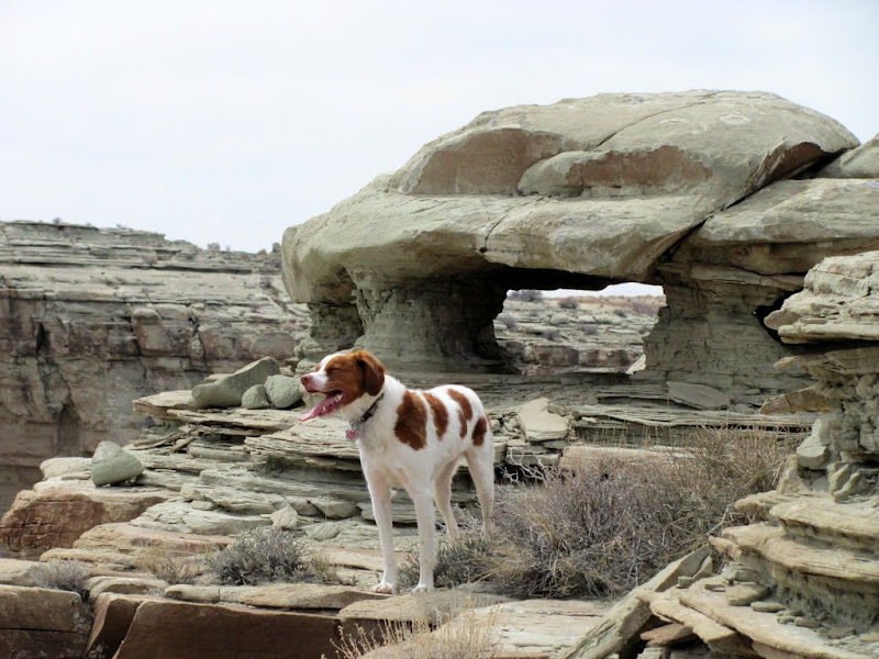
Torrey, my Brittany Spaniel
View from the point

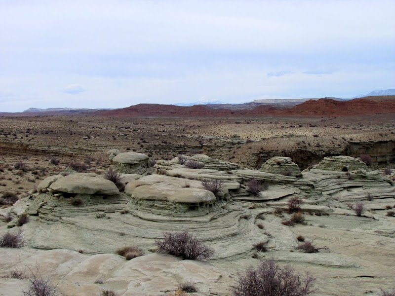
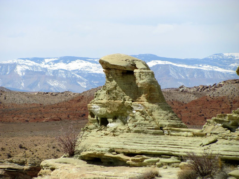
After visiting the second point/overlook, I headed away from the river once again to get around yet another deep canyon. This time I saw some incredible rock formations. This place really is a play land of interesting formations and places to explore. I could easily spend a couple of days just in this small area. Navigating around some of the ledges became more difficult as I approached the third overlook directly above Cat Canyon. The view from that overlook was the best of all three that I'd visited. I could see across Fuller Bottom to the beginning of the San Rafael River gorge where the Little Grand Canyon begins to form, and the view of the Red Ledges to the northeast was great as well.
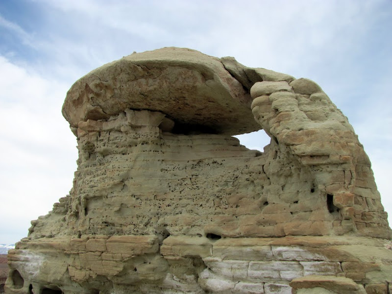
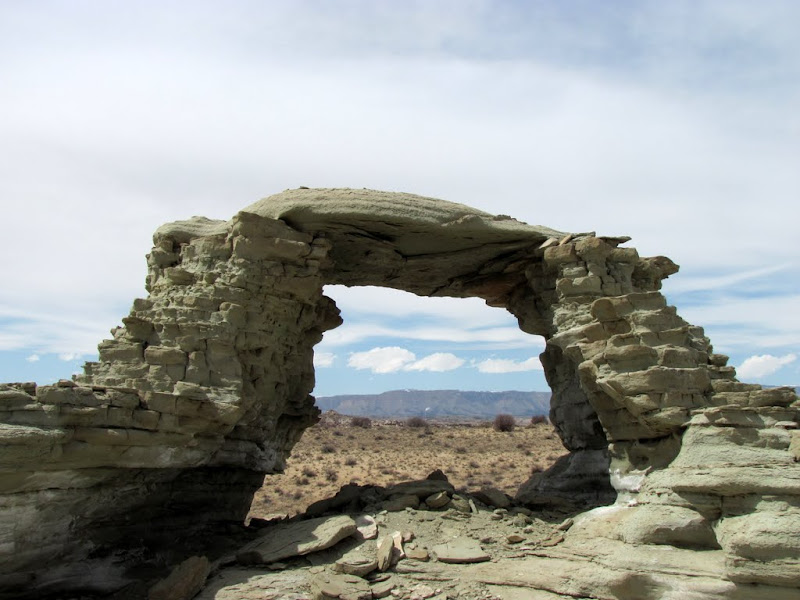
A very cool little arch

Reverse view of the arch
Another hole in another rock
View up the drainage I hiked

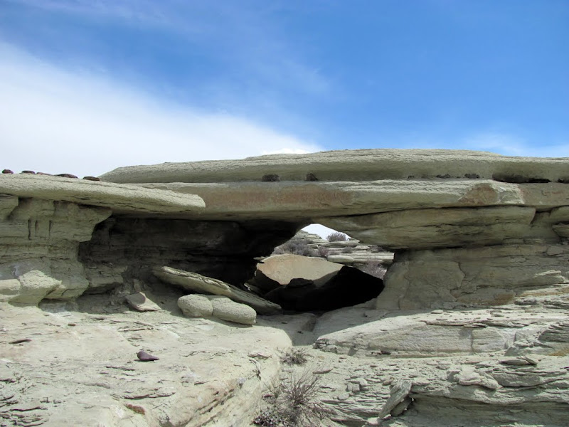
Yet another arch

Reverse view of the arch
Approaching the overlook

Getting even closer

View of the gorgeous green water of the San Rafael River
Red Wash meeting up with the San Rafael
The Red Ledges

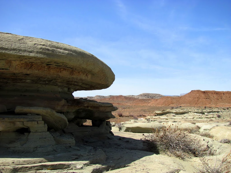
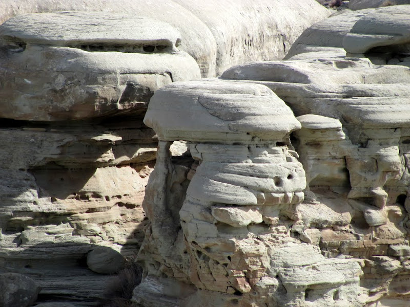
A massive Curtis Formation dome

And a little dome
Jabba
It never ends

It was such a cool place, I'm sure I'll be back to explore more.
There are quite a few more photos here:
http://picasaweb.google.com/Dennis.U...nyonOverlooks#
-
04-11-2010 02:43 PM # ADS
-
04-11-2010, 03:14 PM #2
Wow - that Curtis Formation stuff is incredibly cool. Beautiful stuff, great pics. About how long did you spend wandering around, about how much ground did you cover?

-
04-11-2010, 04:51 PM #3
Very awesome stuff - you seem to know your way around the swell! Would love to check this area out.
"Human beings were not meant to sit in little cubicles staring at computer screens all day, filling out useless forms and listening to eight different bosses drone on about mission statements"
Peter Gibbons - Office Space
-
04-11-2010, 05:50 PM #4
Man, way cool. The hits just kept on coming. The swell is really an amazing place.

Last edited by accadacca; 04-11-2010 at 06:58 PM.
-
04-11-2010, 06:24 PM #5
Wow and wow again. What a simply awesome place. So beautiful.
I love these Arches in your pics, but they look really fragile. I would love the see this unique place by myself.
-
04-11-2010, 07:10 PM #6I hiked 3.5 miles in about 3 hours, and took almost 300 photos.
 Originally Posted by Cirrus2000

The Curtis Formation is pretty awesome. It runs for about 40 miles roughly north to south on the western side of the Swell, and there's more on the east side too. Lots of interesting stuff out there to see. :)
-
04-12-2010, 06:58 AM #7
Nice pictures!
A few shots of the river make it kindof look like antifreeze.
-
04-12-2010, 08:09 AM #8
Very cool formations
-
04-13-2010, 02:44 PM #9
That dome formation is very cool. Thanks for posting.
Life is Good
-
04-20-2010, 11:53 AM #10
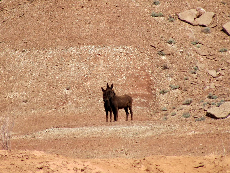
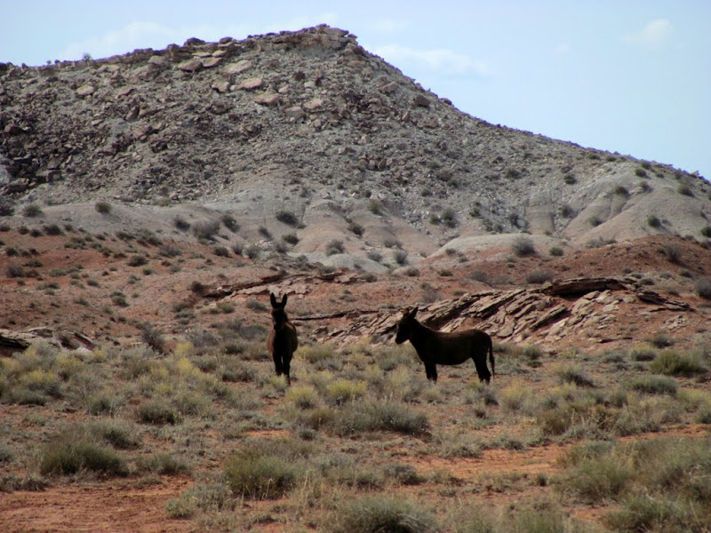
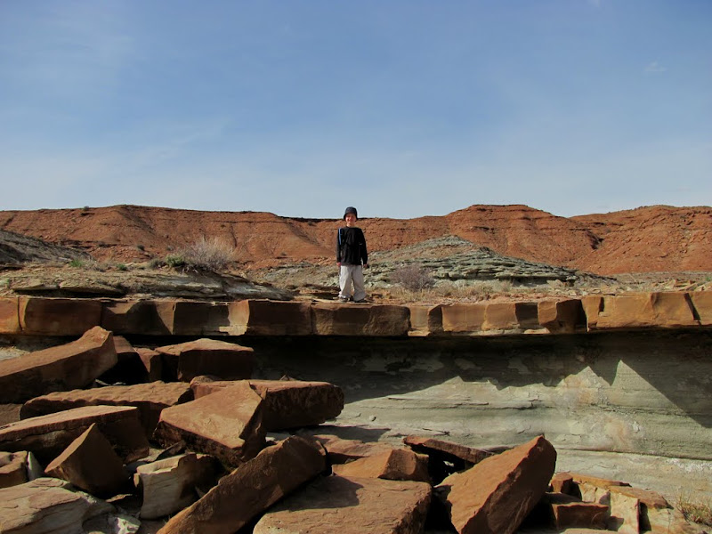
I returned to Sand Bench again this past weekend, this time south of the San Rafael River (between two and six miles south of the Cat Canyon overlooks). I pretty much just wandered around on my ATV looking for interesting-looking places to hike. On the way in I saw a pair of wild donkeys, which are probably the same ones that I'd seen three years ago in this same area and about this same time of year. I explored some rocks close to the road first, then rode along a rough and sandy trail 'til its end, then hiked about a mile to some more rocks visible in the distance.
Wild donkeys
A smallish arch
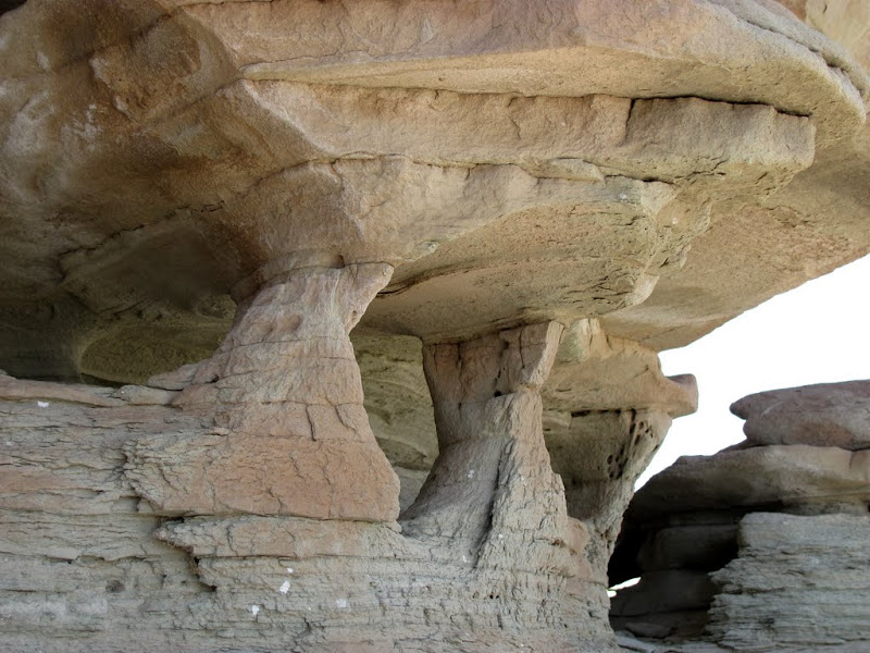
Small pillars of rock supporting a larger rock
Lots of holes in rocks out here
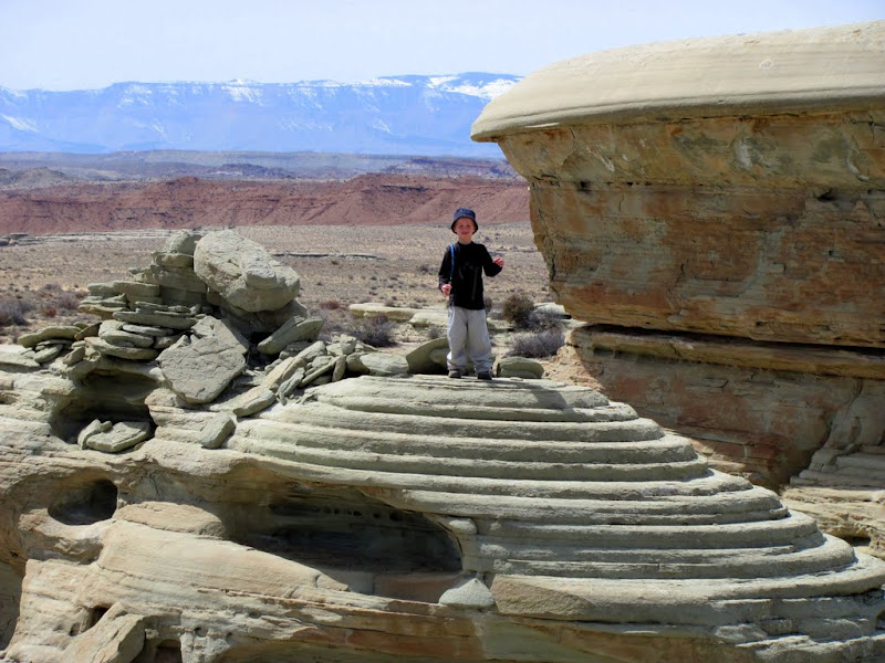
My son standing among more rocks

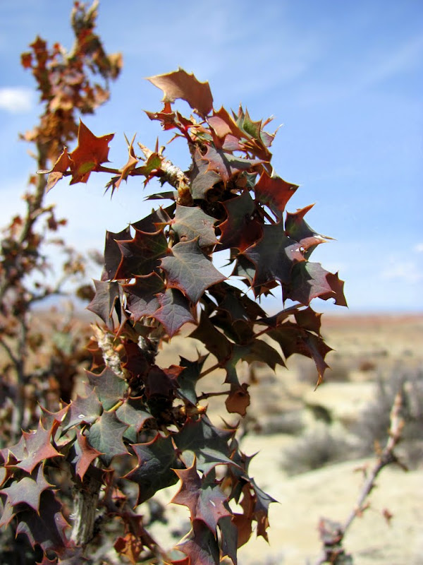
My favorite desert plant, Fremont's Mahonia
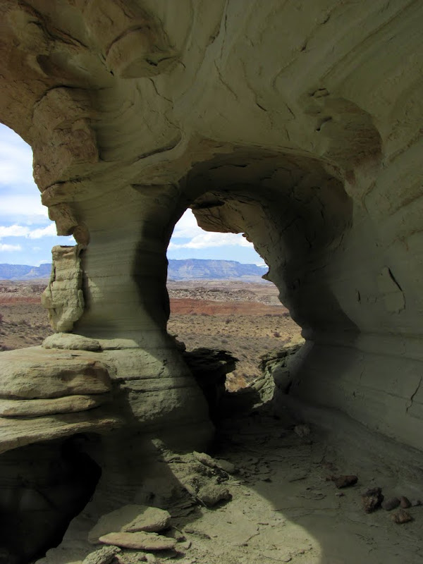
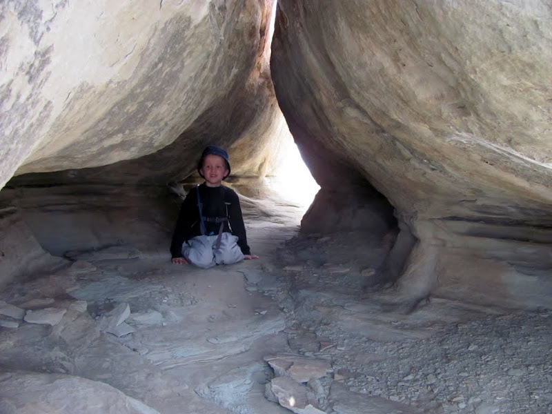
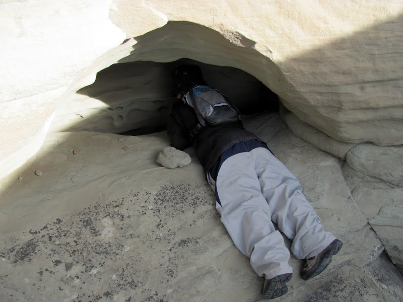
My son in a neat little tunnel
My dog and me in the tunnel

Playin' around

Another very cool arch

Playing on more rocks
Later in the afternoon I headed south back toward where the truck was parked, but along the way stopped again for a short hike through a wash that cut through the Curtis Formation. Along the way, the pair of wild donkeys was still near where they'd been in the morning.
Donkeys again
Entering the wash
An interesting wash bottom
A small arch
Tafoni
A hole with a deep crack at the bottom
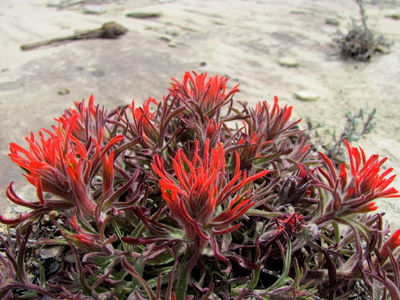
A lot of wildflowers were starting to bloom

Desert Paintbrush
There are a few more photos here:
http://picasaweb.google.com/Dennis.Udink/SandBench#


 Reply With Quote


Similar Threads
-
[Trip Report] Canyon Rims Overlooks
By IntrepidXJ in forum Offroad 4x4, Side by Side and ATVReplies: 5Last Post: 04-07-2009, 03:46 PM -
[Trip Report] Spanky - Escalante Early Weed Bench Area
By french_de in forum CanyoneeringReplies: 2Last Post: 04-28-2008, 08:11 PM -
wolverine bench, escalante
By goofball in forum CanyoneeringReplies: 0Last Post: 04-21-2008, 05:35 PM -
sand mountain
By desertrat222 in forum MotorcyclingReplies: 0Last Post: 02-13-2006, 08:26 PM -
[Trip Report] Sand dunes
By fourtycal in forum MotorcyclingReplies: 1Last Post: 11-27-2005, 03:53 PM
