

Results 1 to 20 of 24
Thread: Flightseeing out of Page AZ
-
02-06-2010, 07:21 PM #1
Flightseeing out of Page AZ
Does anyone have any recommendations for an outfit to arrange a morning of flightseeing out of Page AZ? I've found references to Westwind Aviation but their website only talks about instruction. I assume it would be cost prohibitive for someone to fly down from Canyonlands to do a tour from Page.
Ideally, I'd like to find someone with whom I could give a pre-mapped out flight plan. I have a Utahoniphile friend who is a pilot here in CA who would love to spend an evening helping me plot a path.
Hey denaliguide...wanna come down and get paid to fly over Escalante and Paria canyons on April 8th It is good that warriors such as we meet in the struggle of life... or death. It shall be life. - Ten Bears, "The Outlaw Josie Wales"
-
02-06-2010 07:21 PM # ADS
-
02-06-2010, 07:54 PM #2
wish i could help out, but i'm f;lying in new zealand right now.
try,
classic aviation 928-645-5356
american aviation 928-608-1060
if they don't do seat fares then i'm sure you can set up a hourly charter rate and they will fly you over whatever you want.
if you need any help with your flight plan let me know. i have done the same flight you describe several times when i was flying and instructing out of kingman.But if I agreed with you, we would both be wrong.
-
02-06-2010, 09:00 PM #3
Here's the helicopter outfits:
http://www.papillon.com/popris/show_...=61&lang=en-US
http://www.alllasvegastours.com/air-...FRTyDAodEybrIA
-
02-06-2010, 09:28 PM #4
Thanks guys, that was quick!
Les - how long do you think I should allow? I could do a loop w/Escalante, Paria, and maybe Death Hollow. Or I could go further north to swing past the Waterpocket Fold, maybe even Cataract Canyon & The Maze?
I'm also trying to gauge which spots will be best for viewing from the air. Something like Buckskin Gulch may be just too narrow to be very interesting from a plane, for example. Whereas I'm sure the Coyote Gulch/Escalante junction would be cool.
I did fly over this area a long time ago but we basically just followed the Colorado, once coming to Canyonlands Outpost from LA and once coming back to LA from Boulder CO again just following the river all the way back.It is good that warriors such as we meet in the struggle of life... or death. It shall be life. - Ten Bears, "The Outlaw Josie Wales"
-
02-07-2010, 12:04 AM #5
I've spent plenty of time in a helicopter since I was young and they are excellent for some close-up touring. If you're looking for good pics, it's heli all the way. The most beautiful vistas I've ever witnessed were courtesy of helicopter rides from my Dad.
Planes are still really fun though.Lost On A Hill
Utah Water Log
-
02-07-2010, 08:22 AM #6
Re: Flightseeing out of Page AZ
When were you planning this trip, I am going to get current in the next month or so and would be willing to take you out of St George for half the rental. Originally Posted by ststephen
IF YOU WON'T STAND BEHIND OUR TROOPS, PLEASE, FEEL FREE TO STAND IN FRONT OF THEM!!!!
Originally Posted by ststephen
IF YOU WON'T STAND BEHIND OUR TROOPS, PLEASE, FEEL FREE TO STAND IN FRONT OF THEM!!!!
2008 V2K Classic LT
2004 Toyota Tacoma
Schwinn Homegrown
CouchSurfing
Patriot Guard Riders
-
02-07-2010, 03:13 PM #7Zions the "s" is silent

- Join Date
- Nov 2007
- Location
- indoors wanting to be outdoors
- Posts
- 3,216
I've heard of a groups out of Kanab that does flightseeing. But I'd take up the previous offer.
-
02-07-2010, 08:38 PM #8
Thanks for the suggestions and offers. As to helicopter vs. plane I wonder if the range of the flight is similar with the two? Anyway, I think I'll call around and get some ideas. It's just been too long (decades) since I've seen this wonderful country close up from the air!
Pelon1 - I'm not sure if doing this out of St. George works with the rest of my itinerary, but I'll consider it. I'm very constrained on time for this trip because my son is on a school trip and I need to return home when his trip ends.It is good that warriors such as we meet in the struggle of life... or death. It shall be life. - Ten Bears, "The Outlaw Josie Wales"
-
02-07-2010, 09:41 PM #9
Got nothin' to add, but very amused that when viewing this topic, the ad that came up at the bottom is recruitment for the company I work for...
:

Hope you have a great flight, whatever you end up doing!
-
02-08-2010, 03:46 AM #10That's cool Kev. Are they similar to Serco? Originally Posted by Cirrus2000
-
02-08-2010, 05:56 AM #11No, it's actually our national Air Traffic Services provider. Used to be part of the government until 1996. Imagine if all the controllers & towers, flight service specialists & stations, technicians & navaids broke off from the FAA - that's us, but broken away from the Aviation division of Transport Canada. Now TC is the regulator, but our not-for-profit non-share capital corporation provides the service, and charges fees to the users (mostly the airlines) for funding. http://en.wikipedia.org/wiki/Nav_Canada Originally Posted by bbennett
-
02-08-2010, 06:06 PM #12
from page i would think 2 hours would give you plenty to see buckskin, escalante, and even a look at rainbow bridge. if you want to seee the maze as well then i would add another 1 1/2 hour at least.
you could go out of moab and see the maze, escalante, dark canyon and the needles in probably 3 hours. won't see buckskin gulch on that flight however. i agree that you won't see much in buckskin anyway. escalante however is awesome from the air.
i think it's redtail aviation in moab. clint mcbeth is the guy you want to talk to. he could give you a better estimate of times required from moab.But if I agreed with you, we would both be wrong.
-
02-15-2010, 12:49 PM #13
Just an update if anyone was interested:
Classic Aviation only does heli tours. Wow, the prices for helicopters are much higher than planes. They quoted me $1750/hr. Think I'll be passing up on that one!
American Aviation doesn't currently have the ability to offer anything other than a little flight out-and-back over Lake Powell. But they said they are working to change that and hoped to be able to offer me something by April. Their prices were in the range of $175-$350/hr. They also said if their license wouldn't allow them to offer a tour they would be able to refer me to some other folks.It is good that warriors such as we meet in the struggle of life... or death. It shall be life. - Ten Bears, "The Outlaw Josie Wales"
-
04-08-2010, 07:22 PM #14
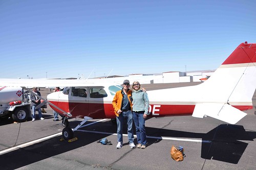
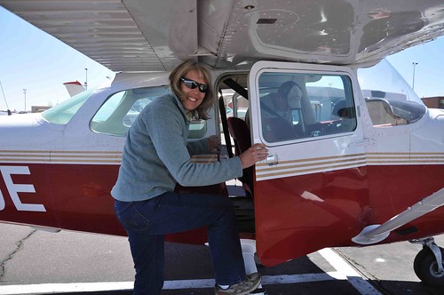
Just a quick update. I flew with American Aviation today. It was great! The pilot they had slotted to go with me, and who knew the area well, couldn't make it. The replacement was not as savvy on the terrain but I was able to figure out where everything I wanted to see was. We did a 2.3 hour loop heading up the Paria, following Buckskin then up north along the Cockscomb and Cottonwood roads to Kodachrome Basin. From there we hoped over to Escalante and followed the whole length of the river back to the lake and Page. Saw Stevens Arch and Rainbow bridge on the way back. I'll get my pics organized and up for all to see soon.
What a great way to end a trip!It is good that warriors such as we meet in the struggle of life... or death. It shall be life. - Ten Bears, "The Outlaw Josie Wales"
-
04-18-2010, 09:33 PM #15
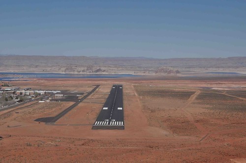
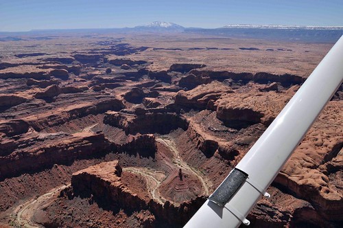
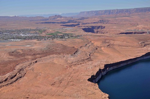
Finally getting a little report and some pictures up from our trip.
Here's the airstrip alongside the town of Page
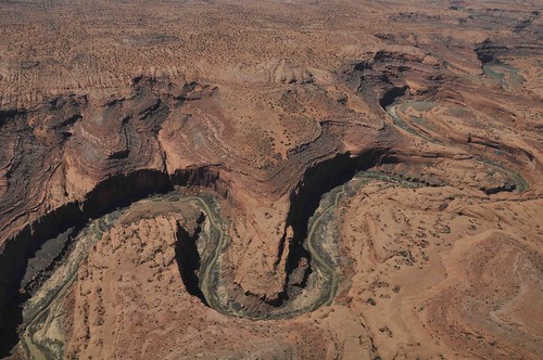
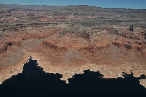
After takeoff the pilot was headed Northeast sort of towards Lone Rock. I wasn't sure if he was following some type of air traffic instructions but finally I said, "The Paria Canyon is over that way, isn't it?" pointing left. He had forgotten that I wanted to go there first but no worries we turned and headed that way. In a way it was cooler because now we entered the canyon by flying over the edge of the high walls of Navajo sandstone and suddenly the canyon and river were below us:
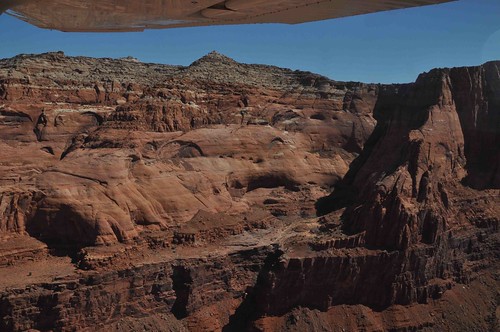
Here's the lower part of the river as it winds through colorful Chinle "dunes":
Here's a mid-part where the Chinle is gone but you can see Kayenta and Moenave:
[IMG]http://farm3.static.flickr.com/2154/4513984326_68b4068c19.jpg
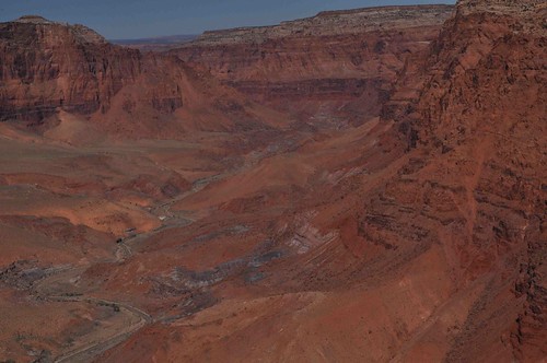
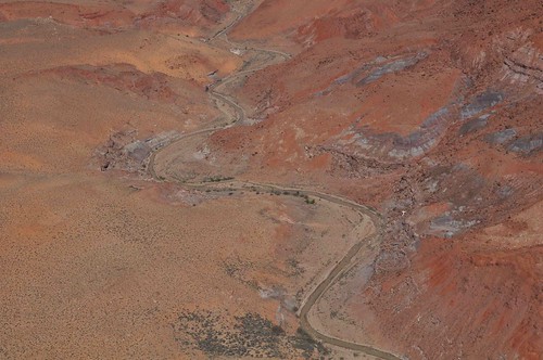
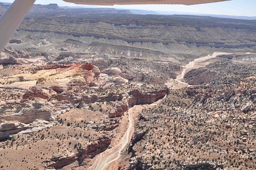
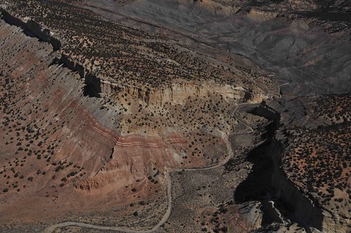
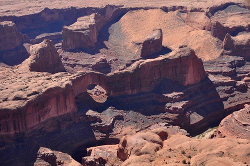
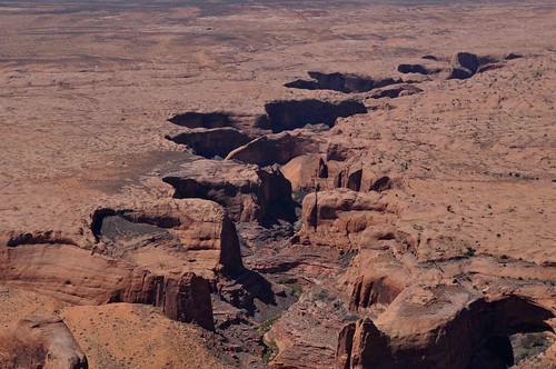
Here are some views of the upper narrows section of the Paria, but below Buckskin:
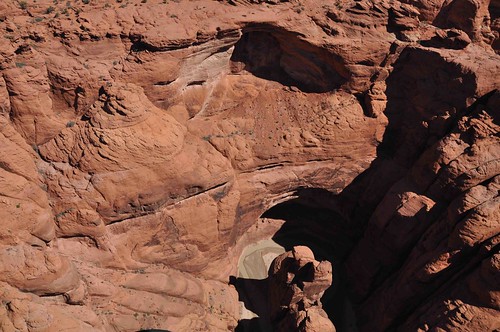
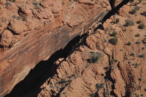
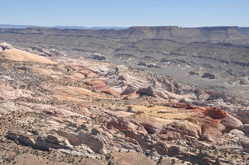
As it started to get more narrow and less deep I was sure that we must have passed the Buckskin entrance. I wanted to head over towards the Cockscomb, where you turn off for Wire Pass from Hwy 89 so I told the pilot to head left. To my surprise I soon realized I had perfectly turned and we were now following Buckskin. Of course you can't see much in it, but it's clear this is it:
Next we followed the Cockscomb and Cottonwood road north. If anyone is interested I found this great article on the geology of the Cockscomb.
I'll spare you all the detailed geology lesson, but here's a diagram of what's going on here:

And the real deal:

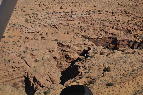
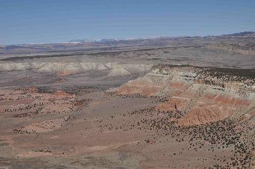
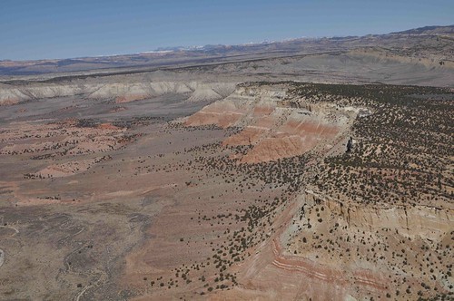
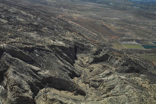
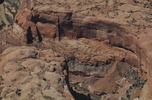
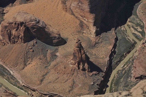
There looks to be some interesting canyons on the east side of Cottonwood road. I want to study some maps and try to figure out exactly where they are:
 It is good that warriors such as we meet in the struggle of life... or death. It shall be life. - Ten Bears, "The Outlaw Josie Wales"
-
04-18-2010, 09:52 PM #16
Next we headed further east to checkout Kodachrome Basin:
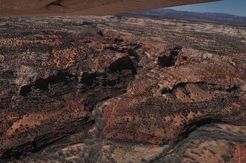
Then we had a bit of less photographic section where we headed northwest to the town of Escalante. Here is the edge of the town and the river entering the canyon just past town:
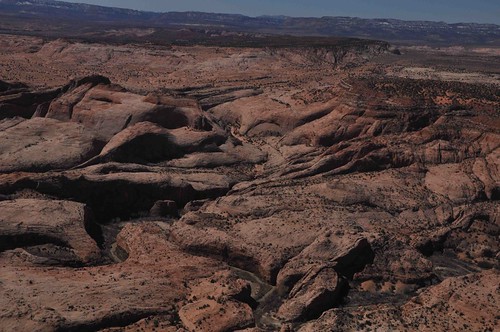
Now the upper part of the Escalante River:

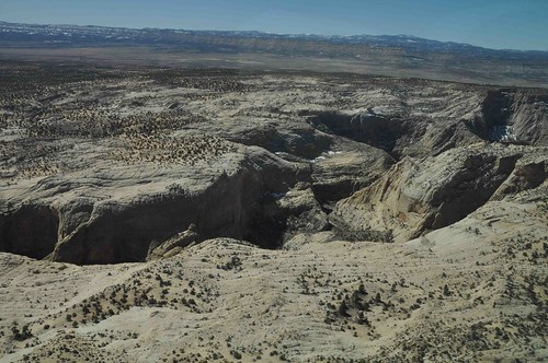
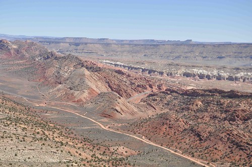
I missed seeing where Hwy 12 cuts across the road. Earlier I had hoped to extend this flight and go up to Calf Creek, Burr Trail and even the Waterpocket Fold but we just didn't have enough time for all that. There's always the next trip! Instead we just followed the Escalante the whole way down:

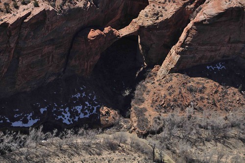

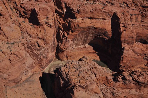
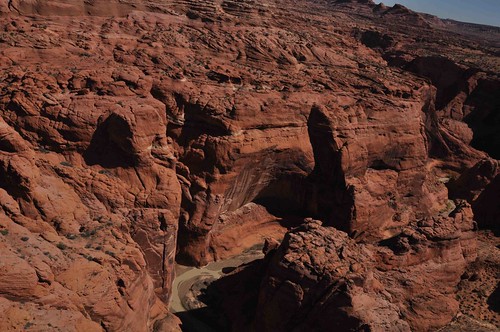
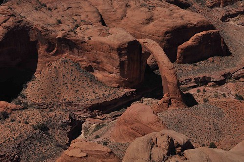
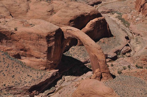
I'm sure you all recognize this arch. Come to think of it, I don't know what "Stevens" it is named after. Anyone know? Unfortunately, the light was wrong for it. Perhaps I should have had the pilot circle it, but I was getting antsy about having enough time to drive to Vegas for our flight back to SFO.
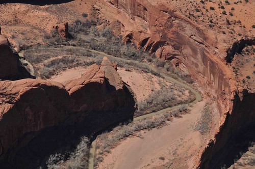
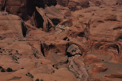
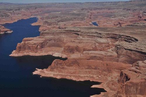
Looking up Coyote Gulch:
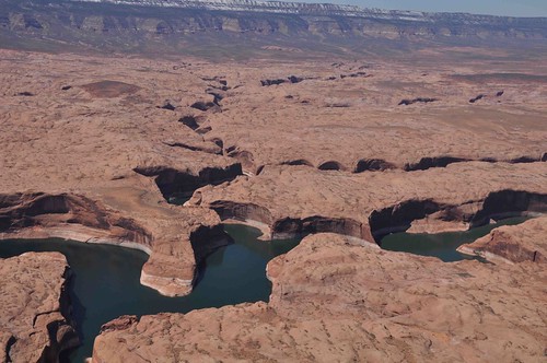
Now the lower part of the river; almost to the lake now:
 It is good that warriors such as we meet in the struggle of life... or death. It shall be life. - Ten Bears, "The Outlaw Josie Wales"
-
Post Thanks / Like - 1 Likes
 rich67 liked this post
-
04-18-2010, 10:05 PM #17
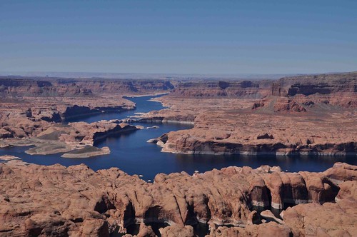
Now we were at the lake. It goes on for a long, long way. Robin was so surprised at the length of it that she asked me "what lake is this?" thinking it couldn't be the same lake near Page as it was so far.

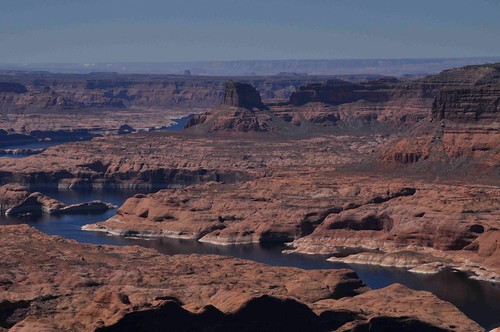
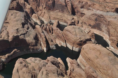
Had to find Rainbow Bridge of course. I've seen it twice now but both times like this. Someday I've got to see it from the ground:
Then it was just a little more deep blue lake shots. As much as a wish I could still experience Glen Canyon as it was before the lake, I have to say the lake sure is pretty.
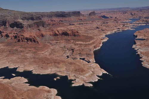
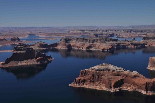
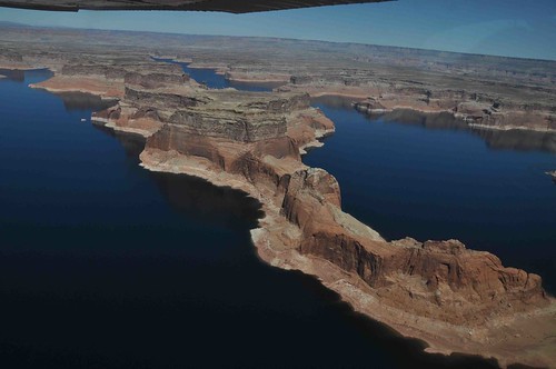
All too soon it was over and the town was back in view:
All in all a very memorable and fun experience. If I can swing it I'll try to incorporate some flying into more of my trips to the Colorado Plateau. It really brings the whole place into perspective when you can see it this way, don't you think?It is good that warriors such as we meet in the struggle of life... or death. It shall be life. - Ten Bears, "The Outlaw Josie Wales"
-
04-18-2010, 11:02 PM #18
Wow, that really is incredible! I'd love to experience it that way some time. One of these days...
Thanks a lot for posting these, Paul! Lots of the shots: Paria, Buckskin, Coyote Gulch, Stevens Arch (and the sand slog & Crack in the Wall) - places I've seen and loved from the ground. Such a different perspective...
Did I see a bit of Yellow Rock here? Doesn't seem massive enough:
Some of the arches and canyons are truly amazing from above.
Thanks again - pretty sweet!
-
Post Thanks / Like - 1 Likes
rich67 liked this post
-
04-18-2010, 11:32 PM #19
very nice! the view from the air really ties everything together so well. glad you had a good flight.
But if I agreed with you, we would both be wrong.
-
04-18-2010, 11:40 PM #20


 Reply With Quote


Similar Threads
-
What's Your Home Page?
By tallsteve in forum General DiscussionReplies: 16Last Post: 12-31-2009, 08:19 AM -
My new artifact page.
By coinslab in forum General DiscussionReplies: 0Last Post: 05-30-2009, 08:57 PM -
USA-All front page comment
By Scott P in forum Environmental IssuesReplies: 21Last Post: 04-07-2009, 02:20 PM -
From Moab to Page and beyond
By Hatchcanyon in forum Offroad 4x4, Side by Side and ATVReplies: 14Last Post: 03-28-2009, 01:10 AM -
New NWS Flash Flood Page
By stefan in forum Backpacking & CampingReplies: 0Last Post: 08-16-2007, 03:47 PM
