

Results 21 to 40 of 47
Thread: Southern Utah Wanderings
-
10-16-2009, 10:48 PM #21Yes I did
 Originally Posted by offpiste
-
10-16-2009 10:48 PM # ADS
-
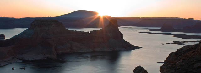
10-18-2009, 08:20 PM #22
Day 4 | Tuesday, October 6, 2009 | Starting Odometer: 144260
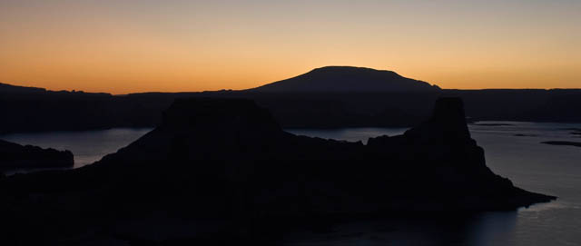
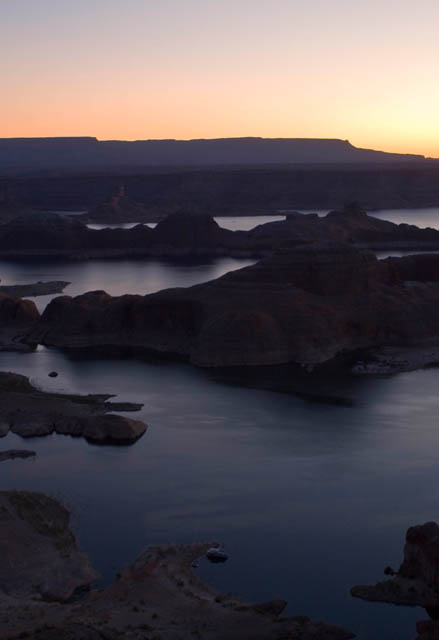
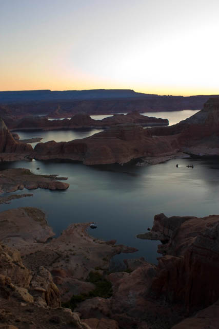
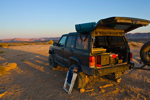
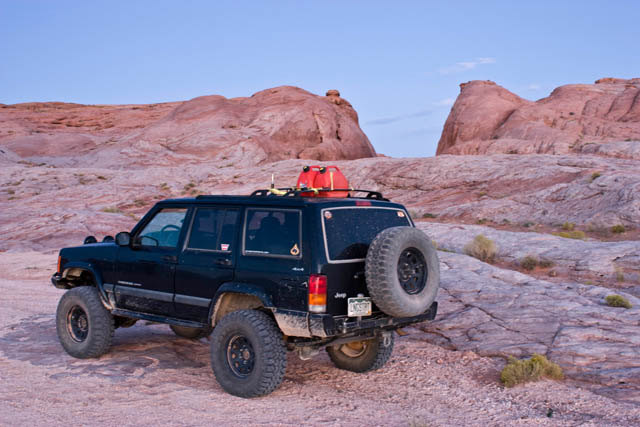
It was a great start to a day. The wind had finally died down overnight and I woke up to a great sunrise over Lake Powell from Alstrom Point. Since it was my mom's birthday and I had full signal up there, I gave her a call to wish her a happy birthday. I took some photos before packing up the Jeep and heading back to Big Water from some more gas.
Packing up
-
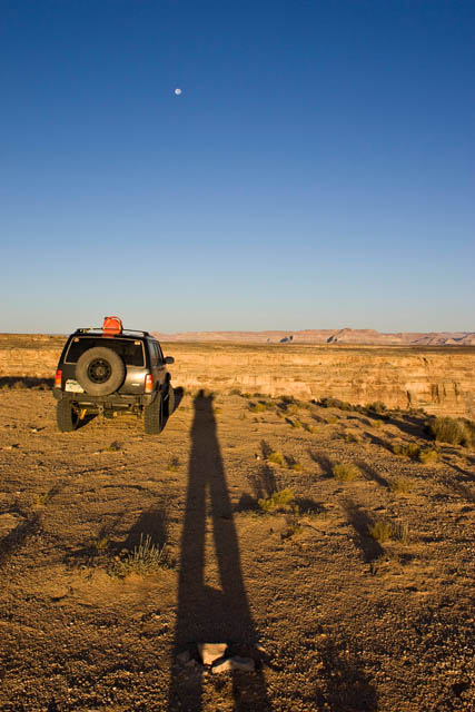
10-18-2009, 08:20 PM #23
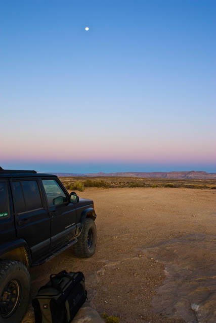
The Moon
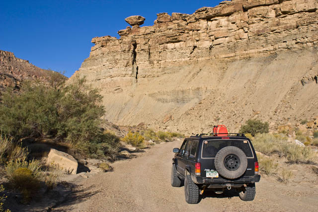
Instead of taking the route I came by, I decided to check out the Tibbet Canyon and Nipple Creek trails which formed a loop off off the Smoky Mountain Road not too far from Alstrom Point.
Tibbet Canyon

-
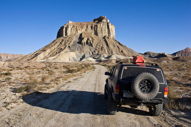
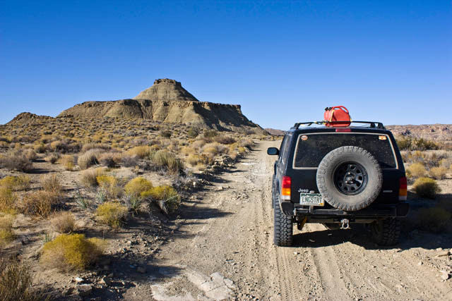
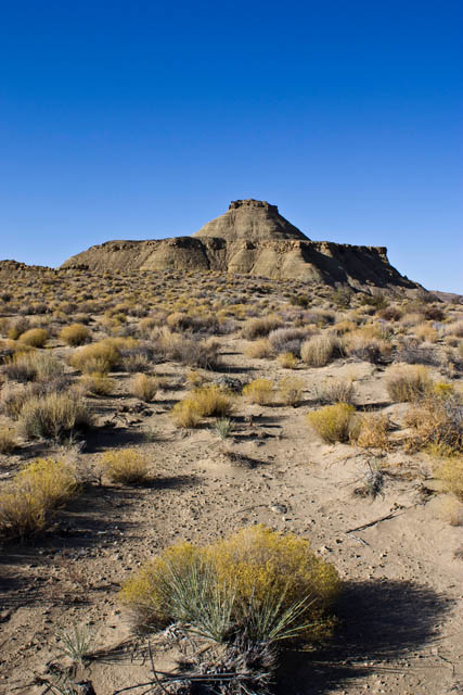
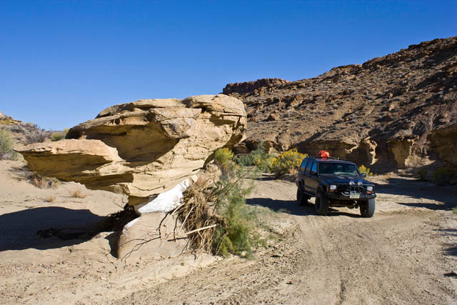
10-18-2009, 08:20 PM #24
Nipple Butte
Mushroom Shaped Rock along Nipple Creek
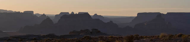
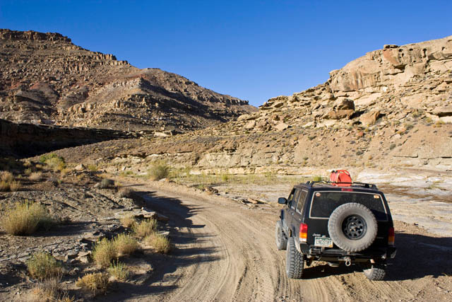
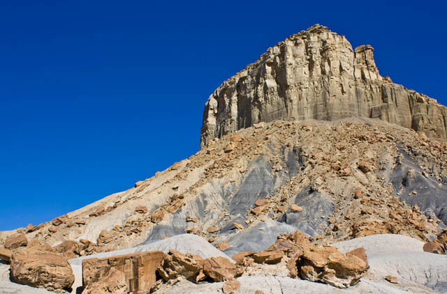
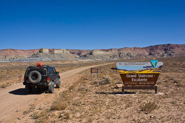
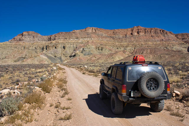
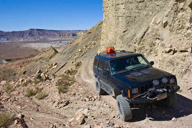
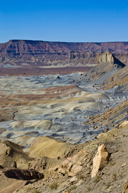
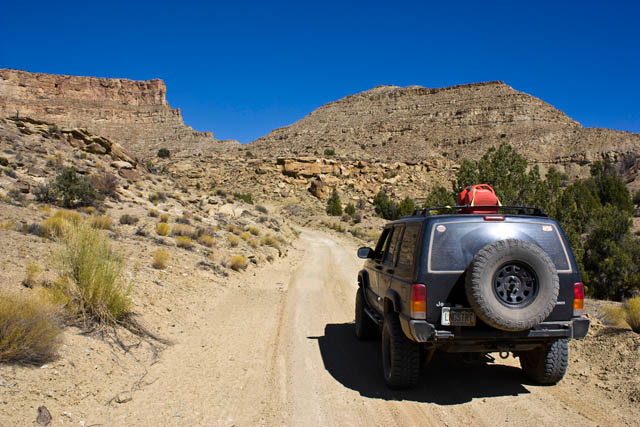
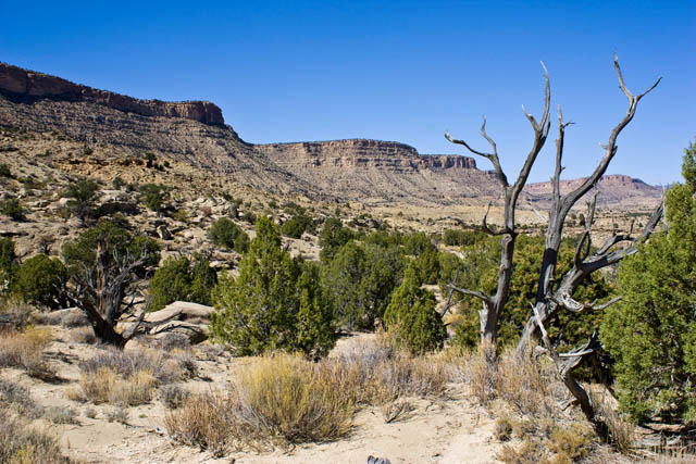
After completing the loop, I headed up the long and dusty Smoky Mountain Road over the desolate Kaiparowits Plateau to Escalante. While the scenery along this road was nice....the highlight of the road was the climb up Kelly Grade.
Along the Smoky Mountain Road in the Glen Canyon NRA
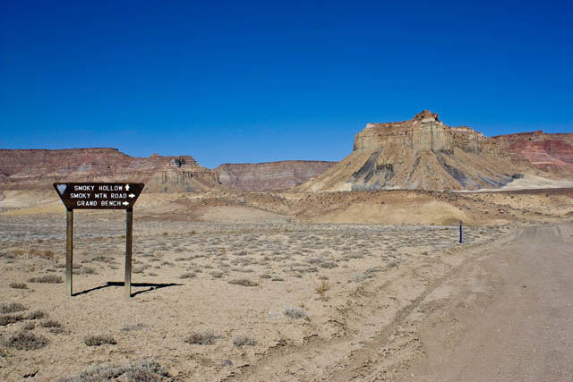
Back into the GSENM
-
10-18-2009, 08:21 PM #25
Headed towards the Kelly Grade
Climbing the Kelly Grade
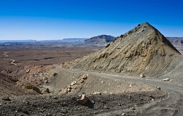
Surrounded by great colors!
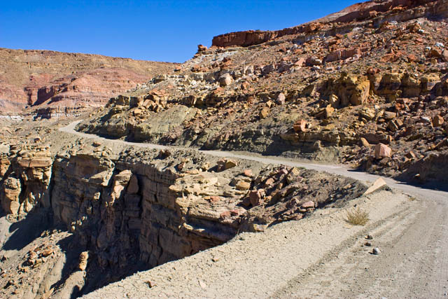
Overlook at the top of the Kelly Grade
-
10-18-2009, 08:21 PM #26
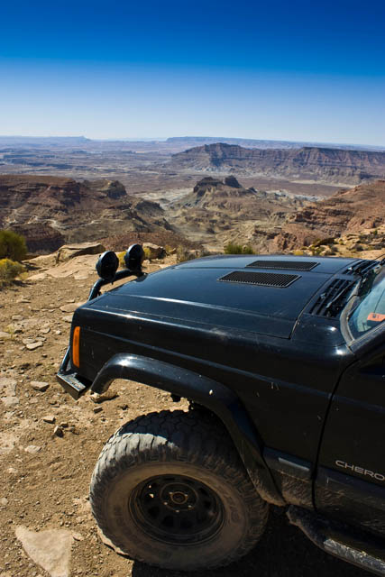
Further along the Smoky Mountain Road after some high speed driving across the top ;)
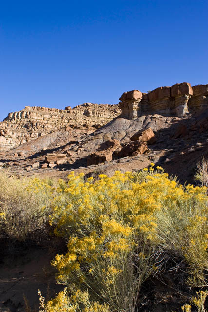
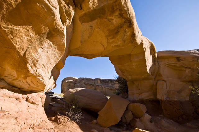
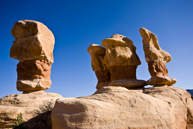
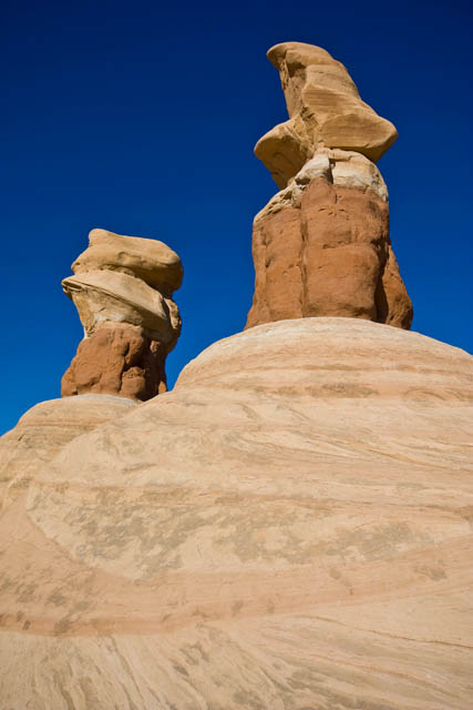
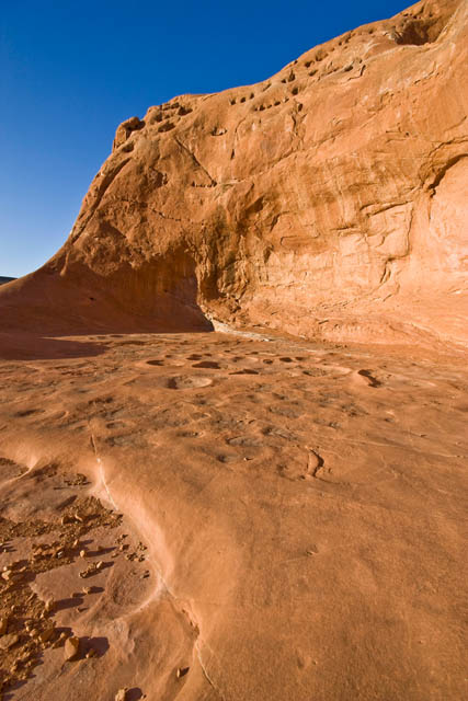
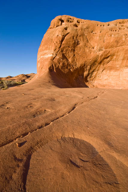
I made it to Escalante for a late lunch at the Golden Loop Cafe to decide where I would head that evening. I ended up deciding to take the Hole in the Rock Road east of town until it got dark and that's where I would setup camp. Along the way I stopped at the Devil's Garden to explore and took a bunch of photos. It reminded me of a smaller Goblin Valley with bigger and more spread out goblins.
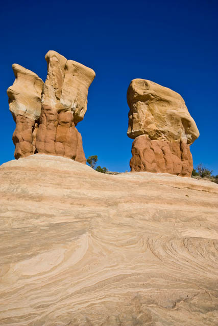
Metate Arch
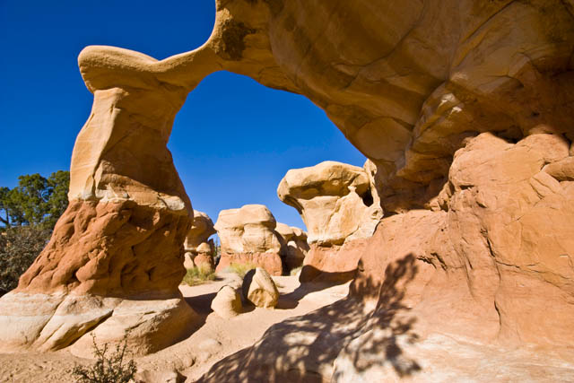
Mano Arch
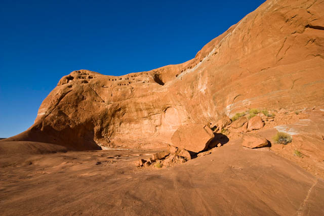
Further along I reached Dance Hall Rock as the sun was getting low in the sky. Made for some good photos.
Dance Hall Rock
-
10-18-2009, 08:21 PM #27
Long shadows
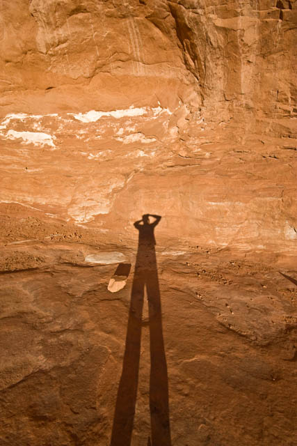

In the end, I actually ended up reaching the Hole in the Rock just after sunset while there was still a little light left. Looks like I would be camping at the end of the trail near Lake Powell again.
Hole in the Rock, just after sunset

My campsite for the night
Ending Odometer: 144445 | Total Miles: 185
-
10-19-2009, 08:44 AM #28Zions the "s" is silent

- Join Date
- Nov 2007
- Location
- indoors wanting to be outdoors
- Posts
- 3,216
X2 This thread if full of win! Originally Posted by accadacca
Every image should be in the image bar and this should be the featured trip report.

-
10-19-2009, 09:16 PM #29
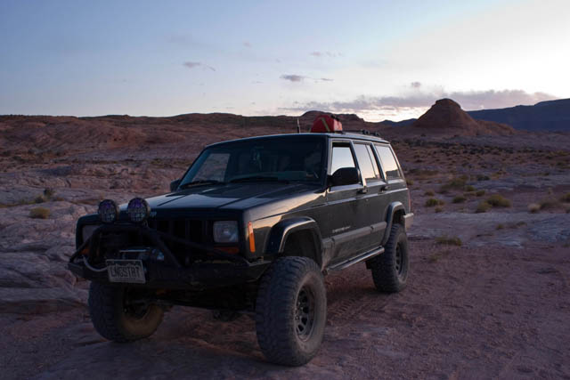
Day 5 | Wednesday, October 7, 2009 | Starting Odometer: 144445

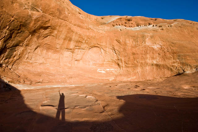
Since it was getting dark pretty quickly when I arrived at the Hole in the Rock the evening before, I didn't really get any good photos. When I woke up today, I grabbed my camera and started shooting away :) I was up before sunrise and hung out for a little while until the sun was up in the sky...well, actually behind some clouds.
Storm rolling through in the distance

Sun coming up behind some clouds over the Hole in the Rock


After taking a bunch of photos I was back on my way back to Escalante.
These markers marked the actual Mormon (Hole in the Rock) Trail. There was a rainbow in the distance when I shot this one.


Old wagon tracks carved into the slickrock

-
10-19-2009, 09:16 PM #30
I stopped at this water carved wash for some more photos

Still a bit away from Escalante


I was originally planning on heading back the way I came, but when I reached the turnoff for Left Hand Collet, I decided to give it a try. When I was at the Visitor's Center a few days earlier, I had inquired about the condition of Left Hand Collet (it is known to wash out frequently) and was informed by the ranger that it was washed out and impassible. I don't always take the ranger's word on road conditions, since it appears to me that their main goal is to keep as many people off of the difficult roads as possible (Though, I can fully understand why they would do that, too). I knew full well there might be a chance I would not make it through and would have to turn around and come back the same way, but that was a chance I was willing to take.


-
10-19-2009, 09:16 PM #31

It turns out that even though there were signs at both ends of Left Hand Collet warning that it is currently impassible, I found out that it is just not the case. While I certainly would not take a stock SUV through this trail because it is a bit rough, any Jeep or modified SUV would have no problems with it. I never even needed to put my Jeep in 4WD to get through it. I'm glad I ended up trying this route, because the scenery was great. I evenutally found myself back at the Smoky Mountain Road again, and continued on to Escalante again.
Yeah right....

When i finally reached Escalante, I continued north until I was in Boulder again where I stopped at the Burr Trail Grill for lunch. The burger I had there was outstanding, and I would highly recommend it. The Burr Trail Grill is located on the corner of UT 12 and the Burr Trail, which was my next road to follow. Even though this road was paved much of the way, the scenery along the way was pretty nice as well...especially the stretch through Long Canyon.

To get off the pavement for a while, I took the Wolverine Loop trail. This was a quick and easy loop.


When I reached the Wolverine hiking trail, I took a break from the Jeep and hiked a ways into the wilderness to check out an old petrified forest. There were also some narrows nearby that I want to head back an explore with Amanda sometime.
Large piece of petrified wood


-
10-19-2009, 09:16 PM #32
Soon I was back the the Burr Trail which finally entered Capitol Reef National Park where it turned to gravel.
Views of the Henry Mountains and Waterpocket Fold as I entered Capitol Reef National Park again.

Another of the highlights of this entire trip was the short spur trail that lead into Upper Muley Canyon. Not only was it a very cool canyon, there were also a number of arches along the way, and the hike to the Strike Valley Overlook at the end gave me great views of the Waterpocket Fold. I took a bunch of photos along this short 3 mile trail....

Plenty of views of Peekaboo Arch as you enter Upper Muley Twist


Double Arch

-
10-19-2009, 09:17 PM #33
Cherrios Double Arch

View of the Waterpocket Fold from the Strike Valley Overlook


Back on the Burr Trail I quickly descended the switchbacks (the actual Burr Trail) and finished up by following the trail to Bullfrog. I headed north on 279 to 95 again and made my way to Hanksville, where I would spend the night at the campground and finally get a real shower ;)
Burr trail switchbacks (hard to see as this side of monocline was already in the shade)


Ending odometer reading: 144703 | Total Miles: 258
-
10-20-2009, 07:45 PM #34
Day 6 | Thursday, October 8, 2009 | Starting Odometer: 144703

This was an indecisive day for me. My original plan was to head back to Bullfrog and take the ferry across Lake Powell. However, I did not feel like going that far out of my way, and I also knew Amanda would probably like to join me for a ferry trip sometime in the future, so I decided to skip it. That left me with a big empty gap in my day. What would I do? I had always wanted to check out the Flint Trail and the Maze District of Canyonlands National Park, and I wasn't that far from there.... So it was decided, I would take the Hans Flat Road to the ranger station and then descend the Flint Trail and make my way to Hite. This would give me a good overview of the Maze area so I could plan a future trip there with Amanda.
I was on the road before sunrise, as the distance between UT24 and Hite via the backroads was 107 miles and I had heard it was a rough ride that would take all day. After filling up at the Hollow Mountain Gas Station in Hanksville, I headed north and turned off on the Hans Flat Road just short of the Goblin Valley turnoff. This was a wide gravel road that was fun to drive on at some higher speeds. I was at the Hans Flat Ranger station in just under 1.5 hours.....about 42 miles of dirt roads. I was making great time so far. I stopped at the ranger station and had a nice chat with the ranger to gather some information to help me plan a future trip (hopefully in the spring) to the area.
Long way to Hite

Sun coming up over Little Flat Top


After leaving the ranger station, I travelled across the top of the Orange Cliffs on my way to the Flint Trail switchbacks. I made my way down the switchbacks, where I found their steepness and narrowness had been greatly exaderated, and continued on the long dirt roads towards Hite. There was some great scenery along this trail.
Orange Cliffs

-
10-20-2009, 07:45 PM #35
View down on the Flint Trail switchbacks


Leaving the Orange Cliffs behind

Headed back towards the Henry Mountains


-
10-20-2009, 07:46 PM #36
Cool thin wall between Rock Canyon and Andy Miller Flats


When I reached Hite, I stopped to fuel up before continuing east on UT95. It was getting close to lunchtime and I wanted to find a spot along Lake Powell to stop for lunch. Luckliy I passed the turnoff for Blue Notch Canyon which would take me to the shore of Lake Powell for lunch. Blue Notch Canyon also offfered some nice scenery along the way, too.


Lake Powell visible in the distance....looks a lot closer than it is....

I liked the way the clouds looked here

Getting closer...

-
10-20-2009, 07:46 PM #37
...and I'm there!


After lunch I headed back to the highway and headed east again. I turned off at the entrance to Natural Bridges National Monument, but that wasn't my destination this time. I would follow a gravel road through the Bears Ears and onto South Elk Ridge which would take me to Blanding off of the pavement.
Castle Butte


By the time I reached Blanding I was was hungry and tired again. I was planning on heading back to my favorite campsite in Comb Wash for the night, but I was not feeling like camping at that point, so I ended up getting a hotel room for the night in town.
Ending odometer reading: 144942 | Total Miles: 239
-
10-21-2009, 09:24 PM #38
Day 7 | Friday, October 9, 2009 | Starting Odometer: 144942

This wasn't intended to be the final day of my trip, but that's the way it ended. By the end of the day I was tired and wanted to just relax for the final weekend of my vacation. I had entertained the thought of getting a hotel room in Moab and having Amanda join me, but since I was so close to home and didn't want to spend the money on a hotel room for the weekend, I decided it would be best to just head home for the weekend.
I started out this morning be heading up Cottonwood Wash into the Abajo Mountains (Blue Mountains). After a short jaunt on the Blue Mountains Road and over to Cottonwood Canyon Road. I was going to head down into Beef Basin this morning, which was a trip I had originally planned for in the spring that was rained out for me. I had a good time exploring the ruins in Beef Basin and Ruin Park. There were a number of side trails and spurs that I did not take, as I would like to spend a lot more time in Beef Basin with Amanda in the future so we can thouroughly explore the area. Sounds like a good spring weekend trip, as long as it doesn't get rained out again ;)

Headed down into Beef Basin


Orange Cliffs and the Henry Mountains in the distance....it felt like I was by them the day before....

The first ruins I came across in Ruin Park

The moon above

-
10-21-2009, 09:24 PM #39


The next small ruin I came across was a little odd, as it was just out in the middle of a large open area

Next I made my way to Farm House Ruin


This tower is half on the ground....I like how you can see where it fell from


-
10-21-2009, 09:25 PM #40
After leaving Beef Basin I was back on the Cottonwood Canyon Road again. There was a fire on the mesa ahead of me that I got to watch throughout the rest of the day.


I followed a bumpy but short road to an overlook of the Big Pocket from Cathedral Point.

Next I finished up the Cottonwood Canyon Road and was back at UT 211.
Closer to the fire


My original plan was to fuel up at the Needles Outpost and head up Lockhart Basin on my way to Moab. When I reached the gas pump at Needles Outpost, I was suprised to find that gas was $5 per gallon. I was not about to pay that much for fuel, and it was at this point I decided I would not be heading up Lockhart Basin this trip.


 Reply With Quote

Similar Threads
-
How Southern Utah Works
By oldno7 in forum CanyoneeringReplies: 30Last Post: 07-27-2010, 05:51 PM -
How well do you know Southern Utah?
By oldno7 in forum Hiking, Scrambling & Peak BaggingReplies: 29Last Post: 04-06-2010, 05:48 PM -
How well do you know Southern Utah? II
By Win in forum Hiking, Scrambling & Peak BaggingReplies: 12Last Post: 04-07-2008, 05:08 PM -
southern utah
By stefan in forum CanyoneeringReplies: 26Last Post: 08-05-2007, 11:07 AM -
Need a little help with my Southern Utah trip
By Mtnbiker in forum General DiscussionReplies: 9Last Post: 10-06-2006, 08:25 AM
