

Results 1 to 5 of 5
-
05-31-2009, 10:54 AM #1
Death Hike 09 (a trip to nelson peak)
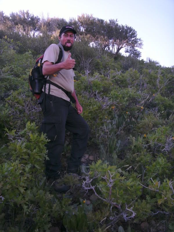
So yesterday my friend Tacoma and I went up to nelson peak - 9359 feet approximately 4000 vertical feet in 4 miles.
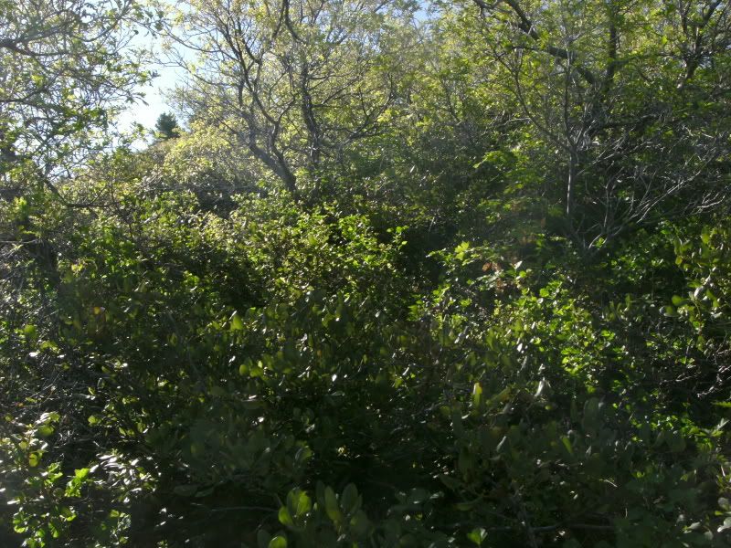
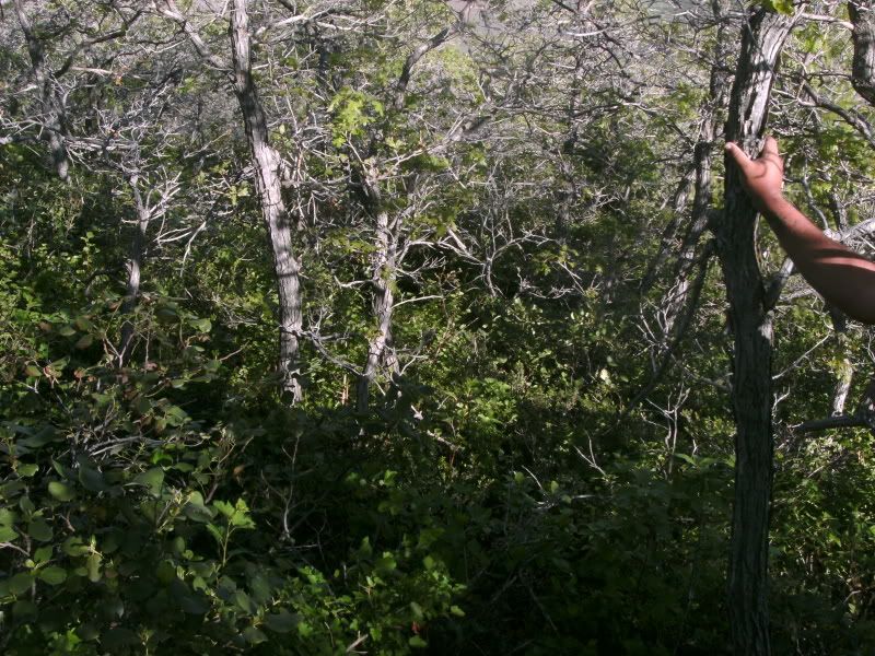
We met up at my house at 6:30 and headed up to the trail head (using the term trail and trail head VERY loosely here) at the top of bates canyon road at 6:45. From there we started hiking up and trying to stay on the ridge as much as possible. Trying to stay on the ridge let alone move forward was what made this the Death Hike. Once we hit the 6000 foot level we began to have to SLOG our way through (and I quote Tacoma here) the "Impassable Expanse of Scrubby Trees".
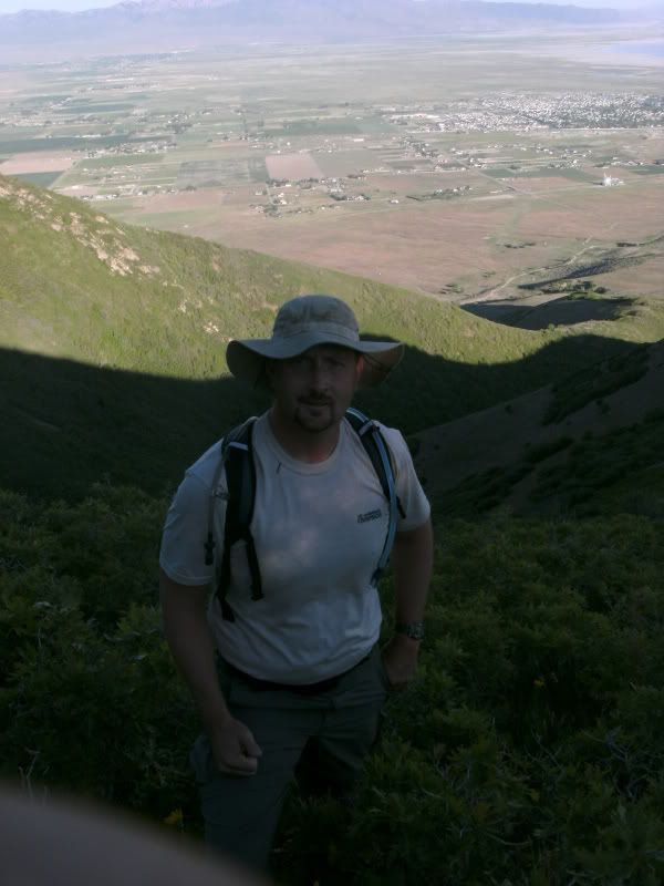
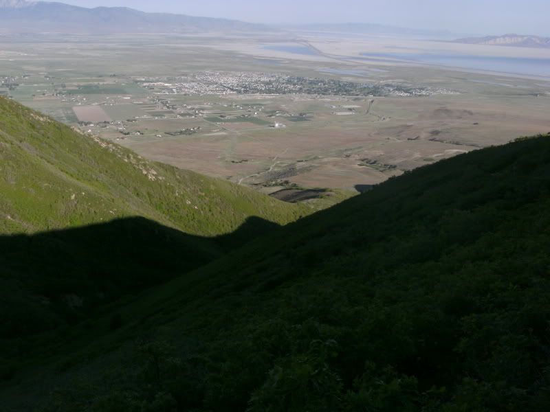
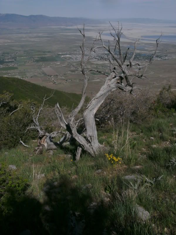
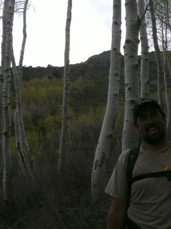
From this point on we were bulling our way though scrub oak, some kind of nice thorny berry plant, some other foliage that I don't know what it was but was always growing in the worst possible direction for travel. On more than one occasion the shrubbery was covered with some rather large red and black ants that had a nice bite to them (Tacoma claims bruising on his sac from getting bit). Occasionally we would come to small clearings to get some wonderful views of the valley and where we had come from. On the ridge before the end of the hike a couple of golden Eagles gave us a show, Flying at eye level, then up above us to circle for a bit where I got a couple of pics
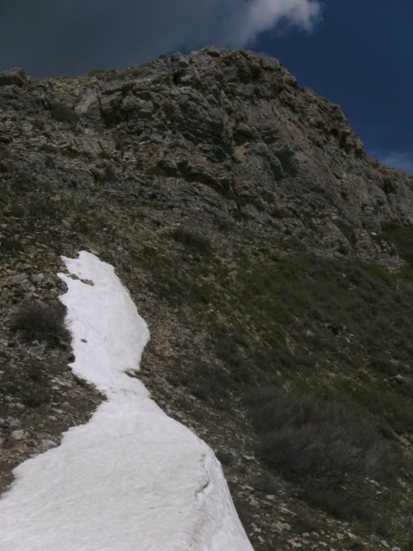
after about 7 hours of hiking (with only short 1 minute stops to catch wind and 2 5 minute stops for a granola bar) we came to the last climb of the hike. a 300 foot class 5 climb to get to the top (that or add another 3/4 mile walk on 70 degree slopes to get around said climb). We decided to stop for a rest. We laid down on the rock for 30 minutes took some pictures and took stock of the situation.
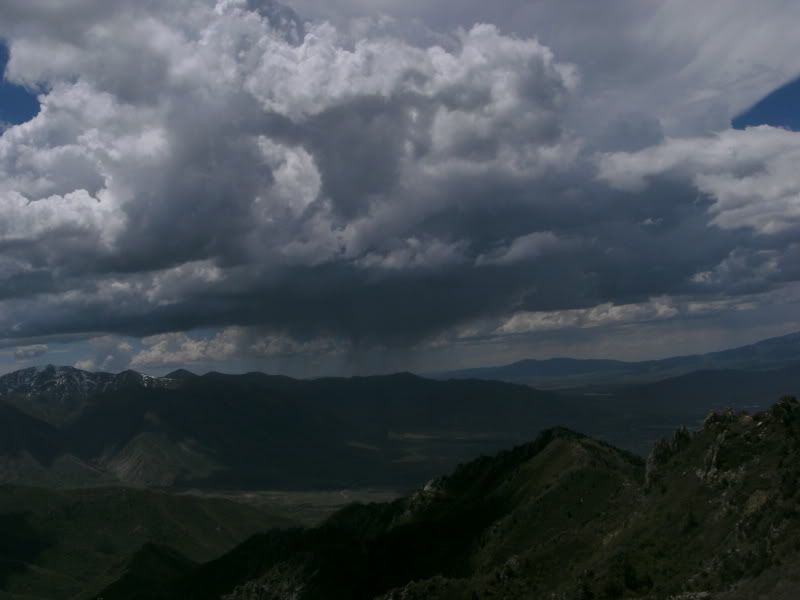
We decided to be on the safe side with how tired we both were it would take us almost 40 minutes to get to the top, rest and then start down. Coming down from the top would keep us on the ridge for a much longer period of time before there would be a safe area to descend. We had storm clouds coming in from the south west that would hit anywhere from 30 minutes to an hour later.. so we headed down. Just after we got down into a group of aspen trees about 1/4 mile from where we were it began to sprinkle.
Throwing on our rain gear just before is started to pour. for 2 hours we we inundated with the smell of the wet forest, ice cold rain, Hail and rolling thunder and lightning often hitting close enough to make both of us jump. we finally made it back to the jeep at 6:15 after about 11 miles of hiking we got in and started home. Unfortunately with the rain it turned the the road to something slick as snot. The jeep got stuck for a minute but with some nifty driving, engaging the Locker and bumping into a couple of trees we were free!
The end result my legs hurt, knees are swollen, Tacoma states that "my left knee seceded from my body" and we are both covered with bites and scratches from the evil trees. This was an Epic adventures
-
05-31-2009 10:54 AM # ADS
-
05-31-2009, 04:49 PM #2
Nice; I always wanted to climb that one. Access is blocked from the SLC side and I never got around to checking the Tooele side.
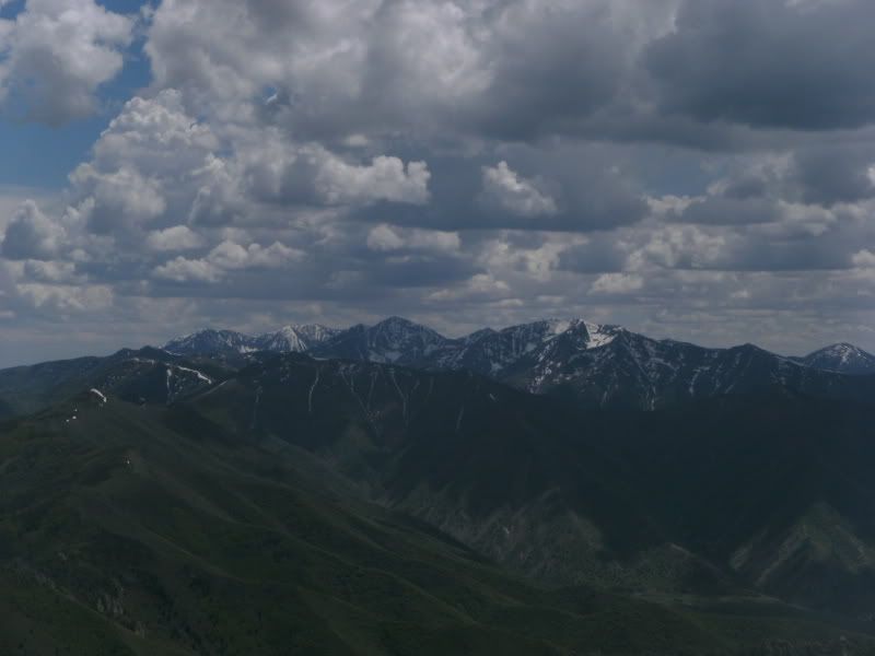
Cool photo of Lowe, Flat Top and Butterfield Peaks from an unusual angle.
-
05-31-2009, 06:36 PM #3Our original plan was to take a different set of ridges up to the top but the road to where we wanted to start didn't open until June 1 so we quickly sketched out a different plan of attack.. unfortunately a lot of the time we were pointing to "that ridge over yonder looks like it has 90% less vegetation.. Ya that was the original plan.."
 Originally Posted by Scott P
-
06-07-2009, 01:28 AM #4
Very nice attempt. I'm needing to summit Nelson and the 8100 foot un-named peak west of Nelson (south of Bates Canyon north of Flood Canyon). What was the original plan that had a lesser bushwhack?
-
06-07-2009, 11:38 AM #5Yep that was the original plan.. but that is how life goes Originally Posted by willhiteweb
Tacoma Said - If Scott he asks you to go on a hike, ask careful questions like "Is it going to be on a trail?" "What are the chances it will kill me?" etc. Maybe "Will there be sack-biting ants along the way?"


 Reply With Quote
Similar Threads
-
[Trip Report] Dude Peak- Good little day hike!
By Big Bone in forum Hiking, Scrambling & Peak BaggingReplies: 3Last Post: 04-26-2010, 10:49 AM -
[Trip Report] Andy Nelson Peak - TR
By Mtnman1830 in forum Hiking, Scrambling & Peak BaggingReplies: 3Last Post: 07-15-2008, 04:50 PM -
[Trip Report] Frary Peak Hike
By tmartenst in forum Hiking, Scrambling & Peak BaggingReplies: 8Last Post: 12-04-2007, 11:24 PM -
kings peak hike
By rlm in forum Hiking, Scrambling & Peak BaggingReplies: 10Last Post: 08-12-2007, 09:51 PM -
Lewis Peak Impromtu Hike...
By Mtnman1830 in forum Hiking, Scrambling & Peak BaggingReplies: 2Last Post: 09-03-2006, 08:46 PM
Visitors found this page by searching for:
Outdoor Forum
