

Results 1 to 16 of 16
-
08-07-2008, 07:11 PM #1
Paddling up the Green or Colorado river?
I've heard that in recent times people have paddled up the Colorado River to Moab from the confluence with the Green River. Has anyone heard about doing this or actually done it? Likewise for paddling up the Green to Green River, UT from the confluence after floating down the Colorado from Moab?
I understand that the best conditions for doing this occur during low water - mid to late summer - and that monsoon rains and irrigation demands can influence river flows and thus current speed...
I'm looking for information and insight about past attempts at doing this and current concerns, including permitting, river flows etc. ...
thanks!
gringorio
copyright g joder 2006:
 bearcanyon.wordpress.com
-
08-07-2008 07:11 PM # ADS
-
08-07-2008, 07:28 PM #2
probably only done by cheap bastards. i'd pay the bucks for the jetboat myself to shuttle me back.
i have taken a canoe from greenriver to mineral bottoms. easy to do and a car shuttle is all that is needed. that was a great trip. going down to spanish bottoms would have been even better. it would be a long paddle up river to moab. you can get a car into lathrop canyon for pickup. that would save many miles of the upriver pull. lining your canoe up the bank won't be easy either. heavy brush will make walking tough.
check with canyonlands nat. park about permits. since most of the trip is in the park.
let me know how it turns out if you decide to do it.But if I agreed with you, we would both be wrong.
-
08-07-2008, 08:15 PM #3
thanks for the comment denaliguide,
not looking to save bucks, just something different. I've floated the Green years ago in a canoe, but this time will be using my sea kayak. Good point about the riverside brush and lining. For now just pondering the idea...bearcanyon.wordpress.com
-
08-07-2008, 08:17 PM #4
I'd paddled plenty of Colorado and the Green, I wouldn't want to paddle against the current.
I am sure it's doable, but the river even at that stretch is moving about 2mph. And you can paddle probably 3-5 mpg, so your average speed would be 2-3 mph.... that's slow.
I'd personally do Labyrinth or Stillwater canyons, very pretty and you go down the river.
-
08-20-2008, 05:09 PM #5
Thanks again Alex and denaliguide ...

Does anyone know if the Potash boat ramp area is a safe place to park a car for a few days?
Thanks!
gregbearcanyon.wordpress.com
-
08-20-2008, 05:27 PM #6i would feel comfortable doing it. just don't leave anything obvious visible.
 Originally Posted by Baja Trekker
But if I agreed with you, we would both be wrong.
Originally Posted by Baja Trekker
But if I agreed with you, we would both be wrong.
-
09-02-2008, 04:46 PM #7
test run
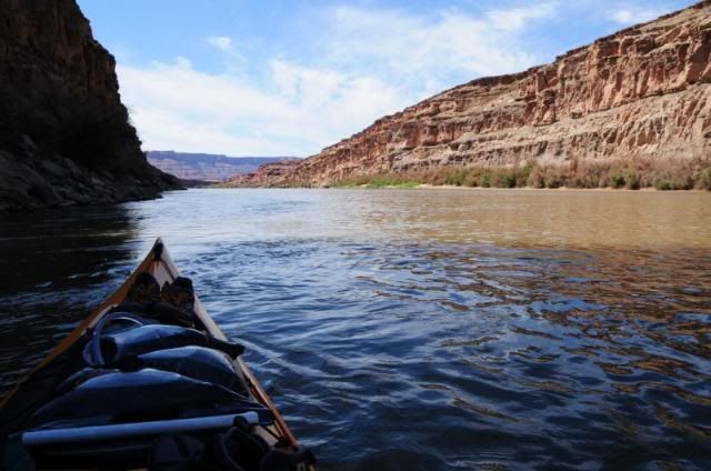
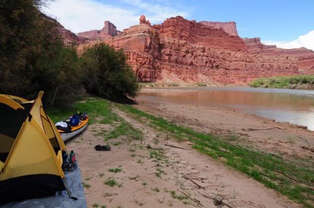
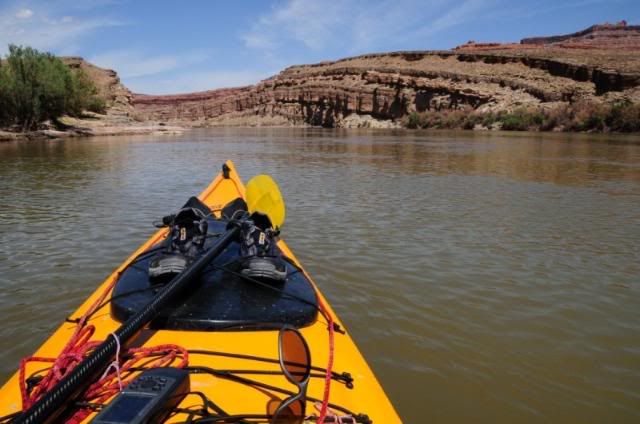
Did a test run of this idea last week. After consulting with both the Park and BLM people in Moab I decided to put in at Potash and float downstream until just before the entrance to Canyonlands (Shafer Canyon) and then paddle back to Potash. One day down and two days up... (all the time I could afford for this trial run). On the second day going up-river paddled about 10 miles in 4 hours with lots of stops and exploration along the way. The campsites were awesome with lots to explore as well.
My conclusion is that paddling up the Colorado from the confluence is definately doable (as those who have done it stated) and the boat of choice is a sea kayak, for me anyway, unless you have two strong/experienced paddlers in a canoe.
At the current water level the paddling was not that much different than coastal paddling where tides and winds influence speed - even on the sea averaging 2.5 mph is sometimes all you can do.
Anyhow, it was a great mini-trip and it provided me with a lot of insight...
Here's some photo's for you to enjoy:
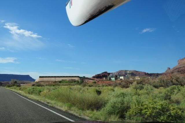
The Potash plant below Moab:
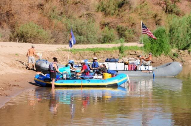
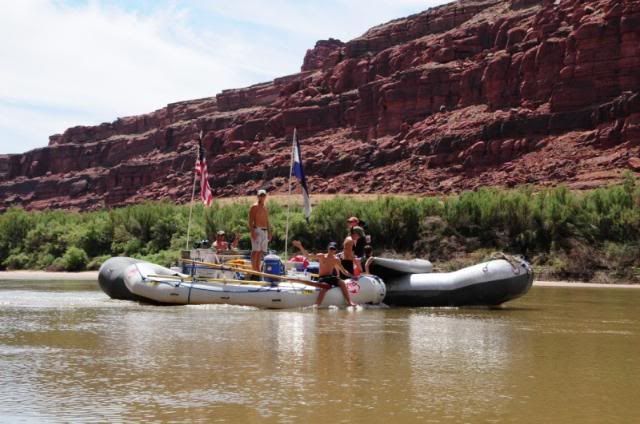
Rafters putting in and headed for Cataract Canyon:
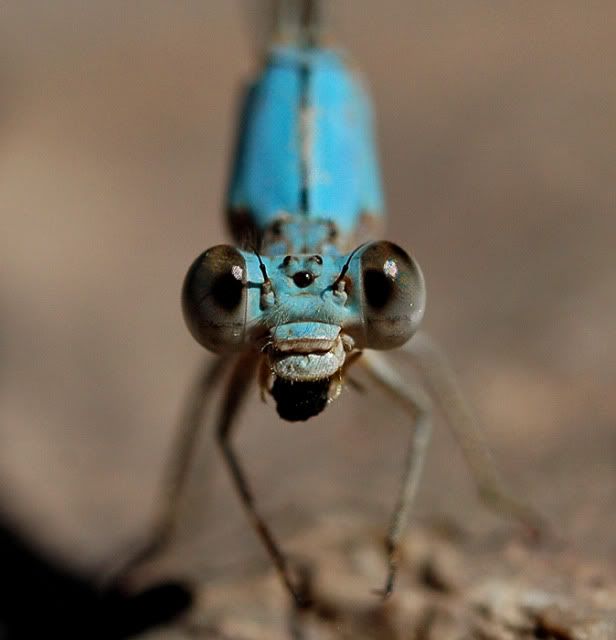
A damselfly eating something ... a spider I think:
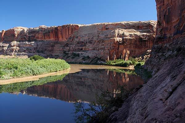
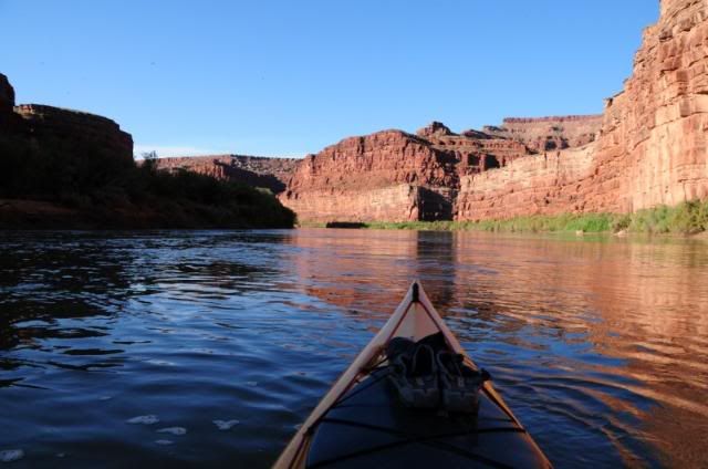
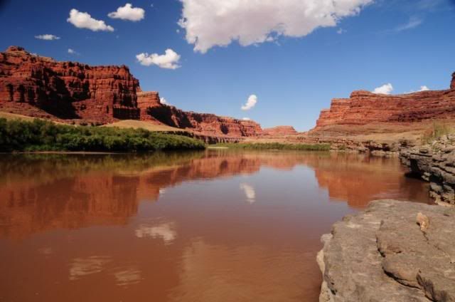
Heading down river from Potash:
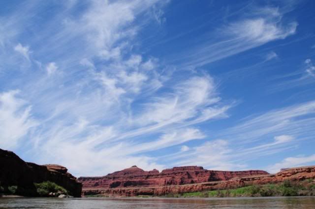
Mares tails clouds:
Motoring downriver (hurry!):
At this point, taking a break, I finally began to relax, leaving the stresses of work behind:
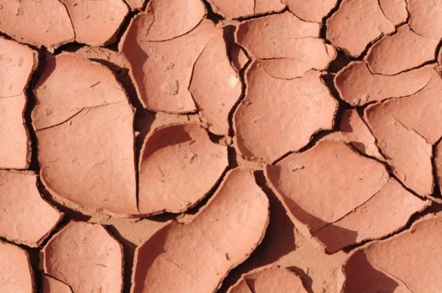
Mud flakes, great for breakfast:
High water:
A camp:
Near the Park entrance:
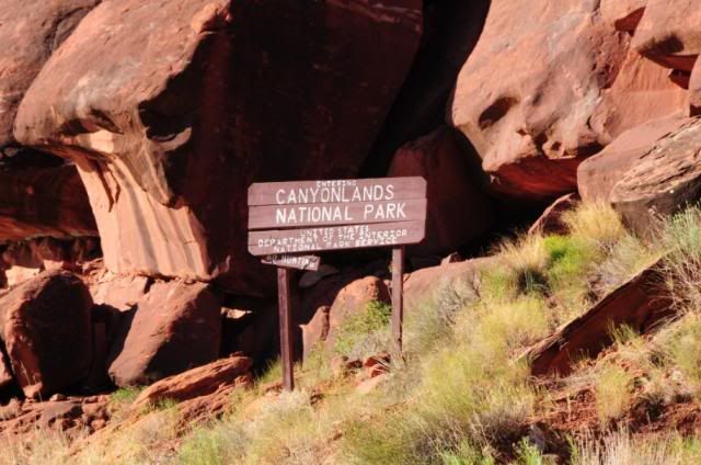
The sign for Canyonlands National Park. Downriver this sign you need a Park permit:
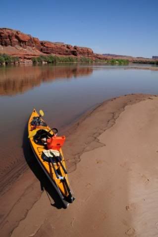
Classic scene... Recognize this photo?
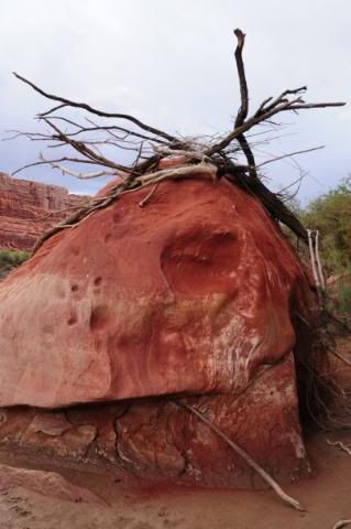
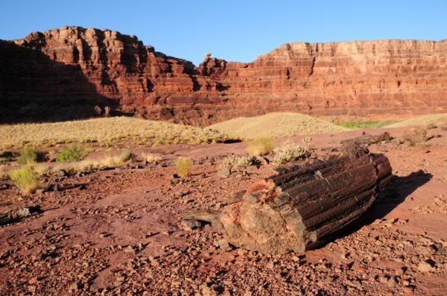
Petrified wood...
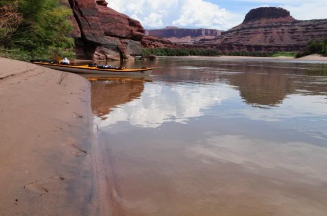
Rest stop, paddling back up river:
Beaver tracks:
Nearing Potash - finally! It's hard work paddling up a river!
 bearcanyon.wordpress.com
-
09-02-2008, 05:10 PM #8
awesome. sounds like it was easier than i thought it would be.
But if I agreed with you, we would both be wrong.
-
09-02-2008, 10:24 PM #9
Wow! great photos. I'll have to feature this one on the front page.

-
09-03-2008, 08:56 AM #10
Great pics, that's a sweet kayak.
I'm not in Utah, but I like Utah, really..
-
09-03-2008, 09:47 AM #11
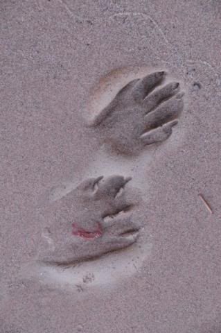
awesome! I love the second pic with the kayak in the background and the bare feet prints in the sand. looks like an awesome trip!
The man thong is wrong.
-
09-03-2008, 10:18 AM #12Zions the "s" is silent

- Join Date
- Nov 2007
- Location
- indoors wanting to be outdoors
- Posts
- 3,216
Totally agree. All the pics were awesome but this second one if you could some up an awesome trip this would be it. Originally Posted by Jaxx
Post more TR & pics

-
09-03-2008, 07:15 PM #13Thanks everyone! Originally Posted by trackrunner
As per trackrunnerbearcanyon.wordpress.com
-
09-06-2008, 10:43 PM #14
Amazing photos.
Chere'

-
10-03-2008, 08:36 PM #15
photos
Thanks Blue Eyes ... I'm hoping to return soon to explore more. Without the camera I feel nekkid, the details are lost ... Originally Posted by blueeyessmiling
gregbearcanyon.wordpress.com
-
08-15-2009, 10:01 PM #16
more
Well... After this summers adventures I do want to return and do this paddle with enough time to explore the side canyons. The Green is a great trip, but it looks like the canyons on the Colorado between Potash and the confluence are more accessible. I'm finding I really like the contrast between the athleticism of paddling up-river to the peacefulness of floating downriver smelling, seeing hearing the canyon...
greg bearcanyon.wordpress.com

 Reply With Quote


Similar Threads
-
Colorado River at different levels
By Alex in forum Boating, Rafting, Kayak and CanoeReplies: 2Last Post: 05-24-2009, 05:11 PM -
[Trip Report] More Colorado River - the Delta
By gringorio in forum Boating, Rafting, Kayak and CanoeReplies: 3Last Post: 10-05-2008, 06:39 PM -
[Trip Report] Another Westwater run on Colorado River
By Alex in forum Boating, Rafting, Kayak and CanoeReplies: 9Last Post: 07-09-2008, 12:33 PM -
Colorado River Hike
By Bo_Beck in forum Hiking, Scrambling & Peak BaggingReplies: 0Last Post: 03-10-2008, 09:51 PM -
Confluence of the Green and the Colorado?
By lonepeakgeek in forum Hiking, Scrambling & Peak BaggingReplies: 10Last Post: 03-05-2006, 07:13 PM
