

Results 1 to 20 of 33
-
06-06-2008, 07:34 AM #1
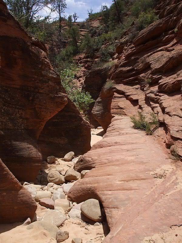
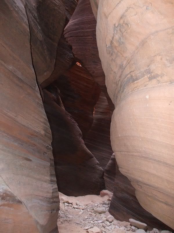
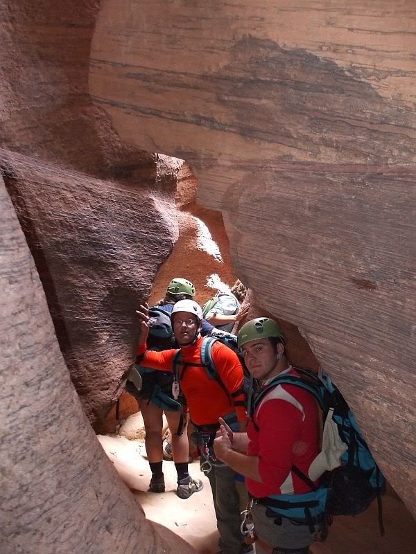
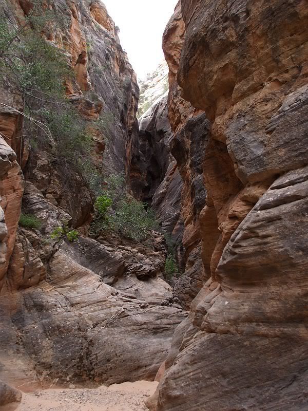
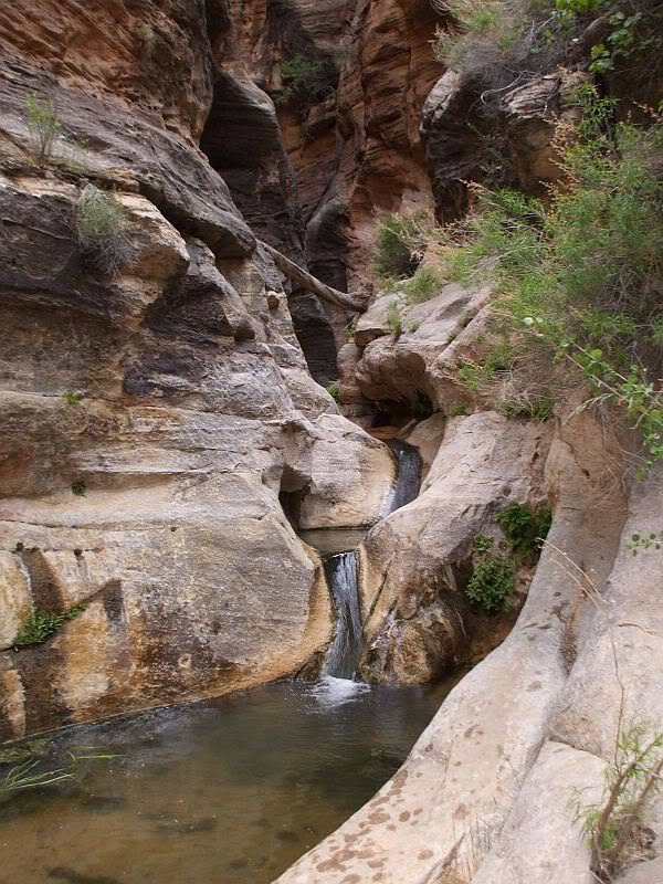
Trip Report for Weds June 4th "Fat Mans Misery"
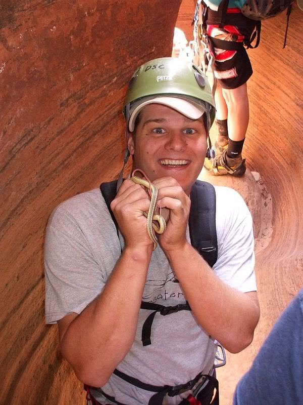
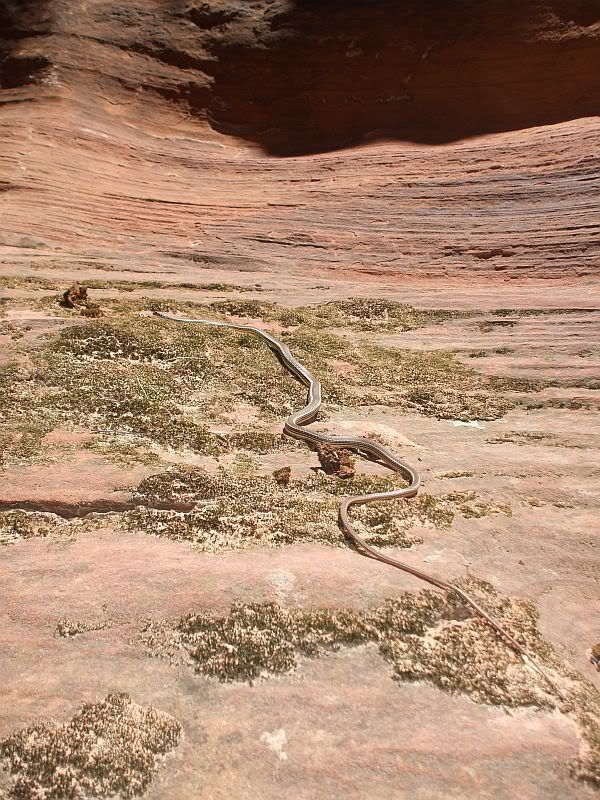
The college research team headed down Fat Mans Misery for the second time this summer to get some mark recapture population studies.
We brought Dr. O' Brien and Dr. Van De Mier with us as well
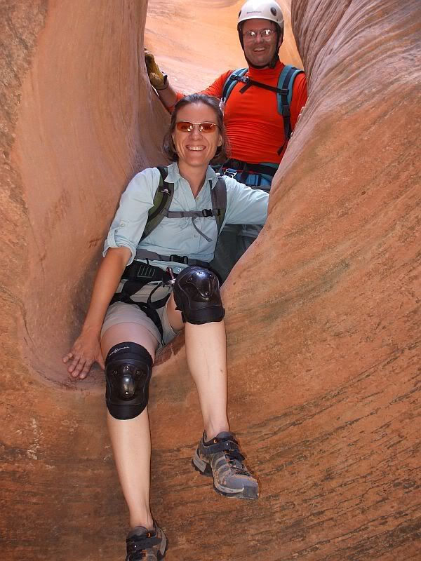
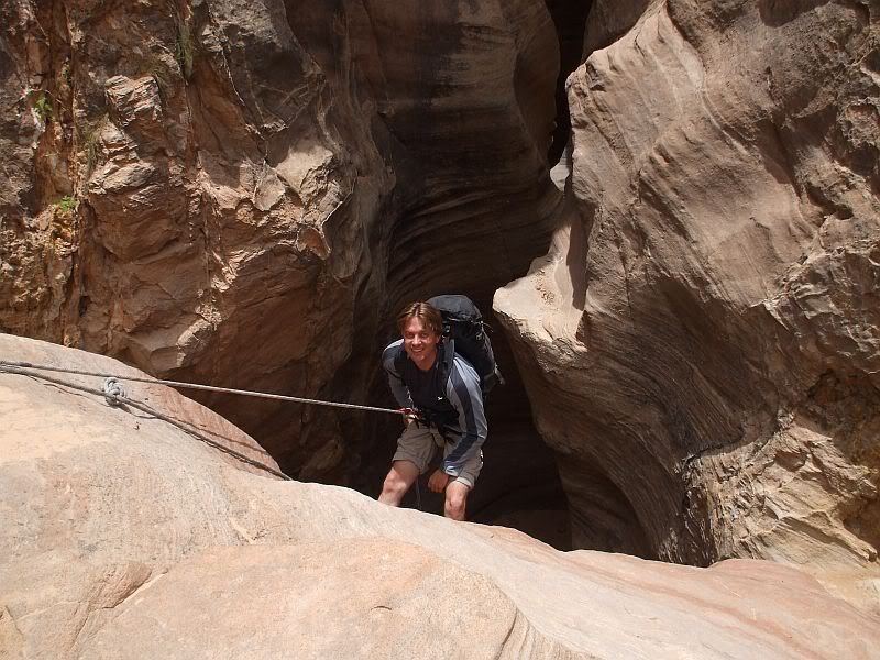
There was not as much water inside the slot as their was before but the raps were simple and quick.
We also decided to park a transport vehicle upstream so we would not have to do the uphill hike out. As soon as we got out of the slot the wind and rain picked up and that vehicle transport that was suppose to be only 2 miles up stream turned out to be about 8-9 miles upstream and we barely got out before dark. :( So if anyone else decides to try that I recommend just hiking back out but I leave that to you.
Here are a few pics to sooth your palet.
If that is too many pics for people to load just let me know for future post!
Otherwise Im going to continue to Jam like Jelly!
-
06-06-2008 07:34 AM # ADS
-
06-06-2008, 07:54 AM #2
*ahem* Not enough pics...

Looks like a good time. Thanks for sharing!It's only "science" if it supports the narrative.
-
06-06-2008, 09:48 AM #3
Sweet! we are doing that this weekend. I notice noone has wetsuits on. Did you find a need for them at all?
The man thong is wrong.
-
06-06-2008, 05:34 PM #4Not enough water to need them. Nor is the water cold enough
 Originally Posted by Jaxx
-
06-07-2008, 02:20 PM #5
Allystair- The hike isn't normally that long. The guys who dropped off the vehicle missed a turn off to the left. If you plan on doing this one and are planning on taking the river out but are not going with someone who knows the way, make sure you look at the maps for the drive out very carefully.
Comparing the GPS record of where we hiked to what it should have been, I'd say we did about 4x the regular distance in the river. I'm trying to convince your fearless leader to go again but with the car in the right spot.
As far as the wetsuits, if it's a nice day, you probably want neoprene socks but that's it. We (the doctors ) did Orderville on Friday and the river was cold enough that some folks put on their wetsuits while others just carried them but the water wasn't as cold on Fat Man's.
-
06-09-2008, 07:27 AM #6Content Provider Emeritus


- Join Date
- Feb 2005
- Location
- Quiet and charming: Mount Carmel
- Posts
- 7,158
Where is it that you like to park the vehicle? (Coords would be nice). Thanks. Tom Originally Posted by obrien
-
06-09-2008, 01:22 PM #7Bogley BigShot
- Join Date
- May 2007
- Location
- We're all here, because we ain't all there.
- Posts
- 19,424
I'm guessing the bottom of the poverty flats road but thats more like six miles to fat mans.
Another on the Rock canyon side.(road)
-
06-11-2008, 09:27 PM #8Bogley BigShot
- Join Date
- Oct 2005
- Location
- Just a few miles from Zion National Park
- Posts
- 8,456
Keep posting those trip reports! Great photos and report!

-
06-12-2008, 06:13 AM #9Bogley BigShot
- Join Date
- May 2007
- Location
- We're all here, because we ain't all there.
- Posts
- 19,424
Could you DSC people have lost a pair of white socks in fat mans?
-
06-12-2008, 06:40 AM #10
lost or missing
I also found a headlamp at the river convergence. If you are missing one let me know what it is.
Stop checking my spelling! I know I suck but I amn't in school anymor, so back off.
-
06-12-2008, 08:19 AM #11
Sorry it took so long to reply. Bo Beck has a map on his website showing this alternative route with the parking spot.
http://www.zionnational-park.com/elephant-butte-map.htm
This only shows where you hike out if you don't want to climb back out on the slick rock. You can piece it together with the more typical hike using this other map.
http://www.zionnational-park.com/misery-canyon-map.htm
I think Bo gives coords for the more traditional hike but not for the Elephant Butte exit which is why it was probably tricky for the guys who left the truck. Since we parked in the wrong spot we don't have the correct coords (and you don't really want to do what we did as a day hike).
-
06-12-2008, 08:29 AM #12Bogley BigShot
- Join Date
- Oct 2005
- Location
- Just a few miles from Zion National Park
- Posts
- 8,456
I will show this to Bo and get the coordinates up for that! Sorry you guys had a hard time! Originally Posted by obrien
-
06-12-2008, 09:45 AM #13
No worries Tanya. I think it was more the problem of thinking the route to the parking spot was more simple than it was. We all learned our lesson!
The mile informaton on your site looks like it is pretty good. It's my understanding that they were not used when the car was parked.
-
06-12-2008, 11:24 AM #14http://www.zionnational-park.com/elephant-butte-map.htm Originally Posted by obrien
This shows one option for driving to the exit parking area. It should be about 12 miles from the Coral Pink Road?
-
06-12-2008, 01:43 PM #15
how long does it take to drop off the shuttle? Looks like a long drive.
The man thong is wrong.
-
06-12-2008, 01:57 PM #16It takes about 3 hours to set up the shuttle... and a lot of it is on really bad 4x4 roads.... and I'm not talking Subaru 4x4, but real 4x4 roads. Originally Posted by Jaxx
This is without a doubt the best way to do Fat Man's, but that shuttle sucks!
Same Trailhead as Rock Canyon... if you do things right you could do Fat Man's on the first day, sleep at the shuttle, and do Rock on the second day. This would allow you to visit all the best of p-weap.
Rock Canyon
http://climb-utah.com/Zion/rock.htm
And then you would never have to drive down that crappy road again.
-
06-12-2008, 02:00 PM #17
Thats a good idea, Thanks!
The man thong is wrong.
-
06-12-2008, 02:12 PM #18Bogley BigShot
- Join Date
- Oct 2005
- Location
- Just a few miles from Zion National Park
- Posts
- 8,456
I think the shuttle set-up is fun at it only takes 2 of the people in the group to do it.
 I thought you like to drive stuff?
I like the 4WDing out there .. it's pretty and it's a fun road. If you stay on the east side of the park it's easier. You just set up the shuttle the night before, stay over here and you are closer to Checkerboard Mesa where the hike begins.
-
06-12-2008, 03:46 PM #19It is not a long drive, just slow driving on the 12-13 mile sandy 4wd road. From the checkerboard pullout to the parking on the south side of Parunuweap is probably 1 1/4 hours????? Figure on 2-3 hours to set up the shuttle? Originally Posted by Jaxx
-
06-12-2008, 04:42 PM #20
There is one way you can set up the shuttle in under 3 hours....

 Reply With Quote


Similar Threads
-
What was your worst "I'll never, ever, EVER do that again" trip?
By Spooky in forum General DiscussionReplies: 41Last Post: 06-03-2010, 09:39 PM -
Saturday, June 21st 2008 at 9:00 am - "Huge" Cave
By jumar in forum Climbing, Caving & MountaineeringReplies: 0Last Post: 06-18-2008, 04:14 PM -
First "family" camping trip
By Skapegoat in forum Backpacking & CampingReplies: 5Last Post: 06-19-2007, 10:06 AM -
Peta: "Let the Wild life Die", "let the cattl
By RedMan in forum The Political ArenaReplies: 68Last Post: 02-03-2007, 02:11 PM -
Do you "trip" the Traffic Light?
By Sombeech in forum General DiscussionReplies: 15Last Post: 01-15-2007, 12:57 PM
Visitors found this page by searching for:
Outdoor Forum

