

Results 1 to 19 of 19
Thread: Pictured in Time
-
10-19-2006, 04:46 PM #1
Pictured in Time
Hey, anyone here remember the story of the two women who died while hiking in the Uinta's three years ago?
Anyhoo..... here is an update I stumbled across that includes pictures taken from the dead hikers camera. I always find these types of pictures to be very unsettling. Makes me feel like I'm seeing a ghost or somethin'
Pictured in Time, Part 1
http://www.ksl.com/?nid=148&sid=517819
Pictured in Time, Part 2
http://www.ksl.com/?nid=148&sid=525434

-
10-19-2006 04:46 PM # ADS
-
10-19-2006, 06:40 PM #2
When this event first occurred I wrote an article about what I thought happened.
Lost In The Uintas
The Tale of Two Hikers
http://climb-utah.com/Uinta/losthiker.htm
With these new facts I can see I have many errors in the original article.
From the pictures I put together the attached map of my best guess of the route the girls would have traveled. It looks like they became disoriented at the north end of Clyde Lake and descended into the Weber Drainage. There is a very heavily used trail that leads to the Three Divide Lakes, which is probably where the hikers made their initial navigation error. I'm guessing by the time they hit Hidden Lake they though they had found Watson Lake and kept hiking down hill. It was reported the hikers had a map, but many of the trails in the area have been realigned over the last ten years and most maps contain numerous errors.
The initial ranger contact report was the hikers were headed to Long Lake, which was probably true. But then the hikers took the cut-off toward Cliff Lake.
Some have proposed that the hikers did the Wall Lake Loop, and then did the Long Lake hike. I disagree with this idea. I think the Wall Lake Loop and then hiking to Long Lake is a lot more then most weekend hikers would bite off.... kinda like eating an elephant sandwich :-) I just don't see that happening. YMMV
Wall Lake Loop
http://climb-utah.com/Uinta/wall.htm
Long Lake Loop
http://climb-utah.com/Uinta/long.htm
Looking at the recovered pictures I am 90% sure the map posted below is the route the hikers traveled.
It's also been noted that the women did have matches but never started a fire. I wonder why? Dry pine needles burn like gasoline, even when wet. Should have been easy to start a fire.
-
10-19-2006, 07:40 PM #3
Wow, it's amazing to see pictures like that, with them smiling and everything, having no idea what's in store.
I remember we got lost for a little bit in the Wind Rivers WITH a GPS.
-
10-19-2006, 07:51 PM #4
wow...i familiar with where those photos were shot, i've climbed a bunch in that area, that's spooky to know that they died do close to a very populated area.
it makes me unease to see their photos...
-
10-20-2006, 10:16 PM #5If they were planning the Wall-Clyde-Watson Loop, there is or was a trail that dead ends at a cliff from south of Watson Lake. Some (at least 10-15 years ago) used to get on this trail and hit the cliff while mistakingly taking the trail instead of the one to Crystal Lake. I've done it before too, but just I just found a route through the cliffs instead of bothering to backtrack to look for the correct trail. If they were planning on doing that loop and got dead ended there in bad weather, I can understand not wanting to routefind off the cliff, but could they have circled around all the way to near Long Lake or around Mount Watson to the Middle Fork? If so, they we way off track. Seems weird, so as Shane, I was thinking they headed to Hidden Lake area. If so, what is the lake in photos 19 and 20? Shane, do you have any photos of Linear? Could it be an un-named one around Hidden or towards the Middle Fork Weber? Weird. And sad.The initial ranger contact report was the hikers were headed to Long Lake, which was probably true. But then the hikers took the cut-off toward Cliff Lake.
Some have proposed that the hikers did the Wall Lake Loop, and then did the Long Lake hike. I disagree with this idea. I think the Wall Lake Loop and then hiking to Long Lake is a lot more then most weekend hikers would bite off.... kinda like eating an elephant sandwich :-) I just don't see that happening. YMMVUtah is a very special and unique place. There is no where else like it on earth. Please take care of it and keep the remaining wild areas in pristine condition. The world will be a better place if you do.
-
10-21-2006, 09:14 AM #6
So you are thinking my route might be correct as far as Clyde, but then you are suggesting they might have went from Clyde, to Watson and then circled around the south side of Mount Watson into the Weber Drainage?
That is possible.
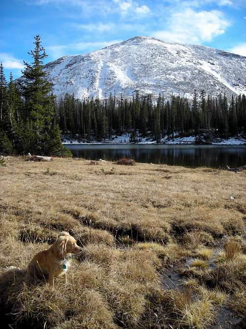
This is the picture in the series that shows presumably the last like the women visited.

I think this is one of the Hidden lakes looking back at Mt Watson, but I'm not sure.
Below is a picture of Linear Lake that you asked for. If these are the same lakes then your theory would probably be correct. But Linear doesn't look big enough to be the same lake from this picture.
I spent a bunch of time in this area in 2004 and hiked every trail and photographed every lake. But it has been long enough ago that things are now a little fuzzy.
-
10-22-2006, 08:01 AM #7It is right for sure. Every photo through #18 is traceable.So you are thinking my route might be correct as far as Clyde,
I acrtually think your proposal make a lot of sense, but apparently the last photo isn't Hidden Lake(?), and for sure not the one to the east, so I couldn't figure out which lake it would be and only guess. If the lake isn't Hidden, I can't find which one it is so I made a guess. Some think it is Long, but it doesn't match my photos of Long and it seems strange that they were that far off.but then you are suggesting they might have went from Clyde, to Watson and then circled around the south side of Mount Watson into the Weber Drainage?
The photo is itself is fuzzy too. If it would show the mountain in the background, it would be easy to figure out. I guess that is why the got lost(?). Once the mountains became fogged over, it would be hard to identify which mountain is which and which lake is which.I spent a bunch of time in this area in 2004 and hiked every trail and photographed every lake. But it has been long enough ago that things are now a little fuzzy.Utah is a very special and unique place. There is no where else like it on earth. Please take care of it and keep the remaining wild areas in pristine condition. The world will be a better place if you do.
-
10-22-2006, 04:53 PM #8I agree the last photo is not Long Lake. I also agree it's not Hidden lake. I believe the final picture is Booker or one of the Divide Lakes. I think the picture is taken from the north side of the lake looking back at Mount Watson. unfortunately I don't have any pictures of these lakes from the north looking south to verify if my guess is correct.Some think it is Long, but it doesn't match my photos of Long
From where my marked route leaves Clyde and heads for the Divides there is a major trail that actually begins heading downhill. Also from that point the main trail to Watson climbs up hill. I'm guessing if visibility were low they just began follow the major trail downhill thinking it would lead them back to the trailhead. Just a guess....
-
10-22-2006, 07:56 PM #9Nope, definately not Booker or the Three Divides (nor Jophn either). I have photos of the lakes to compare and they are open and right at timberline with only scattered trees.I believe the final picture is Booker or one of the Divide Lakes. unfortunately I don't have any pictures of these lakes from the north looking south to verify if my guess is correct.
Hidden is a bit lower and with more trees, but still pretty close to timberline, but still doesn't seem to match:
There are ponds west of Hidden, but could they be big enough? Could it be Watson Lake or Petit? Watson looks too rocky to match on my photo, but if perhaps it was taken in a different place (mine is the south end), it would look different? I don't have photos of Linear or Petit. The sad mystery continues.Utah is a very special and unique place. There is no where else like it on earth. Please take care of it and keep the remaining wild areas in pristine condition. The world will be a better place if you do.
-
10-22-2006, 08:09 PM #10
...
Utah is a very special and unique place. There is no where else like it on earth. Please take care of it and keep the remaining wild areas in pristine condition. The world will be a better place if you do.
-
11-06-2006, 10:57 AM #11
I just heard from an aquaintance who has been spending a lot of time researching the lost women hikers. He has just identified the last picture on the film roll and he says it's Hidden Lake for sure. So it looks like the map I posted above is the route they took. I'm now pretty sure they got messed up at Clyde Lake. I'd bet dollars to donuts the women took the well established trail toward Hidden lake and thought they were at Watson or Cliff Lake.
-
11-08-2006, 07:39 AM #12Yes, I agree. Too bad. I guess if it was clouded over and you didn't know the area, it can happen. I remember a similar thing happened at the nearby Cuberant Lakes a few years ago, but they were found alive.I'm now pretty sure they got messed up at Clyde Lake. I'd bet dollars to donuts the women took the well established trail toward Hidden lake and thought they were at Watson or Cliff Lake.Utah is a very special and unique place. There is no where else like it on earth. Please take care of it and keep the remaining wild areas in pristine condition. The world will be a better place if you do.
-
11-08-2006, 08:27 AM #13
I'm guessing their downfall was a combination of.... the correct trail back to the trailhead actually climbs for a short distance from Clyde before descending, low cloud cover, poor visibility, the well defined trail leading towards Hidden Lake.
Now the only real mystery to me is why didn't they build a fire? I understand matches were discovered with the bodies. With shelter, fire and water you should be able to survive for a month.

-
11-08-2006, 08:35 AM #14
Scott, the spot you have pin pointed is near Abe's Lake and not below Hidden. If the bodies were discover at the spot pin pointed they did a lot of wandering because you can't really get from Hidden to the spot noted very easy. I've spent a lot of time at Abe's Lake and that is some rough country.
You want to verify that GPS location again? Might want to check the NAD27 vs WGS84 thing.... just a guess...
.
-
11-08-2006, 09:49 AM #15Perhaps the matches were wet? That would be my only guess, but good question.Now the only real mystery to me is why didn't they build a fire? I understand matches were discovered with the bodies.
-
11-08-2006, 11:29 AM #16
I think someone has mis-marked a map. I need more info on who marked the position and why. I know orginally a group was trying to find the exact location using the map from my website. The position I had marked was just a wild ass guess.
I've hike all over Notch Mountain and Abe's Lake and the redline trail noted doesn't work. Hiking around the west toe of Notch is a major bitch.
If that is where the bodies were actually found I'm saying they hit the Weber River and then tried to hike back up and over.

-
11-08-2006, 05:18 PM #17I got the map below, but it looks like it has already been changed (see link). Oops, never mind.I think someone has mis-marked a map. I need more info on who marked the position and why.
http://www.summitpost.org/article/23...he-uintas.html
It looks like your theory is spot on all along.
It was the photo of Hidden Lake which proved to be key. It was originally claimed that the photo (with the rain) wasn't Hidden, but it was all along.
Looks like the case is solved.Utah is a very special and unique place. There is no where else like it on earth. Please take care of it and keep the remaining wild areas in pristine condition. The world will be a better place if you do.
-
11-08-2006, 05:41 PM #18
I'm guessing if you could get about 20 guys together, spread out about 50 yards each, and hike straight down the fall line from Hidden Lake to the Weber River you would find there final shelter.
Thanks for the links
Looks Like I need to update my webpage one of these days. Also looks like the ranger bumping into the pair on the Long lake trail didn't help the search. Probably had searchers looking in the wrong areas.
.
-
11-09-2006, 07:38 AM #19
Sobering stuff.
Not sure a GPS would have helped them. I wonder if they weren't lost. Simple compass would have been just as useful. But...makes me wonder if they'd planned a loop all along. Then, decided to try to hunker down and wait out the storm, maybe, but got super cold, and never recovered.
Silent killer, this hypothermia. They may have been too cold, shivering hard, or, past the shivering point and been unable to comprehend lighting a match. Looked like a hard soaking rain. From there shelter, one of them may not have wanted to leave the other to find dry material for a fire, so, stayed put.
I've hiked and climbed a bit in that area. The route from Cliff to Wall is pretty neat.
Stuff to ponder...
-Brian in SLC


 Reply With Quote

Similar Threads
-
Is the time off.
By StudChild in forum About Bogley & SupportReplies: 3Last Post: 03-29-2010, 05:15 PM -
Long time lurker first time poster.
By Lizzard in forum General DiscussionReplies: 11Last Post: 01-31-2009, 07:10 AM -
Can You Name all of the Bands Pictured Here?
By rockgremlin in forum General DiscussionReplies: 25Last Post: 05-24-2007, 03:40 PM -
First time...
By TreeHugger in forum CanyoneeringReplies: 13Last Post: 06-30-2006, 04:28 PM
Visitors found this page by searching for:
Outdoor Forum
