

Results 1 to 1 of 1
-
02-26-2006, 10:08 PM #1
Annotated Photo of Paiute Trail in Utah
I thought you might find this interesting.
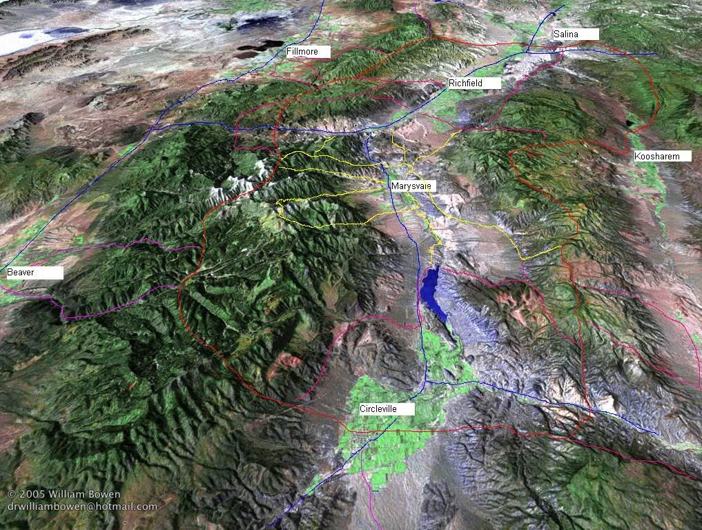
This is a computer generated photo. It appears to me to encompass almost all of the Paiute trail in Southern Utah.
The town of Circleville is a the very bottom, Salina is at the top right.
I annotated the Paiute trial (moderately accurate) on the photo. Trail 01 is in RED and highways are BLUE. Everything else is part of the Paiute trail. The other 2,000 miles of riding are not shown, I didn't have THAT much time. The white peaks to the left of Marysvale are where the trail hits its highest point at around 11,500 feet. The white is not snow, it is bare rock mountain top.
THe original is here.
http://130.166.124.2/utah_panorama_a...1001-full.htmlPlease buy my book - "Paiute ATV Trail Guide" at www.atvutah.com - I need gas money!!!!
-
02-26-2006 10:08 PM # ADS


 Reply With Quote
Similar Threads
-
Paiute Trail?
By moab mark in forum MotorcyclingReplies: 23Last Post: 08-04-2010, 11:01 AM -
Paiute Trail - 10-10-09 Invite
By nelsonccc in forum MotorcyclingReplies: 3Last Post: 10-04-2009, 04:49 PM -
Paiute Trail Invite - 8-21-09 thru 8-23-09
By nelsonccc in forum MotorcyclingReplies: 2Last Post: 08-14-2009, 07:41 PM -
[Trip Report] Paiute Trail 7-18-09
By fourtycal in forum MotorcyclingReplies: 7Last Post: 07-20-2009, 12:07 PM -
[Trip Report] A little loop on the paiute trail
By fourtycal in forum Offroad 4x4, Side by Side and ATVReplies: 6Last Post: 09-09-2008, 05:08 PM
